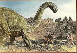
No individual has experienced 4.5 billion seconds (approximately 143 years), and even the history of our civilization spans only 4.5 billion minutes (around 8560 years). However, the Earth itself has endured for a staggering 4.5 billion years! Throughout its existence, the planet has undergone numerous transformations.
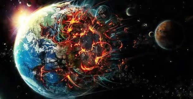
Throughout the course of millions of years, the Earth’s land masses have continuously drifted apart and then come back together, forming new configurations each time. This constant movement has resulted in completely different continental shapes throughout history. If humanity had existed for billions of years, we would have had to revise our geography textbooks numerous times. However, it is important to note that in the early stages, there were no continents present on Earth.
At the start, there existed molten rock
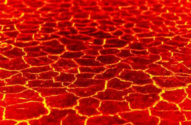
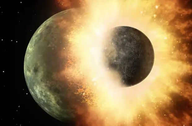
During the period from 4.5 to 3.6 billion years ago, significant events took place on Earth. These included the formation of the Moon, intense meteor bombardment, and the emergence of the first islands.
The early stages of our planet’s existence were challenging. Born approximately 4.5 billion years ago from the remnants and particles left behind after the formation of the Solar System (which, interestingly, took around 1 million years – a mere moment in geological terms), Earth immediately came under attack from asteroids, comets, and even mini-planets. At that time, there were numerous mini-planets orbiting the Sun, and the bombardment began right from the moment of conception.
What about the Earth, you ask? During those tumultuous times, it took on the appearance of a tale straight out of a frightening children’s book: a pitch-black sphere adorned with countless blemishes of blood-red volcanoes and crevices spewing out magma, smoke, and gases. The darkened surface, however, was not comprised of ordinary rock, but rather basalt that had formed when molten lava hardened.
Interestingly, even during that era, it is believed that there was water present on the planet (some of it was delivered via meteorites, while some was contained within the very fabric of the Earth). According to the majority of scientists, a mere 100 million years after the “incident” involving Theia, the Earth became enveloped by a shallow, warm, and incredibly saline ocean – at least twice as salty as the present-day seas (this is partly due to the fact that salt dissolves more readily in warm water).
There was likely no land to be found. Unless one considers the wheezing peaks of volcanoes, which were not even islands – they were comprised of soft, porous, and unstable basalt. To develop into something more substantial, granite, the bedrock of continents, was needed. And so it happened. It is difficult to determine how. Researchers discuss the intricate physical and chemical reactions occurring on the planet’s surface, which led to the formation of a layer of granite. Through the influence of thermal processes, it gradually grew thicker and thicker. Small islands emerged. How did they then evolve into continents? Gradually but surely.
Due to the disparity in temperature between the planet’s surface and its interior, magma remains in perpetual motion, a phenomenon commonly referred to as plate tectonics. Eons ago, this process initiated and continues to persist today, as it forcefully collides and subsequently separates landmasses. This is the very mechanism responsible for the formation of continents, albeit in their early stages when they were comparatively diminutive. During this remote era, the continents no longer possessed their characteristic darkness, instead assuming a lighter shade of gray due to the presence of quartz and feldspar, which constitute the granite. Additionally, the erosion of the granite contributed to the emergence of pristine white sandy beaches.
The initial
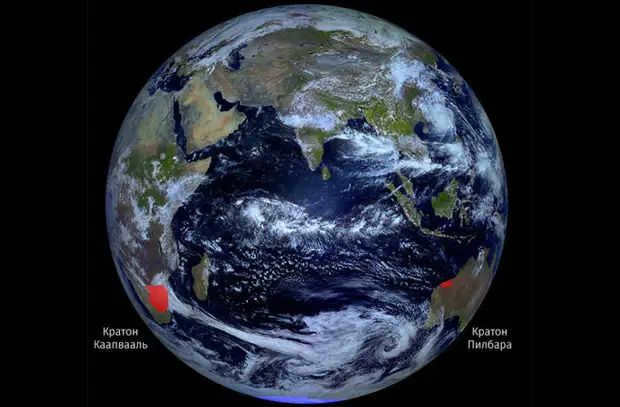
During a period that occurred between 3.6 and 2.8 billion years in the past, an ancient landmass known as Vaalbara existed on Earth.
The first continent, which is also the most controversial, is Vaalbara. Many scientists have differing opinions on the hypothetical existence of Vaalbara. The continent is known for only two ancient terrestrial platforms, namely Kaapvaal in South Africa and Pilbara in Western Australia. Interestingly, the combination of these two words led to the unique name of the continent. While there is evidence suggesting that these land masses were connected 3.1 billion years ago (with the continent’s formation starting even earlier at 3.6 billion years ago), geologists tend to dispute this view. They argue that the similarity in land areas could be attributed to other factors, such as similar volcanic activity. Additionally, the existence of Vaalbara contradicts the more well-supported hypothesis of another later continent called Ur. However, the exact time of Vaalbara’s collapse remains unknown. It is believed to have occurred approximately 2.8 billion years ago.
The original – 2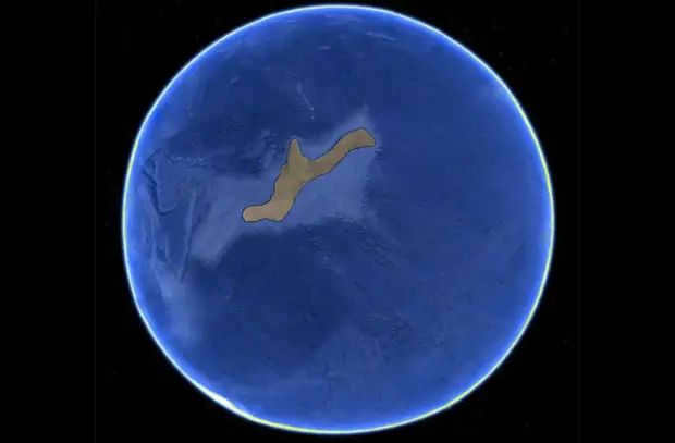
When: 3.1 billion to 200 million years ago
What: Ur
Ur’s hypothesis is widely accepted among scientists. It is referred to as a supercontinent, although it was likely smaller in size compared to modern-day Australia. However, during its formation 3.1 billion years ago, land was scarce, so it took the shape it did. It was formed from smaller islands, which are now part of Australia, India, South Africa, and Madagascar. Examination of magnetic data suggests that Ur remained a single landmass for nearly 3 billion years before starting to break apart around 200 million years ago. However, this doesn’t mean that new supercontinents didn’t emerge. On the contrary, they became increasingly more common.
Closer to the southern region
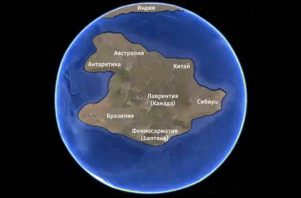
During the period of 2.7 to 2.4 billion years ago, there was a continent known as Kenorland that existed on Earth. This continent had control over some territories that belonged to Ur, but eventually, Kenorland “reclaimed” them. These territories included parts of what would later become North America, Greenland, Scandinavia, the Baltic States, and the Kalahari Desert region of Africa. Throughout most of its existence, Kenorland preferred to be located in the southern hemisphere, in low latitudes, and possibly even crossed the equator. However, around 2.4 billion years ago, the continent started to break apart, and fragments of it began to move towards the poles.
The United Plates of America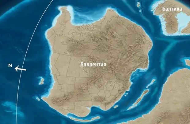
During the period from 2 billion to 175 million years ago, the landmass known as Laurentia existed.
The exact formation time of Laurentia is unknown. There is very limited information available about continents of such ancient age. Researchers only have knowledge that around 2 billion years ago, there were at least five continents on Earth. The largest of these was Laurentia, spanning thousands of kilometers and surpassing the size of the central and eastern regions of North America. This has led experts to sometimes refer to it as the United Plates of America. The second largest landmass was occupied by the “gray-haired” Ur, while the remaining land was shared by the Baltic and Ukrainian cratons (which formed the central part of modern Eastern Europe), as well as sections of present-day South America, Africa, and China.
The Arid Wasteland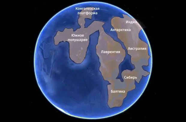
When: 1.9 to 1.5 billion years in the past
What: Colombia
It is also known as Nune, Nena, or Hudsonland, but it is more commonly referred to as Columbia due to the discovery of its existence through geological evidence from a river with the same name that flows in the United States. The formation of this continent dates back approximately 1.9 billion years and it encompassed almost the entire landmass of the Earth. Its dimensions were truly impressive, stretching 13,000 kilometers from north to south and 5,000 kilometers from west to east. Although there was already life at that time, it was limited to the simplest forms found in the ocean. As a result, the majority of this vast landmass resembled a desert with a rust-colored appearance, scorched by the intense heat of the Sun and devoid of any signs of vegetation. Try to picture the Earth during those ancient times, a blue sphere with a solitary reddish patch located near the equator and small white caps at the poles.
Derived from the term “homeland.”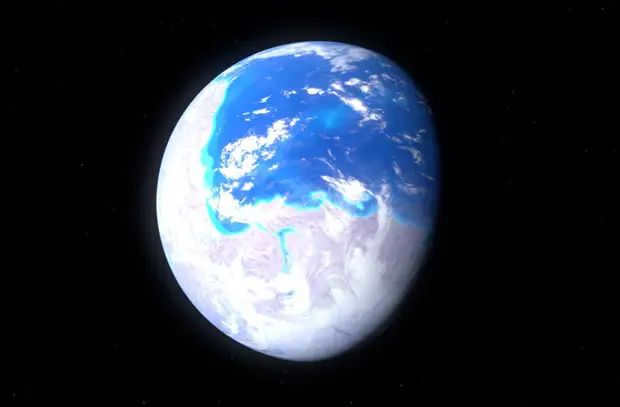
During the period of 1.1 billion to 750 million years ago
The formation known as Rodinia
There is ongoing debate regarding the precise whereabouts of Rodinia, despite the majority of theories placing it near the equator, spanning across the entire region. Positioned at the core was Laurentia, while the remaining cratons were situated on the periphery, encompassed by the vast Mirovia ocean. However, this period of tranquility was short-lived. Approximately 750 million years ago, Rodinia commenced its fragmentation, with the separated landmass Ur drifting westward, and Laurentia, Baltica, Amazonia, and other smaller cratons moving in an eastern direction.
The birthplace of life – the majestic mountain 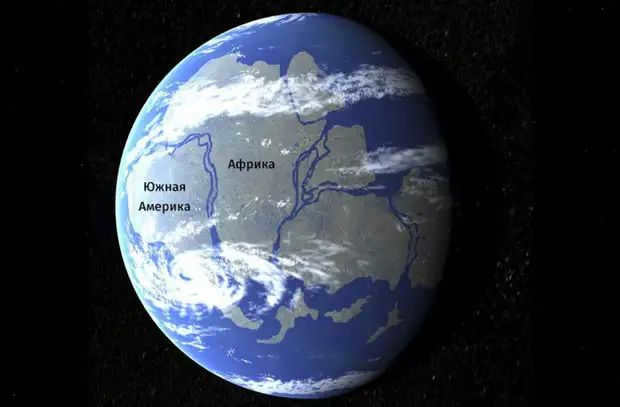
When: 542-300 million years ago
What: Gondwana
During the ancient era, when the fragments of the supercontinent Rodinia were gracefully rotating around each other, they miraculously gave birth to yet another continent known as Pannotia. This extraordinary landmass emerged approximately 600 million years ago, but sadly its existence was short-lived, as it disintegrated between 600-540 million years ago. Among its grand fragments was Gondwana, which took shape around 542 million years ago (with Eurasia being the second largest constituent). Gondwana encompassed present-day Africa, South America, Australia, New Zealand, Antarctica, Madagascar, India, and Arabia.
During the Adamic eras, the widely known Cambrian explosion, which marked the rise of multicellular life, finally occurred. Invertebrates and later vertebrates emerged as a result. Researchers from Monash University in Australia have determined that the formation of a massive mountain range, known as the Transgondwan Supermountain, played a significant role in this event (although the accumulation of oxygen in the atmosphere is still considered the main factor). The geological processes and increased precipitation that took place during this time released large quantities of phosphorus, calcium, and other minerals into the ocean, which were necessary for the formation of bone shells and skeletons in living organisms.
Cracked Teacups
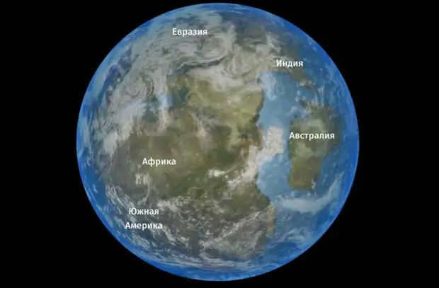
During the period of 300-175 million years ago, a phenomenon known as Pangaea occurred. Gondwana and Laurentia collided to form the youngest supercontinent, Pangea. This supercontinent was surrounded by a world ocean called Panthalassus. Additionally, the ancient sea between Africa and North America disappeared, giving rise to the majestic Appalachian Mountains. These mountains were much taller in the past, with their peaks reaching a staggering 10,000 to 11,000 kilometers above sea level, similar to the modern Himalayas. However, over millions of years, they have been slowly eroded by weathering.
Pangaea assimilated almost the entire landmass and settled in the Southern Hemisphere. However, the plate tectonics, which were unstable, played their role. 175 million years ago, the continent started to separate, and the Atlantic Ocean began to form. Australia and Antarctica broke away and drifted south, while India, originating from East Africa, moved northward and collided with Asia, creating the Himalayas in just 50 million years. Eventually, the modern continents emerged. If you cut them out from a world map and attempt to piece them together, you will notice that the edges fit like parts of a fragmented saucer.
But that’s not everything. Scientists anticipate that in 200-300 million years, the continents will reunite. The supercontinent has already been named Pangaea Ultima, or the Last Pangaea. However, that is an entirely different narrative.
Did you enjoy the article? Make sure to subscribe to the channel in order to stay updated with the latest and most fascinating content.
One Million Years Ago: What Existed on Earth and What Did Not? Remarkable Discoveries Made by Scientists…
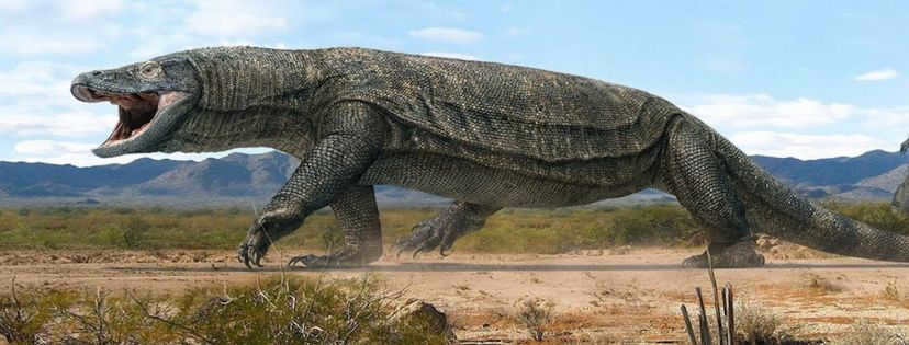
Megalania, which were massive venomous reptiles that resided in Australia one million years ago, had the ability to reach lengths of up to seven meters.
What did the Earth resemble one million years ago? Considering that our planet is 4.54 billion years old, a million years is merely a speck in the grand scheme. From a human perspective, it is challenging to conceive of the conditions of the world one million years ago, but scientific advancements have allowed us to peer into the ancient past, unraveling many of its enigmas and providing insight into what life may have been like on our planet approximately one million years ago.
If we had the opportunity to observe Earth from space a million years ago, we would notice that the arrangement of the continents appears to be much the same as it does in the present day. However, upon closer examination, it becomes evident that there are differences. This period in Earth’s history is known as the Pleistocene epoch, during which the planet was colder and likely experiencing one of its frequent ice ages. As a result, the presence of frozen water caused the ocean levels to lower. Consequently, land bridges between continents were exposed, allowing for easier migration of our ancestors, as well as animals and plants.
For instance, there were once large lakes in the western United States that have since disappeared, while the Great Lakes in the central region of America had not yet formed during that time. Additionally, England was still connected to the European continent.
Regarding our ancient human ancestors, they gradually underwent changes over time, ultimately becoming what we now refer to as modern humanity. They were adept at crafting tools and harnessing the power of fire. Additionally, they made great efforts to avoid falling victim to predatory mammals such as saber-toothed tigers and cave lions, who saw them as potential prey. It would take a considerable amount of time before humans would establish dominance over the planet.
In order to gain insight into the world as it existed a million years ago, a thorough analysis was conducted utilizing various sources, including livescience.com, nasa.gov, universitytoday.com, space.com, insidescience.org, as well as media sites like pbs.org. Additionally, consultations with experts were sought to further enhance our understanding.
What was the Earth like one million years ago?
1. The Earth was colder
During that time, there were long periods of glaciation. In geological terms, one million years ago was the Pleistocene era of the Earth (2.5 million years BC to 11711 BC), and the planet was 5 to 10 degrees colder than it is today.
Sea levels were much lower. Geologists estimate that the difference in sea level between glacial periods was almost 122 meters. Due to the lower water levels caused by the glaciers, dust storms were a regular occurrence across the continents.
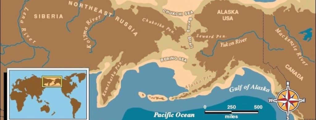
2- The Bering Strait used to be a land bridge
Due to the decrease in sea level, the current narrow Bering Strait could have served as a land crossing for migration from Asia to North America. The concept of a land bridge has captivated people for centuries. It is believed that the first written mention (in Europe) of the existence of such a bridge was documented in 1590 by the Spanish missionary Frey Jose de Acosta.
3. The British Isles were not islands and were connected to Europe
At one point in time, Britain and mainland Europe were linked by a land bridge. However, over time, the seas formed and separated the two. During the Ice Age, the sea levels dropped significantly, revealing the seabed. This exposed area, known as Doggerland, served as a pathway for animals to migrate to the warmer regions of southern Europe.
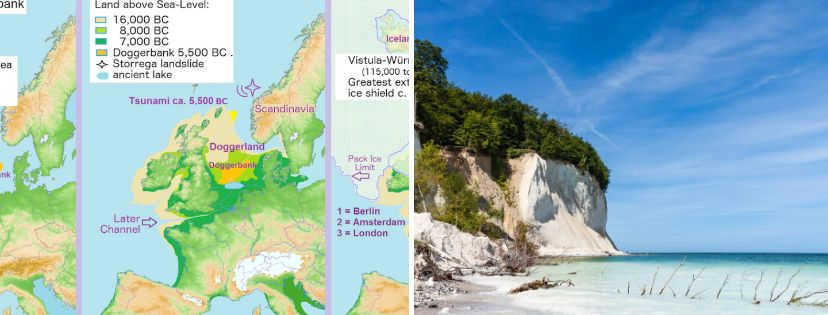
4. Baltic Sea did not exist
A million years ago, there was no Baltic Sea. The Baltic Sea is considered to be the most recent sea that formed between 10,000 and 15,000 years ago as the ice sheets from the Ice Age receded.
The five largest interconnected bodies of fresh water on Earth – Superior, Huron, Michigan, Ontario, and Erie – are known as the Great Lakes. However, these lakes did not exist one million years ago due to the presence of an ice sheet that covered a significant portion of Canada and the northern United States.
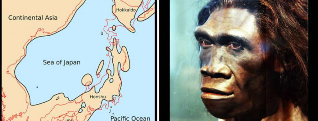
6. Japan and Korea were once connected
In the past, Japan and Korea were connected by land bridges. These land bridges spanned from the Asian mainland to the Korean Peninsula. Some archaeologists speculate that individuals migrated to Japan through these land bridges approximately 100,000 years ago.
7. Our Homo Ancestors
A million years ago, our early human ancestors, known as hominids, resided on Earth. They originated in Africa around one to two million years ago and subsequently migrated to Asia and Europe. Climate change is believed to have played a significant role in their dispersal.
For more information, visit our website:
Sign up to receive our most popular article delivered to your inbox once a day. Follow us on Facebook and VKontakte.
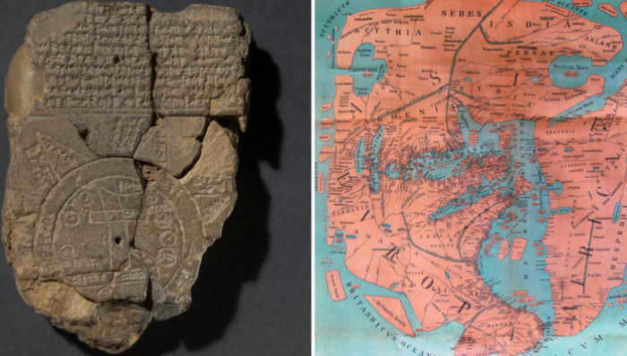
The earliest known maps on Earth emerged around the same time as humans developed the skill of drawing. These early maps were not exactly like the ones we are familiar with today, but they served as prototypes for what would eventually become maps. It is clear that as soon as humans began to travel long distances, they sought to understand and visualize their movement by creating drawings. Although maps in a more recognizable form came much later, they have been in existence for a remarkably long time – even predating our era.
The Ancient Map Prototype
In its early stages, maps were depicted as schematic drawings on cave walls, ancient utensils (such as plates), and stone slabs.
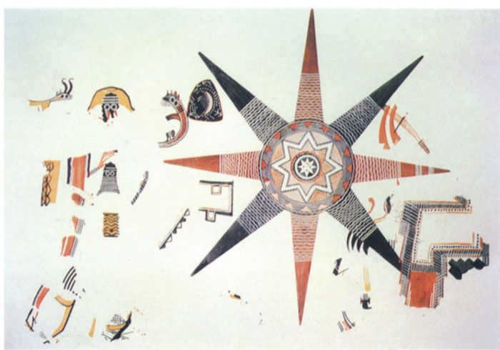
For instance, this archaeological discovery of a mural in ancient Jordan is believed to be a cosmological map. The mural features the “known world” at its center, surrounded by the “first ocean,” the “second world,” and the “second ocean.” Eight points, likely symbolizing islands, were placed to represent the “forbidden world” and the “celestial ocean.” The rectangular shape in the bottom right corner is considered irrelevant by historians, speculated to be a depiction of a building, possibly a temple.
The most ancient world map
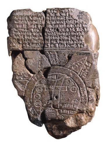
An ancient artifact discovered in present-day Iraq is believed to be one of the earliest known maps. This Babylonian map, which gained significant fame and shaped people’s perceptions of the world, holds a special place in history.
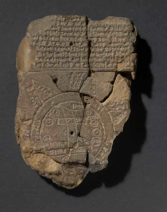
An ancient depiction of the Earth is shown on the clay slab. The Earth is portrayed as flat, round, with Babylon marked at its center. This fascinating image dates back to the 7th century BC and was recently discovered.
Anaximander was a visionary
Anaximander of Miletus (610 – 540 BC) made a significant impact in the fields of geography and cartography with his groundbreaking map. He had a unique perspective on the shape of the earth, envisioning it as an elongated oval stretching from east to west.
Aristotle himself held Anaximander in high regard, recognizing him as a respected sage. In addition to his contributions to geography, Anaximander was also an accomplished astronomer. He sought to compare the earth with other celestial bodies and pondered the origins of the universe, ultimately concluding that it goes through cycles of birth, development, death, and rebirth.
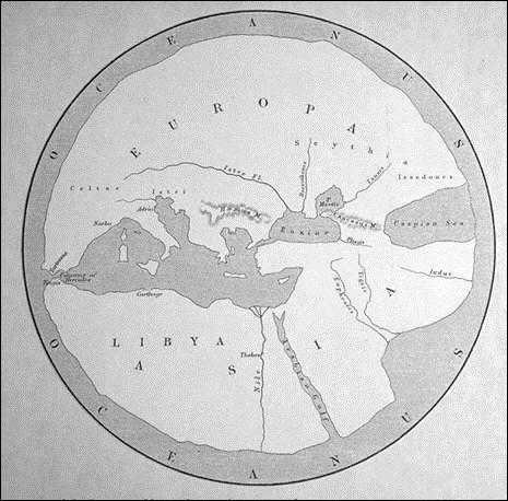
Although Anaximander’s original map and its copies have been lost over time, Herodotus noted that it depicted the world as a drum surrounded by the ocean.
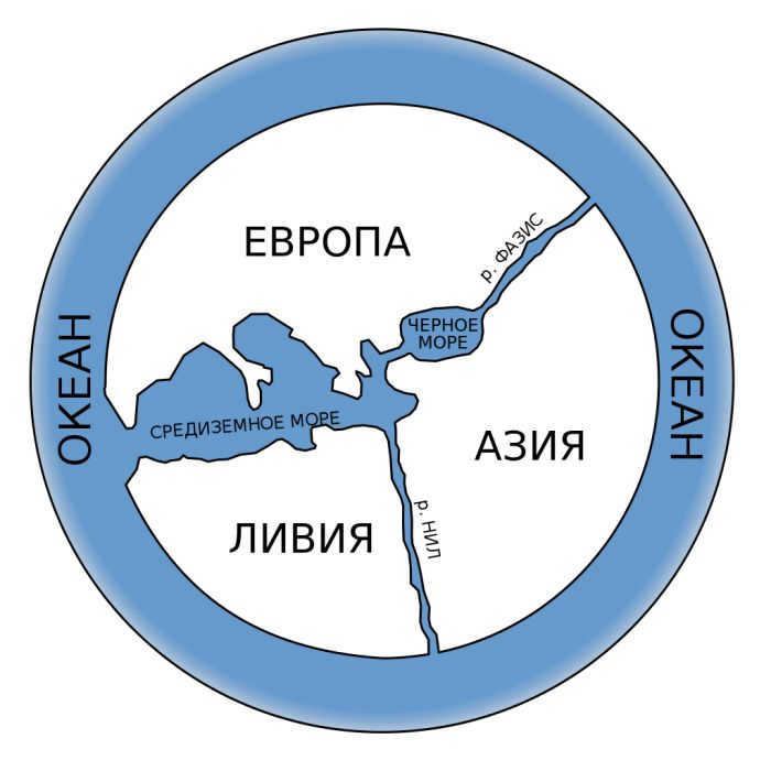

The information regarding the map created by Hecataeus of Miletus, who lived during a similar time period but slightly later, has also been preserved. According to his map, the world is composed of three regions – Europe, Asia, and Libya. All three “continents” are situated around the Mediterranean Sea. Hecataeus’ map was constructed using Anaximander’s data as a basis.
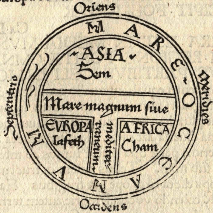
Schematically and accessibly: T – sea, O – ocean. Historians refer to this type of maps as “T-O”. /Photo:noosphere.ru/.
Eratosthenes, who is considered the father of geography (he was the first to introduce the term), wrote a three-volume work called “Geography” in the 2nd century BC. In this work, he stated that the earth is shaped like a ball and supported his statement with mathematical calculations. Unfortunately, the original work has not survived, but it is known from the retelling of Roman authors. Eratosthenes’ map has also been lost, but it had a significant influence on the research of medieval geographers.
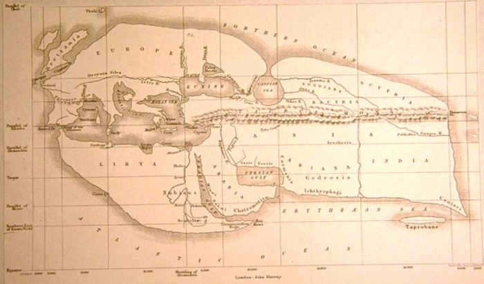
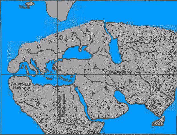
Incidentally, Eratosthenes was the pioneer in introducing meridians on maps, even though they were not as accurate at the time. Additionally, he was responsible for dividing the globe into five distinct climatic zones.
The most fascinating ancient maps
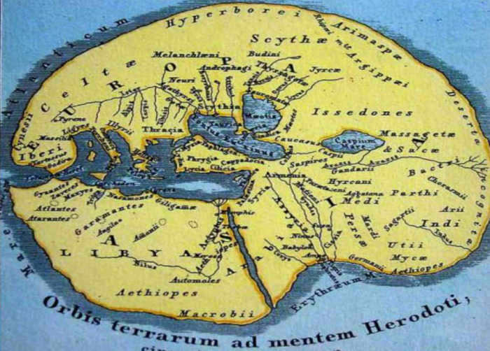
Presenting the cartographic masterpiece crafted in the 5th century BC by the renowned historian Herodotus:
Pomponius Mela, the first Roman geographer to produce the scientific work Descriptive Geography, created a map that divided the Earth into five zones, three of which were devoid of human habitation. According to Mela, the southern regions of our planet were inaccessible to people from the north because they were separated by a dry and unbearably hot territory from the temperate latitudes.
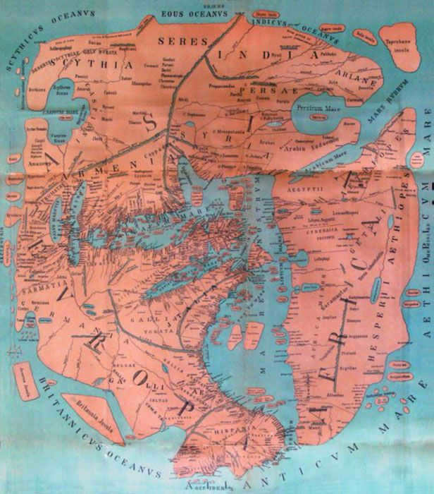
Like many of his predecessors, he regarded the Caspian Sea as a bay of the Northern Ocean. This is not surprising, as in 43, when Pomponius Mela wrote his work, most of our planet remained unexplored.
Another fascinating discovery was made during archaeological excavations of the early Christian temple of St. John the Baptist in Madaba, Jordan. It was a mosaic map depicting the Caspian Sea. The map, which dates back to the 6th century, also portrays ancient Jerusalem, with St. George being a prominent figure. The panel showcases various churches and other buildings, depicted with such detail and accuracy that modern researchers have been able to identify them. For instance, the Church of the Holy Sepulchre, situated in the center, is clearly recognizable. Scholars consider this to be the oldest map of the Holy Land.
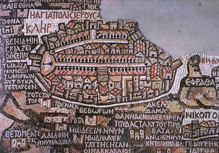
Ptolemy’s Map: An Enduring Reference Point
Claudius Ptolemy, the eminent scholar hailing from Alexandria, made a significant contribution to the field of cartography. In approximately 150 AD, he meticulously crafted a world map, accompanied by approximately 30 additional detailed maps. This comprehensive work was titled “A Manual of Geography.”
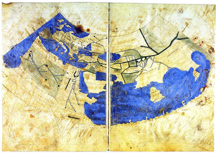
Ptolemy depicted even the most remote regions on his map, from Egypt to Scandinavia, and from the Atlantic to Indochina. This ancient artifact was discovered centuries later and served as the primary cartographic reference for explorers and scientists until the Age of Discovery. Over time, it underwent improvements and revisions.
The revised map depicted the continents of Asia, Europe, and Africa in a more accurate shape, and Jerusalem was identified as the center of the world instead of Babylon.
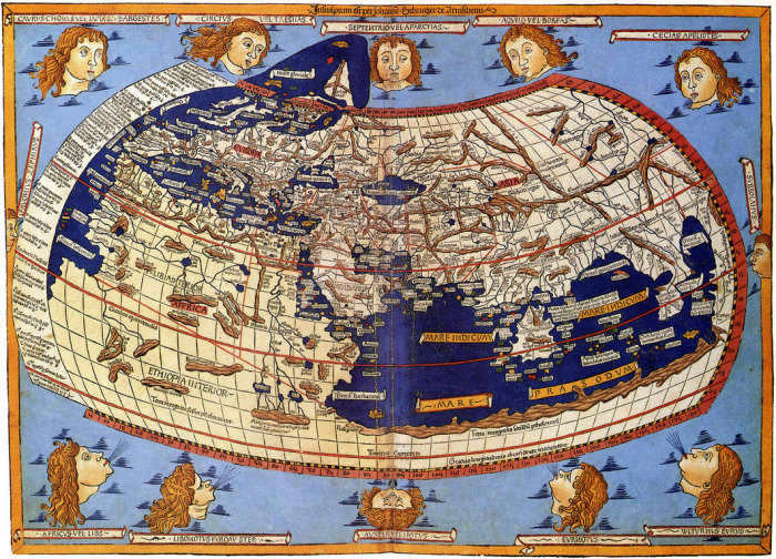

Ptolemy's map of the Inhabited World, which was recreated following his demise on a Byzantine manuscript from the 13th century, is well-known and highly informative.
Ptolemy’s map is divided into equal parts by parallels and meridians. The depiction of the Mediterranean zone and the Near East is relatively accurate, but as one moves further south, Ptolemy’s knowledge of other lands becomes increasingly uncertain. For instance, he describes the Indian Ocean as an inland sea, and the unexplored portion of the African continent to the south expands and envelops it, merging with Asia. Antarctica is not yet known – it remains an “uncharted land”. According to Ptolemy, Asia was so vast that it even extended to the area where, as later discovered, the Pacific Ocean is located.
If you want to delve further into the subject, you can explore additional information regarding Christopher Columbus’ expedition.
Enjoyed the article? Show your support by giving us a click:
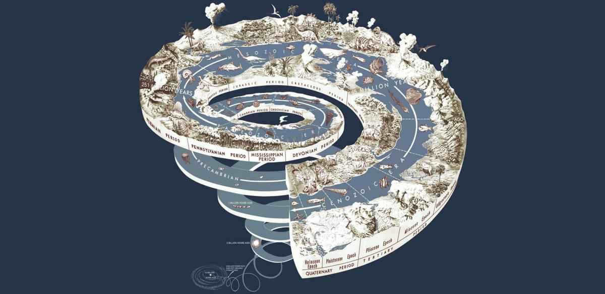
The age of our universe is approximately 13 billion years. The formation of planet Earth occurred around 4.5 billion years ago, originating from the gas and dust created during the birth of the Sun. At first, the Earth was extremely hot due to asteroid impacts and residual heat. However, as time passed, the planet gradually cooled down, leading to the formation of its crust on the surface.
Subsequently, through a collision with another celestial body, the Moon was created. The leftover material, along with the Earth’s mantle, was ejected into space, eventually settling into Earth’s orbit. Thus, our planet acquired its natural satellite, the Moon.
The geological history of Earth is a series of consecutive epochs and periods, encompassing the creation of landscapes and continents, the emergence of flora and fauna, climate fluctuations, and the origin of life.
About 3.8 billion years ago, life began to emerge on our planet, while the Earth’s crust was already in the process of formation. Subsequently, due to the continuous movement of tectonic plates, the crust underwent constant transformations.
The first organisms appeared in water, and it took several million years for life to colonize the land. The process of Earth’s geological development is still ongoing.
Scientists classify the entire timeline of Earth’s existence into different periods known as eons. The two main eons in Earth’s history are the Precambrian and Phanerozoic eons. These eons are further divided into smaller units called eras, and each era is then divided into periods. Each stage represents significant events that have shaped the conditions for life on Earth. These stages transition due to large-scale natural catastrophes.
A geologic era is a specific segment of Earth’s history on the geologic time scale. It is a subinterval of an aeon, such as the Archean Era. Geologic eras are often further divided into smaller periods known as geologic periods.
There are five major eras that hold great importance in Earth’s geological history, which are discussed in detail below.
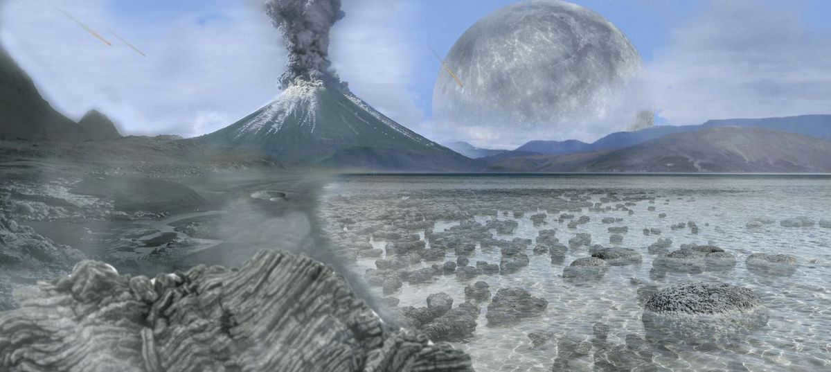
The Archean, which is the earliest stage of life in the history of Earth, was first proposed by geologist J. Dana in 1872.
This particular period began approximately 4.5 billion years ago during the formation of the Earth. Preserved rocks from this era provide evidence of the existence of a pre-nuclear form of life known as prokaryotes.
Fossils of the first photosynthetic organisms, which are 3.4 billion years old, have been discovered and studied.
The Archean period was characterized by an atmosphere containing chlorine, hydrogen, and ammonia. It also witnessed the formation of sulfur, nickel, and iron deposits. Additionally, the radiation levels were considerably high, and the temperature soared up to 80 degrees Celsius.
Furthermore, the impact that led to the formation of the Moon also impacted the Earth’s rotation rate and tilt.
The formation of the atmosphere and the ocean took place, giving rise to the emergence of the first life in what is commonly referred to as the “primordial broth”.
The Proterozoic Era
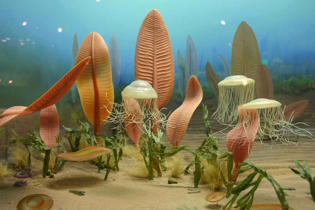
The Proterozoic Era commenced around 2.5 billion years ago and concluded approximately 540 million years ago. This era holds the distinction of being the lengthiest geologic period in the history of our planet. During this time, soil and single-celled organisms were formed, and the first instances of algae, worms, and mollusks emerged.
At the onset of this era, the Earth’s atmosphere lacked oxygen, but as time progressed, bacteria residing in the “primary broth” began to generate it. Some of these bacteria even evolved the ability to respire aerobically.
The Sun’s luminosity began to intensify, although it was insufficient to warm the Earth. Instead, the planet experienced considerable cooling throughout this period. A global glacier covered the entire Earth, leading to the snowball Earth hypothesis. This cooling was likely a result of a drastic rise in atmospheric oxygen levels.
The time period known as the “boring billion” occurred between 1.8 and 0.72 billion years ago during the Paleozoic Era. This period was marked by a consistent climate, low levels of oxygen, and a gradual progression of biological evolution.
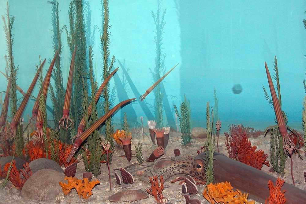
The period we are referring to is commonly referred to as the ancient life era. The Paleozoic era is divided into 6 distinct periods:
- The Cambrian period – This period took place approximately 530-490 million years ago. During the Cambrian period, the Earth’s flora and fauna began to form. However, due to high temperatures, most living organisms were unable to survive on land, and as a result, life predominantly developed in water. Algae, mollusks, and arthropods thrived in the ocean during this time.
- The Ordovician Period (approximately 490 to 422 million years ago). This period saw the emergence of vertebrates, corals, and sponges in the ocean. Lichens also began to spread onto land, along with the first appearance of arthropods.
- The Silurian Period occurred approximately 422 million to 418 million years ago. During this time, plants emerged on land and arthropods developed the ability to breathe air. Vertebrates also evolved a bony skeleton. Additionally, the Silurian saw the formation of climatic zones and the emergence of mountain ranges.
- The Devonian Period spanned from 418 million to 353 million years ago. This period was characterized by widespread forest coverage on land. It was during this time that land-dwelling amphibians and the first insects made their appearance.
- The Carboniferous Period lasted from 353 million to 290 million years ago. It was a time when amphibians thrived, but towards the end of the period, a significant drop in temperatures led to mass extinctions.
- The Permian Period encompassed the time period from 290 million to 249 million years ago. This period was marked by the emergence of reptiles, an increase in temperatures, and the formation of deserts.
The Mesozoic Era
The Mesozoic Era, also known as the Age of Dinosaurs, is a geologic era that lasted from about 252 to 66 million years ago. It is divided into three periods: the Triassic, Jurassic, and Cretaceous periods. During this time, dinosaurs and other reptiles dominated the Earth. The Mesozoic Era was a time of significant geological and biological changes, including the breakup of the supercontinent Pangaea, the evolution of flowering plants, and the emergence of new groups of animals.

Subsequently, the Mesozoic era can be categorized into three distinct periods:
- The Triassic era (248 – 200 million years ago) – during this time, the Earth started to separate into different continents. Mammals and plant species began to emerge.
- The Jurassic era (200 – 140 million years ago) – this period witnessed the rise of covered plants and the ancestors of birds, known as dinosaurs.
- The Cretaceous era (140 – 65 million years ago) – during this phase, advanced forms of mammals and birds thrived. However, towards the end of the Cretaceous era, dinosaurs faced extinction.
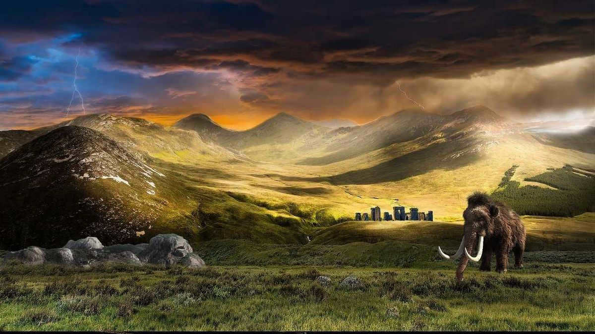
The Cenozoic Era, which started 65 million years ago, is considered the contemporary era of our planet. This particular period in Earth’s history is distinguished by an extensive range of animal and plant species, as well as terrestrial mammals. Additionally, the Cenozoic Era is renowned for being the era that witnessed the emergence of savannas, flowering plants, and insects. Moreover, it was during this time that birds underwent an evolutionary transformation.
Furthermore, the Cenozoic Era was notable for being the epoch in which intelligent human beings made their appearance on Earth.
To sum up
The geological history of the Earth holds great significance in the realm of modern science. The existence of present-day life forms can be attributed to the events that unfolded throughout these various epochs. The ongoing evolution of life on our planet is a continuous process. By retrospectively examining the Earth’s history, we can gain insights into the origin of life, which is arguably the most remarkable phenomenon in the entire Universe.
As we know, historical chronology is divided into two distinct periods. The first period refers to the time that predates the current era, which came to an end with the onset of the first year. From that point onwards, our era began and has persisted until the present day. While the use of “N.E.” is no longer commonplace when referring to the year, it is still implied.
The earliest calendars
The evolution of humanity gave rise to the necessity of arranging and managing dates and times. A primitive agriculturalist required precise knowledge of the optimal sowing periods, while a nomadic herder needed to determine the appropriate time to relocate in order to ensure sufficient food for their livestock.
This is the way the initial calendars started to emerge. They were established on observations of celestial objects and the natural world. Various cultures had their own unique timekeeping systems. For instance, the Romans followed a calendar that dates back to the founding of Rome in 753 B.C., while the Egyptians based their calendar on the start of each pharaoh’s dynasty. Additionally, numerous religions developed their own calendars. In Islam, for instance, the new era commences with the year of Prophet Muhammad’s birth.
Julian and Gregorian calendars
In 45 B.C., Gaius Julius Caesar established his own calendar, known as the Julian calendar, which began on January 1st and lasted for twelve months.
The calendar we use today was introduced by Pope Gregory XII in 1582. He made adjustments to correct significant inaccuracies that had accumulated since the first Ecumenical Council. These inaccuracies had reached as many as ten days. The difference between the Julian and Gregorian calendars increases by approximately one day per century, and currently stands at thirteen days.
Chronology has always been a key factor in history. It is crucial to understand the timeframe in which significant events in human history occurred, whether it was the invention of the first tools or the start of the Hundred Years’ War. It is often stated that history without dates is akin to mathematics without numbers.

The Religious Approach to Chronology
Given that the start of our era is counted from the year believed to be the birth of Jesus, the religious perspective often employs the corresponding terminology: from and to the Nativity of Christ. Accurate historical information about the emergence of life on our planet is still elusive. Scientists can only draw conclusions about the timing of certain events based on religious and historical artifacts. In this context, the years before our era are denoted in reverse chronological order.
Year Zero
The concept of dividing time into periods before and after the Nativity is closely tied to the calculations found in astronomical records, which are based on the integers on a coordinate axis. While the year zero is not widely used in religious or secular notation, it is a commonly accepted concept in astronomical notation and in ISO 8601, an international standard established by the International Organization for Standardization. ISO 8601 outlines the format for dates and times and offers guidelines for their use in an international context.
Time Ticking Away
The concept of “B.C.” was introduced in the field of chronology following the work of the esteemed Bede, a Benedictine monk, who discussed it in one of his treatises. Starting from 731, time has been divided into two periods: before the Common Era and after it. This calendar was gradually adopted by most Western European countries, with Portugal being the last to adopt it on August 22, 1422. Prior to January 1, 1700, Russia used the chronological calculation of the Constantinople era, which was based on the Christian era “from the creation of the world”. Many eras are based on the relationship between the “days of creation of the world” and the total duration of its existence. The Constantinople era, which began in 5509 B.C., was initiated by Constantius, although his name and the corresponding timekeeping were mentioned with reluctance due to his inconsistent Christian beliefs.
Prehistoric and historical epochs
History is characterized by prehistoric and historical epochs. The commencement of the former can be traced back to the advent of the first human being, whereas it concludes with the emergence of writing. As for the prehistoric epoch, it is further divided into various time periods. The classification is primarily based on archaeological discoveries. These artifacts, which our ancestors used to create tools before the advent of our era, not only help in reconstructing the chronological framework, but also enable us to identify the stages of the prehistoric era.
The historical era encompasses periods such as Antiquity, the Middle Ages, the New Age, and Modern times. The onset of these periods varied across different countries, making it difficult for scholars to determine their precise time frames.
It is commonly acknowledged that the inception of the new era was not determined through a continuous countdown of years, such as starting from year one and progressing up to the present. Its chronology commenced much later, with the date of Christ’s birth. It is believed that this calculation was initially carried out by a Roman monk named Dionysius the Lesser in the 6th century, more than five hundred years after the aforementioned event. In order to ascertain the result, Dionysius first calculated the date of Christ’s Resurrection, utilizing the church tradition that the Son of God was crucified in his thirty-first year of life.
The Roman monk determined the date of Christ’s Resurrection to be on the twenty-fifth of March 5539 according to the chronology “from Adam”. This would mean that the year of Christ’s Nativity was the 5508th according to the Byzantine era. However, it is important to note that Dionysius’ calculations were met with skepticism in the West until the fifteenth century. Even in Byzantium, they were never officially recognized as canonical.

Ancient History
Between the seventh and third millennia BC, the Earth experienced the Neolithic era, a period of transition from a hunter-gatherer society to an agricultural one. During this time, people began to engage in farming, animal husbandry, and the development of crafts such as weaving, stone tool grinding, and pottery making.
By the end of the fourth millennium BC and the beginning of the first millennium BC, the Bronze Age had emerged. This era saw the widespread use of metal and bronze weapons, as well as the rise of nomadic pastoralist societies. Eventually, the Bronze Age gave way to the Iron Age. In Egypt, the first and second dynasties ruled, bringing about the unification of the country into a centralized state.
The economic rise of the Sumerian civilization began in 2850-2450 BC. During the same period, the Aegean culture of ancient Greece experienced a significant growth from 2800 to 1100 BC. Simultaneously, the Indus valley witnessed the birth of the Indus civilization and the flourishing of the kingdom of Troy.
However, around 1190 BC, the powerful Hittite empire collapsed. It was not until almost four decades later that the Elamite king seized Babylonia, marking the peak of his power.
Between 1126 and 1105 BC, the Babylonian sovereign Nebuchadnezzar ruled. In 331 BC, the first state was formed in the Caucasus. Subsequently, in 327 BC, Alexander the Great led his Indian campaign. Numerous significant events took place during this period, including the Sicilian slave revolt, the Allied War, the Mithridates Wars, Mark Antony’s campaign against the Parthians, and the reign of Emperor Augustus.
Lastly, in the period ranging from the eighth to the fourth centuries B.C., the birth of Christ occurred.
Novel chronology
Throughout history, different civilizations have had their own unique ways of measuring time. Each nation tackled this task independently, often influenced by religious and political factors. It wasn’t until the 19th century that Christian states agreed upon a common reference point, known as “our era,” which is still used today. The ancient Mayans, Byzantines, Hebrews, and Chinese all had their own systems for dating the creation of the world.

Ancient map of the world
In ancient times, explorers were filled with curiosity about the world and documented their journeys through drawings. These drawings were transferred onto various materials such as tree bark, sand, or papyrus. The very first map of the world emerged many millennia prior to the present era. Cave paintings were among the earliest depictions of maps. As people continued to explore the Earth, they developed a particular fascination for ancient maps from previous eras. Some of these maps portray our planet as a vast island surrounded by the vast ocean, while others already show the outlines of the continents.
The Map of Babylon
The very first map to be created before our era was a small tablet made of clay that was discovered in Mesopotamia. It dates back to the end of the 8th century and the beginning of the 7th century BC, making it the only surviving map from the Babylonians. The land depicted on the map is surrounded by bodies of water referred to as “salt water”. Beyond the water, there are symbols in the form of triangles which are believed to represent the mountains of distant lands.
This ancient map provides a glimpse into the geography of the region during that time, showing the territories of Urartu (modern-day Armenia), Assyria (Iraq), Elam (Iran), and Babylon itself, with the Euphrates River flowing through the middle.
Eratosthenes’ Cartography
The concept of the Earth being a sphere was already envisioned by the ancient Greeks, who made compelling arguments in its favor. Pythagoras, in particular, believed that nature was harmonious and that the most perfect shape it could take was that of a sphere, which is the shape our planet takes. Eratosthenes, who lived in the third century BC in Cyrene and was the head of the Library of Alexandria, is credited with creating the first map based on this spherical image of the Earth. He is also believed to have coined the term “geography”. Before our era, Eratosthenes drew the world with lines running parallel and side by side, which he called “parallels” and “meridians”. In Eratosthenes’ depiction, the world was a single island bordered by the Northern Ocean to the north and the Atlantic Ocean to the south. It was divided into Europe, Arian and Arabia, India, and Scythia. To the south lay Taprobane, which is modern-day Ceylon.
