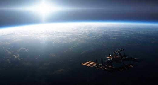
This section will explore the concepts of satellites and their orbits, focusing on the main types.
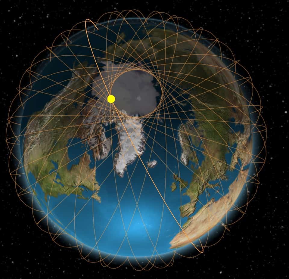
During the past 50 years of the space era, the number of satellites in near-Earth space has grown significantly. There are now tens of thousands of objects ranging in size from the International Space Station (ISS), which measures more than 100 meters in diameter, to smaller debris and fragments measuring 5-10 cm. Figure 1a displays the distribution of satellites at midnight on January 17, 2011, depicting over 14,000 satellites in orbit.
| Figure 1a. Distribution of satellites in near-Earth space. The left image shows the view in the equatorial plane, while the right image shows the view from the north pole. |
From a specific location on Earth, only a small portion of the ISVs can be observed. An animation of an ISV’s movement over Minsk in one minute on a January morning is depicted in Fig. 1b. The data was obtained through the Heavensat program (refer to Chapter 3). Each green marker represents a distinct satellite that is illuminated by the Sun. The blue markers represent ISVs that are in the Earth’s shadow, which is located in the western part of the sky during the morning (see Chapter 3). It is evident that different satellites have varying angular velocities, with some moving faster, some slower, and others remaining stationary (these are geostationary satellites, as explained below). It is important to note that this “mosquito swarm” cannot be seen with the naked eye due to the majority of these satellites and space debris being too dim.
To avoid getting overwhelmed by the multitude of satellites and ISEs, we provide the following classification.
These classifications are not meant to be definitive – as you may know, anything can be classified based on any criteria for as long as desired.
§ 1. Classifications of ICBM orbits
In this paragraph, we will examine the various types of orbits of ISVs. As we learned in Chapter 1, all ICBMs follow elliptical paths with the Earth located at one of the foci. Therefore, all orbit types are considered elliptical. The classification of orbits is based on the inclination value "i" and the major semi-major axis value "a". Furthermore, we can differentiate between low-elliptic and highly elliptic orbits based on the eccentricity value "e". The changes in the appearance of the orbit at different eccentricity values are visually represented in Figure 2.
Now, let’s move on to studying the different types of orbits.
Section 1. Classification of ISPs Orbits by Inclination
Equatorial Orbits
An equatorial orbit is an extreme case of an orbit where the inclination “i” is 0 degrees (see Figure Figure 4). In this scenario, the precession and orbit rotation will be maximized, reaching up to 10 degrees per day and 20 degrees per day, respectively (refer to Section 5 of Chapter 1). The width of the satellite’s swath of visibility, which extends along the equator, is determined by its altitude above the Earth’s surface. Orbits with low inclination “i” are commonly referred to as “near equatorial” orbits.
Polar orbits
A polar orbit is the second extreme case of an orbit where the inclination of the "i" equals 90 degrees (refer to Figure 5). In this scenario, there is no orbital precession, and the satellite rotates in the opposite direction of its rotation, with a maximum rotation of 5 degrees per day (see Section 5 of Chapter 1). This type of polar satellite consistently passes over every part of the Earth’s surface. The width of the satellite’s visibility swath is determined by its altitude above the Earth’s surface, but eventually, the satellite becomes visible from any point. Orbits with an inclination "i" close to 90 degrees are known as “circumpolar” orbits.
In general, the inclination needed for a sun-synchronous orbit can be determined by the formula iss = arccos(1/(1 + e)) – 1, where “e” is the eccentricity of the ISV orbit, “a” is the major semi-major axis of the ISV orbit in kilometers (a = h + RZ), “h” is the perigee distance to the Earth’s surface, and “RZ” is the radius of the Earth, which is approximately 6371 km.
Figure 7 illustrates a graph depicting the required inclination of the satellite’s orbit to achieve sun-synchronicity for various values of the eccentricity “e” and perigee height “h” above the Earth’s surface.
| Figure 7. The necessary inclination of the satellite’s orbit for a sun-synchronous orbit in relation to the perigee distance “h” from the Earth’s surface; “e” represents the eccentricity of the satellite’s orbit. |
Because of the impact of disturbances, the satellite gradually deviates from the synchronized mode, requiring periodic adjustments to its orbit using engines.
Section 2: Classification of ISE Orbits Based on Semi-Major Axis Magnitude
The second classification is based on the magnitude of the semi-major axis, specifically the height above the Earth’s surface.
Low Earth Orbit (LEO)
Satellites that orbit in the Low Earth Orbit (LEO) range (Fig. 8, a) are typically positioned at altitudes ranging from 160 km to 2000 km above the Earth’s surface [5]. In English literature, these orbits and satellites are referred to as LEO, which stands for “Low Earth Orbit”. LEO orbits experience the maximum perturbations from the Earth’s gravitational field and upper atmosphere. The angular velocity of LEO satellites ranges from 0.2°/s to 2.8°/s, with orbital periods ranging from 87.6 minutes to 127 minutes.
Medium-Earth Orbital Satellites (MEO)
Medium Earth orbit satellites, also known as MEO satellites, are satellites that orbit at altitudes ranging from 2000 km to 35786 km above the Earth’s surface [6] (see Figure 8, b). The lower limit of this zone is determined by the boundary of low Earth orbit (LEO), while the upper limit is set by the orbit of geostationary satellites. Navigation satellites, such as the NAVSTAR satellites of the GPS system (which fly at an altitude of 20200 km [7]) and GLONASS satellites (which fly at an altitude of 19100 km [8]), as well as communication satellites that cover the Earth’s poles, are primarily found in this zone [6]. The orbital period of these satellites ranges from 127 minutes to 24 hours, and their angular velocity is measured in units and fractions of an angular minute per second.
Geostationary and geosynchronous orbits in the context of Internet Service Providers (ISPs)
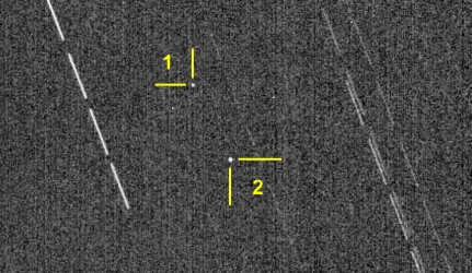 |
| Fig. 10. An image of the geostationary orbit, showing two satellites: Eutelsat W4 (NORAD #26369) and Eutelsat W7 (NORAD #36101). The lines represent the paths of the stars. This photo was taken on June 6, 2010, from the RS observation point using the “Jupiter 36B” lens and the “Canon 30D” DSLR camera. It consists of 12 frames, each with a shutter speed of 30 seconds. © V. Povalishev, V. Mechinsky. |
If we consider the type of the GSS trajectory, it is determined by the values of the inclination “i”, eccentricity “e”, and perigee argument “Wp” of the satellite orbit (refer to Figure 11). When the eccentricity and inclination of the orbit are both zero, the subsatellite point remains stationary and is projected onto a specific point on the Earth’s surface. However, with a non-zero eccentricity and zero inclination, the GSS creates a segment on the surface, moving from east to west and back, shifting from the zero position by no more than ΔLmax = 114.6° – e. For example, if the eccentricity is 0.01, the displacement will be no more than 1.2°. On the other hand, if the inclination is non-zero and the eccentricity is zero, the GSS forms classical “figure eights” where the angular height 2Θ of the figure is equal to twice the inclination i of the orbit, and the maximum width ΔLmax is calculated using the formula 0.044 – i^2 (with the inclination “i” given in degrees). In the most general case, with non-zero “i” and “e”, the GSS track on the Earth’s surface represents an “inclined figure eight” with an angular height of 2Θ = i and a maximum width of ΔLmax = 114.6° – e. However, a “figure eight” shape is only obtained when the perigee argument “Wp” of the orbit is equal to 0° or 180°. In other cases, a more complex figure is obtained, resembling something between an oval and a figure eight.
| Figure 11. The Earth’s surface features different types of GSS tracks depending on the inclination “i”, eccentricity “e”, and perigee argument “Wp” of the orbit [20]. |
For instance, the following animation showcases the movement of SDS 3F2 (SCN: 26635). The animation comprises 19 images captured using a “Jupiter 36B” lens (F=250 mm, 1/3.5) and a “Sony A200” DSLR camera (ISO 1600, exposure 30 s), with each frame taken every 5 minutes. The camera remained stationary.
Contrary to popular belief, GSS do not remain fixed in the sky at a single point. The shape and size of the GSS trajectory in the sky are determined by the inclination, eccentricity, and perigee argument of the satellite orbit. Additionally, if the satellite is not active and does not correct its orbit, it will start to shift against the background of stars at a significant speed. According to [21], corrective propulsion systems are needed on board stationary satellites due to the tasks of launching into a stationary orbit and the perturbations they constantly experience. These perturbations include the inhomogeneity of the Earth’s gravitational field, the gravitational fields of the Moon and the Sun, and even light pressure. For example, light pressure can cause long-periodic movements of IS3 along the orbit and changes in altitude for relatively light but large IS3. The flattening of the Earth at the poles also affects the movement of IS3 along the stationary orbit, causing periodic perturbations in altitude and inclination. Deviations of the Earth’s equator from a perfect circle cause the stationary IS3 to shift and fluctuate in altitude position. The maximum perturbation due to equatorial compression occurs near certain “standing” points, while the most stable “standing” points are at 75 o E and 105 o W. (see below for more on standing points).
And from the same location: “Numerous secular perturbations of the IS3 position on the geostationary orbit can be eliminated by making adjustments after IS3 is launched into orbit. For instance, the secular perturbations of the position in the orbit plane caused by the influence of polar compression can be compensated for by increasing the orbit altitude and correspondingly increasing the satellite velocity. However, the effects of other perturbing factors (particularly due to the equatorial compression of the Earth), which result in almost constant changes in the longitude of the stationary IS3 point, remain unresolved. Therefore, it is necessary to periodically correct the motion of stationary IS3 by adjusting its orbit. The frequency of corrections depends on the acceptable amount of displacement of stationary IS3 in longitude over the course of a year. In general, if the allowable displacement of IS3 should not exceed 1 o -4 o, up to 6 corrections per year need to be carried out. At points of stable position of stationary IS3, no more than one correction per year will be necessary”.
It appears that the GSS cannot remain in geostationary orbit without the necessary orbit adjustments – these adjustments must be made periodically. As a result, each satellite is equipped with a fuel reserve for these corrections. Once this fuel reserve is depleted, the satellite is moved to a burial orbit and deactivated (refer to “The Fuel Reserve for Correction” below). This is done to free up space in the crowded orbit for new satellites and to prevent the risk of collision with active GSS during drifting.
Below, you will find information about the geostationary orbit and the classification of GSS, which has been provided by a member of the profi-s forum at www.astronomy.ru/forum exclusively for our website.
Currently, there are over 16,000 man-made objects in near-Earth and geostationary orbits. Out of these, only around 6% are considered “active” or functioning. Geostationary orbit (GEO) is particularly attractive and beneficial for a wide range of scientific, economic, military, navigational, commercial, and other purposes. Approximately 80% of active satellites are deployed in GEO. This orbit is unique because it allows a satellite to stay fixed over a single point on the Earth’s surface.
- In geostationary orbit, all forces acting on a celestial body, such as the GSO, have zero equidistance.
- The angular velocity of the Earth’s rotation and the satellite’s rotation are the same.
The geostationary orbit, which is approximately 42164 km from the center of the Earth, is limited in size and lies in the Earth’s equatorial plane. A geostationary satellite in this orbit will theoretically have constant celestial coordinates. However, the Keplerian motion of a passive geostationary satellite can be distorted by various factors. Gravitational perturbations, such as geopotential nonsphericity and lunar-solar perturbations, as well as non-gravitational factors like light pressure, can affect the satellite’s motion. These perturbing forces cause the satellite to drift, altering its rotation period around the Earth. The mean longitude of the satellite changes over time due to this drift. If the satellite’s orbital period is less than a stellar day, it drifts slowly from west to east. Conversely, if the orbital period is longer, it drifts from east to west. The eccentricity of the orbit also affects the subsatellite longitude of the geostationary satellite. A non-zero eccentricity leads to a change in the subsatellite longitude. Additionally, there are slight changes in both longitude and latitude. The longitude experiences a periodic change with a period of about 12 hours and an amplitude proportional to the square of the orbit inclination angle. The latitude changes with a period of 24 hours and an amplitude equal to the inclination angle itself. As a result, the subsatellite point traces a well-known “figure eight” pattern on the Earth’s surface (see Fig. 13).
The Earth’s geopotential decomposition, which is the inhomogeneity of its gravitational field, causes resonance effects of longitude terms. As a result, there exist two stable equilibrium positions (points) in the geostationary orbit located at longitudes of 75°E (known as libration point L1) and 255°E (known as libration point L2). Additionally, there are two unstable points approximately 90° away from the stable positions. It is important to note that these libration points in the geostationary orbit should not be confused with the libration points in celestial mechanics when dealing with the problem of “n” bodies.
The geostationary orbit around the Earth is unique. Satellite launches to GEO started in 1963. In the early 21st century, more than 40 countries possess their own geostationary satellites. Every year, numerous satellites are sent to GEO, gradually filling up the orbit with decommissioned satellites. Explosions of these decommissioned satellites and their launch vehicles frequently occur in GEO. These explosions generate dozens to hundreds of space debris, which can disrupt the functioning of operational satellites. The accumulation of space debris in this orbit can result in irreversible consequences, such as the instability of satellite operations. Unlike in orbits closer to Earth, space debris in GEO can orbit the Earth for thousands of years, posing a threat of collision with operational satellites. Since the late 20th century, the issue of GEO pollution has emerged as a global environmental problem of significant magnitude.
Optical telescopes designed for GEO monitoring tasks have a field of view that is tens or even more times greater than the radiation pattern width of radio telescopes. By observing the apparent brilliance in the optical range, it is possible to estimate the size of the apparatus and determine its shape and orientation based on the dependence of brilliance on time and angle of illumination by the Sun. As a result, optical instruments are highly effective for GEO control tasks. However, a drawback of optical observations is their reliance on sky conditions, meaning they are not suitable for all-weather use.
Geostationary satellites are commonly known as satellites with orbital periods ranging from 22 to 26 hours, eccentricities not exceeding 0.3, and inclinations to the equatorial plane up to 15 degrees. However, more detailed classifications and stricter boundaries can be found in some sources.
- “Active” satellites are equipped with an energy source and are controlled through commands from Earth.
- “Passive” satellites are artificial objects that are no longer controlled from Earth. These satellites have depleted their rocket fuel and are now classified as space debris. This category includes launch vehicles, fragments of rocket stages, various parts accompanying the launch, fragments of satellites resulting from onboard explosions or collisions with meteoroids or other satellites.
- Scientific.
- Geodetic.
- Meteorological.
- Navigational.
- Military, which are divided into several subclasses (optical, radio-technical, radar reconnaissance, nuclear missile warning — SPRN).
- Radio-telecommunications satellites (including commercial satellites).
- Engineering.
- Class C – active, correctable GSS (38% of the total number of GSS). This category of objects remains at the same longitude through orbit correction. Active geostationaries are sometimes further classified based on the type of correction, orbital parameters, and longitude. Between corrections, these objects typically exhibit libration behavior. The “lifetime” of active GSSs is 10-15 years, after which they either become libration objects or transition into the drifting object category.
- Class L1 — GSS undergoing libration around a stable point located at longitude 75°E. (10%).
- Class L2 — same for a stable point at longitude 255°E. (4%).
- Class L3 — a few passive objects with drift close to the critical point, capable of changing the libration point or mode of motion (less than 1%).
- Class D1 — GSS with a negative drift of less than -2.5° per day (22%).
- Class D2 — drifting SSGs with drifts ranging from -2.5° to +2.5° per day (16%). Approximately one third of them move from west to east, and two thirds move from east to west.
- Class D3 — GSS with a positive drift greater than +2.5° per day (10%).
High Earth Orbit (HEO) satellites
High-Earth Orbital Satellites (HEO), also known as “HEO” (which stands for High Earth Orbit), are satellites that reach altitudes above 35,786 km above the Earth’s surface [9]. These satellites fly above geostationary satellites (see Fig. 9). Some HEO satellites have highly elliptical orbits with significant eccentricity, such as the Meridian and Molniya satellites. Others have almost circular orbits, like the “Vela” satellites, which were used to discover gamma-ray bursts in the late 1960s.
p.3. Burial orbits
Burial orbits are a distinct category of satellite orbits that are specifically designed for decommissioned satellites to be taken to, in order to minimize the risk of collision with operational satellites and create space for new satellites. In the case of GSS, a burial orbit is situated 200 km above the GSS orbit itself (refer to Fig. 16). Fig. 16) [11].
For each GSS satellite, the burial orbit is computed separately, with the minimum perigee ΔH being:
where "CR" is the coefficient of light pressure (see "Light pressure" §5), "S" is the surface area of the ISV, and "m" is its mass.
Low-orbit satellites equipped with nuclear reactors [12] have a burial orbit altitude of approximately 1000 km, where the nuclear reactor core is relocated once its operation has ceased [11].
Research satellites
Research satellites are specifically designed to observe and gather information about planets, galaxies, and other celestial objects in space.
There are various examples of these types of satellites, including orbiting telescopes such as the “AGILE” (NORAD #31135) from Italy, which is a γ-telescope, the “AKARI” (NORAD #28939) from Japan, which is an infrared telescope, the “Chandra” (NORAD #25867) from the USA, which is an X-ray observatory, the “COROT” (NORAD #29678) from the EU, which is a visible wavelength range telescope, the “Herschel Space Observatory” (formerly known as “FIRST”, NORAD #34937) from the EU, which is an infrared telescope, the “Fermi Gamma-ray Space Telescope” (formerly known as “GLAST”, NORAD #33053) from the USA and EU, which is a γ-ray telescope, and the “Hubble Space Telescope” (NORAD #20580) from the USA and EU, which is capable of observing ultraviolet, infrared, and visible light, among others.
Remote Sensing Satellites for Earth Observation
Remote sensing satellites play a crucial role in observing and monitoring various aspects of the Earth. These satellites utilize imaging equipment capable of receiving a wide range of wavelengths, including ultraviolet (UV), infrared (IR), and radio waves [13]. By analyzing these spectral bands, scientists are able to track the state of flora and fauna, monitor climate patterns, study sea and air currents, and even conduct mineral exploration. Some well-known examples of such satellites include the Landsat series, AQUA, AURA, and many more. Typically, these satellites are placed in sun-synchronous orbits to optimize their observations.
Spacecraft
Manned spacecraft. The Russian “Soyuz” series of spacecraft and the American “Space shuttle” shuttles are some examples.
Space stations
Long-duration spacecraft. Currently, the International Space Station (ISS) is the only object present in orbit [14].
Satellites for Weather Forecasting
Meteorological satellites are specifically built to collect and transmit data that is crucial for predicting weather patterns and monitoring the Earth’s climate.
Satellites for Global Navigation
Navigation satellites play a vital role in facilitating accurate navigation on Earth. The two most widely used global navigation systems are GPS (Global Positioning System) and GLONASS (Globalnaya Navigatsionnaya Sputnikovaya Sistema).
Satellites for Gathering Information
A reconnaissance satellite, also known as an Earth observation satellite, is a type of satellite that is used to gather information about the Earth. This can include data about the Earth’s surface, weather patterns, and other relevant information. These satellites are often used for military purposes, as they can provide valuable intelligence on potential threats or targets.
Satellites for Communication
A communication satellite is an artificial satellite that is specifically designed to facilitate communication between different points on the Earth’s surface. These satellites are used to relay radio signals, allowing for communication between areas that do not have a direct line of sight. They play a crucial role in modern telecommunications, enabling long-distance calls, internet connectivity, and other forms of communication.
Microsatellites, weighing less than 500 kg, are compact spacecraft that have been created by universities, private companies, and even enthusiasts. These small satellites have gained significant popularity due to their affordability and accessibility. Numerous universities in the United States, Europe, and Japan are now launching their own microsatellites for various purposes, such as remote sensing, facilitating communication among radio enthusiasts, and conducting technology trials.
© BelAstro.Net, Lupus, 22.01.2013
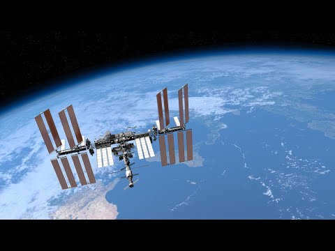
When observing footage from the orbit of an artificial satellite, a common observation is the variation in distance between the International Space Station (ISS) and different parts of the Earth. This phenomenon raises the question: why is the ISS closer to some areas and farther away from others?
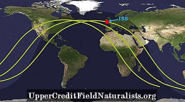
As depicted in the given illustration, it is evident that the satellite follows a curved trajectory, which appears rather unconventional for a satellite’s orbit around our planet. This orbital path does not appear to be very efficient. Hence, the query arises whether all man-made satellites, including the International Space Station (ISS), truly adopt such oscillating orbits while encircling the Earth?
What causes the ISS’s trajectory to appear as a wave on a global map?
In brief: The ISS, similar to other man-made satellites, travels along an (almost) circular orbit around the Earth. The wave-like appearance of its path is due to the fact that its orbit exists in three dimensions. However, when this orbit is projected onto a two-dimensional Mercator world map, it becomes flattened and distorted, resembling a sine wave.
While all man-made satellites follow a (nearly) circular orbit around the planet, this article will focus exclusively on the ISS.
The International Space Station, well-known among space enthusiasts, is an artificial satellite that serves as a manned space station in low Earth orbit. It accommodates a team of 5-6 astronauts who engage in a wide range of scientific and technological research during their stay.
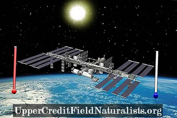
Similar to other artificial satellites, the International Space Station (ISS) also revolves around the Earth on a specific path known as an orbit. The orbit of the ISS is positioned at an altitude above the Earth where it still encounters the strong gravitational force exerted by the Earth. Contrary to popular belief, there is no absence of gravity up there. In reality, the ISS experiences up to 90% of the gravitational force that we experience here on Earth. It is in a constant state of falling towards Earth, but due to its tremendous orbital velocity (17,200 mph / 27,600 km/h) and the spherical shape of the Earth, it never collides with the surface.
One interesting aspect of the ISS orbit is that it deviates from the Earth’s equator. Typically, when we think of a satellite orbiting the Earth, we imagine it following the path of the equator. However, the orbit of the ISS is quite different and can be visualized as follows:
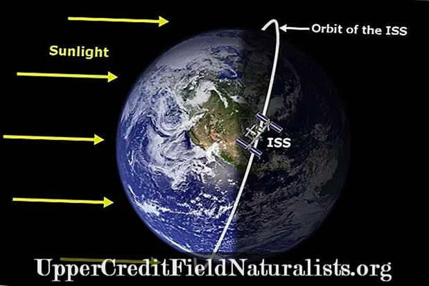
As depicted in the image above, the International Space Station (ISS) is orbiting the Earth along a circular trajectory. Nevertheless, when this trajectory is projected onto a map of the world, it undergoes a significant transformation and appears as shown below:
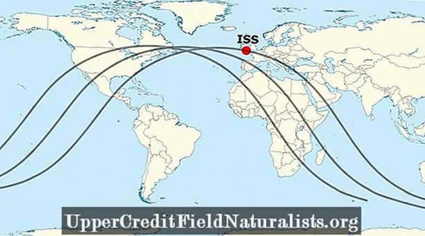
Mercator Projection
The world maps that were presented to us in our childhood at school and the maps that are commonly displayed on television are fundamentally flawed and inaccurate.

The reason behind this is quite logical. The Earth is a three-dimensional entity, while maps are limited to two dimensions. To accurately depict country borders and expansive land masses on the Earth’s surface, a method is needed to project these three-dimensional objects onto a two-dimensional sheet of paper. This is precisely what the Mercator map accomplishes.

The rectangular sheet of paper beautifully illustrates the physical characteristics and landmasses of the globe. It depicts latitude and longitude as straight lines that intersect at right angles, ensuring clear and distinct country shapes. However, the Mercator projection presents challenges in accurately representing the sizes of countries and distorts the trajectory of the International Space Station (ISS) on a world map.
The reason the ISS orbit appears wavy is because it aligns with the Earth’s equator on a two-dimensional map, which is done for our visual convenience.
Here is an animated representation to assist you in visualizing and comprehending this concept more clearly:
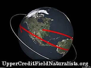
When you represent the orbit of the International Space Station (ISS) on a map, it appears as a sinusoidal wave due to the two-dimensional projection.
To clarify, the trajectory of the ISS (as well as other artificial satellites) appears wave-like because it is flattened onto a two-dimensional surface, not because satellites actually move in a wave-like pattern around the Earth.
References :
- Wikipedia – International Space Station
- Wikipedia – Mercator projection
- Wikipedia – Caterpillar
- NASA
At present, there exist over 1,000 man-made satellites circling the Earth. They carry out various tasks and possess distinct designs. However, they all share the common characteristic of orbiting the planet without descending.

Simple explanation
Essentially, satellites are constantly in free fall towards Earth due to the force of gravity. However, they are able to maintain their orbit because of the initial velocity they are launched with.
When a satellite revolves around the Earth, it is essentially continuously falling past it.
If you toss a ball up into the air, it will eventually fall back down. This occurs because of the force of gravity, which is also responsible for keeping us grounded on Earth and preventing us from floating off into space.
When it comes to putting satellites into orbit, rockets play a crucial role. In order for a rocket to successfully place a satellite in orbit, it must accelerate to a staggering speed of 29,000 kilometers per hour.! This velocity is necessary to counteract the strong pull of gravity and enable the rocket to break free from Earth’s atmosphere. Once the rocket reaches the appropriate position above Earth, it releases the satellite.
Once the satellite is released, it harnesses the energy provided by the rocket to maintain its own motion. This ongoing movement is known as momentum.
However, how does the satellite manage to remain in orbit? Would it not simply travel in a straight line out into space?
Not exactly. Despite being thousands of kilometers away, the satellite is still affected by the pull of the Earth’s gravity. This gravitational force, in combination with the momentum from the rocket, causes the satellite to move in a circular path around the Earth – an orbit.
When a satellite is in orbit, it achieves a delicate equilibrium between its momentum and the gravitational force exerted by the Earth. However, achieving this equilibrium is a rather challenging task.
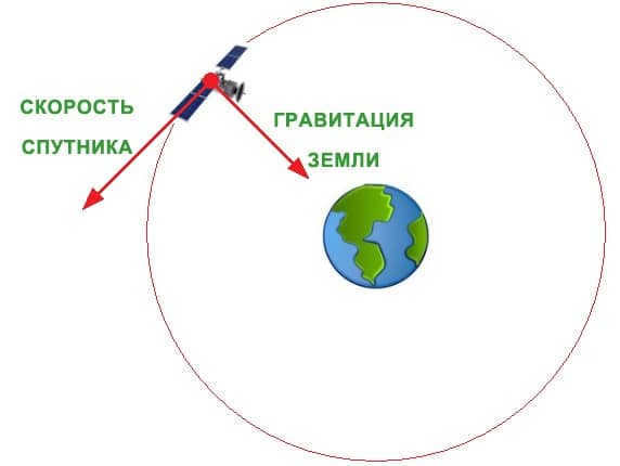
The gravitational force is more powerful when an object is closer to the Earth. Satellites that orbit the Earth must maintain high velocities in order to remain in orbit.
As an example, the NOAA-20 satellite orbits just a few hundred kilometers above the Earth’s surface. It must travel at a speed of 27,300 kilometers per hour to maintain its orbit.
In contrast, NOAA’s GOES-East satellite orbits at an altitude of 35,405 kilometers. It requires a velocity of approximately 10,780 km/h to counteract gravity and remain in orbit.
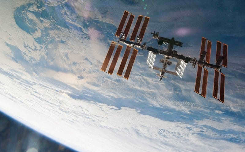
Satellites have the ability to remain in orbit for extended periods of time, eliminating any concerns of them descending to the Earth’s surface.
By donating a minimum of 30 rubles on Boosty, you can express your gratitude to the author of this article and contribute towards the promotion of such valuable content.
What exactly is the geostationary orbit? It is a circular path positioned above the Earth’s equator, where an artificial satellite orbits at the same angular velocity as the planet’s rotation around its axis. This orbit remains constant in the horizontal coordinate system, allowing the satellite to appear stationary in the sky. The Geostationary Earth Orbit (GEO) falls under the category of geosynchronous orbits and is commonly utilized for communication, television broadcasting, and other satellite applications.
The concept of geostationary orbit was first proposed by the Russian inventor K. E. Tsiolkovsky. Tsiolkovsky suggested using orbital stations to populate space. This idea was also explored by foreign scientists like G. Oberth. However, it was Arthur C. Clarke who developed the concept of using the orbit for communication. In 1945, Clarke published an article in Wireless World magazine where he detailed the advantages of operating a geostationary field. As a result of his significant contributions to this field, the orbit became known as “Clarke’s Belt” in honor of the scientist. Over the years, many theorists have contemplated how to achieve high-quality communication. In 1928, Herman Potochnik proposed the idea of utilizing geostationary satellites.
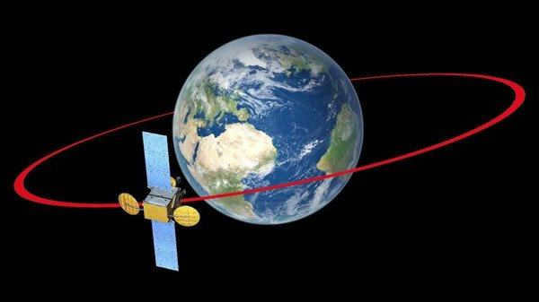
1. Geosynchrony is characterized by a field that has a period matching the Earth’s rotation period. A geosynchronous satellite completes one revolution around the planet in a sideric day, which lasts for 23 hours, 56 minutes, and 4 seconds. This is also the same amount of time it takes for the Earth to complete one revolution in fixed space.
2. In order to keep a satellite in a specific position, the geostationary orbit must be circular and have zero inclination. If the orbit is elliptical, the satellite will experience an offset either to the east or west, as it moves differently at different points in the orbit.
3. The “hover point” of the spacecraft should be located at the equator.
4. To prevent overlapping frequencies and collisions, it is crucial to carefully arrange the satellites in the geostationary orbit, ensuring that a small number of communication frequencies do not interfere with each other during transmission and reception.
5. Adequate propellant is necessary to maintain the spacecraft in a stable position throughout its time in orbit.
The geostationary orbit offers unique advantages for satellite placement. It requires careful consideration of various parameters to achieve the desired immobility of the vehicle. Additionally, satellites positioned in this orbit have the ability to observe the Earth at a specific angle of seventeen degrees. With each satellite covering approximately one-third of the orbital surface, a network of three satellites can provide extensive coverage of the entire planet.
Artificial satellites
can be paraphrased as
Satellites created by humans
.
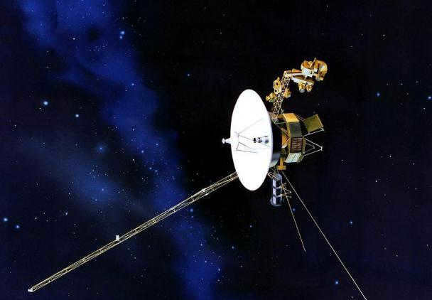
An object in space moves around the Earth along a geocentric trajectory. To launch it, a multi-stage rocket is utilized. This is a space device propelled by the reactive force of its engine. In order for artificial satellites of the Earth to remain in orbit, they must initially have a velocity that matches the first space velocity. These satellites travel at altitudes of several hundred kilometers or higher. The duration of their orbital paths can span multiple years. Artificial Earth satellites can be launched from various platforms, including orbital stations and spacecraft. They can weigh up to around twenty tons and have dimensions reaching several tens of meters. The twenty-first century saw the emergence of ultra-lightweight vehicles, some weighing just a few kilograms.
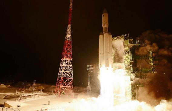
Many countries and companies have launched satellites into space. The USSR created the world’s first artificial vehicle, called Sputnik-1, which was launched on October 4, 1957. The United States followed in 1958 with the launch of Explorer-1. NASA launched its first satellite, Syncom-3, in 1964. Most satellites are not designed to return to Earth, but there are some that can partially or completely return. These satellites are used for scientific research and a variety of tasks. They can be military, research, navigation satellites, among others. Additionally, universities and radio amateurs also launch their own satellites.
"Standing point"
At an altitude of 35786 kilometers above sea level, you can find geostationary satellites. This specific altitude allows the satellites to rotate at the same period as the Earth’s circulation in relation to the stars. Due to its stationary position, the geostationary orbit where the satellite is placed is referred to as the "standing point". Staying still in this orbit guarantees uninterrupted long-distance communication; once aligned, the antenna will always be directed towards the desired satellite.
Relocation
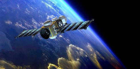
Satellites can be moved from a low-altitude orbit to a geostationary orbit by utilizing geo-transition fields. These fields consist of an elliptical trajectory that has a low-altitude point and a peak altitude that closely matches the geostationary orbit. When a satellite is no longer operational, it is relocated to a disposal orbit situated approximately 200-300 kilometers above the geostationary orbit.
The height of the geostationary orbit
By using the formula for calculating centripetal acceleration, it is possible to determine the angular velocity. The formula can also be used to find the radius of the geostationary orbit by dividing the geocentric gravitational constant by the square of the angular velocity. This results in a radius of 42164 kilometers. Taking into account the equatorial radius of the Earth, the altitude is calculated to be 35786 kilometers.
Alternatively, the calculations can be approached from a different perspective. It can be stated that the altitude of the orbit, which represents the distance from the center of the Earth, together with the angular velocity of the satellite matching the rotational motion of the planet, generates a linear velocity that is equivalent to the first cosmic velocity at that altitude.
The speed of an object in geostationary orbit
The velocity in geostationary orbit is determined by multiplying the angular velocity of the object by the radius of the orbit. In this case, the speed in geostationary orbit is calculated to be 3.07 kilometers per second, which is significantly lower than the speed required for objects in low Earth orbit. To decrease the speed, the radius of the orbit would need to be increased by a factor of six.
The length of the geostationary orbit can be calculated by multiplying the radius of the orbit by two and then multiplying that product by the mathematical constant pi. The length of the geostationary orbit is equal to 264,924 kilometers. This length is an important factor when determining the “standing points” of satellites in geostationary orbit.
The impact of forces
The characteristics of the path along which the artificial mechanism revolves may be altered due to the influence of lunar-solar gravitational perturbations, irregularities in the Earth’s magnetic field, and the ellipticity of the equator. These field transformations manifest in various phenomena, including:
- Deviation of the satellite from its original position along the orbit towards stable equilibrium points known as potential pits of the geostationary orbit.
- The inclination angle towards the equator increases at a specific rate and reaches 15 degrees every 26 years and 5 months.
To maintain the satellite in its desired position, a propulsion system is installed and activated multiple times every 10-15 days. This system is used to make “north-south” corrections to counteract the increase in orbital inclination, as well as “west-east” corrections to counteract drift along the field. A substantial amount of fuel is necessary on board to regulate the satellite’s trajectory throughout its entire operational lifespan.
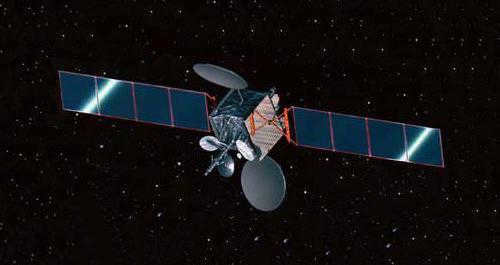
The selection of the fixture depends on the specific technical characteristics of the satellite. For instance, a chemical rocket engine relies on a stored fuel supply and uses high-boiling components like diazote tetroxide and asymmetric dimethylhydrazine. On the other hand, plasma devices generate much lower thrust but can operate continuously for tens of minutes, thereby reducing the amount of fuel consumed. This type of propulsion system is employed for maneuvering the satellite to a different orbital position. The fuel reserve in the geostationary orbit is the primary factor determining the lifespan of the spacecraft.
Disadvantages of Artificial Fields
One major drawback of interacting with geostationary satellites is the significant delay in signal propagation. For instance, with a speed of light of 300,000 kilometers per second and an orbital altitude of 35,786 kilometers, it takes about 0.12 seconds for the “Earth-satellite” beam to travel, and 0.24 seconds for “Earth-satellite-Earth” communication. When considering signal delays in equipment and cable transmission systems on the ground, the total delay for the “source-satellite-receiver” signal reaches approximately 2-4 seconds. This delay greatly hampers the use of vehicles in orbit for telephony and renders satellite communications impractical for real-time systems.
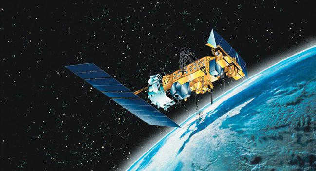
An additional drawback is the lack of visibility of the geostationary orbit from high latitudes, hindering the transmission of communications and television broadcasts in the regions of the Arctic and Antarctica. When the sun and the transmitting satellite align with the receiving antenna, there is a decrease or even a complete absence of signal. This phenomenon is especially pronounced in geostationary orbits due to the satellite’s stationary position.
Doppler effect
The Doppler effect is a phenomenon where the frequencies of electromagnetic vibrations change as the transmitter and receiver move towards or away from each other. This effect is also observed in the movement of artificial vehicles in orbit. It is characterized by fluctuations in the carrier frequency of satellite vibrations, which are compounded by the hardware instability of the on-board repeater and earth station frequencies, making signal reception more challenging. The Doppler effect also affects the frequency of modulating vibrations, which cannot be controlled. However, when communication and direct television broadcasting satellites are utilized in orbit, this phenomenon is effectively minimized, resulting in stable signal levels at the receiving end.
Global perception of geostationary orbits
