The amount of energy our planet receives from the sun is only a fraction of the energy emitted by the star, but it is significantly greater than the energy produced artificially on Earth.
The sun completes one revolution around its axis in approximately 25.4 of our standard twenty-four-hour days.
The distance from our planet to the Sun is approximately 149.5 million kilometers, but these measurements are so vast that they are not expressed in linear units, but rather in terms of the time it takes for light to travel. Sunlight reaches the Earth in just 8 minutes and 18 seconds, with a speed of 300,000 kilometers per second.
The solar system is always in motion as it moves towards the Lyra constellation in outer space. This movement occurs at a speed of 20 kilometers per second.
Can you explain the concept of zenith?
Nevertheless, the term zenith is often informally used to describe the position of the sun. However, this usage is not entirely accurate. Because of the unique characteristics and positions of celestial bodies in outer space, the sun’s rays do not always fall at a 90-degree angle on every part of the Earth.
Variation in the position of the sun’s zenith throughout the year
If you have a basic understanding of the solstice days, you can make an approximate calculation of the latitude where the sun will be at its highest point on any given date.
Which locations on Earth experience the sun at its zenith
Because of the Earth’s shape and the 23-degree tilt of its axis in relation to the Sun, it is not possible for the sun to be at its highest point, known as the zenith, for every location on Earth. This occurrence is out of reach for the majority of people.
At midday, the Northern tropic (also known as the Tropic of Cancer) and the Southern tropic (also known as the Tropic of Capricorn) define the regions where the sun reaches its highest point in the sky.
How the highest point of the sun in the sky inspires poets
One of them is a young poetess from Moscow, who won the Pushkin Youth Festival “On a par with the century” under the name Kira Tikhonova (formerly known as Danilyants).
The sun is at its peak, my coat rests on the snow.
Snow, like in the tundra, a celebration for children!
We return home in darkness,
Hot as a sauna,
The sun is at its zenith, shorts covered in dust.
The steering wheel covered in red rust.
Knees covered in green, knocked down once again.
The sun is like the tropics, thirty-five degrees!
Ten years before the first computers.
Childhood, as joyful as light,
The sun at its peak. Overalls.
My eldest child with a worried expression
Kicking the snow with a delicate toe
Victoria Vikolskaya, a resident of Mytishchi, a town in the Moscow Region, is an aspiring author.
When the sun reaches its highest point in the sky
And in the evening, there are clear skies
Not just at noon.
Even if the weather is gloomy,
Because the sun is at its zenith!
That’s how it is today, that’s how it was yesterday.
What’s so remarkable about it
The sun doesn’t care
When it’s at its highest point
And in the evening, there are no clouds in the sky.
A beam of light shines on a glass.
A beam of light on a leaf of a tree
Shines on that beam of sunshine.
If there’s even a faint ray
No matter how weak that ray is,
It’s stronger than the clouds!
Because it broke through the clouds,
♪ Given by the powerful sun ♪
There are no clouds in the sky today,
If there is just one beam of light
Then the sun is directly overhead!
It might not be scientifically accurate, but it is pleasant and incredibly bright.
The symbolism of the sun at its highest point
The sun holds a significant position in every symbolic doctrine. When it comes to the sun’s role in deciphering dreams, various interpretations can be found in different compilations.
When the sun rises and sets in Moscow
In order to obtain information about the sunrise and sunset times for any location on Earth, you must choose the specific city from our extensive database. If you cannot locate your desired city in the provided list, simply locate it on the interactive map below or input its coordinates manually.
Calculation of data (September 9, 2021 UTC +3)
Equinoxes and solstices 2021-2022 in Moscow, Russia
| Autumnal equinox 2021 | 22.09.2021 |
| Winter solstice 2021 | 21.12.2021 |
| Spring equinox 2022 | 20.03.2022 |
| Summer solstice 2022 | 21.06.2022 |
By utilizing the graph, one can identify and visually track the fluctuations of all variables over time, in order to comprehend the periods of the year with varying levels of light and darkness, as well as the duration of daylight in Moscow and how it changes.
Moscow’s Sunrise and Sunset Calendar
The table of calculations presents an overview of data for the selected timeframe. It is useful for determining the average length of a day in a given year or month, or obtaining a list of specific data, such as the time of dawn, which can be printed or used to generate a graph later on. To specify a timeframe, click on the calendar located to the right of the date. To print the table, use the corresponding button to the right of the period form.
Graph for a specific time period
By utilizing the graph, you have the ability to identify and visually track the fluctuations of various factors over a particular duration. This allows you to comprehend when it becomes light or dark during specific periods of the year, as well as the duration of daylight hours in Moscow and how it evolves. All the pertinent data can be transformed into a graph format – simply choose the desired parameter from the dropdown menu and specify the desired time interval.
Weather forecast for Moscow over the next 5 days
Altitude and distance to the Sun: a comparison table
Hourly Sun observations in Moscow today
Discover more about Moscow
A quick overview of Moscow
Moscow was first documented in Russian historical records in 1147. Initially, it was a small fortress located in the territory of the Vladimir-Suzdal Principality. Presently, Moscow is recognized as the most populous city in Europe. Throughout its history, Moscow has been home to a diverse population from various ethnic backgrounds. In recent years, the city has experienced significant population growth due to migration and an influx of newcomers.
As the sun rises in Moscow, you’ll have the chance to behold the lush green environs that encircle the city. Moscow is encompassed by a forest park belt and there are also areas with indigenous vegetation. The predominant foliage consists of pine trees, with peat bogs also present. Within the forest habitats, one can observe the red vole or woodland mouse, while the meadows are home to the field mouse. On the outskirts of Moscow, one can often catch a glimpse of the sizable muskrats.
Currently, Moscow stands as one of the few European capitals that has successfully maintained various forests, natural lakes, vast meadow fields, and significant clusters of swamps within its own territory. Rivers such as Presnya, Likhoborka, Neglinka, Ichka, and numerous other tributaries of the Yauza River are interconnected with the flat marshy depressions of the Moskva River.
Moscow has a temperate continental climate, with occasional stable and sharp frosts.
Sunrise
Get the latest and most accurate information about when the sunrise will occur on the current date. Knowing the exact time of sunrise and sunset can help you plan your day and make sure you don’t miss them. Additionally, you can find out the day length, civil twilight, sunset time, and other useful sun information for navigation and astronomy. A sunrise and sunset calendar can also help you determine the best times to observe these natural phenomena.
On the 9th of September 2021, the sunrise is set to occur at 05:50, while the sunset will take place at 19:03. The sun will reach its highest point, also known as its zenith, at 12:26. The duration of daylight will be 16 hours and 13 minutes. Civil dawn will begin at 05:12, and civil sunset will end at 19:41.
Selecting a Location for Sun Calculation
Upcoming Day
On the upcoming day, 10.09.2021, the sunrise will occur at 05:52, while the sunset is expected at 19:00. The sun will reach its zenith, or highest point, at 12:26. The duration of daylight will be 16 hours and 08 minutes. Civil dawn will begin at 05:14, and civil sunset will end at 19:38.
Throughout the week
The appearance of the luminary above the horizon line is known as sunrise, while its disappearance from the horizon line is called sunset. Due to the presence of our planet’s atmosphere, we are able to witness the sunrise slightly earlier than we would in a non-atmospheric environment. This is because the atmosphere causes a phenomenon known as atmospheric refraction. Atmospheric refraction causes the direct path of the sun’s rays to bend, resulting in the sunrise being visible approximately 35 angular minutes earlier, and the sunset being observed later than it would be without an atmosphere. In practical terms, the effects of refraction are most noticeable when comparing the lengthening of the day at the equator, where the sun rises almost perpendicular to the horizon, which amounts to a 7-minute increase, whereas at the poles, the transition between polar day and night lasts for 2 days.
The civil twilight period provides us with an opportunity to witness the presence of Venus, which can sometimes be seen even in the presence of sunlight. The term “civil twilight” is utilized to indicate the time when an individual outdoors, without any additional sources of light, can engage in various activities. During this time, under ideal weather conditions, the line of the horizon and objects on the ground are clearly visible. From the latitude of 60°33′ and extending up to the Arctic Circle (66°33′), a phenomenon known as “white nights” occurs, where the evening civil twilight is replaced by the morning. This definition is also incorporated into certain laws, one of which mandates drivers to use headlights after sunset.
Twilight duration
The duration of civil twilight, whether in the morning or evening, varies depending on the latitude. The speed of the solar disk’s movement is approximately 0.25 degrees per minute or 15 degrees per hour (360 degrees per day). However, at sunrise and sunset, the movement of the solar disk is not perpendicular to the horizon line. This angle of movement determines the duration of all twilight periods, with sharper angles resulting in longer durations. The angle at which the Sun’s trajectory intersects with the horizon line is influenced by the geographic latitude and the time of year, which is affected by the planet’s axial tilt towards the Sun. The equator experiences the shortest average annual twilight, as the Sun rises almost perpendicular to the horizon line. Excluding the latitudes of the Arctic Circle, the equinoxes have the shortest duration of twilight throughout the year. As the angle of the Sun’s crossing over the horizon becomes sharper, the duration of twilight increases, particularly during the approach to the summer and winter solstices.
Duration of civil twilight in minutes:
Navigational twilight
The period when the Sun is above the horizon in the angular interval of 6°- 12°, it is possible to observe the primary navigational stars and the horizon, which the ship’s captain can use a sextant to orient himself and measure the angles between celestial objects and the horizon line. However, during this time, it is necessary to use additional sources of light as it is more like night than evening. When the evening navigation twilight transitions to morning twilight, a beautiful phenomenon known as “blue nights” occurs.
Astronomical twilight
Astronomical twilight refers to the period of time when the Sun is positioned at an angle of 12° to 18° below the horizon. During this phase, the sky takes on a similar appearance to that of nighttime, allowing observers to catch a glimpse of celestial objects. In fact, in the time between astronomical twilight and astronomical night, it is even possible to observe galaxies and nebulae. However, due to the absence of natural light, normal human activities without the aid of artificial lighting are not feasible during this period. This is particularly true in urban areas with high levels of light pollution, where the opportunity to observe stars with a magnitude of 4 or higher is greatly diminished, regardless of the Sun’s position above the horizon.
Allow me to introduce you to a small yet practical project that I have recently completed in my spare time – SunCalc solar calculator.
SunCalc displays the sun’s trajectory and the phases of illumination throughout the day for a selected location and date on a map (along with a few other nifty features).
The inspiration for this project came to me when I was searching for a picturesque spot in Crimea to capture the sun setting over the sea (which eventually became a part of a video clip). I discovered that all the existing tools for this purpose were outdated. Determined to create the best tool imaginable, I stumbled upon a webpage filled with numerous astronomical formulas. With this newfound knowledge, I embarked on the development process during my free evenings, and the end result is SunCalc.
Possible Applications
Utilizing the Ego
First and foremost, in everyday situations. What is the latest time I should leave the woods while still having visibility, considering I haven’t purchased a bike headlight? How late can I sunbathe in the evening before the beach becomes shaded by the cliff on the right? When will the sun no longer directly blind me when I play soccer on the nearby playground? What is the level of natural light in the apartment I am considering renting throughout the year? These types of inquiries have proven incredibly useful on numerous occasions.
Additionally, I would like to address photography enthusiasts, including myself. It is crucial to have knowledge of certain aspects such as the duration of twilight (especially for capturing night landscapes), the direction of the sun’s setting or rising (to select the optimal angle), and the ideal time to photograph an object to avoid shooting against the sun or having it partially obscured by a nearby building.
Furthermore, this information is also beneficial for general education and satisfying natural curiosity. Have you ever wondered why Australia experiences hotter temperatures during winter than in summer? How about the phenomenon of white nights and which cities and specific dates they occur? Do you know what polar day and night entail? Additionally, understanding how the sun’s trajectory changes from north to south and the duration of dawn from Moscow to Kiev can provide fascinating insights. These are just a few examples of the countless intriguing questions that can be answered.
A few implementation details
Future plans
I trust you will discover this small service to be useful. I am eagerly anticipating your feedback and comments. Additionally, feel free to share your ideas or vote for existing ones here. Thank you!
update: Apologies for the hosting issues, the project has been temporarily relocated to a different server – everything appears to be functioning properly now.
Time of sunrise and sunset in Moscow
To obtain data for any location on the planet, you must choose the city from our database. In the event that the desired city is not listed, simply locate it on the map below or enter its coordinates.
Data calculation (09.09.2021 UTC +3)
Equinoxes and solstices 2021-2022 in Moscow, Russia
| Autumnal equinox 2021 | 22.09.2021 |
| Winter solstice 2021 | 21.12.2021 |
| Spring equinox 2022 | 20.03.2022 |
| Summer solstice 2022 | 21.06.2022 |
By utilizing the graph, you have the ability to analyze and visually track the variations of all variables over time. This allows for a comprehension of the periods throughout the year when it becomes lighter or darker, as well as the duration and number of daylight hours in Moscow.
Sunrise and sunset calendar for Moscow
The calculation table presents an overview of data for the specified time frame. It is particularly useful for determining the average length of a day within a given year or month. Additionally, it provides data such as the sunrise time in list format, which can be printed or used to generate a graph. To select a time frame, simply click on the calendar located to the right of the date. To print the table, utilize the corresponding button on the right side of the form.
Graph for a specific time period
Using the graph, you can analyze and visually track the fluctuations of various parameters over a given period of time. It allows you to determine the specific time of the year when it becomes light or dark, as well as the duration of daylight hours in Moscow and how it changes over time. You can convert any data into a graph format by selecting the desired item from the drop-down menu and adjusting the time range accordingly.
Weather forecast for Moscow. 5-day outlook
Altitude and Distance from Moscow to the Sun
Sunrise and Sunset times in Moscow today
Discover more about Moscow
Abrégé de Moscou
The first mention of Moscow in Russian chronicles dates back to 1147. It was then a small fortress in the Vladimir-Suzdal principality. Today, Moscow is recognized as the most populous city in Europe. Throughout its history, Moscow has always had a diverse population. In recent years, the city’s population has seen significant growth due to both emigration and the arrival of newcomers.
As the sun rises over Moscow, you will have the chance to marvel at the lush greenery that encompasses the city. Moscow is enveloped by a forest park belt and also boasts areas of natural vegetation. The predominant flora consists of pine trees, with the addition of peat bogs. Within the forested habitats, one can spot the red spit or forest mouse, while the field mouse can be found in the clearings. On the outskirts of Moscow, it is not uncommon to come across the majestic gopher tortoise.
Currently, Moscow stands out as one of the few European capitals that has successfully maintained various forests, natural lakes, vast meadows, and significant marshland areas within its own territory. Rivers such as Presnya, Likhoborka, Neglinka, Ichka, and numerous other tributaries of the Yauza River are connected to the flat, marshy basins of the Moskva River.
Moscow has a temperate continental climate, with infrequent but occasional stable and severe frosts.
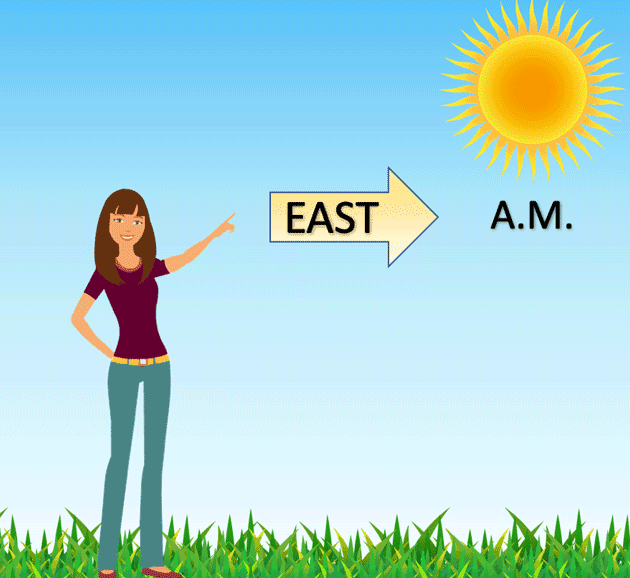
The terms “east” and “west” are derived from the movement of the sun. The sun “rises” in the east and “sets” in the west, while the concepts of south and north are more complex.
Words related to the word “north” are associated with the concept of “cold”. In dialects, there is the term “siver” which means “cold”. There is a hypothesis suggesting that the word “north” is derived from an Indo-European root that originally meant the left side. For ancient worshippers of the sun who prayed towards the east, the north was always on their left. However, since cold air comes from the north, the root was reinterpreted. The word “south” is likely connected to the Indo-European term meaning “to shine, to radiate” and has a parallel with the Greek word “auge” which means “brilliance, radiance, dawn”. Once again, it is related to the sun. The sun is at its zenith.
No matter which map you choose, the top will always be north. There are multiple explanations for this phenomenon. One scientific explanation is that in order to create a convenient and accurate map, it is essential to have a fixed point of reference. The North Star, or Polaris, became the ideal reference point due to its proximity to the Earth’s rotation axis. In ancient times, cartographers would stand facing the North Star and place a piece of paper in front of them, marking north at the top. Over time, astronomer Ptolemy proposed a standardized rule for the orientation of maps, which was widely accepted by European scientists.
As per an ancient theory, the convention of placing the north at the top of maps originated in ancient Rome. During this time, cartographers would create maps based on the topography of the land. In the north, there were mountains, while in the south, there were water bodies and lowlands. This association led to the north being depicted at the top and the south at the bottom. Another theory suggests that the inhabitants near the Mediterranean Sea typically traveled towards the north. Consequently, when drawing travel routes, they would start from the bottom of the sheet and continue upwards. Some historians argue that the tradition of placing north at the top of maps was influenced by China. This is because the emperor resided in the northern part of the country, and his subjects would look up to him, showing their respect.
According to another well-known theory, the convention of placing north at the top was influenced by Mercator’s world map, created in 1569, which took into consideration the Earth’s curvature. However, historian Jerry Brotton points out that the mapmaker did not give much thought to the exact location of the poles.
Another less popular but still plausible theory suggests that north began to be placed at the top due to the fact that most explorers and navigators during the Age of Discovery originated from northern regions. As psychologists suggest, individuals tend to prioritize and place their most cherished and significant objects at the top, hence why explorers depicted their homeland above the places they ventured to.
How to find out the cardinal directions?
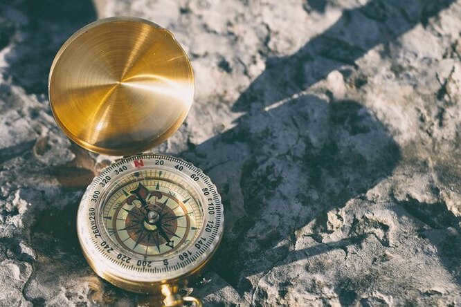
There are multiple methods to determine the cardinal directions. One of the easiest ways is to use a compass. Although not everyone has access to a physical compass nowadays, it is simple to install a compass app on your phone. There are numerous applications and websites that can help you find the cardinal directions using a smartphone. However, if you don’t have a compass available and your phone is out of battery, there are alternative methods to determine the cardinal directions.
Determining the directions using the position of the sun
There is a simple technique that can be used even by young children to determine the directions of the world. The sun rises in the east and sets in the west, so if you stand up and stretch out your arms, pointing your right hand towards where the sun rises and your left hand towards where it sets, you can determine the general directions. In front of you will be the north, and behind you will be the south. However, it is important to note that this method only provides an approximate estimation of the directions. The accuracy of this technique varies depending on the time of year. To determine the directions with maximum accuracy, this method can be used on two specific days: the vernal and autumnal equinoxes.
At the peak of its ascent, when the sun reaches its zenith, the shadows cast by objects become significantly diminished. During this time, the sun is positioned directly southward, with the north behind and the east and west on either side. To establish the cardinal directions in this manner, it is crucial to observe the moment when the shortest shadow is cast by a particular object. It should be noted that this occurrence may not always coincide with noon, as the sun operates on its own timetable, which may differ from our conventional measurement of time.
Determining Cardinal Directions with a Magnetized Needle
An alternative to a compass arrow is using a magnetized needle. To accomplish this, you will need a bowl of water, vegetable oil, a small piece of cork or Styrofoam, a steel needle, and a method to magnetize it. If a magnet is not available, you can use steel scissors. Simply click them quickly to create a magnetic field in the metal. Then, rub the scissors with the needle to transfer its magnetic properties. After these straightforward steps, the needle will function as a compass arrow, aligning itself along the north-south axis. However, using this method only allows you to determine the general direction of north-south. To determine which side is north and which is south, additional techniques must be employed.
Determining cardinal directions using Polaris
This technique is perfect for those with a sense of adventure who want to experience the spirit of early explorers. Polaris, also known as the North Star, remains almost stationary as the Earth rotates and is located at the North Pole. It is easily visible at night: simply locate the Big Dipper constellation, mentally draw a line connecting the two stars that form the outer edge of the dipper’s ladle. Extending this line will lead you to Polaris, a brilliant star that serves as a reliable marker for determining the direction of north.
Determining Cardinal Directions Using Natural Elements
The method that we were all taught in school is actually quite unreliable. For instance, we were taught that on the trunks of solitary trees and on rocks, more moss grows on the northern side, and that anthills have a steeper northern slope. However, in practice, it is not as straightforward as it is described in the “Natural History” textbook. The growth of moss is influenced by various factors, and the shape of an anthill is heavily dependent on the landscape. Therefore, if you wish to determine the cardinal directions using natural objects, it is advisable to combine this method with others.
How to Find Cardinal Directions in an Urban Environment?
In urban areas, determining the cardinal directions is much simpler compared to, for instance, the forest. Nowadays, satellite dishes can be found in almost every city. These devices are always aligned with satellites positioned above the equator. Therefore, if you are in the northern hemisphere, satellite dishes will always face south, while in the southern hemisphere, they will point north. Moreover, you can use sacred buildings as landmarks to determine the cardinal directions:
- In Orthodox and Lutheran churches, the altar always faces east, and the bell tower always faces west;
- In an Orthodox church, the lower end of the slanted crossbar points south and the raised end of the cross points north;
- If you happen to come across a Buddhist monastery, take note that kumirnas (pagan prayer houses) and pagodas are typically oriented with their facades facing south;
- When it comes to Muslim mosques and synagogues, it is useful to orient yourself based on their entrances. These buildings always have their entrances facing north, with their opposite sides oriented towards Mecca in Arabia for mosques (which is roughly on the same latitude as Voronezh), and towards Jerusalem in Palestine for synagogues (which is on the same latitude as Dnepropetrovsk). In the European part of Russia, this general direction would be south;
- Typically, village houses have most of their windows on the south side;
- And if you come across a yurt, take note that its entrance will face south.
How to Determine the Directions in Your Apartment
If you need to determine the directions in your apartment, there are several methods you can use. However, the simplest way is to utilize Google Maps.
- Go to maps.google.com;
- Enter your address and hit Enter;
- Access the panorama feature by clicking on the small yellow figure;
- On the screen, you will see blue lines indicating the areas where you can click to view the panorama. These locations have been visited and photographed by Google’s mapping cars;
- A 3D representation of the area will appear, allowing you to navigate and explore.
A compass will be displayed at the bottom of the screen. It can be utilized to ascertain the orientations of the windows in your picture. For instance, if the red tip of the arrow is pointing to the right and slightly upward, it indicates that the windows face north and slightly upward. To determine whether they face northwest or northeast, simply imagine you are facing north, and to your right will be east, and to your left will be west.

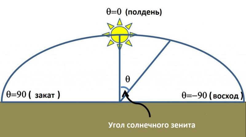
As a result of this, the position of the sun is directly overhead, with its rays hitting the earth at a 90-degree angle.

The sun reaches its highest point in the sky when it is at its zenith, with the angle of incidence of the sun’s rays being 90 degrees.

At what time on Earth is the duration of day exactly equal to the duration of night?
When on Earth is the length of daytime precisely the same as the length of nighttime?
Where is the position of the sun directly overhead during that specific moment?

Is the sun never directly overhead on any parallel?
The sun is never directly overhead on any parallel.

At what line does the sun reach its highest point?
At what line does the sun reach its zenith?
At what latitude does the Sun reach its highest point?
At what parallel does the Sun reach its zenith?
What are the days when the Sun is directly overhead at the following locations?
a) Days when the Sun is at its zenith over the Northern Tropic.
b) Days when the Sun is at its zenith over the Southern Tropic.
c) Days when the Sun is at its zenith over the equator.

At what latitudes is the sun at its zenith?
The sun reaches its highest point in the sky, known as its zenith, at all latitudes.


Can you assist me with understanding the location of the sun when it is at its zenith? Thank you in advance.
I would greatly appreciate your help in clarifying the position of the sun when it reaches its highest point in the sky. Thank you in advance.

What is the latitude where the sun can be directly overhead?
What latitude is necessary for the sun to be at its highest point in the sky?
The complete region where the sun is directly overhead?
The entirety of the region where the sun is directly overhead.
At what time does the sun reach its zenith at the equator?
When does the sun reach its highest point directly overhead at the equator?
You are currently viewing the page that addresses the inquiry of “What is zinit and how is it the sun at zenith?” This question falls under the category of Geography. In terms of difficulty, it is suitable for students in grades 5 to 9. Within the same category, you can find answers to other similar questions on this topic by utilizing the “smart search” automatic system. Users’ comments and responses also provide interesting information and serve as a platform for discussing the topic. If the provided answer choices are not satisfactory, feel free to create your own query in the search bar above.
There are four distinct climatic zones in this area that run along the lines of latitude. Due to the influence of the Asian continent, the northern Indian Ocean experiences a monsoon climate, which brings frequent cyclones moving towards the coast. You.
Africa is home to three main racial groups, with the Negroid race being the most prevalent. This race is particularly common in former European colonies in Africa, such as South Africa.
It’s quite simple, here you are.

The Nelson River is a Canadian river that stretches for 640 kilometers. It originates from Lake Winnipeg and empties into Hudson Bay. The river is responsible for draining the Bow-Saskatchewan-Nelson lake-river system and covers an area of 1072 thousand km2. Known for its rapids, the Nelson River boasts an average water flow of 23 cubic kilometers per year at its mouth.
There is the postscript. It is possible to locate it in cyberspace.))
Indications of stable, cloudless weather, with no rain, include: – During clear weather, the temperature drops gradually, while the atmospheric pressure steadily rises. Small, jagged cumulus clouds start to form in the sky, and the wind blows from the northeast or east. – The temperature…
14 A 15 B 16 A 17 C 18 B 19 D 20 B 21 Alice 22 Brummie 23 Hawaii 24 dog 25 COP.
© 2000-2023. It is necessary to provide a reference when using the materials in their entirety or in part. 16+
The Site is safeguarded by reCAPTCHA technology, which is subject to Google’s Privacy Policy and Terms of Use.
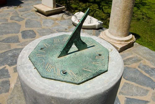
In simple terms, zenith refers to the direction directly above a specific location. It is one of the two vertical directions that are perpendicular to the horizontal plane at a given point. The concept of “up” is more precisely defined in fields such as astronomy, geophysics, and meteorology, where it is the opposite direction to the gravitational force at a particular point. The opposite direction to the zenith, which aligns with the gravitational force, is known as the nadir. The term zenith is also used to describe the highest point reached by a celestial body during its apparent orbital motion relative to an observer’s location. [1] This term is commonly used to determine the position of the Sun, although it can only be accurately determined at specific times and at low latitudes.
Technically speaking, the highest point in the sky, also known as the zenith, is only approximately aligned with the local meridian plane. This is because the meridian plane is determined by the rotational characteristics of a celestial body, not its gravitational field. The two align perfectly only for a perfectly symmetrical rotating body. However, for our Earth, the axis of rotation is not fixed due to factors such as the constant movement of ocean water and other water resources. Additionally, the local vertical direction, which is determined by the gravity field, also changes over time due to lunar and solar tides.
Origin
The term zenith originated from a misinterpretation of the Arabic phrase سمت الرأس (samt ar-rais), which translates to “direction on the head” or “path over the head”. In the 14th century, this word made its way to Europe through Latin and possibly Old Spanish. However, it was mistakenly altered by medieval scribes to ‘samt’ (‘direction’) and misspelled as ‘senit’. Over time, through Old French and Middle English, the term ‘senit’ eventually evolved into the modern word ‘zenith’. [2] [3]
In Arabic, the word zenith is spelled zawâl and actually means “sunset” – referring to the moment when the sun has finished rising and begins its descent.
The term zenith is applied in various scientific situations:
- It is utilized to determine the zenith angle, which measures the angular distance between the direction of the observed object (such as a star) and the local zenith in relation to the specified point.
- It establishes one of the axes in the horizontal coordinate system used in astronomy.
Related content
Important details
Recommended readings
- Dagaev M.M. Observations of the celestial dome. Moscow: Nauka. Main ed. phys.-math. literature, 1988.-176 p.
- Huschke, Ralph E. (1959) Glossary of Meteorology American Meteorological Society, Boston, Second printing-1970.
- McIntosh, D. H. (1972) Meteorological Glossary, Her Majesty’s Stationery Office, Met. O. 842, A.P. 897, 319 p.
- Picoche, J. (1992) Etymological Dictionary of French, Le Robert, Paris, ISBN 2-85036-458-4.
Wikimedia Foundation. 2010.
Helpful
Discover the meaning of “Zenith (astronomy)” in various dictionaries:
Astronomy in the Islamic Middle Ages – Astronomy in the Islamic Middle Ages refers to the astronomical knowledge and perspectives that were prevalent during the Middle Ages in the Arab Caliphate and the states that arose from its ruins, specifically in the Middle East and Near East regions. This knowledge was extensively documented and passed down through various texts and observations. For more information, you can visit the Wikipedia page on Astronomy in the Islamic Middle Ages.
Incan Astronomy – Incan Astronomy refers to the astronomical knowledge and perspectives held by the inhabitants of the Inca Empire in South America. The Incan civilization had unique practices and beliefs regarding astronomy, including the observation of not only stars but also interstellar dark “constellations”. To learn more about this fascinating topic, you can visit the Wikipedia page on Inca Astronomy.
Zenith – European science, particularly astronomy, was not as advanced as Arabic science during the Middle Ages. As a result, books written by Eastern scientists were translated into European languages, and many terms were simply transcribed using Latin letters. However, there were instances where scribes made errors during the transcription process. Some … … Etymology Dictionary
Practical astronomy – A branch of astrometry (See Astrometry), focused on the study of astronomical instruments and the methods for determining time, geographic coordinates, and azimuths of directions based on astronomical observations. The specific techniques used in practical astronomy vary depending on the circumstances in which … … … The Big Soviet Encyclopedia
Geodetic astronomy – An area of practical astronomy (refer to Geodetic astronomy. Practical astronomy) that is closely related to geodesy and cartography. It focuses on the theory and techniques used to determine the latitude φ and longitude λ of a location, as well as the azimuth, which is the direction to an object on Earth, and the local … … … Big Soviet Encyclopedia
Nadir (astronomy) – This term has other meanings, please see Nadir (meaning). A diagram that illustrates the relationship between zenith, nadir, and mountains … Wikipedia
Declination (astronomy) – This term has other meanings, please see Declination. In astronomy, the declination (δ) is one of the two coordinates in the equatorial coordinate system … Wikipedia
Cosmos-461 is a satellite that operates in the waveband of X-rays and gamma rays. It has a NSSDC ID of 1971 105A and is located in a geocentric orbit with an altitude of 490/520 km. The orbital period of Cosmos-461 is 90 minutes. It was launched on December 2, 1971 from Plesetsk and was sent into orbit. (Source: Wikipedia)
Kosmos-914 is a satellite that is similar to the Zenit 2M satellite. It is represented schematically in the Foton satellite. The Science module, marked as number 1, includes X-ray instruments. The organization behind Kosmos-914 is not specified. (Source: Wikipedia)
Horizontal coordinate system is a celestial coordinate system where the principal plane is the plane of the mathematical horizon. The poles in this system are zenith and nadir. The horizontal coordinate system is commonly used in observations. (Source: Wikipedia)
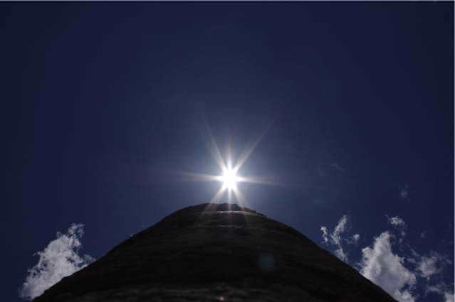
Understanding the meaning of the phrase “the sun is at its zenith”
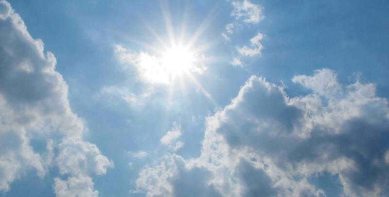
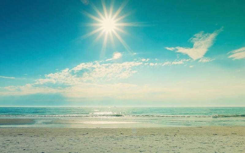
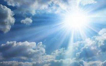
During a scorching summer day, when the sky is clear and we are feeling drained from the intense heat, we frequently hear the expression “the sun is at its zenith.” In our interpretation, this phrase implies that the celestial body is positioned at its highest point in the sky and is emitting the most powerful warmth, almost as if it is burning the earth. Let’s delve into the realm of astronomy to gain a deeper understanding of this phrase and ascertain the accuracy of our interpretation.
Earth parallels
From what we learn in school, we are aware that our planet has invisible lines known as parallels. These lines are a result of basic principles in geometry and physics, and understanding their origin is essential for comprehending the entirety of geography. There are three main lines that are traditionally recognized – the equator, the Arctic Circle, and the tropics.
Equator
is an imaginary line that divides the Earth into two equal parts: the Northern Hemisphere and the Southern Hemisphere. It is located at 0 degrees latitude and stretches approximately 40,075 kilometers (24,901 miles) around the Earth. The Equator is an important reference point for navigation, climate, and geography. It is also known for its unique climate, with temperatures that are generally high and constant throughout the year. The Equator is home to a diverse range of ecosystems and is crossed by many countries, including Ecuador, Kenya, Indonesia, and Brazil. It is a fascinating and significant feature of our planet.
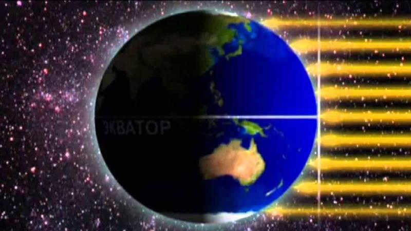
The equator is commonly referred to as an invisible (conventional) line that divides our planet into two equal halves – the Northern and Southern hemispheres. It has long been understood that the Earth is not supported on the backs of three giant animals, as ancient beliefs suggested, but rather it is a spherical shape that both orbits the Sun and rotates on its axis. Consequently, the equator emerges as the longest parallel on Earth, stretching approximately 40,000 kilometers. While the mathematics behind this concept may be clear, what does it mean for geography? Upon closer examination, it becomes evident that the region between the tropics receives the most intense solar heat and light. This is due to the fact that this area of the Earth is always oriented towards the Sun, resulting in nearly perpendicular sunlight. As a result, the equatorial regions experience the highest air temperatures, and the moisture-laden air masses lead to significant evaporation. Twice a year, the Sun reaches its zenith at the equator, shining directly downwards. This phenomenon, for instance, never occurs in Russia.
Tropical Regions
There are two tropical regions on Earth, namely the Southern and Northern tropics. It is interesting to note that the sun reaches its highest point in the sky, known as its zenith, only once a year during the solstice. The Southern Hemisphere is oriented towards the sun at its maximum on December 22, which is known as the winter solstice, while the opposite occurs on June 22.
These tropical regions are sometimes referred to by the zodiacal constellation that intersects the path of the sun on these specific days. For instance, the Southern Tropic is commonly called the Tropic of Capricorn, while the Northern Tropic is known as the Tropic of Cancer during December and June, respectively.
Polar Circles
The polar circle is the latitude above which the polar night or day phenomenon is observed. The position of the polar circles is also mathematically determined, being 90° minus the tilt of the planet’s axis. For Earth, the value of the polar circles is 66.5°. Unfortunately, people living in temperate latitudes are unable to witness these phenomena. However, the sun being at its zenith on the parallel corresponding to the polar circle is a completely natural event.

General knowledge
It is a well-known fact that the Earth is in constant motion. Not only does it revolve around the Sun, but it also rotates on its own axis every 24 hours. As the year progresses, we can observe changes in the length of the day, the outdoor temperature, and even the positions of the stars in the sky. In a span of 364 days, the Earth completes a full orbit around the Sun.
Day and night
When we experience darkness, or night, it signifies that the Sun is illuminating the other hemisphere during that particular period of time. A logical question arises as to why the duration of the day is not equal to the duration of the night. The reason lies in the fact that the plane of the Sun’s trajectory is not perpendicular to the Earth’s axis. This inclination is what allows us to have seasons, during which the ratio of daylight to darkness varies.
On the 20th of March, the North Pole leans toward the Sun. Then, around noon on the equator, we can confidently say that the sun is directly overhead. This is followed by days when a similar event occurs at more northern locations. By June 22, the sun is at its highest point on the Tropic of Cancer, marking the middle of summer and the longest day in the northern hemisphere. The solstice phenomenon is a familiar concept to us.
What’s interesting is that after this day, everything happens in reverse and continues until September 23, when the sun is once again directly overhead at noon on the equator – this marks the start of spring in the southern hemisphere.
From this information, we can conclude that when the sun is directly overhead at the equator, the length of the night on Earth is 12 hours, which is the same as the length of the day. We commonly refer to this phenomenon as the autumn or spring equinox.
Although we have clarified the proper definition of the term “sun at zenith,” it is still more common for us to use the phrase that simply means the sun is at its highest point on that particular day.
The most terrible travel blog ever
Share this article
Headings
Latest posts
Record Archives
Recent Comments
- Not Very Knowledgeable about Visa, authorized stays in Turkey (and in Schengen) and the 90/180 rule
- Vrode the Ignorant documenting Incidents of Assault during Travel in Southeast Asia
- David discussing Incidents of assaults while traveling in southeast Asia
- Elena commenting on Visa, authorized stays in Turkey (and Schengen) and the 90/180 rule
- Not Very Knowledgeable adding to the article on Malay Borneo, Sarawak – about Niah Caves and Miri town.
- Yuri Fedorovich contributing to the article on Malay Borneo, Sarawak – about Niah Caves and Miri Town.
- Not Very Knowledgeable commenting on the article about Visa, authorized stays in Turkey (and Schengen) and the 90/180 rule
- Olga is familiar with the entry Visa, authorized stays in Turkey (and Schengen), and the 90/180 rule
- Kind of Ignorant is aware of the entry Visa, authorized stays in Turkey (and in Schengen), and the 90/180 rule
- Ayzhanar knows about the entry Visa, authorized stays in Turkey (and in Schengen), and the 90/180 rule
- Kind of Ignorant is knowledgeable about the entry Free overnight accommodation in Christian/Orthodox monasteries and churches
- Igor is aware of the entry Free overnight accommodation in Christian/Orthodox monasteries and churches
- Igor is familiar with the entry Free overnight accommodation in Christian/Orthodox monasteries and churches
- Best of the Best recommends the entry Interesting places around Lake Sevan (Gegharkunik Province)
- Kind of Ignorant is aware of the entry Visa, allowed stays in Turkey (and in Schengen), and the 90/180 rule
- Catherine has knowledge about the entry Visa, which allows authorized stays in Turkey (and in Schengen) and follows the 90/180 rule.
- Kind of Ignorant about the entry Visa, authorized stays in Turkey (and Schengen), and the 90/180 rule.
- Catherine is familiar with the entry Visa, which permits authorized stays in Turkey (and in Schengen) and abides by the 90/180 rule.
- Kind of Ignorant about the entry Visa, authorized stays in Turkey (and in Schengen), and the 90/180 rule.
- Marina is knowledgeable about the entry Visa, which allows authorized stays in Turkey (and in Schengen) and follows the 90/180 rule.
- Kind of Ignorant about the entry Visa, authorized stays in Turkey (and in Schengen), and the 90/180 rule.
- Marina knows about the entry Visa, which permits authorized stays in Turkey (and in Schengen) and abides by the 90/180 rule.
- Kind of Ignorant about the entry Visa, authorized stays in Turkey (and in Schengen), and the 90/180 rule.
- Marina has obtained a Visa, which allows her to stay in Turkey (and in Schengen) and abide by the 90/180 rule
- Marina lacks knowledge when it comes to the entry Visa, authorized stays in Turkey (and in Schengen) and the 90/180 rule
Orientation using the Sun
This article discusses various techniques for orienting oneself in space without relying on a navigator or compass, using only natural methods. The next article will focus on orienting by the stars, while this one will focus on orienting using our own star, the Sun.
Content:
- Orienting by the Sun.
- The occasional challenges in orienting by our Sun.
- The Sun’s shadow is more easily detectable on a flat surface than on an uneven one.
- Approximately determining direction with the help of a watch and the Sun.
In all my travels, I have never carried any navigational tools with me (at least until May 2016, when this text was published)…
However, I almost always had a compass with me, just in case. It was rarely taken out of the backpack, only about once or twice a year, for instance, when trying to find the correct direction in foggy conditions where neither the celestial body nor other landmarks are visible. Even in overcast weather, the Sun usually manages to peek through and provide guidance.
While a regular magnetic compass is more convenient to use than relying on celestial objects, it can occasionally produce the same inaccuracies (typically within a 20-degree range). In certain regions, such as areas with magnetic anomalies, it becomes completely useless. Furthermore, the compass is not always readily available (it can be cumbersome to carry around your neck or in your pocket) and often requires rummaging through your backpack to retrieve it.
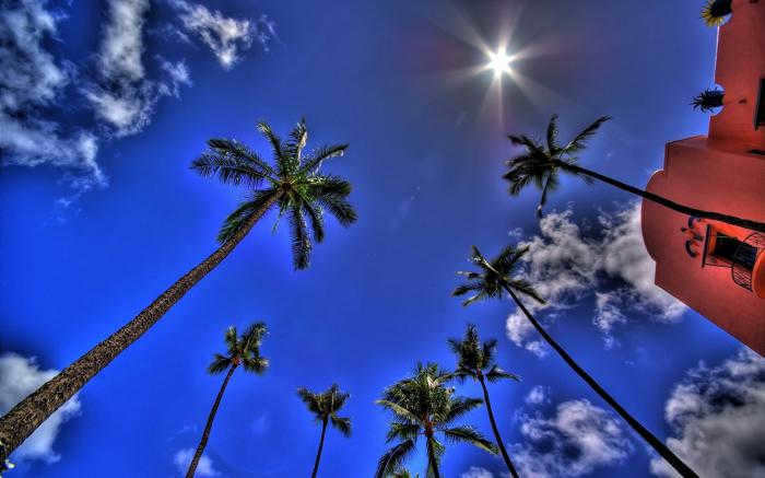
As I rarely venture into the mountains when the weather is overcast (except for at lower altitudes), the sunlight serves as a reliable guide for me, and I seldom find the need to rely on a compass (unless the entire sky is obscured by clouds). This photograph was taken from an elevation of 3200 in the Kaçkar Mountains (which, in my opinion, are the most stunning mountains in Turkey).
Solar Orientation
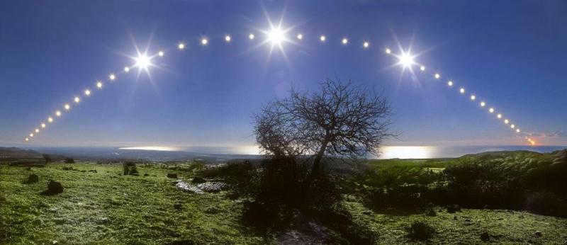
Let’s begin with the fundamentals. As we are aware, the sun rises in the east in the morning and gradually moves towards the west, where it sets behind the horizon in the evening (although, there may be variations in these directions depending on the time of year, but we’ll discuss that later)… If you have the time (and most people carry a watch with them), it is quite simple to determine the cardinal directions. For instance, if sunrise occurs at 6:00 AM and sunset is at 9:00 PM, the true noon would be at 1:30 PM (midway between sunrise and sunset).
And during that midday. the sun will be precisely facing south (assuming we are in the northern hemisphere, or to be more precise – at a more northern latitude than where the sun is currently at its highest point).
From sunrise until midday the sun will be facing southeast, and from midday until sunset it will be facing southwest (although this pertains to our northern hemisphere, specifically to locations and times when you are north of the zenith).
In the central region of Russia, such as Ufa or Moscow, the direction of the sunrise and sunset shifts towards the south as we approach the summer solstice (June 20-21). For instance, on June 21, the sun sets in the south-southwest. On the other hand, as we approach the winter solstice (December 21), the sun shows a greater bias towards the south during sunrises and sunsets. The sunset tends to be in the northwest, while the sunrise is in the northeast. The image below provides a clear visualization of this phenomenon.
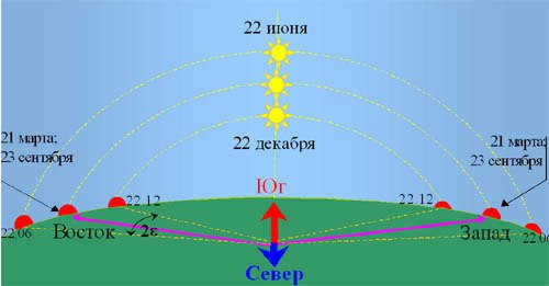
Diagram illustrating the phenomenon of sunrises and sunsets
As we approach the days of the vernal and autumnal equinoxes (September 20-21 and March 21-22), the position of the sunrise shifts further east and the sunset shifts further west.
During these equinoxes, the sunrise and sunset of the Sun occur precisely in the east and west, regardless of the location on the globe (with the exception of the poles and their immediate surroundings, most likely).
The Sun’s visible motion along the ecliptic intersects the celestial equator during the vernal and autumnal equinoxes (and it is directly above the equator at these times)… During these two specific days of the year, the length of the day is practically equal to the length of the night in all locations on our planet (except for the poles, where there is neither day nor night, but a prolonged twilight state).
If you go in the direction of sunrise in March or September (especially on days close to the equinoxes) and then turn around and head towards the sunset at midday, there is a high likelihood that the pedestrian will be able to return to their starting point. This is true almost anywhere on the planet, although in latitudes closer to the poles, the margin of error increases with a greater temporal distance from the day of the equinox.
However, if you attempt this same journey in the middle of summer or winter, the risk of getting lost is significantly higher.
It is important to consider the time of year and which pole is pointing towards the Sun. – The North or South pole will determine this.
You can find more detailed and official information about the winter solstice here.
In general, regardless of the current time of year or the timing of sunset and sunrise, the true noon at 1:00 p.m. (which is the midpoint between dawn and dusk) will have the following arrangement of our celestial body:
At 7 p.m., the sun will typically be in the west, and in the morning at 7.00, it will be in the east (even if, for example, it is currently winter in Russia and the daylight hours are noticeably shorter than 12 hours).
That is, the position of the sun in relation to the horizon will vary throughout the year, but its direction will remain consistent. … Please refer to the diagram below for a visual representation. While it is similar to the previous illustration and depicts the sun’s movement using a similar principle, it may be perceived differently.
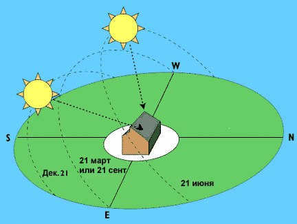
By looking at the image, we can observe that the distance covered by the sun from “point west” to “point east” remains constant throughout the year. However, the angle at which the sun’s path appears to us changes. It is worth noting that between September 21 and March 21, a portion of the sun’s path is not visible to us, but we can still imagine its continuation.
- When the sky is mostly obscured by dark clouds, particularly in the area where the sun is currently located. However, even if the clouds completely cover the sky, it is still sometimes possible to estimate the sun’s general position (+- 10-20 degrees) if the rest of the sky is not obstructed by clouds… Clouds rarely pose a problem, as the sun usually manages to make itself faintly visible through them in some way or another.
- When exploring the farthest reaches of the Earth’s northern or southern latitudes during the days surrounding the summer or winter solstice (June 20-21 and December 21-22 in the northern hemisphere), you will experience either an almost nonexistent sunset or an almost nonexistent sunrise. As you venture further north from the Arctic Circle, these periods of “sunless days” or “unending daylight” become longer.
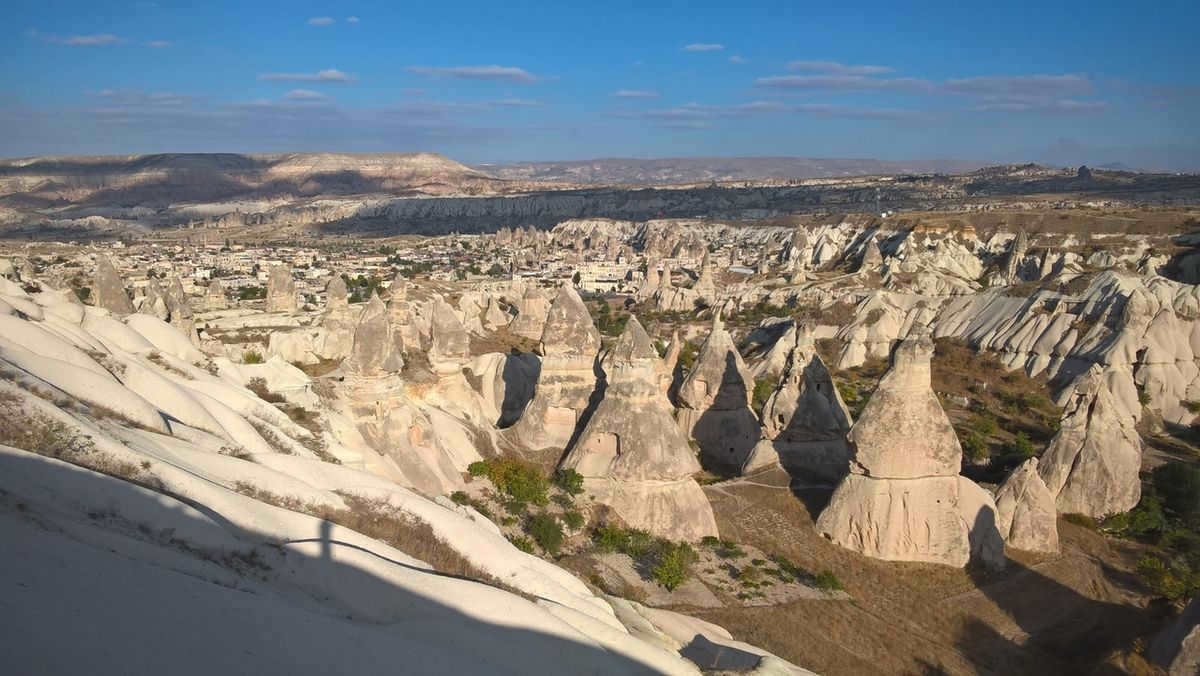
It is simple to determine the directions of the world using these Cappadocian poles.
As you move further north or south from the equator, the accuracy and clarity of sunsets and sunrises decrease. At the equator, the sunrise is always – regardless of the date – directly in the east, and the sunset – directly in the west. Unfortunately and fortunately at the same time, the length of daylight hours on the equator is always exactly 12 hours, with the other 12 hours being the dark period of the day.
- Another significant issue arises when the sun is directly above at its peak position (which occurs only in the regions of the northern and southern tropics situated at the 23rd parallel on either side of the equator, and naturally, between these tropics). Even with a slight inclination of 1-2 degrees, it becomes extremely challenging to determine the exact direction (that’s why we will continue following points “close to the zenith” until the 25th parallel)… However, if you patiently wait for 15-20 minutes, you will still be able to observe the sun’s movement.
- There is one more particular point. The behavior of luminosity can be perplexing. in the southern part of the globe (from September 21 to March 21, when the Sun is located north of the equator) – when the Sun, rising in the east, will gradually shift towards the north by midday. (and IT moves towards the south, as we are accustomed to), and then gradually sets in the west – that is, in a counterclockwise direction.
The writer of this passage had a similar experience in Indonesia, but luckily he visited during the “dry season,” which typically occurs from May to October in 90% of the country. Furthermore, up until September 22nd, the Sun is situated just north of the equator. As a result, the author had to adapt to the changing trajectory of the Sun in relation to his vision for a period of time.
However, it proved to be a fascinating adventure, not only in orienteering, but also in the art of telling time with the help of the Sun. Although I usually carry a watch in my backpack, I find it more intriguing to rely on the Sun’s position to gauge the time. Telling time by the sun is my preferred method. Admittedly, the accuracy may be off by around 30-40 minutes, but with practice, it becomes increasingly effortless.
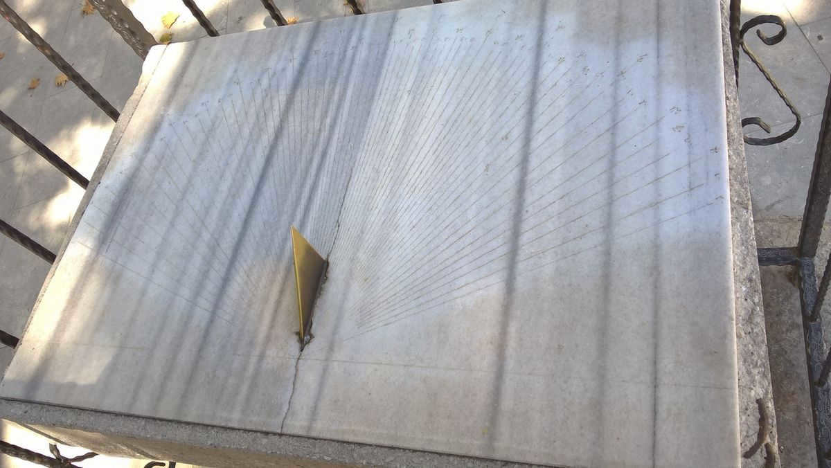
These ancient sundials have been standing in the courtyard for approximately 2-3 centuries. While they may not indicate direction, they do tell the time… This is located within the fascinating historical town of Safranbolu in Turkey (which holds the record for the highest number of traditional old mansions in Turkey).
Particularly in the event that, when the Sun is at a high point and near the zenith. (which is only achievable within the tropics). If you find yourself on the incline of a hill/mountain with a specific slope, it becomes slightly more challenging to position yourself or an object vertically, which is determined by the shadow (the slope of the mountain is obstructive). However, on a flat surface, it is much simpler to maintain a vertical position due to the law of balance (at least according to the author of this text).
Well, in the most extreme scenario, if at noon the direction of north cannot be determined by the presence or absence of a shadow, you can simply wait for a maximum of 15-20 minutes. By observing the movement of the shadow from a stationary tree/person/post during this timeframe, it will become apparent which direction is south or north.
The body of the checker himself is rarely the best checker. Typically, individuals have a well-developed vestibular apparatus (at least those who venture out on their own), making it easy for them to stand upright on a flat surface and determine the direction of the shadow.
Alternatively, one can determine the shadow from the sun. Let’s say you come across an oasis with a single tree, whose trunk is completely bent and not vertical at all. However, if you hang an object weighing about 1 kilogram from a branch, you can observe its verticality… although this method can be quite cumbersome, so it’s simpler to use the shadow of your body.
Using a clock to orient yourself with the Sun
Position the clock face horizontally, with the hour hand pointing towards the point on the horizon directly below the Sun. The angle bisector between the hour hand and the spot on the dial that represents true noon will indicate the approximate direction to the south… In the example shown below, true noon is at 14:00.
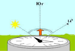
The sun is at its highest point when the angle is divided in two and the bisector is pointing south.
A lot of individuals find it challenging to determine the exact time of true noon, which is when the sun’s shadow is at its shortest and it points north, opposite to the sun. If I am in a natural setting, I somehow manage to estimate the approximate time (+- 5-15 minutes) of sunrise and sunset, and based on that, I can easily calculate noon. Of course, it didn’t happen instantly, but with experience of spending time in nature.
For instance, in the latitudes of Ufa and Moscow, the time of sunrise and sunset varies between two consecutive days. The difference in the duration of daylight between two adjacent days ranges from 10-20 seconds (during the winter and summer equinoxes and the days near them) to 2-2.5 minutes (during the spring and autumn equinoxes). In other words, in the latter scenario, the time of sunrise and sunset alters by 2-2.5 minutes every day.
Incidentally, as numerous individuals have heard. as you approach the equatorthe time difference between “winter” sunrise and sunset and “summer” sunrise and sunset becomes smaller. Precisely at the equator, the time difference between dawn and sunset is precisely 12 hours – at any point in the year. This means that day and night are equal. And as you move further away from the equator, the difference becomes greater and greater. It typically takes some time to adjust to this as well. Particularly for those who rely on the sun for navigation in those areas.
Nevertheless, as previously stated, in the subequatorial regions one must become accustomed to the notion that the sun moves in a clockwise direction (when positioned to the south of the observer) or counterclockwise.
By the way, for those unaware, the hands on our timepieces rotate in a clockwise fashion due to the fact that the “patent for the invention” was granted in Europe, where sundials have consistently displayed this particular shadow movement. And so it continues.