Discussions on the subject of summer, winter, belt, local, and astronomical time have inspired me to write this post. I will share with you how to calculate local time and explain what zone time is. I will provide some background information and history, but I will not delve into medical, physiological, political, or economic perspectives on the matter. I am not a doctor, economist, or politician; I am a shipwright.
As a shipwright, I am well acquainted with navigational astronomy, which is a crucial science for ship navigation even in modern times. Navigational astronomy allows us to determine the position of a ship by observing celestial bodies. These celestial bodies are constantly in motion, and understanding their movements, as studied in astronomy, is necessary to determine their position at any given moment. The same principles apply to artificial satellites orbiting the Earth. Navigational astronomy also provides valuable information about timekeeping and various phenomena occurring on Earth, such as sunrises, sunsets, illumination, and eclipses, as well as phenomena in the Universe.
The main objectives of nautical astronomy include:
– Determining a ship’s location at sea through observations of celestial bodies;
– Correcting directional instruments, such as compasses;
– Providing timekeeping services.
Additional tasks include:
– Determining illumination levels;
– Calculating the culmination of celestial bodies, among others.
Russia is considering making its time zones smaller. President Dmitry Medvedev has suggested reducing the current 11 time zones to just 4. The reason behind this proposal is that the significant time difference between the eastern and western parts of Russia creates a divide and makes effective governance challenging. However, it is important to understand how time zones are defined and whether such a change is feasible.
Before the implementation of standardized time zones, individual cities were responsible for setting their own local time. However, the rise of railroads and their associated travel schedules in the 19th century necessitated the need for an accurate and consistent time system to ensure that people did not miss their trains. As a result, the United States and Canada established a standard time system. In the subsequent year, representatives from 22 countries convened in Washington, D.C. to synchronize timekeeping between nations. They agreed upon the longitudinal line that passes through Greenwich, England, as the reference point from which all time measurements would be based.
Now let’s discuss the concept of time. It is evident that humanity has chosen a 24-hour day as the standard unit of time – during this period, the Earth completes one full rotation on its axis, or the time from sunrise to sunrise. This 24-hour period was then divided into 24 parts, resulting in 1 hour. Since a full rotation is equivalent to 360 degrees, we can deduce that 1 hour corresponds to 15 degrees of the Earth’s rotation (as observed by the Sun’s apparent motion), and each degree of the Sun’s movement (caused by the Earth’s rotation) corresponds to 4 minutes of time according to human convention.
Let’s not complicate matters further with the knowledge that:
– The Earth’s rotation slows down by 0.00023 seconds per century;
– There are occasional abrupt changes in the Earth’s rotation speed (several of them, with one occurring in 1920 and resulting in a change of 0.000000045 seconds);
– The true solar day varies by an average of 59.14 seconds throughout the year;
– The duration of a year is not exactly 365 days, but rather 365.2422 days.
Arizona decided against implementing the new time scheme due to the excessive heat during the summer, which made it impractical to “spring forward” the hour. In Hawaii, where daylight doesn’t fluctuate much, there is no need for a time scheme. While Americans were aware of daylight saving time, they were not fond of it. As a consequence, Indiana finds itself divided, with some parts following Central Time, some Eastern Time, some observing daylight saving time, and some sticking to standard time year-round.
If Russia, which is 180 times larger than Indiana and has many millions of people, can have two time zones, then there is no reason why it cannot adjust its clocks to accommodate its Eastern citizens. S. took the initiative to save energy by implementing daylight saving time three weeks earlier. Nepal is ahead of India by 15 minutes and behind China by an hour and 15 minutes. Iran is currently grappling with the issue of daylight saving time; while its parliament supports it, President Mahmoud Ahmadinejad opposes it. Ultimately, the concept of time is subjective and relative.
It has been established that Greenwich Mean Time serves as a standard reference point, however, local time proves to be inconvenient for day-to-day activities. As a result, a singular time (such as that observed at a local observatory or ruler’s palace) was adopted for an entire neighborhood or country. However, the disparity between the time in one region or country and another could include fractions of hours and even minutes. The progression of civilization and the need for effective communication among peoples necessitated the establishment of a standardized method for measuring time.
Significant parallels of latitudes
In this article: parallels of latitudes and longitudes – latitudinal heat zones on the Earth – longitude and time – standard time and time zones – international date line – Indian standard time – Taibagaan time. Parallels of latitudes and longitudes are imaginary lines used to pinpoint a location on the Earth. Latitude refers to the angular distance of a specific point on the Earth’s surface, measured in degrees from the Earth’s center. Due to the Earth’s slight flattening at the poles, the linear distance of one degree of latitude is slightly greater at the poles than at the equator. For instance, at the equator, it measures 704 miles, at 45° it measures 054 miles, and at the poles, it measures 407 miles. Alongside the equator, the North Pole, and the South Pole, there exist four significant parallels of latitude, including the Tropic of Cancer in the Northern Hemisphere.
Earth’s heat zones along the latitudinal lines
Why does the international datum line follow a zigzag pattern?
- The earth’s shape is known as the “Geoid”.
- The location of a place on earth can be determined using latitude and longitude.
- The average distance between each zigzag is 69 miles (1 mile = 607 kilometers).
- The Tropic of Capricorn is situated in the southern hemisphere.
- The Arctic Circle is located at approximately 66.5 degrees north of the equator.
- The Antarctic Circle is situated at approximately 66.5 degrees south of the equator.
- As we move towards the poles, the angle of the sun’s rays decreases.
- The International Date Line is also referred to as Greenwich Mean Time (GMT), which serves as the standard time for the world.
- When traveling westward, local time is delayed by 1 hour.
- Following a straight line for the International Date Line would be impractical and inconvenient.
- The International Date Line spans across the Pacific Ocean.
- The International Date Line is an imaginary line similar to longitude and latitude.
- There is a 24-hour time difference on each side of this line.
- As soon as the date line is crossed, the date changes.
- Some groups of islands are located on different dates.
- The shape of the earth is known as the Geoid.
- Due to the earth’s shape, the temperature decreases from the equator to the poles.
- The North Pole is located at a latitude.
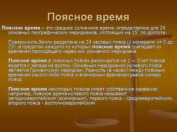
During the Astronomical Congress of 1884, a revolutionary concept called belt times was introduced and gradually accepted by nearly all nations worldwide. This groundbreaking system, known as zone time, operates by dividing the Earth into 24 central meridians, each spaced 15 degrees of longitude apart. As a result, neighboring zones experience a 1-hour time difference. In fact, zone time extends up to 7.5 degrees of longitude on both sides of these central meridians.
Zone time can be defined as the average local time observed at the central meridian within a specific time zone, encompassing the entire zone.
Which of the following statements is not true?
The definition of time intervals is historically closely connected to astronomy. A day was originally defined as the apparent path of the sun around the Earth, a month based on the lunar phase, and a year determined by the Earth’s orbit around the sun. As time measurement became more accurate, discrepancies from these definitions emerged, and adjustments were required. These advancements resulted in the creation of various definitions for time intervals, times, and calendars.
If you need to describe the corresponding time within a single day, it is evident that the position of the sun is crucial. However, since this varies depending on the location on Earth, certain conventions must be followed. Firstly, one should consider the true solar time. In order to commence the day at 0 hours, an additional 12 hours must be added. The same true solar time is applicable in all longitudes. However, due to the Earth’s elliptical orbit and the ecliptic, this does not function uniformly. Hence, an average sun is established, which moves at a consistent angular velocity around the equator and requires the same amount of time as the true sun for the ecliptic.
Next, the average sun’s hour angle is used to calculate the average solar time, which is then implemented. However, each meridian has a different average solar time. As a result, 15-degree intervals have been established starting from the zero meridian, where the same time is observed, creating time zones. Consequently, there are a total of 24 time zones. It is important to note that the equation of time is not constant and varies throughout the year, having four extreme points.
The measurement of time is closely tied to the movements of celestial bodies. The rotation of the earth on its axis and the apparent path of the sun around the earth are used to determine the length of a day. Similarly, the earth’s orbit around the sun defines the length of a year. However, there are different ways to define a year. One definition is based on the tropical year, which is the time it takes for the sun to move from spring to spring. This is measured from the vernal equinox, when the sun crosses the equator from south to north. However, because calendars are based on whole days, an extra day, known as a leap day, is added every four years.
With this belt structure, the difference between belt time and local time cannot exceed 30 minutes. However, the exact boundaries of the belt are only adhered to in seas, oceans, and sparsely populated areas. In reality, the belt boundaries are determined by national governments, taking into consideration administrative, geographical, and economic factors.
Daylight saving time. To conserve electricity for evening lighting, the clocks in the territory of the USSR were set 1 hour ahead of the standard time. Initially, this time change was only implemented during the summer months (summer time), but a decree in 1931 made it permanent. Thus, the decree time is always 1 hour ahead of the belt time.
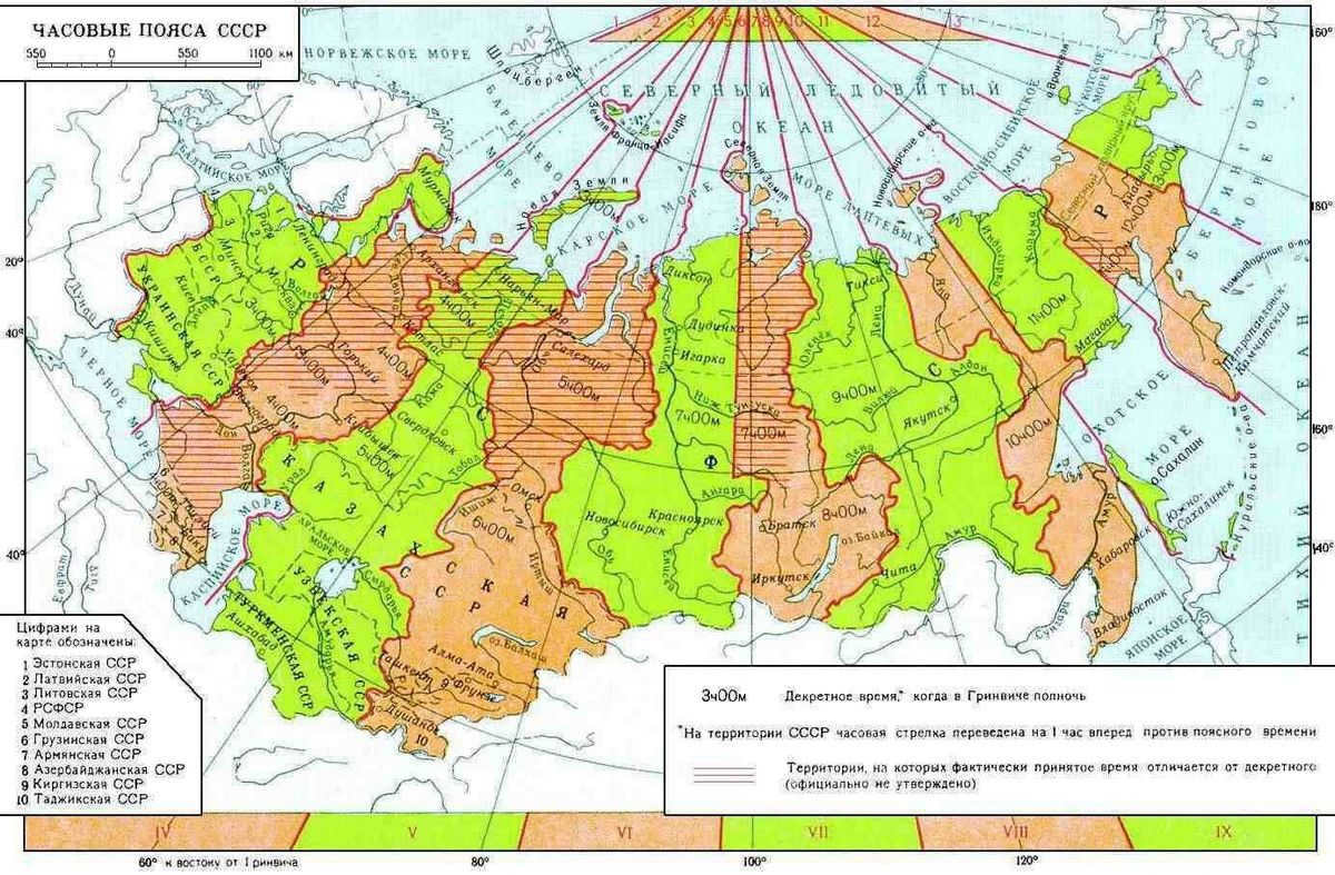
Daylight saving time. Some countries have the practice of advancing the clock by 1 or 2 hours during the summer months. In the former Soviet Union, daylight saving time was introduced in 1980, where the clock would be set forward by 1 hour (or 2 hours for certain time zones). I won’t go into the details of the complex time zone system in our country, as it is widely known.
Currently, our country is divided into different time zones.
The longitude that we receive (excluding any decimal places) is converted into hours and minutes using the conversion rate of 15 degrees to 1 hour and 1 degree to 4 minutes. We assume that the Sun reaches its highest point (noon) at approximately 12:00 local time (with a margin of about 15 minutes).
Now, we subtract (for the eastern hemisphere) or add (for the western hemisphere) the calculated longitude in hours and minutes from 12h 00 min. This gives us the Greenwich time of noon at this specific longitude. Then, we add or subtract the difference between your watch and Greenwich Mean Time (UTC, Universal Time) for the Eastern Hemisphere (depending on whether you are in the Western Hemisphere).
You may be wondering, “Where can I find out the Greenwich Mean Time?” The answer is that it is the current Moscow time minus 4 hours (since today is February 3, 2013, and we do not know what will happen to the time tomorrow).
Longitude is converted into time:
– 33/15=2.2 so 2 hours
– 2.2-2=0.2
– 0.2*60=12 so 12 minutes.
– Longitude 33 degrees expressed in time – 2 hours 12 minutes.
Determine the time of our local noon GMT:
12h00m – 2h12m = 9h48m
Add the difference of the clock (on or near the hand) with Greenwich:
9h48m + 4h = 13h48m.
This is the time of noon according to our clock (that on the hand or near) in a place with a longitude of 33 degrees of the eastern hemisphere (remember – with an accuracy of 30 minutes, because the Sun is not always at 12.00 is in the upper culmination). Shipmasters use astronomical tables for accurate calculation.
Now let’s talk about the time zone. We need to convert the longitude of the location into hours and round it up to the nearest hour.
For instance: if the longitude is 142.9 degrees East,
142.9 divided by 15 equals 9.526.
This means that it is in the 10th Eastern time zone, which is 10 hours ahead of Greenwich Mean Time.
A brief overview of the sunrise phenomenon. On the Equator, the Sun consistently rises at approximately 6 am local time and sets around 18 hours later. However, as we move further North or South, the timing of sunrise and sunset varies based on the latitude and time of year. Interestingly, during the spring and fall equinoxes, regardless of latitude, the Sun rises and sets at similar times as it does on the Equator – around 6 am and 18 hours later, respectively.
Let’s take St. Petersburg and other locations at a latitude of 60 degrees north as an example. Here is the local time for various dates:
March 20: sunrise at 6 am, sunset at 6:15 pm
June 21: sunrise at 2:36 am, sunset at 9:28 pm
September 22: sunrise at 5:45 am, sunset at 6 pm
December 21: sunrise at 8:30 am, sunset at 2:55 pm.
Source: “Navigational Astronomy” by B.I. Krasavtsev (Moscow: “Transport” 1986), MAE 2012.
How to determine the local time. As you may recall from your geography class, the local time can vary in different parts of the world due to the Earth’s rotation on its axis. The time will only be the same for locations on the same meridian. However, even within a single locality, the local time can differ between its western and eastern edges. This difference increases as the distance between meridians increases. For example, neighboring meridians that are 15 degrees apart have a 1-hour difference in local time. Similarly, one minute of angular distance corresponds to a 1-4 second difference in local time.
In this scenario, the local time on the meridian located to the east of the point is ahead of the time in it, while on the more western meridian it lags behind. For instance, if the local time in Kiev is noon (12 o’clock), then in Donetsk it is 12:29 a.m., and in Lviv at that moment it is only 11:33:56. Therefore, in order to determine the accurate time in different points based on the known time in one of them, these calculations need to be made.
2. Calculate the difference in longitudes between the points (in degrees and minutes):
a) between Donetsk and Kiev – 37° 49″ – 30° 34″ = 7° 15″ East;
b) between Kiev and Lvov – 30° 34″ – 24° 03″ = 6° 31″ East.
3. Convert the difference in longitude (from degrees and minutes) into the difference in time (in hours, minutes, and seconds):
a) 7°15" = 7 x 4 xv15 x 4 s = 29 xv;
b) 6°31" = 6 x 4 xv31 x 4 s = 26 xv4 s.
The values obtained indicate the variation in local time along the meridians passing through Kiev, Lvov, and Donetsk.
4. To determine the local time in Donetsk (located to the east of Kiev), add the calculated value to the known time in Kiev (12 h):
a) If Kiev is 12 h, the local time in Donetsk will be:
b) If Kiev is 12 h, the local time in Lviv will be:
12 h – 26 xv 4 s = 11 h 33 xv 56 s.
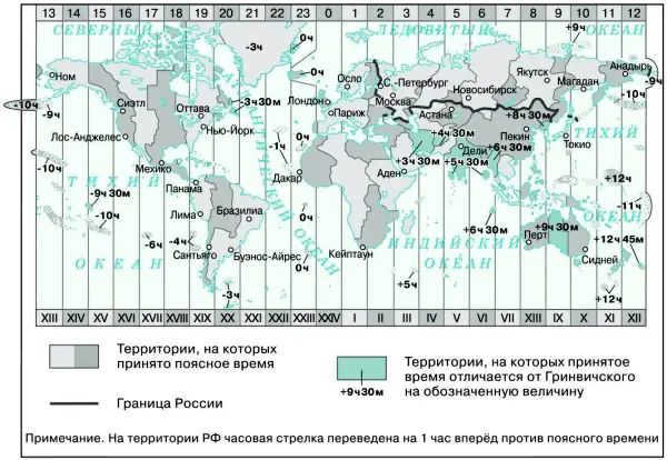
Time zones and local time. It is nearly impossible to use the local time, which varies in each location, in everyday life. To make things more convenient, people all over the world utilize time zones. The globe is conventionally divided into 24 strips, each covering 15 degrees of longitude, corresponding to the number of hours in a day. In each time zone, the time is considered the same. The local time of the meridian passing through the center of each time zone, known as the middle meridian, is taken as the zone time.
The time zones are numbered from 0 to 23 in an eastward direction: the central meridian of the 0th zone is the Greenwich Mean Time Zone. Greenwich (Initial) prime meridian The central meridian of the 1st zone is the 15°E meridian, the 12th zone is the 180th meridian, and the 23rd zone is the 15°W meridian.
The time of the 0-th zone is called Western European and the time of the 1st zone is calledCentral European and the others – Eastern European . The zone number indicates the time zone when it is north on the Greenwich meridian. The time difference between two neighboring zones is one hour. Moving around the globe from west to east, we must move the clock’s hand one hour forward when crossing the borders of each subsequent zone, and moving westward – one hour backward.
Ukraine is conveniently located in relation to time zones: 95% of its territory is in the second zone, with only the Luhansk region falling into the third zone. Additionally, parts of Donetsk and Kharkiv oblasts are in the third zone, while a small portion of the Transcarpathian region falls into the first zone. However, in practice, the boundaries of time zones on land are not strictly based on meridians, but rather take into account state borders. As a result, the entire territory of Ukraine is considered to be in the second time zone. The time in our country is based on the average time of the meridian (30) that passes through Kiev. Therefore, the time zone in Ukraine is also referred to as “Kiev time.”
Ri c . Time zones of the world
Summer time. Every year, Ukraine implements daylight saving time . On the last Sunday in March, the clock is moved forward by one hour, allowing for more daylight during the day and saving electricity. On the last Sunday in October, the clock is set back by one hour, returning to standard time.
Most European countries synchronize the introduction and abolition of daylight saving time.

When planning a trip to an unfamiliar area, it is important to be prepared with the necessary tools for orientation. While a compass or GPS are commonly used for navigation, what can you do if you don’t have these devices on hand? It is still possible to determine longitude and latitude without them. By knowing the angle at which Polaris is visible, one can easily establish the geographic latitude. To determine the geographic longitude of a location, one can draw a meridian line and use the sun to determine the local time, which can then be used to orient oneself with respect to longitude.
Ways to Determine the Local Meridian
Prior to noon, it is advisable to make arrangements for locating the meridian line. It is crucial that the height of the pole to be inserted is no less than 1 meter. The pole should be positioned in an area that receives ample sunlight, and the shadow it casts should be marked. Afterwards, a semi-circle should be drawn from the northern direction, ensuring that the radius of the semi-circle is slightly shorter than the shadow cast by the pole.
Next, you need to indicate the initial point where the shadow from the pole first intersects the drawn line. Then, mark the shortest shadow, which will indicate when noon arrives in this area. After that, mark the point where the shadow next intersects the drawn half-circle. Connect this point to the contact point of the shadow from the hammered stake and the semicircle with a straight line. The center of this line will be the shortest shadow from the pole (noon), which can be used to verify the accuracy of the meridian definition.
On the second day, the local time needs to be determined. To do this, set the clock to 12:00 when the shortest shadow is observed, and it should align with the center of the meridian. It is important to note that solar time may differ from the actual time in the locality.
Time and Location
The moment of true noon, when a stick inserted into the ground produces the shortest shadow, varies in different places around the world. How then do we establish a standard time? Should it differ in each location? Would this not lead to confusion in train schedules and potentially dangerous movements? Is it even possible to have a single global time? However, it is unlikely that the residents of countries with significant time differences would agree to such a solution.
All of these issues have already been resolved, but in order to truly understand the challenges, discoveries, and breakthroughs associated with their resolution, let’s take a mental journey back a few hundred years…
However, Magellan tragically lost his life during a violent confrontation with the indigenous people, leaving the expedition without his strong leadership. The Spanish crew quickly loses their discipline and the natives learn to fight back, seeking revenge. Some of the crew members fall into a trap set by the natives, who invite them to a feast only to kill them. With a shortage of men, one of the ships is set on fire.
Eventually, two ships manage to reach the highly desired Moluccas Islands, also known as the “spice islands”. The ships are loaded with an abundance of cinnamon, nutmeg, and pepper. Unfortunately, one of the ships begins to leak and is ultimately abandoned.
And at present, only a single ship, which is the tiniest among the initial five vessels that departed from Spain, persists in its journey. The Spanish sailors cautiously avoid the Portuguese ports-fortresses. The diminutive sailing craft circumnavigates Africa and, managing to narrowly evade the risk of being seized by the Portuguese, ultimately arrives at Seville. After three years, upon completing its voyage to the far west, it returns. And ever since its return, there exists absolutely no uncertainty that the Earth is indeed a sphere.
However, the little vessel presented another revelation. Throughout the journey, one of its crew members, Pigafetta, diligently documented their experiences. Every single day, without fail, he meticulously recorded everything he witnessed. And now it appears that an additional day has elapsed on land compared to the ship. On the ship, it was Wednesday, while on land it was already Thursday. This realization shocks the devout Spaniards, as they have unintentionally disrupted the days designated for religious observances and fasting. Three years later, upon finally setting foot on their homeland, the participants of the voyage rush to cleanse themselves of their transgression. Clad in white shrouds, barefoot, and holding lit candles, they make their way to the church…
But what could explain this discrepancy? Why is it that different parts of the Earth experience different times simultaneously? The answer lies in the Earth’s rotation. This newfound truth was discovered by Pigafetta, the chronicler of the round-the-world voyage.
How to determine the time
In the modern era, each town and city follows its own time zone, which helps maintain order and prevent confusion. If everyone relied solely on solar time, it would lead to chaos. Within a given time zone, all settlements synchronize their clocks. In Russia, there is a long-standing practice of using decree time, where Moscow time serves as the standard. This system has been widely adopted since 1960. According to this principle, all clocks are set one hour ahead. So, if Moscow time is 12 o’clock, the time on the 30th meridian would be calculated as 12-1=11 o’clock. By understanding both the actual time (adjusted for the time zone) and the time on the 30th meridian, it becomes possible to accurately determine the geographic longitude.
If, for example, the meridian time is 11 hours and the actual time is 11:20, it is possible to determine the longitude. Researchers have provided evidence that the Earth completes a full rotation of 360 degrees in 24 hours, which means it rotates by 1 degree every 4 minutes. As a result, the location will be situated 5 degrees to the east of the 30th meridian, placing it at a geographic longitude of 35 degrees E.
Zone time.
Zone time Tp is the mean local time at the central meridian of a specific time zone, universally accepted within the region. The solar burden is calculated from the moment when the mean Sun reaches its highest point on the central meridian to the specified instant.
The diagram illustrates the conceptual layout of the time zones:
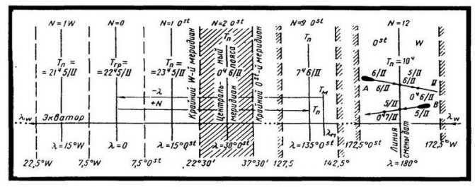
Calculation of N belt based on longitude. To determine the N belt, divide the longitude by 15°. If the remainder is less than 7°30/, the quotient represents the N of the belt. If the remainder is greater than 7°30/, add one unit to the quotient.
The time remains constant within each belt, so clocks do not need to be adjusted when moving. Upon crossing the eastern boundary of a belt, clocks are immediately moved forward by 1 hour. When crossing the western boundary, clocks are moved back by 1 hour.
Converting from local time to zone time.
To adjust the transition from local time to zone time, it is necessary to account for the difference in longitudes between the local and central meridians (Dl in hours). However, for a moving ship, it is more convenient to solve the problem “through Greenwich”. Let Tm be the time for meridian lm (see Fig.); by converting longitude into hours, we can determine the local time at the zero meridian, denoted as Tgr, which is also the zero belt. To move to the time Tp on the central meridian of this belt, we use the N belt (representing the central meridian in hours) as follows:
Tgr=Tm + l 0stw; Tp=Tgr ± N 0stw. The reverse transition from Tp to Tm is done similarly, but using the following formulas:
Tgr = Tp + N 0stw; Tm = Tgr ± l 0stw
Example. 17/VIII 1977 d. in l = 82°10′ W we have TM = 5h38m. Find, Tp:
Solution. We will solve this problem using the “Greenwich” method.
| Tm + | 5Ch38m 17/VIII |
| lw | 5 29 … |
| 11 07 | |
| – Nw | 5 |
| Tp | 6h07m |
Translate l = 5h28m40s and round to 1m, as Tm is given to 1m.
Belt times: Many belt times have their own names; for instance, the time of the first belt (N = 1 Ost) is referred to as Central European, and that of the second belt is Eastern European.
The belt time Td in Russia is the time increased by 1h, meaning it is one hour ahead.
The N = 13 Ost belt extends to the date change line in the Bering Strait (l =1690 W), with the clock showing N = 11 W, but the date is different by 1 day.
Ship’s time.
Ship’s time Tc refers to the time in the specific time zone where the ship’s watch is set. The master provides the zone number, which is then recorded in the logbook. For example, 22.00, N = 10 Ost, or N = -10. It is worth noting that the belt number provided by the master often differs from the computed longitude. Therefore, when making calculations, it is preferable to use the belt number from the logbook rather than determining it based on longitude. Ship’s time is typically measured to the nearest minute, which is sufficient for the ship’s daily activities, operation, and navigation (particularly at speeds of up to 15 – 16 knots.)
Tgr = Tm + lOstW ; Tc = Tgr ± N OstW ;
where l represents the longitude of the ship’s location at that specific moment;
N stands for the number of the belt used to set the ship’s watch (from the logbook);
Example. On November 23, 1977, with d. in l = 13040′ Оst sunset Tm = 17h15m, we need to determine Tc, with No. = 3 0st.
Solution:
| Tm | 17Ch15m 23/I I |
| lOst | 0 55 |
| Tgr | 16 20 |
| № | 3 |
| Tc | 19h20m |
Systems of measuring time.
In everyday use, the unit of measuring time is the “average solar day”. This average solar day is then divided into smaller units as follows: 1 average solar day = 24 average solar hours, 1 average solar hour = 60 average solar minutes, 1 average solar minute = 60 average solar seconds. Therefore, there are 86,400 average solar seconds in one average solar day.
Traditionally, a day is considered to begin at midnight and last for 24 hours. However, in the United States, for civilian purposes, the day is divided into two equal parts – before noon and after noon, and a 12-hour time format is used within these periods.
Time is represented differently in the U.S. military and most of continental Europe compared to other parts of the world. Instead of using the traditional 12-hour clock, these regions use a 24-hour dial with four-digit numbers to indicate time. For example, midnight, which marks the beginning of the day, is represented as 0000. The following noon is represented as 1200, 3 pm is represented as 1500, and the next midnight, marking the end of the day, is represented as 2400. To indicate specific minutes past the hour, additional digits are added. For example, 1 hour and 25 minutes after midnight would be represented as 0125. This system allows for precise timekeeping and eliminates any confusion that may arise from using a 12-hour clock.
How can we determine the positions of planets in the birth chart?
To create a birth chart, we require specific information: the individual’s date of birth (day, month, year), the time of birth, and the coordinates of the birth city.
For example, let’s calculate the positions of the Sun, Moon, and Mercury for December 5, 1965, at 17:38 (local time) in the city of Riga. The coordinates of Riga are: N = 56 degrees 57 minutes, E = 24 degrees 06 minutes. Let’s calculate the Greenwich Mean Time (GMT). Riga is in the second time zone (minus 2 hours), in 1965 there was a decree time (minus 1 hour), and no daylight saving time was observed (minus 0 hours). GMT = 17:38 – 2 – 1 – 0 = 14:38.
1. Let’s record the information from the ephemeris for December 5, 1965 at 12:00 AM. Day: Sunday Stellar Time(ST): 4:54:20 Sun: 12° 38′ 31″ Sagittarius Moon: 25° 33′ 32″ Aries Mercury R: 8° 18.4′ Sagittarius. And Mercury is retrograde (indicated by the letter R). Note that 18.4 minutes is equivalent to 18 minutes and 24 seconds (18.4 – 18 = 0.4 and 0.4 x 60 = 24).
2. Record the information from the ephemeris for December 6, 1965 at 12:00 AM (24 hours later). Day: Monday Sidereal Time(ST): 4:58:16 (the difference for the day is 3 minutes and 56 seconds) Sun: 13° 39′ 24″ Sagittarius Moon: 8° 42′ 29″ Taurus Mercury R: 7° 3.4′ Sagittarius
The calculation of planets other than Mercury follows the same algorithm, but there are some differences when it comes to retrograde planets, as we will explore using the example of Mercury.
But before we proceed, let’s determine the current location of the Moon. Throughout the day, the Moon has shifted from the zodiac sign of Aries to the zodiac sign of Taurus. Therefore, it is important to keep in mind the translation of values in terms of absolute longitude. On December 5th, the Moon was positioned at 25 degrees 33 minutes 32 seconds in Aries (25.5589). On December 6th, the Moon’s position changed to 8 degrees 42 minutes 29 seconds in Taurus (8.7081). To calculate the absolute longitude, we need to add 30 degrees to the initial 8 degrees in Aries (representing the transition from Aries to Taurus). Thus, 8.7081 + 30 = 38.7081. Let’s now perform the following calculations: 1. 38.7081 – 25.5589 = 13.1492 (the Moon’s daily speed) 2. 13.1492 : 24 = 0.5479 (the Moon’s speed per hour) 3. 0.5479 x 14.6333 = 8.0176 (the distance traveled per GMT) 4. 8.0176 + 25.5589 = 33.5765 (the Moon’s current position in absolute value) 5. 33.5765 – 30 = 3.5765 degrees in the sign of Taurus 6. 3.5765 can be expressed as 3 degrees 34 minutes 35 seconds in the sign of Taurus.
When determining the positions of planets in retrograde, we need to calculate Mercury’s velocity by subtracting the smaller value (on December 5) from the larger value (on December 6) as Mercury moves backwards. On December 5, Mercury R is at 8 degrees 18.4 minutes of Sagittarius (8.3067), and on December 6, it is at 7 degrees 3.4 minutes of Sagittarius (7.0567). To calculate Mercury’s speed for the day, we subtract 7.0567 from 8.3067, which gives us 1.25. Dividing 1.25 by 24, we find that Mercury’s velocity per hour is 0.0521. Multiplying 0.0521 by 14.6333, we get 0.7624, which represents the path per GMT. Subtracting 0.7624 from 8.3067, we find that the position is 7.5443, which translates to 7 degrees 32 minutes 40 seconds of the sign of Sagittarius. Since the planet is retrograde, we need to subtract the planet’s path from the greater value (as of December 5). The desired natal position of the planet should be between the two original positions on December 5 and 6.
Sidereal time and solar time.
In order to calculate the average solar time, astronomers rely on observations of the celestial bodies, rather than directly measuring the position of the Sun. This is known as sidereal or sideric time, which is based on the movement of the stars and constellations. By applying mathematical formulas, the average solar time can be determined based on the sidereal time.
If we extend the imaginary line of the Earth’s axis in both directions, it will intersect with the celestial sphere at the points known as the poles of the world – the North and South poles (Fig. 1). A large circle called the celestial equator, which is a continuation of the Earth’s equator plane, passes at an angular distance of 90° from these poles. The path of the Sun’s movement that is visible is called the ecliptic. The equator and ecliptic planes intersect at an angle of approximately 23.5°; these points of intersection are referred to as the equinox points. Each year, around March 20-21, the Sun crosses the equator from the South to the North at the vernal equinox. This point is almost stationary in relation to the stars and serves as a reference for determining the position of stars in the astronomical coordinate system, as well as for measuring sidereal time. Sidereal time is measured using the hour angle, which is the angle between the meridian where the object is located and the equinox point (measured west of the meridian). In terms of time, one hour corresponds to 15 degrees of arc. In relation to an observer situated on a specific meridian, the point of the vernal equinox traces a closed trajectory in the sky on a daily basis. The time interval between two consecutive crossings of this meridian is referred to as a sidereal day.
When observed from Earth, the Sun appears to move from east to west across the celestial sphere each day. The angle between the Sun’s direction and the celestial meridian of a specific location determines the “local apparent solar time,” which is indicated by a sundial. A true solar day is the time interval between two consecutive crossings of the meridian by the Sun. Over the course of a year (approximately 365 days), the Sun completes a full revolution on the ecliptic (360°), causing it to shift in relation to the stars and the vernal equinox by nearly 1° each day. As a result, the true solar day is longer than the sidereal day by an average of 3 minutes and 56 seconds. Due to the uneven apparent motion of the Sun compared to the stars, the true solar day also varies in duration. This irregularity in the Sun’s motion is caused by the Earth’s orbital eccentricity and the tilt of its equator in relation to the ecliptic plane (Fig. 2).
How to Discover the Day
In Jules Verne’s captivating novel “Around the World in Eighty Days,” the protagonist embarks on a daring wager to circumnavigate the globe within a time frame of 80 days. From steamships to trains, and even on foot and atop an elephant, he traverses through mountains, deserts, and forests, ensuring not a single moment is wasted as he marches towards the eastern horizon. east
Countless obstacles are surmounted, yet upon his return to his hometown, he realizes that he has exceeded the 80-day limit by several hours. Despondency takes hold as he contemplates his seemingly futile efforts and the loss of the bet. However, his loyal servant uncovers a remarkable revelation – the city is still experiencing “yesterday’s day.” With this newfound knowledge, the intrepid traveler resolutely appears at the designated rendezvous point, triumphantly claiming victory in the eleventh hour.
How did he manage to find a day? What caused it to happen? – It happened because he embarked on a journey around the world, always heading east. During his adventurous race that lasted for 80 days, the traveler, constantly moving towards the Sun, witnessed a total of 81 sunrises. Meanwhile, the people in his hometown saw only 80 sunrises within the same timeframe, which ultimately helped the traveler win the bet.
According to another account, two captains who had recently completed a circumnavigation of the globe paid a visit to a certain host one evening. One captain had traveled around the world in a westward direction, while the other went in an eastward direction. Both captains departed from their hometown on the same day and returned on the same day as well. The captain who traveled westward claimed that Sunday would be tomorrow, while the captain who sailed eastward insisted that Sunday had already passed. However, the host firmly asserted that Sunday is today.
This narrative is centered around a misconception. Solely the landlord was accurate. And the reason behind his accuracy will be revealed in a few pages.
Regions with Different Time Zones
To avoid the need for local time adjustments for every degree or minute of latitude, the Earth’s surface was divided into 24 time zones by convention. When transitioning from one time zone to another, the minutes and seconds remain constant, only the hours change.
There are certain regions where local time deviates from universal time by not just a whole number of hours, but also an additional 30, 40, or 45 minutes. However, these time zones are not considered standard.
At the North and South Poles, meridians intersect at a single point, rendering the concept of time zones irrelevant in those areas. Traditionally, it is assumed that the time at the poles aligns with the global time.
In theory, the boundaries of all time zones around the world should be defined by straight lines extending 7.5° to the east and west of the average meridian of each zone. However, in practice, these boundaries are often adjusted in order to maintain consistent time within a particular administrative or geographical area, deviating from the originally proposed arrangement.
Supplementary materials for the lesson
1- Accurate timing and determination of geographical longitude
The Sun always only illuminates half of the Earth: one hemisphere experiences daytime while the other experiences nighttime. Therefore, there are always specific locations where it is noon and the Sun is at its highest point. As the Earth rotates on its axis, noon occurs at points that are increasingly to the west. The position of the Sun (or stars) in the sky is utilized to calculate the local time for any given location on the globe. The time difference between two points (T1 and T2) is exactly equal to the difference in their geographical longitudes.
It is evident that the time of noon is delayed at a specific location on Earth compared to another location, precisely equal to the time it takes for the planet to rotate to an angle that corresponds to the difference in their longitudes. Therefore, in the case of St. Petersburg, which is 8°45' west of Moscow, noon occurs 35 minutes after.
By making observations and comparing the local time at a specific point with the local time at another point whose geographic longitude is known, it becomes possible to calculate the geographic longitude of the observation point. The longitude is counted from the initial (zero) meridian that passes through the Greenwich Observatory. The local time at this meridian is referred to as Universal Time (UT). Therefore, T1 = UT + λ1, meaning that the local time at any point is equal to the Universal Time at that moment plus the longitude of that point from the initial meridian, measured in hours.
The precise measurement of time is complicated by the fact that the former standard, the Earth’s rotation period, has proven to be unreliable. The solar day, which is the time between two upper culminations of the Sun, has long been used as a fundamental unit of time. However, as astronomical observations became more accurate, it became evident that the length of the day is not constant. The Earth’s rotation rate changes throughout the year, and there is also a gradual slowing down of its rotation. Therefore, the definition of a second as 1/86400th of a day needed clarification. You are familiar with the modern definition of a second from your physics course. The use of atomic clocks, which are accessible to precision time services and the state standard of time and frequency, allows for extremely accurate time measurement with a very small error (approximately 5 ∙ 10 -9 s per day). Radio broadcasts transmit precise time signals from these atomic clocks.
Using local time in our everyday lives would require us to constantly adjust the clock’s hands as we travel in either a westward or eastward direction. The inconvenience of this practice is so evident that nowadays nearly the entire global population relies on zone time.
The concept of the belt time system was introduced in 1884. Under this system, the entire globe was divided into 24 time zones, each covering approximately 15 degrees of longitude. Time is measured based on the 24 main meridians, which are spaced 15 degrees apart. The time on these meridians, which are located in the middle of each time zone, differs by exactly one hour. The local time on the main meridian of a specific time zone is known as zone time and is used to keep track of time within that time zone. Belt time, which is observed in a particular location, differs from world time by the number of hours corresponding to its time zone:
where UT represents Universal Time and n represents the time zone number.
The boundaries of time zones are the lines that stretch from the North Pole to the South Pole of the Earth and are about 7.5° away from the prime meridians. These boundaries are not always precisely along meridians but are instead drawn along the administrative boundaries of oblasts or other regions to ensure that the same time is observed throughout their territory (Fig. 2.18).
For instance, it’s natural that Moscow adheres to the time of a single time zone. If we strictly follow the established rule of dividing into time zones, we would have to draw the boundary in a way that the city would be split into two unequal parts.
In our nation, belt time was implemented on July 1, 1919. Since then, the boundaries of time zones have been revised and altered multiple times.
During the late 20th century in Russia, decree time, which is 1 hour ahead of the zone time, was introduced and subsequently revoked several times. In January 1992, it was established for the last time, and now in our daily lives, we once again utilize this time, referring to it as local time.
Many countries transition to “daylight saving time” during the spring, advancing the clock hands by 1 hour from the “winter time” they return to in late fall.
2. Calendar
A calendar is a system for measuring long periods of time, which establishes a specific duration for months, their order in the year, and the starting point for counting years. The calendar we currently use was developed after extensive research to find the most convenient system for these purposes. Throughout human history, there have been over 200 different calendars created.
Since the earliest stages of human civilization, certain societies have embraced the use of lunar calendars. These calendars were structured in a way that alternated between months of 29 and 30 days. The commencement of each month was marked by the appearance of a new moon. It is important to note that the time interval between consecutive new moons is approximately 29.5 days, which aligns with the Moon’s revolution around the Earth and its corresponding phases. However, this lunar calendar did not perfectly align with the solar year, which consists of approximately 365.25 days. In fact, twelve lunar months only total 354 days. To address this disparity between the lunar and solar year in various lunar calendars, necessary adjustments were proposed.
The solar calendar is based on the length of the tropical year, which is the time it takes for the center of the Sun to pass through the vernal equinox twice in a row. The tropical year lasts for 365 days, 5 hours 48 minutes 46.1 seconds. Since a year cannot have a fractional number of days, most calendars have 365 days in a year, with some years being one day longer. This helps to keep the average length of a year in line with the length of a tropical year.
In Ancient Egypt, around the 5th millennium BC, a calendar was introduced. It consisted of 12 months, each with 30 days, and an additional 5 days at the end of the year. This calendar resulted in a yearly lag of 0.25 days, or 1 year in 1460 years.
The Julian calendar, named after Emperor Julius Caesar, was the precursor to the modern calendar in Ancient Rome. It consisted of 12 months and had a total of 365 or 366 days. Every four years, an additional day was added, known as a leap day, to account for the extra time. These leap years occurred when the year was divisible by four.
The term “leap year” is derived from the Latin word bissextus, which means “second sixth”. This word was then adapted into the Greek word “bisokos”, which eventually became “visokos” in Russian. The word’s origin is related to the method of counting days in descending order until the start of the next month. In a leap year, an extra day was added in February, specifically after the sixth day before the start of March. This additional day was considered as the sixth day once again, rather than the fifth.
To rectify the inconsistency, Pope Gregory XIII introduced a novel style in 1582, known as the Gregorian calendar. To minimize the disparity between the calendar year and the tropical year, it was decided that every 400 years, 3 days would be subtracted by reducing the number of leap years. It was agreed that all years ending in centuries would be considered regular years, except for those divisible by 4 without a remainder. Thus, 1600 and 2000 were deemed leap years, while 1700, 1800, and 1900 were not.
In Russia, the adoption of the new calendar system occurred on February 1, 1918, resulting in a 13-day discrepancy with the old style. This difference will persist until 2100, when, according to the old style, it would have been considered a leap year, while the new style designates it as a regular year. The distinction between the old and new styles is typically noted when discussing past events. For instance, we would say that C. E. Tsiolkovsky was born on September 5 (17), 1857.
The Gregorian calendar is approximately half a minute longer than the tropical calendar on average, resulting in a difference of only 2 hours and 53 minutes over a span of 400 years, or one day in 3300 years.
The numbering of years, both in the new and old styles, is based on the year of Christmas, the beginning of a new era. In Russia, the new era was established by Peter I’s decree, which stated that after December 31, 7208 “from the creation of the world,” January 1, 1700 would be counted from the Nativity of Christ.
Queries
1. What is the reason behind the implementation of the belt system for measuring time?
2. What is the rationale for using the atomic second as the standard unit of time?
3. What challenges arise when creating a precise calendar?
4. How does the method of counting leap years differ between the old and new styles?
1. How much does the time on your watch deviate from Universal Time?
2. Utilize the map to ascertain the geographic longitude of your school. Compute the local time for this longitude. How divergent is it from the time in your current location?
3. Isaac Newton was born on January 4, 1643 in the new style calendar. What is his birth date in the old style calendar?
Task 10
Produce a report on the origins of the calendar.
Consequently, at 8:00:00 UTC the average solar time in the heart of Moscow will be 8:00:00 + 2:30:28 = 10:30:28. By using Greenwich time, it is possible to determine not just the local time in any given time zone, but also the mean solar time on any meridian. For the contemporary city dweller, true time is more of a celestial concept that holds little significance in their day-to-day life due to its irregularity (refer to Solar Day).
In several nations, the official time is moved one hour ahead during the summer season. Our planet is divided into 24 meridians of 15 degrees, each representing a time zone, and time is averaged accordingly.
Imagine you reside in Moscow, where the geographical longitude is 37 degrees. The present time zone in Moscow is GMT+3 (since October 26, 2014). If we multiply 15 degrees by 3, we obtain 45 degrees. Moscow is situated at an eastern longitude of 37 degrees, 36′. For the sake of simplicity in this example, let’s “round” the longitude to 37 degrees. The discrepancy between the base meridian and Moscow’s longitude is approximately 45 – 37 = 8 degrees.
How can I determine Greenwich time?
When trying to find out Greenwich time, you subtract the eastern longitude and add the western longitude. Conversely, when trying to determine local time, you take into consideration the longitude of the place.
What are the steps to set up a phone connection? How do I configure my phone to display the battery percentage? How can I set up my phone for USB usage? How do I enable internet access on my phone? How do I personalize my Honor phone? How can I customize my Lumia 535 phone? How do I adjust my phone settings for 4G network? How can I personalize my phone for Russian language? How do I configure my Nokia phone for Russian language? What are the steps to create a hotspot on my Android phone?
In this scenario, the local time on the meridian located to the east of a certain point is ahead of the time in that point, while the meridian located more to the west lags behind. For instance, if the local time in Kiev is 12:00 PM, then in Donetsk it would already be 12:29 PM, and in Lviv at that moment, it would only be 11:33 AM and 56 seconds. Hence, in order to establish the accurate time in different points, it is necessary to perform these calculations.
2. Determine the longitude difference between the points (in degrees and minutes):
a) between Donetsk and Kiev – 37° 49′ – 30° 34′ = 7° 15′ E. E.;
b) between Kiev and Lvov – 30° 34′ – 24° 03′ = 6° 31′ east. e.
3. Convert the longitude difference (from degrees and minutes) into the time difference (in hours, minutes, and seconds):
a) 7°15′ is equal to 7 multiplied by 4, which is 28, plus 15 multiplied by 4, which is 60, equals 29.
b) 6°31′ is equal to 6 multiplied by 4, which is 24, plus 31 multiplied by 4, which is 124, equals 26.
The values found indicate the difference in local time on the meridians passing through Kiev, Lvov, and Donetsk.
4. To determine the local time in Donetsk (which is located east of Kiev) or Lviv (which is located west of Kiev), add or subtract the obtained value from the known time in Kiev (12 h):
a) If Kiev is 12 h, the local time in Donetsk will be:
b) If Kiev is 12 h, the local time in Lviv will be:
12 h – 26 = 11 h 33.
Time zones and local time. It is nearly impossible to use the local time, which differs in each location, in everyday life. To make things more convenient, people all over the world utilize time zones. To achieve this, the globe is divided into 24 bands (each 15 degrees of longitude) representing the number of hours in a day. In each time zone, it is agreed that the local time will be the same. The time of the meridian running through the center of each band (the middle meridian) is considered the zone time.
Time zones are numbered from 0 to 23 in the eastward direction: the middle meridian of the 0th band is the Greenwich (Beginning) meridian, the 1st band is the 15 degrees east meridian, the 12th band is the 180th meridian, and the 23rd band is the 15 degrees west meridian.
The first time belt is known as Western European, the second time belt is known as Central European, and the remaining time belts are known as Eastern European. The number associated with each belt represents the time zone it falls in when traveling north along the Greenwich meridian. The time difference between each neighboring belt is one hour. When traveling eastward, we need to advance the clock by one hour as we cross into each new time zone, and when traveling westward, we need to set the clock back by one hour.
The geographical location of Ukraine makes it conveniently positioned in relation to time zones: approximately 95% of its territory falls within the second time zone, with only Lugansk and parts of Donetsk and Kharkov regions falling within the third time zone, and a small portion of the Zakarpattya region falling within the first time zone. However, for practical purposes, the boundaries of time zones on land are not strictly defined by meridians, but rather take into account state borders. As a result, the entire territory of Ukraine is classified under the second time zone. The local time in Ukraine corresponds to the time of the meridian that represents the average for the second time zone (30°), which runs near Kiev. Hence, in Ukraine, the time zone is commonly referred to as Kiev time.
Europe has several time zones. Besides Ukraine, the countries that are in the same time zone are Belarus, Latvia, Lithuania, Estonia, Finland, Moldova, Romania, and Turkey. Meanwhile, the countries that use Central European time are Ukraine’s western neighbors, as well as most Western and Central European countries. On the other hand, Great Britain, Ireland, Iceland, and Portugal use Western European time. Additionally, the Russian territories that are adjacent to Ukraine’s borders follow Moscow time, which is one hour ahead of Moscow time.
Ric. Time zones of the world
Summer time. Every year in Ukraine, summer time is implemented. On the last Sunday in March, the clock is moved forward by one hour, allowing for longer daylight hours and energy savings. On the last Sunday in October, the clock is set back by one hour to return to standard time.
The introduction and removal of daylight saving time is coordinated among most European countries.
The concept: Due to the Earth’s rotation, the Sun’s position in relation to different parts of our planet changes, resulting in the phenomenon of sunrise and sunset occurring at varying times. In practical terms, using local time for everyday purposes would be impractical, as each meridian would have its own unique time. Therefore, for convenience, the Earth is divided into 24 time zones.
Methods for removing old adhesive from tiles, silicone sealant from a bathtub, and tint film from a car window, as well as expulsions from the Russian Federation, protective film from kitchen fronts, furniture, and a plastic door, and the protective film from sandwich panels, can be found below.
Discover the meaning of “True solar time” in alternative dictionaries:
“True solar time” refers to a time measurement where the length of the day is considered to be equal to the interval between two consecutive occurrences of the highest point of the Sun’s path. In order to solve various problems related to aeronautical astronomy, it is important to have knowledge of the local time, which serves as the foundation for all astronomical observations.
Each meridian has its own unique local time. It can be categorized as stellar, true solar, or mean solar. This relationship applies to both solar and sidereal time, encompassing any system of time measurement.
Accurate Time Calculation
Our time calculations are based on the Chinese cosmic energy calendar, ensuring that the dates and clocks selected are not influenced by government regulations, but rather by the true solar time. This is determined by the precise angle between planet Earth and the Sun, serving as the reference meridian. In certain cases, it is necessary to consider times near the boundaries of each day. It is crucial to accurately determine the hour to avoid any errors in selecting the day, as each day possesses distinct energy properties.
I sincerely appreciate your interest in our articles and your commitment to living in accordance with the principles of feng shui. Regarding your query about the correct time calculation for Krasnoyarsk, it is determined to be 112 minutes later than solar time.
Hello, Denis! I want to confirm if I have calculated correctly: City of Tiraspol, TMR1. The geographical longitude is 29°.2. The time zone is GMT +2:003. I am a bit confused because some sources state that the GMT of Barnaul (Altai region) is +3, while others say it is +4. This discrepancy in calculations, although small (4 minutes), needs to be resolved! Currently, we are observing daylight saving time. Does this mean that in winter, the GMT will be -4? Kindly clarify this for me! Previously, the time difference was +1.5 hours, but now it seems to be around 30 minutes. Can you confirm if this is correct or if it will actually be 2.5 hours the other way around? Thank you!
SOLAR TIME refers to the time calculated based on the changing hour angle of the Sun. I originally hail from Prokopyevsk, which falls within the 6th time zone… However, the concept of maternity time was eventually abolished. To determine the average solar time in Moscow, one must convert the longitude of the location (approximately 38°) into hour units. The Sun’s center serves as the reference point for International Standard Time (I.S.T.), with the counting starting from the Sun’s highest point in the sky (true noon)… This information is relevant to the field of Natural History.
Time and location
The moment of true noon, when a stick inserted into the ground casts the shortest shadow, varies in different parts of the world. This raises the question of how to synchronize clocks. Should each location have its own time? But wouldn’t this confuse train schedules and make travel dangerous? Is it possible to establish a single global time? However, it is unlikely that countries with significant time discrepancies would agree to this.
All of these issues have already been resolved, but let’s take a step back in time to better understand the challenges, discoveries, and solutions that were involved…
However, during a violent confrontation with the indigenous people, Magellan tragically lost his life, leaving the expedition without its strong leader. The discipline among the Spanish crew quickly deteriorated, and the natives learned to respond with aggression, seeking revenge. In a cunning trap, some of the crew members were lured into a feast and then mercilessly killed by the vengeful natives. With a reduced number of men, it became clear that there were not enough resources to sustain all three ships, leading to the decision to burn one of them.
Eventually, two ships managed to reach the highly sought-after Moluccas Islands, also known as the “spice islands”. The holds of the ships were filled to the brim with valuable spices such as cinnamon, nutmeg, and pepper. Unfortunately, one of the ships suffered from a leak and had to be abandoned.
And now, there is only one ship left, the smallest among the five that originally departed from Spain, that continues its journey. The Spanish sailors anxiously avoid the Portuguese harbors-fortresses. This tiny sailing vessel circumnavigates Africa and, narrowly evading capture by the Portuguese, eventually arrives in Seville. After three years, it completes its westward journey and returns. And now, with its successful return, there is absolutely no doubt that the Earth is indeed a spherical object.
However, the small vessel revealed another revelation. Throughout the journey, one of its crew members, Pigafetta, diligently recorded everything he witnessed. Day after day, without fail, he meticulously documented his observations. Astonishingly, it was discovered that an extra day had elapsed on land compared to the ship. Wednesday aboard the ship corresponded to Thursday on land. This realization left the devout Spaniards in a state of horror as they had inadvertently altered the days of their religious holidays and fasts. Three years later, upon finally returning to their homeland, the participants of the expedition made it a priority to cleanse themselves of this unintentional transgression. Clad in white shrouds and holding lit candles, they ventured to the church, walking barefoot….
However, the question remained: why did this discrepancy occur? Why did different locations on Earth experience different times? The answer lies in the rotation of the Earth. This newfound truth was brought back from the circumnavigation voyage by Pigafetta, the diligent chronicler.
Calculating the local time at a specific location.
To determine the local time at a given point, we can use the following method. Firstly, we can take the longitude of the location and convert it into minutes. For example, if we have a longitude value of 8 degrees, we can multiply it by 4 to get 32 minutes. This approximate difference between Moscow time and the real solar time can help us convert the solar time to the local time. Therefore, when choosing the hour, it’s important to take into account this difference and adjust accordingly. Denis, greetings! I wanted to ask you where you obtain the longitude for calculating the local time? Could you please assist me in understanding how to determine the solar time for Warming the Money Star in April 2014 in Pyatigorsk, Stavropol region? I’m a bit confused….Wishing you happiness and prosperity.
Have I correctly determined that the discrepancy between maternity time and astronomical time is 58 minutes (equivalent to 14.5 degrees)? Therefore, if I intend to construct a horizontal sundial, I would have to rotate it 14.5 degrees in a clockwise direction in order for it to display maternity time. I appreciate your assistance in advance, Denis. I am having difficulty understanding the phrase “local time is less than solar time.” Does it imply that the event will transpire earlier? I am situated in GMT -5 (Toronto).
Time is a fundamental concept that encompasses philosophical, physical, and social aspects. As such, the accurate measurement of time is a crucial problem in modern science. Throughout history, we have observed that time appears to flow smoothly, much like the calm and quiet flow of water in a river. This observation led to the creation of ancient timekeeping devices such as water clocks and hourglasses. As time progressed, mechanical clocks were developed, utilizing the periodic oscillations of a pendulum to maintain a consistent period of timekeeping. Today, modern electronic clocks rely on the oscillations in the electromagnetic field of crystals or even individual molecules to ensure precise timekeeping. While the methods and technologies used to measure time have evolved over the centuries (Fig. 3.1, 3.2), certain units of time measurement have remained constant, such as the year and the day. These units are tied to the Earth’s movement around the Sun and its rotation on its axis.
| A solar day refers to the duration it takes for the Earth to complete one full rotation on its axis with respect to the Sun. 1 hour is equivalent to 1/24th of a day. 1 hour can also be expressed as 60 minutes or 3600 seconds. |
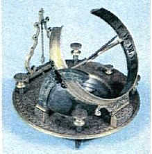
Fig. 3.1. An ancient sundial
In order to determine the rate at which the Earth rotates, astronomers can use the Sun, stars, and other celestial bodies as points of reference. This is why there are two systems of time measurement – sidereal time and solar time. Astronomers primarily use sidereal time, while the general population relies on solar time for everyday life. A solar day is the period of time it takes for the Earth to complete one full rotation on its axis relative to the Sun. This day is divided into 24 hours, with the start of the solar day (0 h) traditionally being midnight.
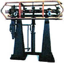
Fig. 3.2. The first atomic clock
An accurate method for determining the local time, also known as solar time, is by using a sundial. A sundial is a simple instrument consisting of an ordinary stick that casts a shadow helping to approximate the local time. The moment of local noon, which is 12 o’clock local time, occurs when the upper culmination of the Sun happens and the shadow of the stick is the shortest (see § 2).
Using local time can be inconvenient in everyday life as it varies at different locations on Earth’s surface. This would require us to constantly adjust our clocks by a few minutes as we move from one place to another. However, this problem was resolved with the introduction of belt time in the late 19th century. The Earth was divided into 24 time zones along meridians, with each zone having the same time as the local time of the middle meridian (Fig. 3.3). When travelers cross the border of a zone, they only need to set their clocks back by one hour.
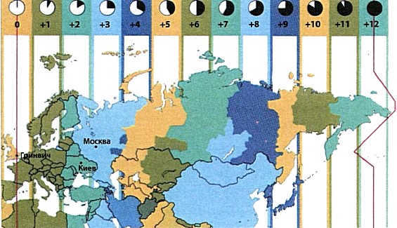
Fig. 3.3. Time zones. The Earth is split into 24 regions, where all timepieces indicate the identical time. When travelers transition from one region to another, they adjust the clocks by a whole number of hours.
The discrepancy between local time and Moscow time is determined by the difference in geographical longitudes between Moscow and the location of observation.
On the meridian with a longitude of 180°, there is a line where dates change. Crossing this line allows for not only spatial travel but also time travel. For instance, when flying from Asia to the East towards America, if it’s January 1st, the next day will also be January 1st, providing the seemingly fantastical opportunity to relive the same day. However, when passengers fly in the opposite direction from America to the West towards Asia, they can actually live through two days during the flight – after January 1st, January 3rd will immediately follow.
Zone time corresponds to the local time of the central meridian of the respective zone.
For those who are curious
In spring, on the last Sunday of March, most European countries adjust their clocks forward by 1 hour, implementing what is known as daylight saving time. As a result, during the summer, the time in Kiev will be ahead of the local time in all Ukrainian cities. Essentially, Western Europe is aligning with Kiev time while Ukraine is aligning with Moscow time. For instance, during the summer, even in the eastern part of Ukraine, such as Lugansk, the local time is 23 minutes behind Kiev time, and noon on the Lugansk meridian corresponds to 12:23 Moscow time. It’s worth noting that not all countries around the world observe daylight saving time. It doesn’t make sense to implement it in tropical regions where the duration of daylight remains relatively constant at around 12 hours throughout the year. In Russia, the summer days can exceed 20 hours in certain regions, which is why they have chosen not to adjust their clocks. In April 2011, Russia made daylight saving time permanent, meaning that Moscow time in the winter will be 2 hours ahead of Kiev time.
Solar time and the zodiac
The term “zodiac” (derived from the Greek word for “circle of animals”) was initially coined to describe a set of specific constellations thousands of years ago. This term is linked to the observation that the Sun, Moon, and planets of our solar system can be seen against the backdrop of 12 zodiacal constellations, which together form a vast circle in the celestial sphere. Interestingly, the majority of these constellations are named after living creatures.
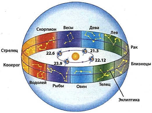
Figure 3.4 illustrates the orbit of the Earth around the Sun and the zodiac. The position of the Earth’s orbit in relation to the stars remains constant. The imaginary celestial sphere intersects with the plane of Earth’s orbit at a line known as the ecliptic. The zodiacal constellations are the 12 constellations that the ecliptic passes through.
In Figure 3.4, the Earth’s path around the Sun is depicted, along with the distant constellations. At intervals of 30 degrees, there are lines indicating the Earth’s position relative to the stars for each month. This allows us to track the Earth’s orbital motion and mark significant time periods. To begin tracking the Earth’s motion, we can use the vernal equinox as a reference point. On March 21st, if we draw a straight line connecting the Earth and the Sun and extend it into space, this line will intersect the imaginary celestial sphere at two opposite points. One of these points is located in the constellation of Virgo (on the side of the Earth), and the other is in the constellation of Pisces (behind the Sun).
As we travel around the Earth, we can see the Sun from different angles in relation to the various constellations throughout the year. By marking the position of the Sun’s center relative to the distant stars every day, we can create a large circle on the celestial sphere known as the ecliptic (derived from the Greek word for “eclipse”). The mathematical definition of the ecliptic is the line where the Earth’s orbit intersects with the celestial sphere, meaning that the plane of the ecliptic aligns with the plane of the Earth’s orbit.
Throughout the centuries, the plane of the ecliptic has maintained a consistent position in relation to the stars, while the Earth’s poles gradually shift in space. This phenomenon, known as precession (derived from the Latin word for “advance”; see Fig. 3.5), has significant implications. Currently, the North Pole of the Earth is situated within the constellation of Ursa Minor, but in 13000 years, it will have shifted to the constellation of Lyra. Consequently, our future generations will rely on the star Vega to determine the direction of north. Furthermore, as a result of precession, the position of the celestial equator among the stars also changes. Therefore, in the future, the constellation Orion will no longer be visible in Ukraine, but instead, our descendants will have the opportunity to observe the closest star, Proxima Centauri.
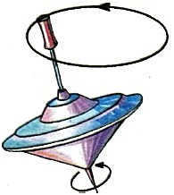
Fig. 3.5. The concept of precession can be illustrated by the motion of a child’s yula. As the yula rotates around its own axis, its axis traces out a cone in space.
| Precession refers to the phenomenon where the Earth’s axis of rotation shifts in relation to the stars. This motion takes the form of a cone in space and occurs over a period of 26000 years. |
For those who are interested.
Please take note that the location of the vernal equinox lies within the constellation of Pisces, but it is designated as Aries. This peculiar inconsistency is attributed to the phenomenon of precession, which causes the point of the vernal equinox to shift in relation to the stars by approximately 50″ annually. In other words, throughout the course of the past two millennia, the point of the vernal equinox has migrated nearly 30 degrees, and within a few decades, it will reside in the constellation of Aquarius. Furthermore, in approximately 13,000 years, the vernal equinox will be situated in the constellation of Virgo, while the fall equinox will be observed in Pisces.
The alteration of seasons on Earth
Based on the study of natural history, it is understood that the Earth’s axis of rotation is tilted at an angle of 66.5° in relation to the plane of its orbit. This inclination is what causes the change of seasons on Earth. If the Earth’s axis of rotation were perpendicular to the orbital plane, there would be no variation in seasons. In such a scenario, the Sun would illuminate both the Northern and Southern hemispheres of our planet equally throughout the year.
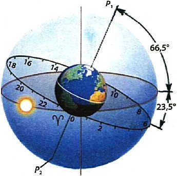
Figure 3.6 illustrates the inclination of the Earth’s equator and ecliptic planes, which is 23.5°, as well as the angle between the ecliptic plane and the Earth’s pole, which is 66.5°. These angles are responsible for the occurrence of seasons on our planet
Fig. 3.7. The Sun’s rays illuminate the Earth differently in winter and summer. During winter, the Sun’s rays hit the Earth at an angle, resulting in less energy being received. In contrast, during summer, the Sun’s rays can fall perpendicular to the horizon in the tropical zone, allowing for more energy to be received. The tropical zone is located at a latitude of approximately ±23.5°
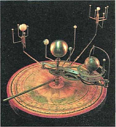
Figure 3.8. An ancient mechanical device from the 19th century that illustrated the movement of celestial bodies and the changing seasons on Earth
When located at a latitude of 50 degrees, the longest day occurs on June 22nd and lasts for 16 hours and 20 minutes, which is twice as long as the shortest day on December 22nd, lasting for 8 hours. At a latitude of 45 degrees, the difference between the longest and shortest day decreases slightly, resulting in a longest day of 15 hours and 30 minutes in Crimea, and a shortest day of 8 hours and 40 minutes.
The Earth’s surface receives the highest amount of solar energy at noon, when the Sun is at its highest point in the sky, and the lowest amount in the morning and evening. During the night, the Earth cools down, so the average surface temperature also depends on the length of the day and night. For instance, at a latitude of 50°, the surface receives 25000 kJ/m2 of energy during a summer day. Interestingly, this amount is even higher than at the equator, where the day length remains constant throughout the year at 12 hours.
In winter, the shorter duration of the day and the lower position of the Sun above the horizon result in a significant decrease in the amount of solar energy heating the Earth’s surface. For example, in December, the surface at our latitudes receives almost 7 times less energy during the day compared to a summer day.
The current angle of tilt of the Earth’s rotation axis, which is 66.5° to the orbital plane, is ideal for supporting a range of climatic zones on the Earth’s surface, from the tropics to the Arctic Circle. Any other variations in the tilt angle would result in severe climate changes and global environmental disasters. For instance, if the Earth’s rotation axis were inclined at an angle of 50° to the orbital plane, Ukraine would fall within the polar circle, and the Black Sea would lie within the tropics. In this scenario, during the summer months, the Sun would never set below the horizon at our latitudes, and it would reach its highest point near the zenith at noon. Based on calculations, the surface temperature in Ukraine during the summer would rise to life-threatening levels, ranging from +60 to +80 °C. On the other hand, if the Earth’s rotation axis were perpendicular to the orbital plane, the change of seasons would cease to exist, and Europe could potentially transform into a cold tundra-like semi-desert.
For those who are curious
In countries near the poles, the duration of the longest and shortest days varies greatly. For instance, in Moscow, the longest day lasts for 17 hours and 40 minutes, while the shortest day only lasts for 7 hours. In St. Petersburg, the longest day is 19 hours, while the shortest day is 6 hours. At the latitude of St. Petersburg in June, the Sun briefly disappears below the horizon, leading to the phenomenon known as the “white nights”. This period, which lasts for almost a month, allows for the observation of bright stars in the southern part of the sky at night, while the northern horizon remains illuminated to the extent that one can even read books at midnight.
At the poles, the polar day and polar night each last for six months. For instance, at the North Pole, the Sun rises on March 21st and sets on September 23rd. During this time, the Sun’s declination is above zero. Conversely, at the South Pole, the polar day occurs from September 23rd to March 21st.
Calendars are devised to measure lengthy periods of time. In the contemporary calendar used in European countries, the basis is one tropical year – the duration it takes for the Earth to orbit the Sun in relation to the vernal equinox point. However, creating an ideal calendar becomes complicated due to the fact that a tropical year does not consist of a whole number of days.
A tropical year (365 days 5 hours 48 minutes 46 seconds) is the duration of the Earth’s revolution around the Sun in relation to the vernal equinox point.
In Europe, the Julian calendar was used for a significant period of time, having been introduced by Julius Caesar in 46 B.C. This calendar was based on the concept of a tropical year lasting 365 days 6 hours 00 min 00 s. To ensure that the year consisted of a whole number of days, it was determined that every three consecutive years would consist of 365 days, while every fourth year would be a leap year with 366 days. However, on average, each calendar year exceeded the duration of the tropical year by 11 min 14 s (365 days 6 h 00 min 00 s – 365 days 5 h 48 min 46 s). This meant that when the tropical year actually ended, the Julian calendar year lasted an additional 11 min 14 s. As a result, over the course of four years, the calendar accumulated an error of 44 min 56 s, and over a period of 400 years, it fell behind by nearly three days.
The Gregorian calendar, which is currently in use, addressed this discrepancy. It adjusted by removing three days every 400 years, making three leap years ordinary. Figure 3.9 illustrates the leap years according to the Julian calendar, while the Gregorian calendar designates them as non-leap years. It is evident that these years are characterized by ending in double zeros and having a non-divisible number of hundreds by four.
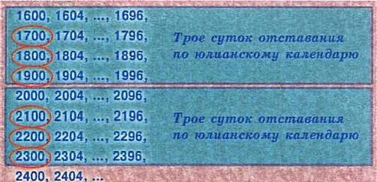
Figure 3.9. Highlighted years that are leap years according to the Julian calendar, while not being leap years according to the Gregorian calendar
The Gregorian calendar, although not flawless, introduces an error of approximately one day every 33 centuries.
For those who are interested
In 1582, a reform of the calendar was implemented based on the proposal of Pope Gregory XIII. To address the accumulated discrepancy, it was decreed that the year 1582 would only consist of 355 days. This new calendar became known as the Gregorian (or new style) calendar, named after the Pope, and was gradually adopted across Europe and the Americas. As of now, there is a 13-day difference between the Julian and Gregorian calendars, which will persist into the 21st century. In Ukraine, the new style was introduced by the government of the Central Rada in 1918.
By utilizing the power of celestial bodies, it becomes possible to ascertain the passage of time. The Earth’s rotation around its axis serves as the basis for measuring hours, minutes, and seconds, while the Earth’s revolution around the Sun forms the foundation for creating calendars to track longer periods of time.
Examinations
- The tropics refer to a geographical latitude where:
- A. Palm trees flourish.
- B. The sun never sets.
- C. The Sun reaches its highest point at the zenith during the solstice.
- D. The Sun reaches its highest point at the zenith during the equinox.
- E. It never rains.
- The Arctic Circle corresponds to a geographical latitude where:
A. Snow remains unmelted throughout the entire year.
B. Polar bears inhabit this region.
C. The duration of night and day is evenly split in half throughout the year.
D. During the equinox, the Sun reaches its highest point directly overhead.
E. On the day of the winter solstice, the Sun does not appear above the horizon. - What is the tilt angle of the Earth’s axis of rotation with respect to the plane of its orbit?
A. 0 degrees.
B. 23.5 degrees.
C. 45 degrees.
D. 66.5 degrees.
E. 90 degrees. - What is the angle between the equator and the plane of the ecliptic?
A. 0 degrees.
B. 23.5 degrees.
C. 45 degrees.
D. 66.5 degrees.
E. 90 degrees. - What is the length of the longest day at the Arctic Circle?
A. 12 hours.
B. 24 hours.
C. 1 month.
D. 3 months.
E. Half a year. - What is the cause of the changing seasons on Earth?
- Why does summer have higher temperatures than winter, even though we receive the same amount of sunlight?
- What was the reason behind the need to reform the Julian calendar?
- In Ukraine, there is a long-standing tradition of celebrating the Old New Year on January 14. What is the origin of this tradition?
- Which location on Earth experiences a consistent day length throughout the year without any changes?
- By using the shadow of a stick, you can determine the angle of the Sun above the horizon at its highest point. How does this angle change over the course of a month?
- Does the Sun set later in Lviv or Kharkiv?
- Using a star map, you can determine the equatorial coordinates of the Sun on the day of your birth. Which constellation is the Sun observed in on this day? Does this coincide with the zodiac sign for that day in horoscopes?


