The Earth’s structure is diverse, consisting of various layers, including solid and liquid shells. What are these layers called? How many layers are there? How do they differ from each other? Let’s explore.
How were the Earth’s layers created?
Compared to other planets in the Earth group (such as Mars, Venus, and Mercury), the Earth has the greatest mass, diameter, and density. It formed approximately 4.5 billion years ago. According to one theory, our planet, along with others, originated from small particles that emerged after the occurrence of the Big Bang.
Under the influence of gravity, debris, dust, and gas began to come together and took on a spherical shape. The initial Earth was extremely hot and caused minerals and metals to melt and fall onto its surface. Heavier substances sank towards the center of the planet, while lighter ones rose to the top.
As a result, the first layers of the Earth formed – the core and the mantle. This also gave rise to a magnetic field. Over time, the mantle gradually cooled down and developed a film, which eventually became the crust. The process of planet formation did not stop there; in fact, it continues to this day.
The primary atmosphere was formed by the gases and bubbling substances from the mantle that constantly erupted through the rifts in the crust. During this period, there was a significant amount of carbon dioxide present, along with hydrogen and helium. Another theory suggests that water came later through the condensation of ice brought by asteroids and comets.
Earth’s Core
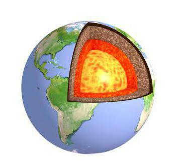
The Earth’s core, along with the mantle and crust, make up the layers of our planet. Each layer possesses unique characteristics. Located at the very center of the Earth is the core, which is the least explored of the three layers. Despite scientific theories, much of our knowledge about the core remains speculative. The temperature inside this innermost layer reaches approximately 10,000 degrees, making it currently impossible to directly study.
The core is situated about 2,900 kilometers beneath the Earth’s surface. It is widely believed to consist of two distinct layers: an outer layer and an inner layer. Combined, these layers have an average radius of 3.5 thousand kilometers and are composed primarily of iron and nickel. Additionally, there is speculation that the core may also contain elements such as sulfur, silicon, hydrogen, carbon, and phosphorus.
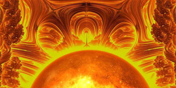
The inner layer of the Earth is solid due to the immense pressure it experiences. Its radius is approximately 70% of the Moon’s radius, which is around 1200 kilometers. On the other hand, the outer core exists in a liquid state, composed not only of iron but also sulfur and oxygen.
The temperature of the outer core varies between 4,000 and 6,000 degrees Celsius. Its constantly moving liquid has a significant impact on the Earth’s magnetic field.
Mantle
The mantle is the middle layer of the planet’s structure that surrounds the core. It cannot be directly examined and is studied using geophysical and geochemical methods. Approximately 83% of the planet’s volume is occupied by the mantle. In the oceans, its upper boundary is located several kilometers below the surface, while under the continents, this boundary can extend up to 70 kilometers.
The mantle is divided into upper and lower parts, with the Golitsin layer in between. Similar to the deeper layers of the Earth, the mantle has a high temperature ranging from 900 to 4000 degrees. It has a viscous consistency, and its density can vary depending on chemical changes and pressure.
Earth’s surface layer
Above the mantle lies the Mohorovicich boundary, which separates different chemically composed layers. In this region, seismic wave velocity increases significantly. The uppermost layer of the Earth is known as the crust.
The outer part of the crust interacts with the planet’s hydrosphere and atmosphere. It is thinner beneath the oceans compared to the land. Approximately 3/4 of the crust is covered by water. The crust’s structure resembles that of other terrestrial planets and partially the Moon. However, on Earth, it is further divided into continental and oceanic sections.
The earth’s surface is composed of different layers. The oceanic crust, which is relatively young, is mostly made up of basaltic rocks. This layer can vary in thickness, ranging from 5 to 12 kilometers depending on the location in the ocean.
On the other hand, the continental crust is made up of three distinct layers. The bottom layer consists of granulites and other similar metamorphic rocks. Above this layer, there is a layer composed of granites and gneisses. The uppermost layer is composed of sedimentary rocks. The continental crust is composed of 18 different elements, including hydrogen, oxygen, silicon, aluminum, iron, sodium, and others.
Lithosphere
The lithosphere, one of the spheres within the Earth’s geographic envelope, encompasses layers such as the upper mantle and crust. It is commonly referred to as the planet’s solid shell. Its thickness varies from 30 kilometers in flat areas to 70 kilometers in mountainous regions.
Within the lithosphere, there are stable platforms and mobile folded regions where mountains and volcanoes can be found. The upper layer of this solid shell was created by magma flows that erupted through the Earth’s crust from the mantle. As a result, the lithosphere is predominantly composed of crystalline rocks.
The outer layer of the Earth is influenced by various external processes, such as weathering. Within the mantle, there are ongoing processes that result in volcanic and seismic activity, the movement of lithospheric plates, and the formation of mountains. These processes also have an impact on the structure of the lithosphere.
The surface of the Earth is shaped by a multitude of external and internal processes, which exert varying degrees of speed and force upon it. Consequently, it assumes an assortment of diverse forms, ranging from towering mountain ranges and diminutive hills to profound faults, depressions, and canyons. What exactly constitutes the Earth’s surface? What are its constituent structural elements? Let us delve into these questions.
Earth’s Crust
The Earth came into existence approximately 4.5 billion years ago, and ever since then, it has undergone constant changes and transformations. Initially, it was a molten spherical entity, but eventually, its upper part cooled and solidified, giving rise to a crust that is about 5 to 150 kilometers thick. This outermost layer is commonly known as the Earth’s crust.
A significant portion of the crust is submerged underwater, while the remaining part forms the landmass of the planet in the form of continents and islands. The Earth’s surface is mainly comprised of oceans, accounting for approximately 70% of the total area. Beneath the oceanic crust, there are only two layers, which are much thinner and younger compared to those found on land. The ocean floor is characterized by a gently sloping bed that descends from the continental shores.
About 30% of the Earth’s surface is covered by land. The land’s crust is made up of three main layers and has an average thickness of 40-45 kilometers. Continents, which are large land masses, are unevenly distributed on the planet, with 67% of their total area located in the Northern Hemisphere.
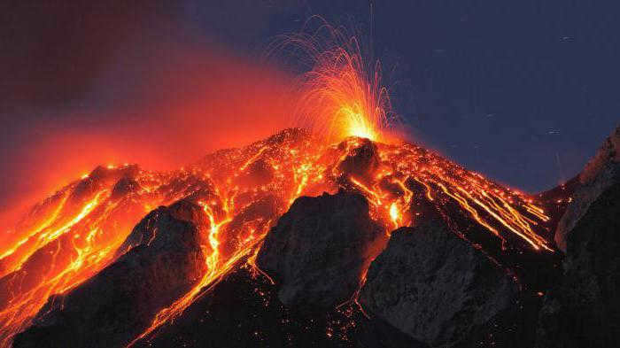
The Earth’s crust is not continuous and is composed of several tectonic plates that are densely connected to each other. These plates are constantly moving in relation to one another, shifting by 20-100 mm each year. While small movements may go unnoticed in daily life, strong collisions between plates can result in earthquakes and other natural disasters. Plate boundaries are known as “hot spots” on the planet, often experiencing volcanic eruptions and the formation of cracks and faults.
The primary configurations of the Earth’s surface
The solid outer layer of our planet is continuously influenced by internal and external forces. Movements of molten magma and tectonic plates, solar radiation, wind, and precipitation all contribute to the creation of various irregularities that characterize both the continental crust and the seafloor.
There are multiple classifications of land surface types based on their characteristics. For instance, they can be categorized as positive or negative depending on whether they are convex or concave. Furthermore, they can be differentiated by the size and extent of the area they cover:
- Planetary configurations – continents, oceanic basins, geosynclinal belts, and mid-ocean ridges.
- Mega-configurations – mountains, plains, troughs, and plateaus.
- Macro-configurations – ridges and troughs within the same mountainous region.
- Microforms – caves, sinkholes, potholes, wells, and coastal ramparts.
- Nanoforms – tiny ridges and bumps, folds and indentations on sand dunes.
Landforms are categorized based on the processes that shaped their formation:
- tectonic;
- volcanic;
- glacial;
- aeolian;
- karst;
- water erosion;
- gravitational;
- coastal (formed by the action of sea waters);
- fluvial;
- anthropogenic, etc.
Mountains
Mountains are elevated regions on the Earth’s surface that have been heavily eroded, with heights exceeding 500 meters. They are typically found in areas where the Earth’s crust is highly active, formed through the movement of tectonic plates or volcanic activity. Mountain ranges and massifs that are located in close proximity are grouped together to form mountain systems. Covering approximately 24% of the Earth’s surface, mountains are most abundant in Asia and least prevalent in Africa.
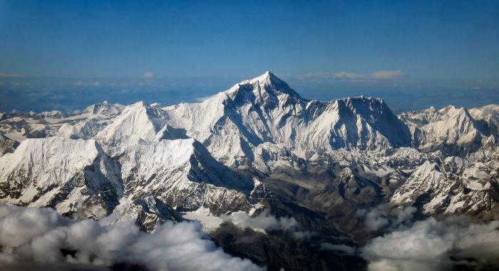
Andes-Cordilleras is the longest mountain system on Earth, spanning a distance of 18,000 kilometers. It follows the western coastlines of both South and North America. The title of the tallest mountain in the world is typically given to Mount Everest, also known as Jomolungma, which reaches a height of 8,850 meters. However, when considering relative height rather than absolute height, the record is held by the Hawaiian volcano Mauna Kea. Beginning from the ocean floor, its total height from base to summit measures 10,203 meters.
Plains
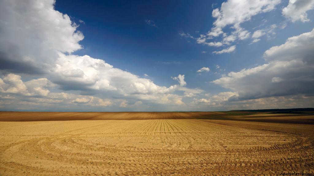
Plains are expansive regions of land characterized by a gentle slope, minimal variation in elevation, and limited relief. They make up approximately 65% of the Earth’s surface. Plains can be found at the base of mountains, in valley bottoms, on flat or slightly undulating plateaus, and on plateaus. They can be formed through processes such as erosion of rocks, volcanic activity and subsequent cooling, or by the accumulation of sedimentary deposits. The largest plain in the world is the Amazon lowland, which spans an impressive area of 5 million square kilometers and is situated in Brazil.
Mountains and plains are among the most common landforms. Now let’s explore the primary types of land surfaces.
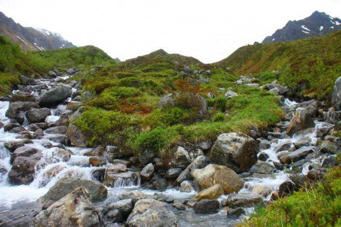
River topography
Water plays a significant geological role, reshaping the surrounding landscapes. Permanent and temporary watercourses erode rocks in one area and transport them to another. This process results in two types of relief: denudational and accumulative. Denudational relief is associated with rock erosion, which leads to the formation of gullies, furrows, ravines, canyons, scarps, and meanders. Accumulative relief, on the other hand, involves the deposition of geological material and gives rise to deltas, shoals, and alluvial fans.
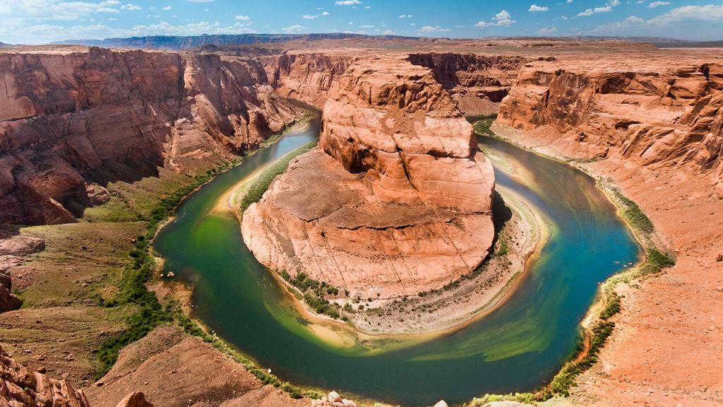
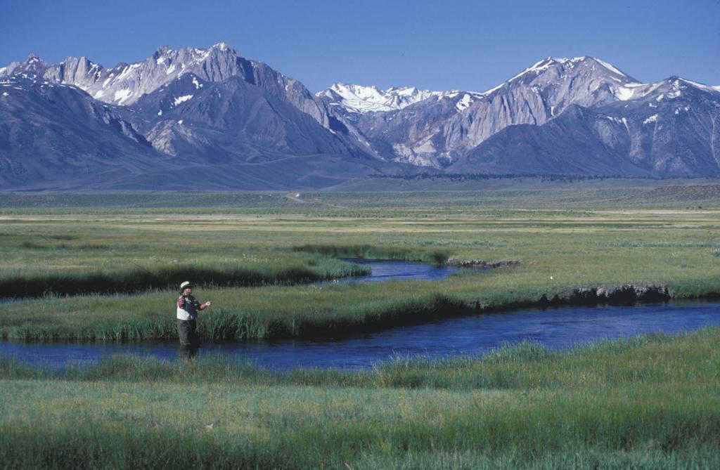
A river valley is a classic example of fluvial relief. As a newly created stream flows, it gradually carves out channels, floodplains, and terraces. The shape and appearance of a river and its valley are influenced by the strength of the stream and the characteristics of the underlying rocks. In areas with soft clay soils, for instance, meandering and wide rivers often form. On the other hand, rivers that flow through narrow valleys and eventually transform into deep gorges and canyons are common in regions with hard rocks. One of the most magnificent and vast examples of this type of landscape is the Grand Canyon in Colorado, which plunges to a depth of approximately 1600 meters.
Aeolian landforms
Aeolian landforms are formed through the action of wind, which transports fine particles such as dust, clay, or lightweight rocks. This process gives rise to various land formations, such as sand dunes, known as barkhans, which can reach heights of up to one hundred meters in desert areas. Additionally, dunes can be found along riverbanks, while other regions may feature kuchuguras, loesses, and mobile sands.
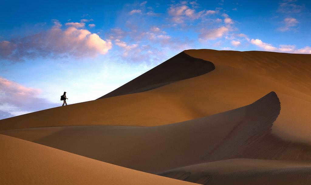
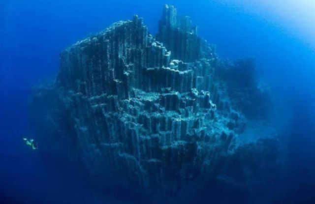
The power of air currents extends beyond just accumulation as they also have the ability to erode. By carrying tiny particles, these currents can wear down rocks, creating corrosion niches, rocks with holes, and even “stone pillars”. The Demerdzhi massif in Crimea serves as a striking illustration of this phenomenon.
Karst topography
Karst topography is created in areas where there are rocks that are susceptible to dissolution in water. Through the influence of surface or underground springs, a variety of cavities, tunnels, and passages emerge within deposits of gypsum, salt, chalk, marble, dolomite, and limestone.
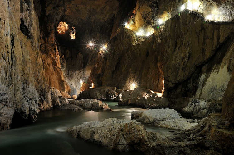
Karst landforms encompass a variety of geological features, such as caves, sinkholes, hollows, troughs, karras, mines, and chutes. They can be found all over the world, with notable concentrations in the Crimea and the Caucasus regions. This specific type of terrain is named after the Karst plateau in Slovenia, which is situated in the Dinaric Highlands.
Technogenic Landscapes
Human activities also play a significant role in shaping the Earth’s surface. When valuable resources are extracted, large quantities of minerals, soil, and mixed rocks are excavated from beneath the Earth’s crust. This mining process often results in the creation of cavities and depressions, taking the form of quarries and mines. Additionally, unused materials are frequently piled up to form embankments and dumps.
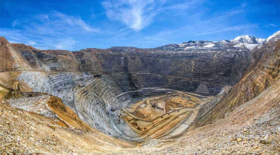
Bingham Canyon in Utah, United States, is home to one of the world’s largest quarries. This quarry specializes in the extraction of copper ore. The depths of the quarry reach an impressive 1.2 kilometers, while its width spans up to 4 kilometers. Each year, over 400 tons of rock are extracted from this site.
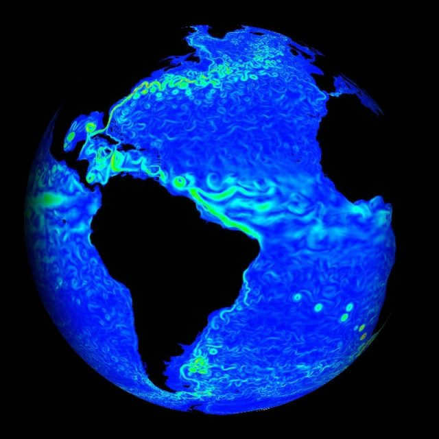
The Earth is a truly remarkable planet, unlike any other in our solar system. It provides the essential elements necessary for the existence and development of life, such as water. Water covers more than 70% of the Earth’s surface. Additionally, we have a breathable atmosphere, favorable temperatures, and other conditions that support the growth and survival of plants, animals, and humans.
The deepest spot on Earth
As we are aware, the Earth’s surface is diverse and consists of depressions, plains, and elevations. The Mariana Trench is recognized as the deepest point, sinking 10,994 meters below sea level. Situated to the east of Japan, near the Mariana Islands, this depression obtained its name from them.
The initial descent to this location occurred in 1960 by a pair of American explorers. The most recent documented dive was conducted in 2012.
The highest peak on Earth
Located in the Himalayas, Mount Everest stands as the highest peak on Earth, reaching an impressive altitude of 8,850 meters above sea level. This majestic mountain straddles the borders of Nepal and China, with its southern slope in Nepal and its northern slope in China. At its summit, powerful winds blow, with speeds reaching up to sixty meters per second.
Throughout history, numerous expeditions have aimed to conquer this formidable summit, but one ascent stands out among the rest. In 2013, Yuichiro Miura achieved an unexpected feat by reaching the summit at the age of eighty. To this day, he remains the oldest person to have conquered Everest’s peak.
Hemispheres of the Earth
The planet’s surface is commonly divided into two hemispheres: the southern hemisphere and the northern hemisphere. The southern hemisphere is primarily composed of water, accounting for approximately eighty percent of its surface, while the remaining twenty percent is comprised of dry land. On the other hand, the northern hemisphere contains less water, making up only about sixty percent, with the remaining forty percent consisting of landmasses. This hemisphere is home to large continents such as North America, parts of Africa, and Eurasia. Additionally, the northern hemisphere experiences significant temperature fluctuations, with some regions reaching as low as -90 degrees and others reaching as high as +75 degrees.
Discoveries and Enigmas
The Earth’s surface remains partially unexplored, despite the collective knowledge of scientists from various disciplines who can provide explanations for many phenomena. However, there are still enigmatic mysteries that defy comprehension. One such enigma is the notorious Bermuda Triangle, an area just off the coast of Bermuda where ships and airplanes mysteriously vanish. Travelers who navigate through this region actively avoid this perplexing location.
The Earth’s surface is in constant motion, with the positions of continents continuously shifting. As a result, certain areas may become submerged while others emerge from the depths of the ocean.
The planet’s diverse climate zones contribute to distinct seasons experienced in different regions. Closer to the poles, the climate becomes colder, whereas the central regions enjoy milder weather without drastic annual temperature fluctuations.
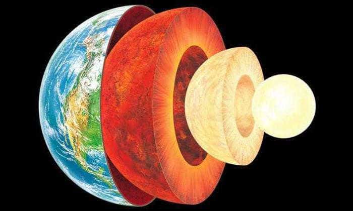
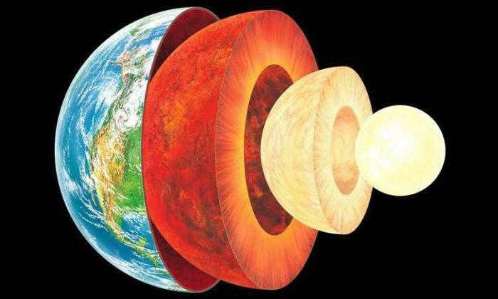
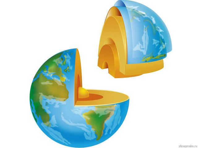
Structure of the planet
The Earth’s surface is unique and diverse, and its internal structure is also varied. There are several layers that scientists identify: the crust, mantle, and core. Each layer has its own distinct characteristics.
The Earth’s crust is the hardest part of the planet. It is divided into three layers: sedimentary, granite, and basalt. The thickness of the crust can range up to seventy kilometers, although in some areas it may be as thin as ten kilometers. This variation can be attributed to the location of measurement: the crust is thinner at the bottom of the oceans compared to land, while mountain ranges have the thickest crust.
Basalt is the first layer of the Earth’s crust, while granite comes next. Just to clarify, basalt is not found at the bottom of the oceans. The final layer is sedimentary and undergoes constant change.
Beneath the crust lies the mantle, which accounts for approximately eighty percent of the Earth’s total volume and around seventy percent of its mass. This layer measures about three thousand kilometers in thickness. The upper part, known as magma, is about 900 kilometers thick and is composed of minerals in a molten state.
The core, composed of nickel and iron, is situated at the precise central point of the Earth. With a radius of approximately 3550 kilometers, this pivotal layer is further divided into two distinct sections: the outer core, which measures approximately 2200 kilometers in thickness, and the inner core, boasting a diameter of around 1350 kilometers. It is believed that the temperature at the core’s very center reaches an astonishing ten thousand degrees Celsius, while the surface of the core maintains a slightly cooler temperature of about six thousand degrees Celsius.
The dimensions of planet Earth
When inquiring about the dimensions of Earth’s surface, one may be informed that it is spherical in shape. Another term used to describe its shape is geoid, which is essentially an ellipsoid of rotation. By understanding the shape of the surface, scientists have been able to calculate the planet’s diameter, circumference, and other relevant data.
So what are the specific measurements of Earth’s surface and what is the mass of this celestial body? At the equator, the diameter of the planet measures 12,756 kilometers. The total surface area of the planet is 510,072,000 square kilometers.
The planet’s mass is 5.97X1024 kilograms, and it increases by forty thousand tons each year. This increase is caused by the constant accumulation of space dust and meteorites that fall on the Earth’s flat surface, as well as in the oceans and uplands. However, the dispersion of gases into space results in an annual loss of about one hundred thousand tons of mass. The increase in temperature also contributes to the loss of mass. As the mass decreases, so does the gravitational force, making it more difficult to maintain an atmosphere around the surface.
Using the radioisotope method, scientists have determined that the Earth is approximately 4.5 billion years old, which is believed to be the same age as our solar system.
The planet’s surface is composed of both water and land. The oceans cover an area of 361.9 million square kilometers, while the land occupies just over 148.9 million square kilometers.
Additional details
As previously mentioned, we have identified the highest and lowest points on Earth – Mount Everest and the Mariana Trench respectively. The latter is situated at great depths beneath the ocean. However, the average depth of the world’s oceans is approximately 3800 kilometers. Conversely, the average elevation above sea level is eight hundred and seventy meters.
Our planet Earth is an extraordinary and enigmatic sphere. The more we delve into its complexities, the more unanswered questions arise. On its surface lie hidden mysteries and enigmas waiting to be unraveled by humankind. One such enigma is the precise scenario that led to the formation of our planet. Numerous theories exist, but it is highly unlikely that we will ever ascertain the true account of its origin.

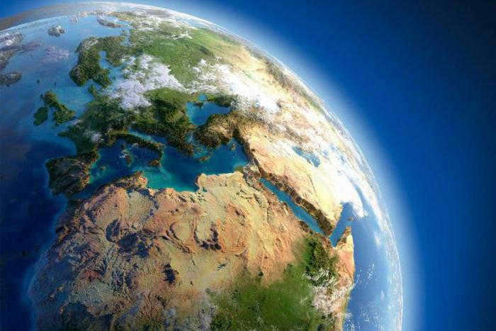
The field of geography encompasses the exploration and understanding of the Earth’s internal and external composition, with a particular focus on the characteristics and interactions of its continents and oceans. Its primary focus lies in the examination of different geospheres and geosystems.

Overview
The geographical envelope, also known as the GE, is a fundamental concept in the field of geography. It was first introduced in the early 20th century and refers to the outer layer of the Earth, which is a complex and interconnected system. The geographical envelope encompasses various components that interact with each other, allowing for the exchange of substances and energy.
There are comparable terms, with limited meanings, employed in the works of European scientists. However, they do not denote a natural system, only a collection of natural and social phenomena.
Phases of development
The geographical shell of the Earth has undergone several distinct phases in its development and formation:
- geological (pre-biogenic) – the initial phase of formation, which commenced approximately 4.5 billion years ago (lasting around 3 billion years);
- biological – the second phase, which began around 600 million years ago;
- anthropogenic (modern) – the phase that persists to the present day, starting around 40,000 years ago, when humanity began to have a noticeable impact on nature.
Composition of the Earth’s geographic shell
The Earth’s geographic shell is the spherical system of the planet that is flattened on both sides by the polar caps and has an equator length of over 40,000 kilometers. It has a specific structure composed of interconnected environments.
This information should be considered in relation to the following.


| Structural element | Definition |
| Earth’s outer layer | The solid shell on the Earth’s surface, adjacent to the mantle, and in direct contact with the hydrosphere and different parts of the atmosphere (specifically the troposphere). |
| Troposphere | The lower portion of the atmosphere (most extensively explored). |
| Stratosphere | The atmospheric layer that spans from 11 to 50 km in height. |
| Biosphere | The Earth’s shell inhabited by living organisms. |
| Hydrosphere | The Earth’s water envelope, encompassing all water resources. |
| Anthroposphere or noosphere | The sphere inhabited by humans or the realm of interaction between humans and nature. |
According to some experts, the Geographic Organization (GO) can be classified into four spheres, each of which is further divided:
The structure of the geographic envelope is far from being conventional, as it has well-defined boundaries.
Boundaries at different levels
Throughout the entire structure of the geographic shell and its environments, there is a distinct zonality.
The principle of geographical zonality not only involves dividing the entire shell into spheres and environments, but also classifying land and oceans into natural zones. Interestingly, this division naturally repeats itself in both hemispheres.
Zonality is influenced by the distribution of solar energy across latitudes and the level of moisture (which varies between the northern and southern hemispheres as well as across continents).
Naturally, there is a possibility to establish the upper limit of the geographical shell as well as the lower limit. The upper limit can be found at a height of 25 km, while the lower limit of the geographical shell is situated 6 km beneath the oceans and 30-50 km on the continents. However, it is important to note that the lower limit is subjective and there are still ongoing debates regarding its determination.
Even if we consider the upper limit to be 25 km and the lower limit to be 50 km, in comparison to the overall size of the Earth, we are left with a thin film covering the planet, providing protection.
Essential principles and characteristics of the geographic envelope
The geographic envelope operates within these boundaries, governed by fundamental principles and characteristics that define its nature.
- Intermingling of components or movement within components – this is a fundamental characteristic (there are two types of movement within components – horizontal and vertical; they do not contradict or impede each other, although the rate of movement may vary in different structural parts of the geographic envelope).
- Geographic zonality – a fundamental law.
- Rhythmicity – the repetition of all natural phenomena (daily, yearly).
- Unity of all parts of the geographic shell due to their strong interconnectedness.
Atmosphere
The atmosphere plays a crucial role in maintaining heat and supporting life on our planet. Additionally, it serves as a shield against harmful ultraviolet radiation, influences the formation of soil, and affects climate patterns.
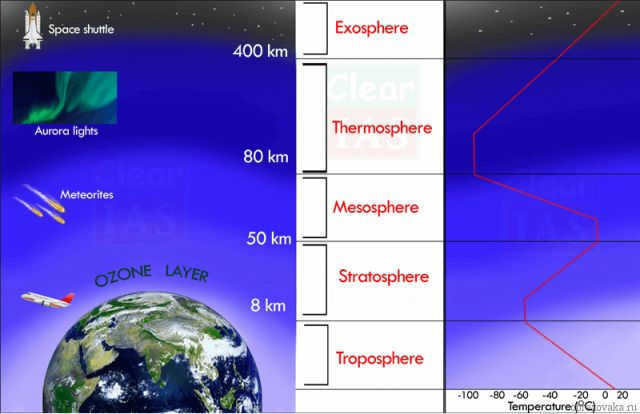
This protective shell extends from approximately 8 km to 1,000 km or more in height and consists of various components, including:
- Gases such as nitrogen, oxygen, argon, carbon dioxide, ozone, helium, hydrogen, and inert gases.
- Dust particles.
- Water vapor.
Furthermore, the atmosphere can be divided into multiple interconnected layers, each with its own unique characteristics as outlined in the table below.
| Name of the Layer | Altitude | Characteristics |
| Troposphere | 8-12 km | Responsible for precipitation, climate, movement of air masses, and has a very high water vapor content. |
| Stratosphere | 12-55 km | Responsible for protecting the earth from UV radiation and contains a significant amount of ozone (ozone layer). |
| Mesosphere | 55-88 km | Has reduced air density. |
| Ionosphere | 80-1000 km | Filled with charged gas molecules. |
| Upper atmosphere | More than 1000 km | Has a high velocity of molecules, some of which penetrate into space. |
All the shells on Earth have a similar composition. For instance, they contain various forms of matter, including solids, liquids, and gases.
Lithosphere
The solid outer shell of the Earth’s crust is known as the lithosphere. It is composed of several layers, each with its own unique characteristics in terms of thickness, density, and composition:
- The uppermost layer of the lithosphere
- The sigmatic shell
- The semi-metallic or ore shell
The lithosphere extends to a depth of 2900 km.
What is the composition of the lithosphere? It primarily consists of solid materials such as basalt, magnesium, cobalt, iron, and other metals…
The water cycle and Earth’s hydrosphere
The hydrosphere encompasses all the water on Earth, including oceans, seas, rivers, lakes, swamps, glaciers, and even groundwater. This vast body of water covers over 70% of the Earth’s surface. Intriguingly, there is a theory suggesting that the Earth’s crust holds significant reserves of water.
Within the hydrosphere, there are two main types of water: saltwater and freshwater. Through the process of evaporation and condensation, water is constantly cycling between the Earth’s surface and the atmosphere, providing a renewable source of freshwater to the land.
Biosphere
The biosphere is the earth’s most vibrant and dynamic layer. It encompasses the entirety of the hydrosphere, the lower atmosphere, the land surface, and the upper lithospheric layer. What makes it fascinating is that the biosphere is teeming with living organisms that play a crucial role in harnessing and dispersing energy from the sun, facilitating the movement of chemical substances in soil, enabling gas exchange, and catalyzing oxidation-reduction reactions. It can be argued that the atmosphere owes its existence solely to the presence of these living organisms.

Instances of Earth’s media (shells) interaction
There are numerous instances of media interaction.
- When rivers, lakes, seas, and oceans evaporate, they release water into the atmosphere.
- By infiltrating the soil and reaching the depths of the lithosphere, air and water facilitate the growth of vegetation.
- Vegetation plays a crucial role in the process of photosynthesis, which enriches the atmosphere with oxygen and absorbs carbon dioxide.
- The surface of the earth and oceans heat the upper atmosphere, creating climate belts that support life.
- As living organisms die, they contribute to the formation of soil.
What is our takeaway?
The idea of a “geographic envelope” is a topic of debate. The definition of this term is intricate. However, despite occasional criticism, this term continues to be employed. During 7th-grade geography lessons, students delve into the structure of the geographical shell, gain a brief understanding of the intricate process of environment interaction, and learn that the geographical shell serves as the focal point of study in geography and related disciplines.
In the past, individuals examined the forms of the Earth’s surface within the boundaries of their environment. As geographical explorations commenced, their understanding of the world grew. Humans took to the skies and witnessed the unevenness of the planet’s surface. There are depressions and elevated regions, as well as flat and mountainous areas. In this article, we will explore the various shapes of the Earth’s surface and their respective names.
Shapes of the earth’s surface
The arrangement of irregularities on the surface of the planet is known as relief. Relief features refer to specific objects on the planet’s surface and are compared to the level of the world’s oceans.
- The largest shapes are visible from outer space. These include the deep trenches of the oceans and the continents that rise above the water.
- The continents are home to towering mountain ranges and vast plains. In the oceans, there are also trenches, plains, and mountains. Some of these mountains emerge from the water and form islands and groups of islands.
- On the plains, there are highlands, hills, valleys, depressions filled with water (lakes). In mountainous regions, there are individual mountains, lengthy mountain ranges comprised of numerous peaks, and gorges situated between the ridges.
There exist landforms that have emerged due to human activities. These encompass quarries, dams, road embankments, canals, and reservoirs.
Classification of Earth’s Surface
The classification of Earth’s surface, also known as relief, identifies the various types of terrain found on our planet. Here, we will provide a brief overview of the main types of relief: flat, hilly, and mountainous.
The flat terrain can be found both below and above sea level. If it’s above sea level, it is referred to as lowlands (0-200 m), uplands (200-500 m), or plateaus (above 500 m). On the other hand, plains below sea level include the Caspian lowlands and oceanic plains.
The surface of the Earth can vary in different ways, with hilly terrain often featuring hollows, ravines, hills, and stepped forms.
In mountainous areas, the relief is characterized by a combination of mountain ranges, individual mountains, river valleys, and gorges. The slopes of mountains are typically steep, while river valleys often have rocky banks.
The different types of relief are of great importance to various industries such as the military and builders. They are also taken into account in road construction and landscape design projects.
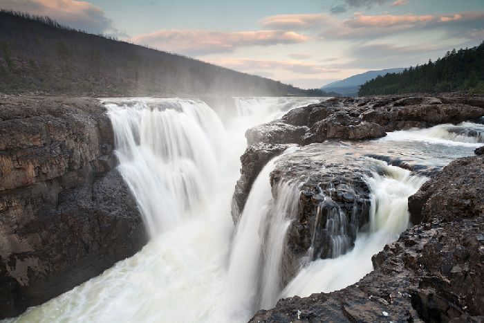
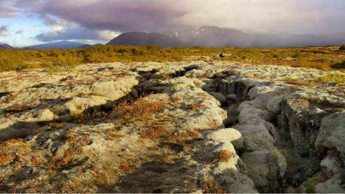
Putorana Plateau
The Putorana Plateau is located in the northwestern part of the Central Siberian Plateau. With a peak height of 1701 meters, it offers stunning views of its surrounding landscape. Its northern and western slopes are characterized by steep escarpments, while the eastern and southern parts display more gentle relief.
This plateau is not only a remarkable natural wonder but also a designated nature reserve and a UNESCO World Heritage Site.
Formed approximately 250 million years ago, the Putorana Plateau is composed of fossilized basalt lava that once flowed to the surface. Over time, the landmass rose, causing the lava layers to crack. These cracks were then filled with water, giving rise to rivers and lakes. The result is a stepped plateau dotted with numerous breathtaking waterfalls, the highest of which measures 482 meters. In fact, there are approximately 22 thousand lakes scattered across the plateau.