The subject of space has always captivated human curiosity. The possibility of space travel and the exploration of distant, uncharted worlds has always intrigued us. As we know, the Moon is the closest celestial body to our planet. Thus, during the early days of space exploration, the dream was to reach the Moon. Surely, in your childhood, you too may have aspired to become an astronaut, with only one question in your mind: “How far is it to space?”.
Today, the fascination with outer space has only grown stronger – news of NASA’s accomplishments is everywhere. And Elon Musk’s insights on science are seen by many as glimpses into the future.
On the 12th of April, Soviet cosmonaut Yuri Gagarin made the first-ever orbital flight. It was an unforgettable moment when he exclaimed, “Let’s go!” and had the opportunity to come so close to the wonders of the cosmos.
In today’s world, even the oldest spacecraft can transport you to space with remarkable speed. However, the question on everyone’s mind is, how long will it take?
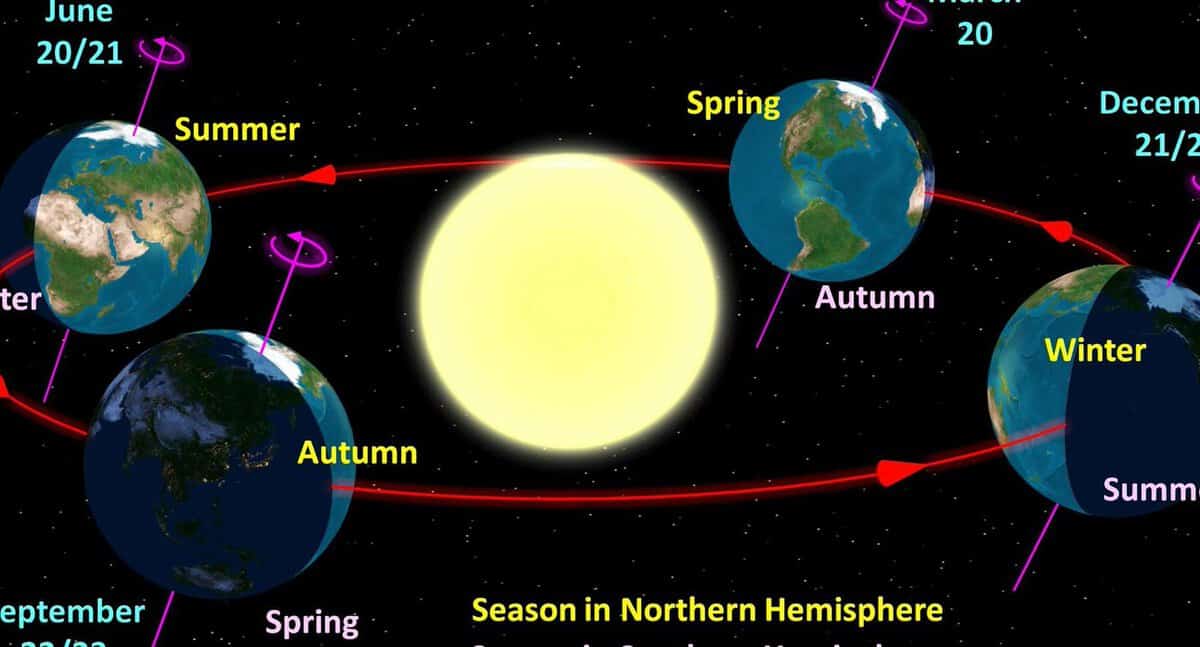
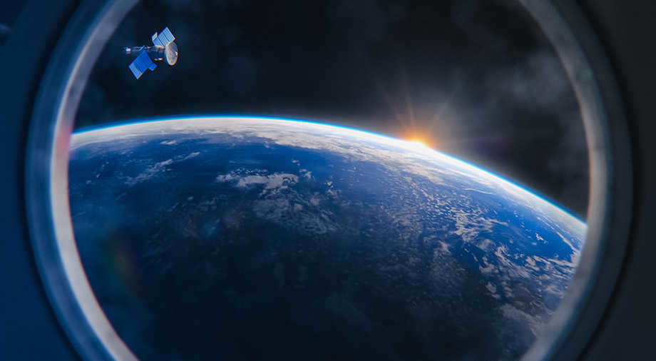
Firstly, we must comprehend the concept of “space”. If we are referring to the point where the Earth’s atmosphere ends, it is approximately 100 kilometers above us. This boundary is known as the Karman Line, marking the transition from the Thermosphere to the Exosphere. Just to give you an idea, the International Space Station orbits the Earth at a distance of 435 kilometers.
Where does space begin?
The boundary between the atmosphere and space is not easily defined. It is commonly referred to as the mesosphere, which is located approximately 500 to 1000 km above our planet.
How long does it take to reach space?
The minimum time it takes to reach space is around 5 minutes. It is not possible to go faster due to the limitation of acceleration, which should not exceed 9.8 m/sec.sq. Additionally, the instruments may not be able to withstand high levels of pressure. On average, a rocket takes about 8 to 12 minutes to reach space.
Journey duration to a space station
It is feasible to travel to the International Space Station (ISS) within 6 hours. In the past, it took 2 days to reach the destination, but soon it will be reduced to 1.5 hours.
How much time does it take to travel to the Moon?
The distance between Earth and the Moon is approximately 380-400 thousand kilometers. On average, it takes 3-5 days to journey to the Moon. The actual duration depends on the specific spacecraft and its speed capabilities. For instance, a satellite traveling at a speed of 58 thousand km/h completed the trip to the Moon in 8 hours and 35 minutes. Currently, there are ongoing developments in powerful engines and spacecraft modifications, which will ultimately reduce the travel time.
What is the initial velocity required to reach space?
We are referring to the minimum velocity needed for an object to maintain a circular orbit around the Earth – 7.9 kilometers per second. This speed is not sufficient to overcome the gravitational pull of our planet, hence the existence of a second cosmic velocity.
Now you have the knowledge – when determining the distance required to travel to space, it is crucial to take into account various factors, such as the efficiency of the propellant utilized and the destination.
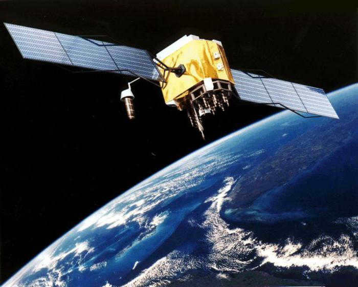
In 1957, the first man-made satellite was successfully launched into space. Since then, there have been significant advancements in technology. Currently, there are numerous satellites orbiting Earth, providing essential services such as cellular communication, Internet access, GPS navigation, television broadcasting, and contributing to scientific research. These satellites also have military applications. Depending on their intended purpose, satellites are positioned at varying altitudes in space. These advancements have greatly improved the quality of life and communication for people around the world. Furthermore, satellites have played a crucial role in studying Earth’s atmosphere, monitoring weather patterns, exploring outer space, and studying celestial bodies, making significant contributions to the field of science.
What types of satellites orbit the Earth?
- Research satellites: These satellites are used to study the composition of the atmosphere and outer space. They may even have telescopes on board to observe distant planets.
- Applied satellites: These satellites are designed to meet the needs of the general population, such as testing equipment and communication systems.
Satellites operate autonomously and do not require fuel. They are monitored and maneuvered from command centers on Earth. Depending on their specific purpose, satellites are equipped with the necessary instruments and communication systems.
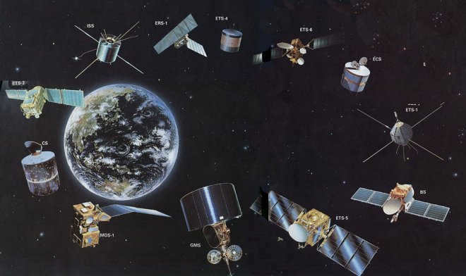
The size of a satellite is determined by its intended use and functionality. Satellites come in a range of sizes, from small ones weighing around 20 kg to larger ones weighing several hundred tons. The very first satellite launched by the USSR had a weight of just 28 kilograms and was equipped with a radio transmission system.
What is the altitude at which satellites fly?
Satellites are launched into orbit using a multi-stage rocket. The basic principle is straightforward – the device is propelled out of the atmosphere with enough force to establish its flight path. It then orbits the planet due to the gravitational force. The equipment includes maneuvering engines for adjusting the trajectory, which help avoid collisions with space debris and other satellites.
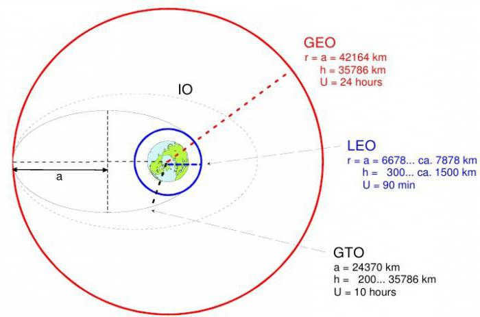
- Near-Earth or low orbit: This is the closest orbit, with an altitude of 300-500 km above sea level. It was initially used for the operation of the first spacecraft and is now used for remote sensing of the Earth’s surface and atmosphere.
- The polar orbit is situated in the plane of the polar poles of the Earth, with an inclination angle close to 90 degrees. Due to the planet’s flattening, it allows for different rotation rates, enabling satellites to pass over the same latitude at the same time;
- The geostationary orbit is located at an altitude of 35,000 km and is positioned in the equator’s plane. There are only two stable points in this orbit, requiring artificial trajectory adjustments for the rest of the way;
- The strongly elliptical orbit follows an elliptical path, with the altitude varying depending on the point of the trajectory. Its large size allows for the simultaneous maintenance of the required number of satellites over a single country. This orbit is primarily used for telecommunications purposes and also serves as a platform for telescopes studying distant objects.
- Circular. The shape of the orbit is round. The altitude level remains relatively constant at all times.
The altitude of satellites positioned above the Earth is determined by their intended function and selected orbit. The geostationary orbit is highly significant and costly. Consequently, satellites that have reached the end of their lifespan are relocated from this orbit. It is primarily utilized for scientific objectives.
Circular orbits with a consistent altitude are employed for global positioning systems. This particular trajectory is deemed optimal for transmitting signals. The altitude of GPS satellites orbits is 20,000 kilometers. Each satellite completes two rotations around the Earth within a 24-hour period. The velocity allows for the utilization of four satellites within a single plane to maintain continuous data transmission.
What is the altitude at which spacecraft fly?
The altitude at which spacecraft fly varies depending on whether they are manned or unmanned. Manned spacecraft, which require life support for the crew, tend to fly at lower altitudes compared to unmanned vehicles. These manned stations are used for various purposes including scientific research, studying the effects of weightlessness, exploring outer space, and observing celestial bodies.
The first manned spacecraft was launched in 1961 and followed an elliptical orbit. It had a perigee of 175 kilometers and an apogee of 320 kilometers above sea level. However, over the past fifty years, the altitude of manned spacecraft has increased significantly due to the presence of a large amount of space debris in Earth’s orbit. Currently, spacecraft typically orbit at an altitude of around 400 kilometers, which helps minimize the influence of the Earth’s atmosphere on their trajectory.
Did you enjoy the article? Have any thoughts to share? Come join us:
There are over 3,000 satellites currently in orbit around the Earth, serving a crucial role in benefiting humanity. These satellites provide essential services such as advanced communication systems, navigation aids, and the collection of accurate data on various planetary issues. From monitoring pollution levels to predicting natural disasters, these satellites play a vital role in achieving the United Nations’ sustainable development goals.
The team at MaxPolyakov.Space aims to shed light on the significance of Earth’s orbit and how its exploration has positively impacted mankind.
During the nighttime, it is possible to observe a relatively limited portion of the cosmos without the aid of a telescope. The most distant entity that can be perceived by the human eye is a dim speck known as the Andromeda Nebula, which is a galaxy situated approximately 2.5 million light-years away from our planet.
Considerably closer, merely a few hundred kilometers above the Earth’s surface, is the near-Earth orbit.
Thanks to its exploration, various advancements have become accessible, including satellite television, wireless Internet, precise weather forecasts, and GPS – a satellite navigation system that can accurately determine an individual’s location with a smartphone nearly anywhere on Earth, with a precision of 6-8 meters.
Exploration of near-Earth space is a field that is currently being actively pursued by the scientific and technological communities. However, it is unfortunate that many individuals do not fully appreciate the significance of this domain. In the United States, for instance, only a mere 5% of the population can claim to possess a comprehensive understanding of space exploration. Similarly, within the European Union, just over a third of respondents possess the ability to articulate the purpose and function of an aerospace agency.
A large number of individuals remain oblivious to the extent to which they rely on space technology for even the most mundane of tasks.
For instance, the average person spends over two hours per day utilizing their smartphone, which includes the use of a navigation system that is reliant on satellite support. Merely a decade ago, it was all too easy to become lost in an unfamiliar city without the aid of such a device integrated into smartphones.
All of these possibilities are provided by artificial satellites, of which there are over three thousand, with the largest constellation of satellites belonging to the United States – 1.8 thousand devices.
What is the Earth’s Orbit?
An orbit is the path of rotation of one celestial body around another body that has significantly more mass. For instance, the Earth orbits around the Sun, and the Moon orbits around the Earth.
The orbit around the Earth is referred to as a low-Earth orbit. It is an imaginary sphere around the planet that extends from the surface to an altitude of 2,000 kilometers above sea level. It is most commonly used to describe the orbit of a spacecraft around the Earth, with altitudes ranging from 160 km (with an orbital period of about 88 minutes) to 2,000 km (approximately 127 minutes).
When comparing, it can be noted that the maximum altitude that a civilian aircraft can reach is below 20 km. For instance, a typical flight of a Boeing 737 passenger plane from Kiev to Berlin has an average altitude of 7 km. To reach orbit, this plane would need to ascend more than 20 times its usual altitude. It is worth mentioning that artificial satellites and the International Space Station are positioned in low-Earth orbit, and most manned space missions (excluding those aimed at reaching the Moon) have taken place in this region.
The concept of orbit as we know it today originated from the observations and theories of Nicolaus Copernicus, a Polish astronomer, in the 16th century. Copernicus recognized that the Earth, along with other planets like Venus and Saturn, orbits the Sun. This groundbreaking understanding of the solar system led to further scientific advancements in the following century, as researchers calculated the rotation periods of planets and discovered satellites orbiting some of them. These findings ultimately led to the abandonment of the ancient belief that Earth was the center of the universe.
Scientists explained that celestial bodies are held together in a stable system, with a star at the center and planets revolving around it. It was not until the late 17th century that Sir Isaac Newton, an Englishman, coined the term “gravity” to describe the force that moves matter. Newton’s discovery revolutionized our understanding of how objects move and interact in space.
If the scientists of that era were solely interested in studying nature, then in the 19th century, researchers were eager to explore beyond the confines of their familiar world. During this time, the renowned science fiction author Jules Verne became the first to scientifically depict a journey from Earth to the Moon. Simultaneously, scientists were proposing theories on rocket propulsion to venture into space, and following World War II, the United States, the Soviet Union, and other nations embarked on active development of this technology, primarily for military applications.
Take, for instance, the initial man-made satellite of Earth, known as the Soviet Sputnik 1, which was successfully placed into orbit by means of an intercontinental ballistic missile back in 1957. This particular apparatus held significant scientific value, as it allowed for the exploration of the upper atmosphere, a feat that was previously unattainable. Subsequent satellites also contributed to scientific advancements – for example, the American Explorer-1, launched in 1958, played a pivotal role in the discovery of the radiation belt.
Organization of the orbit
The Earth’s orbit is a complex phenomenon, and it is categorized by altitude in the field of astronomy.
One of the key orbits is the geostationary orbit, which is situated at a distance of 35,000 kilometers. Satellites in this orbit move in sync with the Earth, remaining fixed at the same longitude.
This particular orbit plays a critical role in weather monitoring as it allows satellites to constantly observe the same area of the planet from a high altitude.
How does it function? When a user visits a website to check the weather forecast, they can view satellite images of their location. These images are transmitted from the geostationary orbit where specialized satellites are positioned. These satellites update and transmit data about clouds, water vapor, and wind every few minutes, enabling accurate local weather forecasts.
There are various other types of orbits present. For instance, the “Lightning Bolt” orbit, which exhibits an elongated elliptical shape with one end being closer to Earth than the other. The complete collection of orbits is comprehensively listed in the NASA catalog.
The orbit closest to the Earth’s surface is the low-Earth orbit, positioned at an altitude ranging from 160 to 2 thousand kilometers. Numerous space stations and the majority of satellites, approximately 2000, are situated in this orbit.
Within this orbit, human survival is impossible without the utilization of a life support system similar to the one utilized by astronauts during spacewalks.
The region of low-Earth orbit is not devoid of matter – it contains atmospheric gases that have a minor, yet noticeable impact on objects in orbit, similar to how air affects the trajectory of a bullet fired from a rifle, albeit much weaker. The average temperature in this region is around 10 degrees Celsius. It is important to note that low Earth orbit is relatively close to the Earth’s surface, hence the similarities in conditions should not come as a surprise.
Satellites, which serve various purposes for the benefit of humanity, can be found in this orbital region. Some of these satellites have been operational for a duration of 15 years.
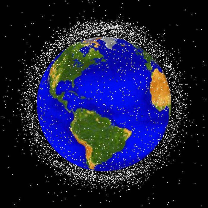
On the other hand, there are non-operational objects known as space debris. These objects are actively cleared by space agencies worldwide due to the potential hazards they pose to functioning satellites. They have the capability to cause damage that requires repair or disrupt the accuracy of satellite data.
What are the advantages of orbit for humanity?
With a multitude of artificial objects currently circling the Earth, space exploration and human economic progress are closely intertwined. As per NASA, space exploration not only brings about technological and cultural benefits, but also consistently offers fresh perspectives on resolving longstanding terrestrial issues. Enhanced solar panels that convert the sun’s energy into electricity, numerous medical technologies, ultra-lightweight metal alloys, water purification systems, advanced electronics, and much more. Modern life, which humanity has attained through its foray into space, would be inconceivable without all of these advancements.

Let’s outline the key accomplishments of entering orbit:
- Satellite TV. Satellites transmit signals directly to households where they are received by antennas. Additionally, space devices enable high-quality live broadcasts with both visual and auditory excellence.
- Telephone communications. Phones on airplanes, satellite phones in remote regions without cell phone towers, or in areas affected by natural disasters.
- Internet. SpaceX has initiated the launch of satellites for the Starlink global wireless internet project. By year-end, the company plans to deploy a total of 1.5 thousand units.
- Navigation. The Navstar Global Positioning Systems (GPS) satellite navigation system, which is commonly known as GPS, is able to determine location with an accuracy of 6-8 meters. This technology is extremely useful for navigating in unfamiliar cities and countries, as well as for locating individuals in remote areas. For instance, if someone gets lost in the forest, they can send their location data with an accuracy of 10 meters to a friend who is searching for them via messaging apps like Telegram.
- Meteorology. Satellites play a crucial role in assessing global weather conditions and making forecasts. They also enable rapid tracking of dangerous natural disasters such as volcanic eruptions and forest fires. For example, the satellites operated by the U.S. National Oceanic and Atmospheric Administration (NOAA) have been involved in 48,000 rescue operations since 1982.
- Land utilization. Satellites have the capability to detect subterranean reservoirs of water and minerals, monitor the movement of nutrients and harmful substances from the ground to bodies of water, observe the growth of algae in the oceans, and track land erosion. Additionally, satellites can provide surveillance for large-scale infrastructure projects such as gas and oil pipelines. For instance, Max Polyakov’s company EOSDA is actively involved in the advancement of these technologies.
- Scientific exploration. The deployment of astronomical equipment into orbit has revolutionized our ability to investigate the depths of space without the limitations imposed by the Earth’s atmosphere. The Hubble Space Telescope, for example, is capable of capturing far more detailed imagery than ground-based instruments, which are hindered by atmospheric interference.
The utilization of the Earth’s orbit presents fresh prospects for business as well – for instance, NASA is of the opinion that commercial initiatives can ultimately establish an autonomous, sustainable, and swiftly expanding orbital economy, wherein private enterprises assume a leading role.
Privately financed expeditions would enable the conduct of commercial research, such as pharmaceutical experiments, in orbit and even entice tourists. Furthermore, a significant portion is allocated to contracts for delivering cargo to the International Space Station. By way of comparison, the global “space market” had a capitalization of $176 billion in 2006, but by 2018, it had surged to $345 billion. In 2017 alone, commercial space companies garnered $3.9 billion in investments from individuals.
According to NSR’s prediction, over the next decade, there will be a total of more than 12,000 satellites launched into orbit. The revenue generated from just one of these launches is estimated to exceed $130 billion. Morgan Stanley, the world’s largest financial company, projects that by 2040, the entire orbital economy will be valued at one trillion dollars. Additionally, it is expected that at least half of the satellites in orbit will be dedicated to providing high-speed Internet, which will cost less than 1% of the current rates.
At present, the expense of launching a solitary satellite into space has surged by nearly four times. It is not difficult to envision the numerous prospects for economic and scientific advancements that the near-Earth orbit will present in the coming years. Corporations will vie for the privilege to launch rockets into outer space. Humanity possesses all the necessary resources to capitalize on this potential. The crucial aspect is to persist on the established course and attain fresh objectives aimed at enhancing the quality of life on our planet.
While inspecting the segment of the International Space Station (ISS), astronauts have discovered new cracks that are not related to the space environment. These cracks have been found in the first and oldest module of the station, known as “Zarya”. The general designer of the Rocket and Space Corporation “Energia”, flight director of the Russian segment of the ISS, and a cosmonaut who is twice a Hero of the USSR, Vladimir Soloviev, revealed this information in an interview with RIA “Novosti”.
According to Soloviev, there is a possibility that these cracks may expand in the future. This year marks the 23rd anniversary of the ISS, which is considered the most costly and ambitious project in manned space exploration. Since its launch in 1998, the ISS has been circling the Earth, serving as a platform for scientific research conducted by numerous countries. The station holds great significance for scientists, but how much do we really know about it?
What is the altitude of the station?
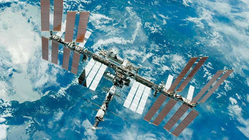
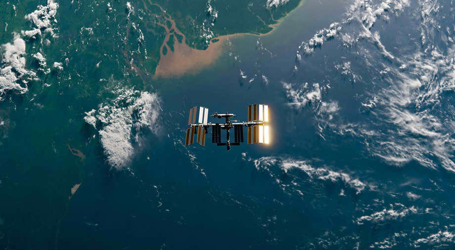
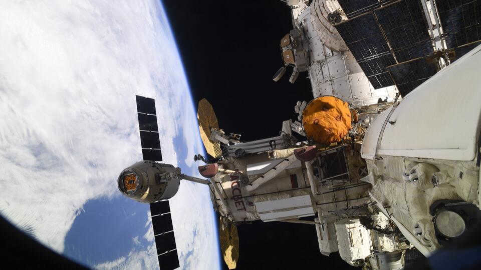
The International Space Station (ISS) is a multinational crewed facility that orbits the Earth and serves as an open space research laboratory. Its first modules were docked in 1998, marking the beginning of this collaborative project involving Russia, the United States, several European Union countries, Japan, and Canada.
The ISS orbits at an altitude ranging from 330 to 430 kilometers above the Earth’s surface. Initially, the average distance from the Earth to the ISS was 418 km, but on January 21, 2021, it increased by 1.25 km. Subsequently, on March 12, 2021, the altitude was further raised by another 450 meters. Currently, the average orbital altitude of the ISS is 419.7 kilometers above the Earth’s surface.
The station’s own engines or the power units of docked cargo ships cause the orbital altitude to fluctuate. The velocity of the ISS is consistently decreasing, resulting in a decrease in its orbit, necessitating regular corrections. These adjustments are necessary due to the gravitational pull of the Earth and the friction caused by the atmosphere.
Characteristics of the station
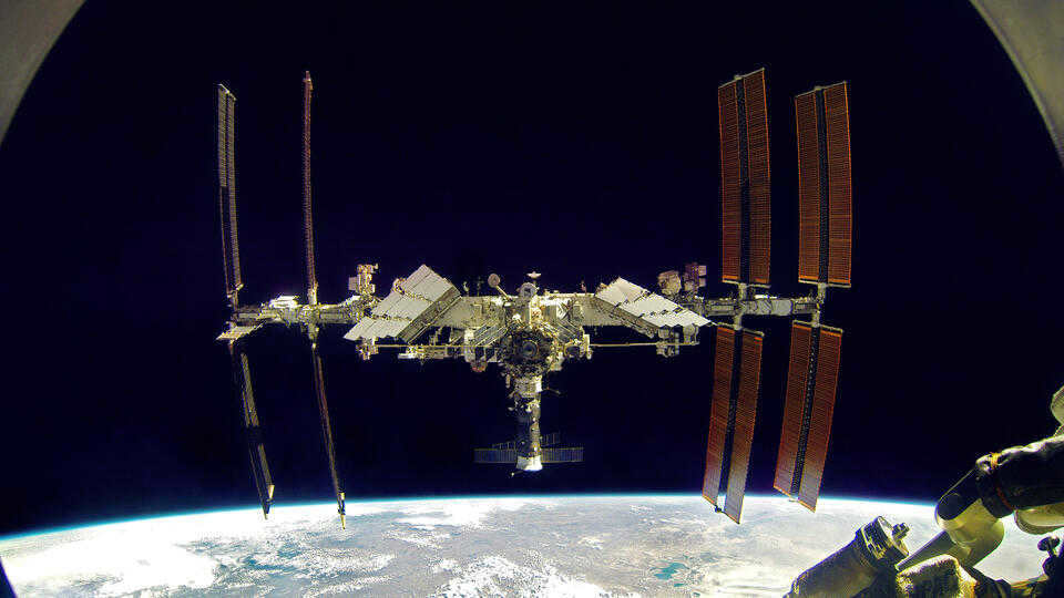
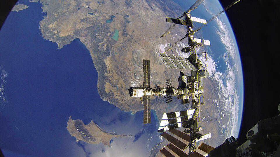
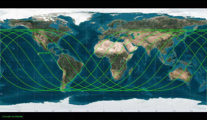
The ISS travels at a speed of 7.6 km/s (27,500 km/h) while orbiting around the Earth. It takes the ISS 1 hour 32 minutes and 53 seconds to complete one full revolution. Over the course of 24 hours, the station completes 15.5 revolutions around the planet. With the dimensions of a 30-story building, the ISS measures 109 meters in length, 51 meters in width (73 meters including truss structures), and stands at a height of nearly 30 meters. The total weight of all modules combined is approximately 420 tons.
Structure of the station
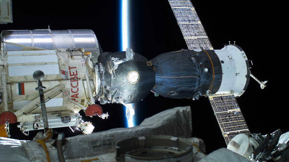
The International Space Station (ISS) is constructed using a modular design. Prefabricated blocks are assembled on Earth and then transported to orbit, where they are connected to the station. The ISS is comprised of fifteen primary modules, including five Russian modules (named “Zarya”, “Dawn”, “Zvezda”, “Poisk”, and “Pirs”), seven American modules (named “Unity”, “Destiny”, “Tranquility”, “Quest”, “Domes”, “Harmony”, and “Leonardo”), one European module called “Columbus”, and one Japanese module called “Kibo”. Additionally, there is an experimental living module called BEAM, which was developed by the private company Bigelow Aerospace. The ISS also includes several secondary modules.
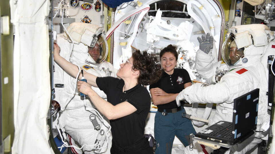
What activities do astronauts engage in while on the International Space Station (ISS)?
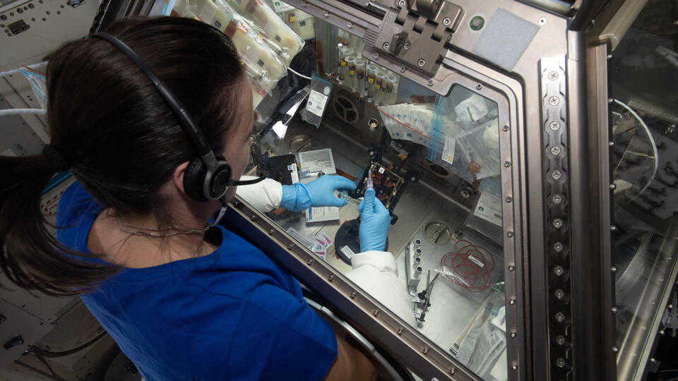
The International Space Station (ISS) is home to a permanent human presence in space. Additionally, the station was designed to facilitate scientific experiments in the unique conditions of zero gravity and the absence of Earth’s atmosphere.
The ISS serves as a platform for a wide range of experiments in biology, physics, astronomy, cosmology, and meteorology. These experiments utilize specialized equipment housed in the station’s scientific modules. For instance, scientists have spent years attempting to cultivate various plants in space, although no successful attempts have been made thus far.
Furthermore, there are experiments that take place in the vacuum of outer space, utilizing equipment attached to the exterior of the ISS.
Who was the mastermind behind the creation of the ISS?
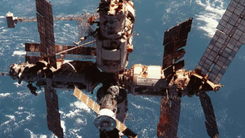
The International Space Station (ISS) was originally developed as a response to the Soviet station “Mir”, with Western countries and Japan leading the project’s initial development. In 1984, during the height of the Cold War, US President Ronald Reagan announced the project, which was codenamed Freedom.
However, the project proved to be too costly, even for wealthy countries, and the political landscape of the world changed in the early 1990s. Russia had plans to build the Mir-2 station, but faced financial difficulties. This led the countries to collaborate and on June 17, 1992, the Russian Space Agency and NASA signed an agreement to jointly explore space.
The team of the initial enduring mission
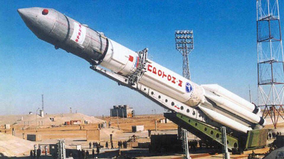
The International Space Station’s first module was launched in 1998. The Russian cargo block Zarya was put into orbit using a Proton-K rocket. Two weeks later, the American Unity module was docked to it, which still handles the docking of all spacecraft to the ISS. On December 10, 1998, cosmonaut Sergei Krikalev (Russia) and astronaut Robert Caban (USA) stepped on board the station.
In 2000, the assembly of the station continued. The Russian segment of the ISS was expanded with the addition of the Zvezda service module, which initially handled the station’s life support. The first permanent expedition crew, consisting of cosmonauts Sergey Krikalev, Yuri Gidzenko (Russia), and astronaut William Shepard (USA), was then delivered to the ISS.
Assembling the Modules of the International Space Station
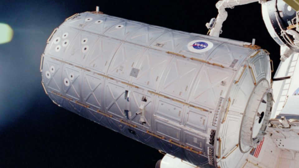
Back in 2001, the International Space Station (ISS) saw some major additions with the attachment of the Destiny science laboratory from the USA, the Canadarm2 robotic manipulator from Canada, and the Quest and Pirs airlocks from the USA and Russia, respectively. However, the assembly of the station came to a halt in 2003 following the tragic accident involving the US reusable shuttle Columbia. It wasn’t until 2005 that a new module called the external storage platform ESP-2 was finally sent into orbit. The year 2011 marked the completion of the main configuration of the station’s assembly, and further development was momentarily put on hold.
Fast forward to 2016, and the delivery of new modules was once again resumed. This multi-year hiatus was primarily due to the retirement of the reusable Space Shuttle space shuttles, which had previously been instrumental in transporting ISS modules. However, Russian spacecraft, despite their technical capabilities, faced limitations in delivering modules to the ISS. Consequently, only two Russian units managed to make their way to the station, courtesy of the Proton spacecraft.
The progress of the station’s expansion is ongoing. There are plans to launch four Russian modules ("Nauka", ERA, "Prichal", and NEM-1) into orbit, which could potentially serve as the foundation for a future Russian space station once the ISS is retired.
Russia’s Departure from the ISS Initiative
During the meeting of the President of the Russian Federation on April 12, 2021, it was determined that Russia will discontinue its participation in the ISS project after 2024. This choice stems from the technical state of the station’s modules and the excessive costs associated with maintaining outdated components.
Russia has formulated plans to develop its own national orbital space station. The station will consist of five modules: a central module, a production module, a materials storage facility, a platform for spacecraft assembly, launch, reception, and maintenance, as well as a commercial module designed to accommodate up to four tourists.
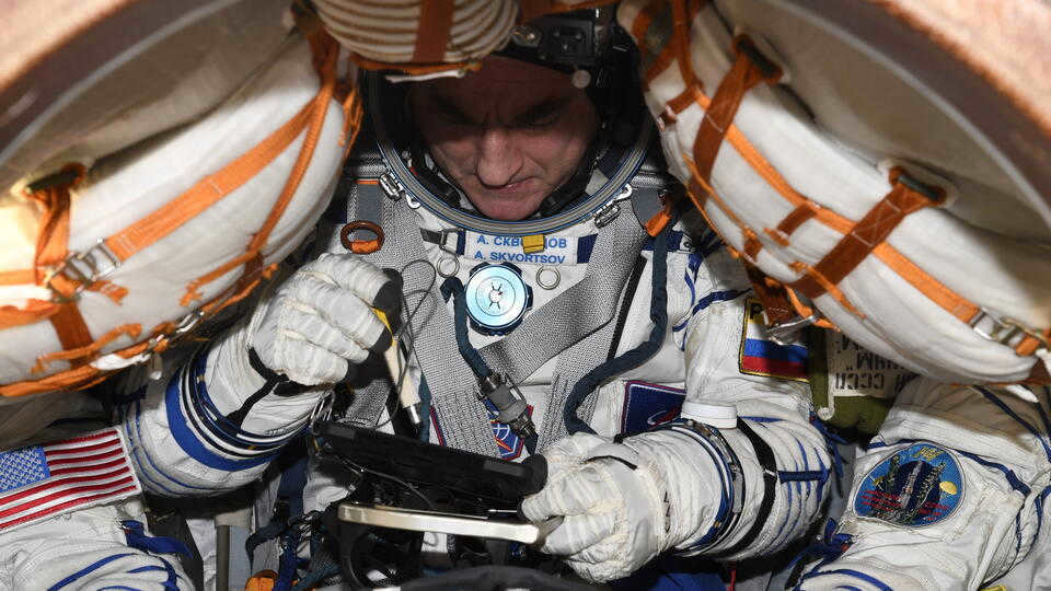
What is the duration of the journey to the International Space Station?
When it comes to docking with the International Space Station (ISS), a typical cargo ship usually takes up to two days from launch to reach the ISS and dock. In order to transport the crew to the station, a six-hour flight scheme is commonly utilized.
In the year 2019, the Progress MS-09 cargo ship successfully docked with the ISS just 3 hours and 40 minutes after takeoff, setting a new record that was two hours shorter than the previous one. Then, on July 23, 2020, another new record was achieved when the Soyuz-2.1a spacecraft made the trip to the ISS in an impressive 3 hours, 18 minutes, and 31 seconds. Roscosmos, the Russian space agency, has announced plans to further reduce the flight time to the ISS to just 1.5 hours.
Who is the owner of the International Space Station?
The station holds international status, however, the involvement of project participants varies significantly. The majority of orbital units are manufactured and owned by the US. The Russian segment consists of five main modules. The Kibo module is operated and owned by Japan, while the Columbus science laboratory is owned by the European Union, represented by the European Space Agency.
Canada, on the other hand, is the manufacturer of several components and the owner of the Orbital boom with cameras. It played an active role in the creation of the ISS. Additionally, the UK and Brazil joined the project during its early stages.
However, do you know who is the rightful owner of the International Space Station (ISS)? The legal status of the ISS is determined by international agreements, where each country’s jurisdiction is limited to its own designated segment. The station itself is divided into two primary blocks: the Russian segment, which is exclusively owned by the Russian Federation, and the American segment, which belongs to the United States. The American segment also allows astronauts from other participating countries to join.
For other project participants to work in the Russian segment, they must have bilateral agreements with Russia. Russian cosmonauts are only allowed to stay in the Russian segment, while the American segment (including the Zarya module) is accessible to the rest of the crew based on predetermined percentages of their total time spent there.
Observing the International Space Station with the unaided eye
The International Space Station (ISS) is a remarkable human creation that can be observed from Earth without the need for any optical aids. In fact, it is the third brightest permanent object in the sky, surpassed only by the Sun and the Moon. Due to its incredible speed, it can be challenging to track with optical equipment, making binoculars or a telescope unnecessary for viewing.
The ISS is particularly visible over major cities like Moscow, provided the sky is clear. It is best observed at night, as daylight can make it difficult to see.
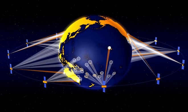
Similar to the seats in a theater that offer diverse viewpoints of a performance, the various orbits of the satellites offer distinct perspectives, each serving a unique purpose. Some satellites seem to float above a specific point on the Earth’s surface, providing a continuous view of one side, while others orbit our planet, traversing numerous locations within a single day.
Categories of orbital paths
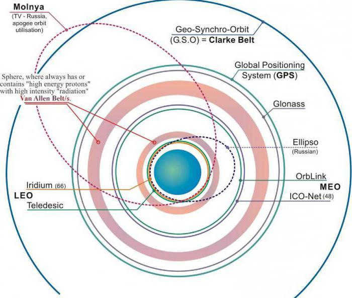
What is the altitude at which satellites traverse? Near-Earth orbits can be classified into three categories: high, medium, and low. The high orbit, situated farthest from the Earth’s surface, is primarily occupied by weather satellites and a few communication satellites. Medium Earth orbit accommodates navigation satellites and specialized satellites engineered for monitoring specific regions. Low Earth orbit is home to a multitude of scientific spacecraft, such as NASA’s Earth Observing System fleet.
The speed at which satellites move depends on their altitude. When satellites are closer to Earth, they experience a stronger gravitational pull, which causes them to accelerate. For instance, NASA’s Aqua satellite takes approximately 99 minutes to orbit the Earth at an altitude of around 705 kilometers. In contrast, a weather satellite located 35,786 kilometers above the surface completes one orbit in 23 hours, 56 minutes, and 4 seconds. The Moon, which is situated 384,403 kilometers from the center of the Earth, completes a full revolution in 28 days.
A paradox of aerodynamics
When the altitude of a satellite is changed, its orbital velocity also changes. This presents a paradoxical situation. If the operator of a satellite wants to increase its speed, they cannot simply accelerate it by firing the engines. Doing so would raise the orbit (and altitude), resulting in a decrease in speed. Instead, the engines must be fired in the opposite direction of the satellite’s travel, a maneuver that would slow down a moving vehicle on Earth. This action would cause the satellite to move lower, allowing the velocity to increase.
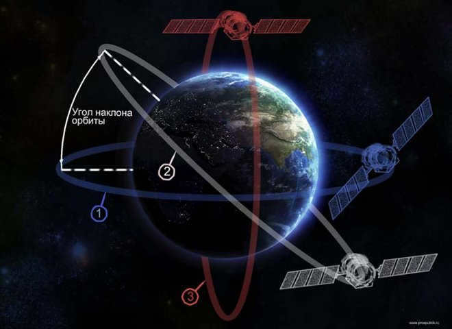
Aside from altitude, a satellite’s path of movement is characterized by eccentricity and inclination. Eccentricity pertains to the shape of the orbit. A satellite with a low eccentricity follows a path that closely resembles a circle. An elliptical orbit, on the other hand, exhibits an eccentric shape. The spacecraft’s distance from Earth is contingent upon its attitude.
Inclination denotes the angle of the orbit in relation to the equator. A satellite that revolves directly above the equator possesses zero inclination. If the spacecraft passes over the geographical north and south poles (not the magnetic poles), its inclination measures 90 degrees.
Collectively, altitude, eccentricity, and inclination determine the satellite’s motion and how the Earth appears from its vantage point.
High Near-Earth
Once the satellite reaches a distance of exactly 42164 km from the Earth’s center (approximately 36,000 km from the surface), it enters a region where its orbit aligns with the Earth’s rotation. Since the satellite moves at the same speed as the Earth, with an orbital period of 24 hours, it appears to remain stationary over a specific longitude, although it may experience some north-south drift. This unique high orbit is known as a geosynchronous orbit.
The satellite follows a circular orbit directly above the equator, with zero eccentricity and inclination, and appears to be motionless relative to the Earth. It remains fixed above the same point on the Earth’s surface at all times.
An orbit that remains fixed in relation to the Earth’s surface, known as a geostationary orbit, is of great significance when it comes to monitoring weather conditions. Satellites positioned in this orbit provide a constant view of the same area on the Earth’s surface. These satellites, such as GOES, gather data on clouds, water vapor, and winds every few minutes, enabling continuous monitoring and accurate weather forecasting.
Moreover, geostationary satellites are also utilized for communication purposes, including telephony, television, and radio. For instance, GOES satellites incorporate a search and rescue beacon that aids in locating distressed ships and aircraft.
Furthermore, many high-orbit satellites around the Earth are dedicated to monitoring solar activity, as well as tracking magnetic field and radiation levels.
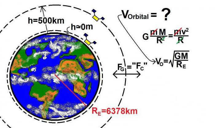
Calculating the Altitude of a GEO Satellite
A GEO satellite experiences a centripetal force Fc=(M1v^2)/R and gravity force Fg=(GM1M2)/R^2. As these forces are equal, we can equate their right-hand sides and simplify by the mass M1. This results in the equation v^2=(GM2)/R. Thus, the velocity of motion v=((GM2)/R)^(1/2).
Considering that the geostationary orbit has a circumference of 2πr, the orbital velocity can be expressed as v=2πR/T.
Given that T=8.64×10⁴ s, G=6.673×10⁻¹¹ N-m2/kg2, M=5.98×1024 kg, R=4.23×10⁷ m, we can determine the altitude at which satellites hover over a specific point on the Earth’s surface by subtracting the radius of the Earth, which is equal to 6.38×10⁶ m. The result is 3.59×10⁷ m.
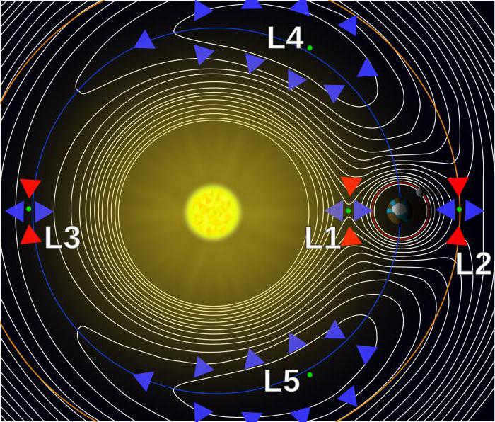
The Lagrange points
Another interesting set of orbits are the Lagrange points, where the gravitational forces of the Earth and the Sun balance each other out. Objects at these points experience an equal attraction to both celestial bodies and orbit around the Earth along with our planet.
Out of the five Lagrangian points in the Sun-Earth system, only the last two, known as L4 and L5, are stable. The other points are like a ball balancing precariously on top of a steep hill: any small disturbance will cause it to roll off. Satellites at these points require constant adjustments to maintain their balance. On the other hand, the last two Lagrangian points can be compared to a ball floating inside a balloon: even after a significant disturbance, they will return to their original position.
L1, positioned between the Sun and Earth, offers a perpetual vantage point for satellites to observe our star. The SOHO Solar Observatory, a collaborative endeavor between NASA and the European Space Agency, is stationed at the first Lagrangian point, approximately 1.5 million kilometers from Earth.
L2, situated at the same distance from Earth but trailing behind, necessitates only one protective shield to shield satellites from the Sun’s intense light and heat. This location is well-suited for space telescopes engaged in studying the universe’s nature through observations of background microwave radiation.
The third Lagrange point resides on the opposite side of the Sun from Earth, ensuring the Sun always lies between it and our planet. A satellite positioned here would be incapable of establishing communication with Earth.
The fourth and fifth Lagrange points in our planet’s orbital trajectory, which are located 60° ahead and behind the Earth, are known for their exceptional stability.
Medium Earth Orbit
Satellites in medium Earth orbit (MEO) have a closer proximity to the Earth, resulting in faster movement compared to satellites in other orbits. There are two types of MEO: the semi-synchronous orbit and the “Lightning” orbit.
The semi-synchronous orbit, one type of MEO, is characterized by its altitude. Satellites in this orbit fly at an altitude of approximately 26,560 kilometers from the Earth’s center, which is about 20,200 kilometers above the Earth’s surface. A satellite in this orbit completes one full revolution around the Earth every 12 hours. As it moves, the Earth rotates beneath it, causing the satellite to cross two identical points on the equator within a 24-hour period. This orbit is highly consistent and predictable, making it ideal for the GPS global positioning system.
The high latitude observations are carried out using the Lightning orbit with an inclination of 63.4°. The geostationary satellites are limited to the equator and are not suitable for regions in the far north or south. The Lightning orbit is characterized by a highly eccentric trajectory, where the spacecraft follows an elongated ellipse with the Earth close to one edge. Due to the gravitational acceleration, the satellite moves at a high speed when it is in close proximity to our planet. As it moves away, its speed decreases, resulting in more time spent at the top of its orbit, which can reach a distance of 40,000 kilometers from Earth. The orbital period of this orbit is 12 hours, but the satellite spends approximately two-thirds of that time over one hemisphere. Similar to a semi-synchronous orbit, the satellite follows the same path every 24 hours. The Lightning orbit is commonly utilized for communication purposes in the far north or south.
Low Earth
The majority of scientific satellites, a large number of weather satellites, and the International Space Station are located in an orbit known as low Earth orbit, which is nearly circular. The specific inclination of these satellites depends on the purpose of their mission. For instance, the Tropical Rainfall Measuring Mission (TRMM) satellite was launched to monitor precipitation in the tropics, so it was placed in a low inclination orbit (35°) to remain close to the equator.
Many of NASA’s observation satellites, on the other hand, are placed in a highly inclined orbit that is nearly polar. This means that the spacecraft travels from one pole to the other, completing a full orbit in 99 minutes. As it travels, it spends half of its time over the day side of Earth and then transitions to the night side once it reaches the pole.
As the satellite orbits, the Earth spins below it. By the time the spacecraft enters the illuminated portion, it is positioned above the region neighboring its previous orbital path. Within a span of 24 hours, polar satellites traverse a majority of the Earth’s surface twice: once during daylight hours and once during nighttime.
Orbiting the Sun in Sync
Similar to how geosynchronous satellites must remain above the equator to stay fixed in one location, polar-orbiting satellites possess the ability to remain synchronized with time. Their orbit is known as sun-synchronous, meaning that when a spacecraft crosses the equator, the local solar time remains constant. For instance, the Terra satellite consistently crosses the equator above Brazil at 10:30 am. The subsequent crossing, 99 minutes later, above Ecuador or Colombia also occurs at 10:30 local time.
A sun-synchronous orbit is crucial for scientific purposes as it enables the maintenance of a consistent angle of sunlight incidence on the Earth’s surface, despite seasonal variations. This stability allows scientists to compare images of our planet taken at the same time of year over multiple years, without concern for significant fluctuations in light that could distort the perception of change. Without a sun-synchronous orbit, it would be challenging to monitor these changes over time and collect the necessary data for climate change studies.
The path of the satellite is highly restricted in this scenario. If it is positioned at an altitude of 100 kilometers, the orbit must have an inclination of 96 degrees. Any deviation from this trajectory would be deemed unacceptable. Due to atmospheric drag and the gravitational forces of the Sun and Moon, the vehicle’s orbit must be regularly adjusted to compensate for these influences.
Orbital insertion: launch
Launching a satellite requires a certain amount of energy, which varies depending on factors such as the location of the launch site, the desired altitude, and the inclination of the satellite’s trajectory. The amount of energy needed increases for satellites that are intended to be placed in more distant orbits. Satellites with a significant inclination, such as polar satellites, require more energy compared to those that orbit closer to the equator. This is because low-inclination orbits can take advantage of the Earth’s rotation to help with the launch. For example, the International Space Station (ISS) is positioned at an angle of 51.6397° in order to make it easier for space shuttles and Russian rockets to reach it. The ISS maintains an altitude of 337-430 kilometers. On the other hand, polar satellites do not benefit from the Earth’s momentum, so they require additional energy to reach the same distance.
Orbit Correction
After a satellite is launched, it is necessary to make adjustments to maintain its intended orbit. Due to the Earth’s non-uniform shape, gravity is stronger in certain areas. This irregularity, combined with the gravitational pull of the Sun, Moon, and Jupiter (the largest planet in our solar system), causes changes in the satellite’s orbital inclination. Throughout their operational lifespan, the GOES satellites have undergone three or four orbital position adjustments. NASA’s low-Earth orbiters require yearly corrections to their orbital inclination.
When the Sun is active, atmospheric drag becomes more powerful. Similar to how the air inside a balloon expands and rises when it is heated, the atmosphere also rises and expands when the Sun provides it with additional energy. This results in the displacement of the thin layers of the atmosphere and their replacement with denser layers. Consequently, satellites that orbit the Earth need to adjust their position approximately four times per year in order to counteract the effects of atmospheric drag. When solar activity reaches its peak, the spacecraft’s position may need to be readjusted every 2-3 weeks.


