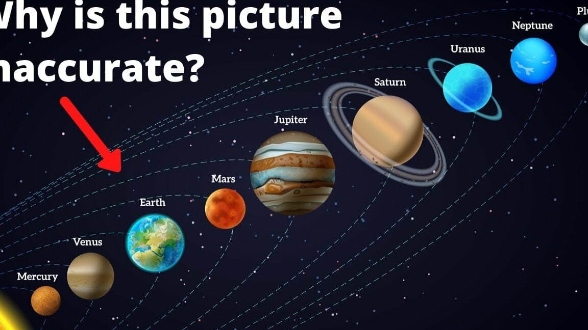
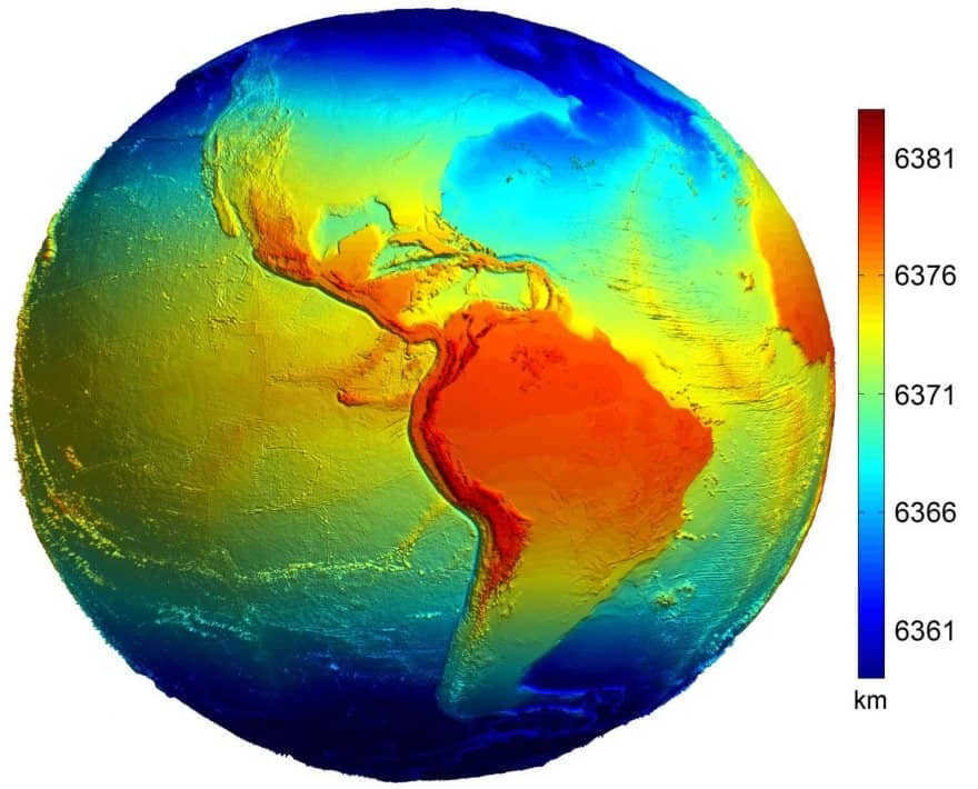
Let’s begin by defining the concept of a radius and its purpose. It’s a rather straightforward concept. The radius is the line segment that connects the center of the circle with any point on its circumference. In other words, it is the length of this segment. Additionally, it is equivalent to half the diameter. Consequently, the radius of the Earth refers to the distance from its center to a given point. However, there is an intriguing aspect to consider.
The measurements of Earth: its mass, volume, circumference, and diameter.
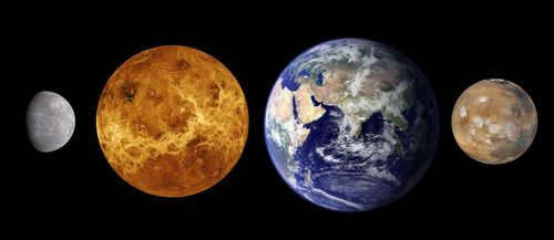
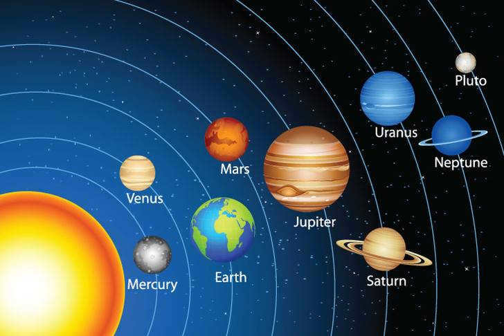
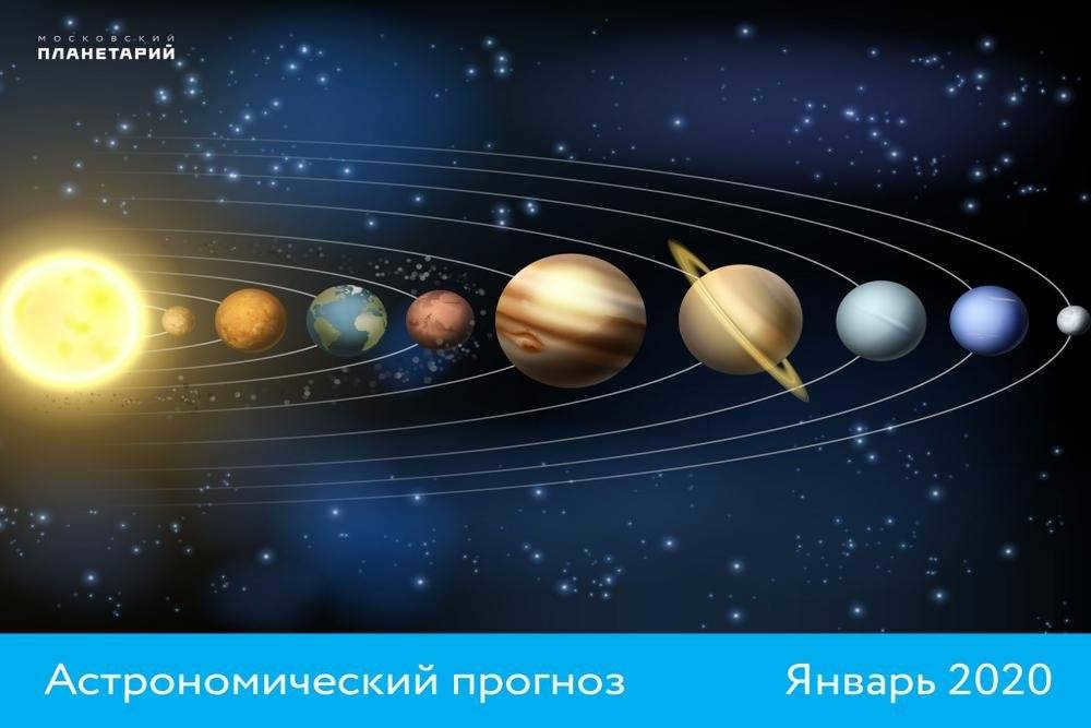
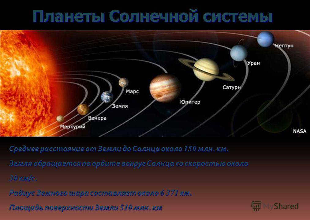
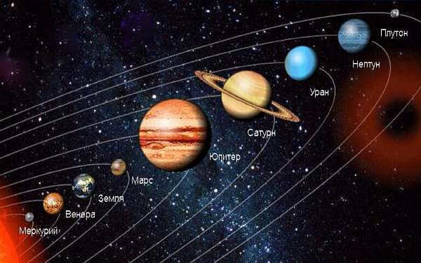
The Earth group consists of four planets: Mercury, Venus, Earth, and Mars.
Earth, being the largest planet in the Earth group, has an estimated mass of 5.9722±0.0006×10^24 kg. It also has the largest volume among these planets, measuring at 1.08321×10^18 km³.
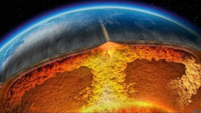
Furthermore, Earth is the densest planet among the terrestrial group planets due to its composition of crust, mantle, and core. The Earth’s crust is the thinnest layer, while the mantle comprises 84% of the Earth’s volume and extends 2,900 km beneath the surface. The core is responsible for Earth’s high density. It is the only planet in the Earth group that has a liquid outer core surrounding a solid and dense inner core.
The average density of Earth is 5.514×10 g/cm³, while Mars, one of the smallest Earth-like planets in the solar system, has a density that is only about 70% of Earth’s.
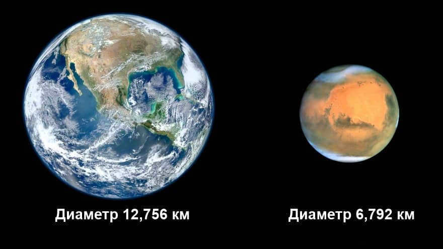
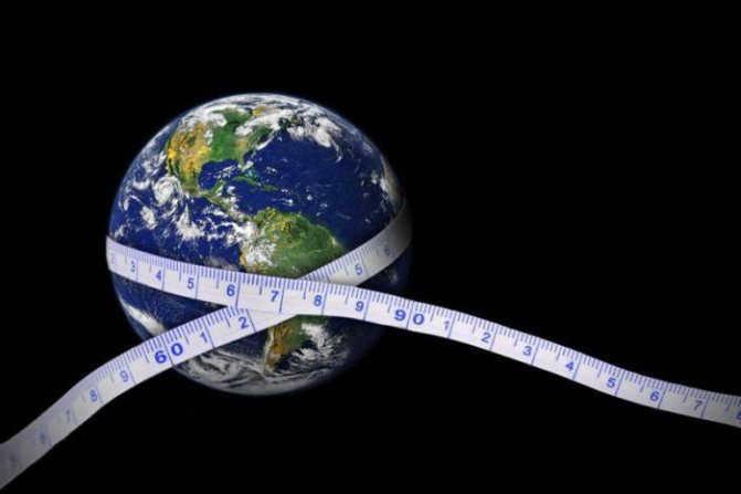
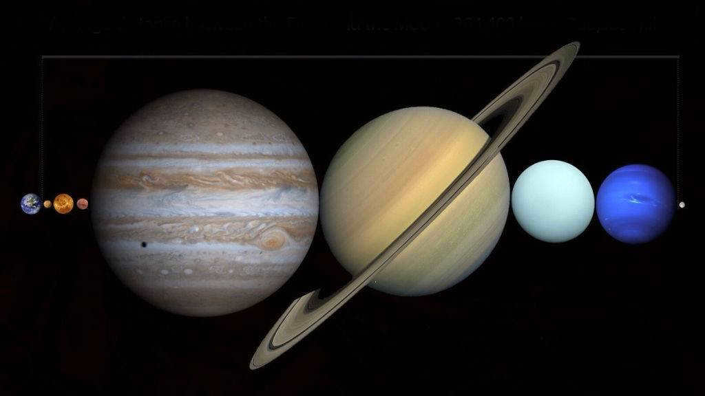
Earth is considered the largest among the Earth-group planets when it comes to circumference and diameter. The equatorial circumference of Earth measures 40,075.16 kilometers, while the distance between the North and South poles is slightly smaller at 40,008 km. The diameter of Earth at the poles is 12,713.5 km, while at the equator it is 12,756.1 km. In contrast, Jupiter, the largest planet in the solar system, has a diameter of 142,984 km.

When it comes to rectangular objects, measuring their volume and area is quite straightforward. All you need to know are the dimensions of width, length, and height in order to gather essential information about the object. The volume of a rectangular object is determined by multiplying these three dimensions together. As for the area, it can be calculated by taking twice the sum of the products of each pair of sides. In mathematical terms, the volume can be represented as V=abc, while the area can be expressed as S=2(ab+bc+ac).
However, when it comes to a ball, these equations can be quite cumbersome. In order to determine the diameter (and subsequently the radius) of a ball, one would need to enclose it within a cube, ensuring that it makes contact at six points. The length, width, or height of this cube would then represent the ball’s diameter. Yet, there is a much simpler method for determining the volume of a ball – by submerging it in a vessel filled to the brim. By measuring the amount of water displaced, one can determine the volume of the ball. Utilizing the formula V=4/3*π*R3, the radius can then be determined, allowing for the calculation of other characteristics of the object.
Another intriguing approach for measuring the volume of a ball will be discussed in the following section.
Form of the Planet
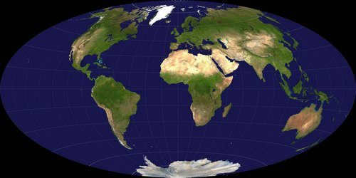
The reason why Earth’s circumference and diameter are not the same is due to its shape being a flattened spheroid or ellipsoid instead of a perfect sphere. The planet’s poles experience a slight flattening, resulting in an equatorial bulge and thus, a larger circumference and diameter.
The equatorial bulge of Earth measures 42.72 kilometers and is attributed to the planet’s rotation and gravitational forces. Gravity itself causes celestial bodies, including planets, to compress and take on a spherical shape. This happens because gravity pulls the entire mass of the object towards the center of gravity, which in this case is the Earth’s core.
When the Earth spins, the centrifugal force distorts the sphere, causing objects to move away from the center of gravity. The equator experiences the greatest centrifugal force, resulting in a slight bulge that makes this region have a larger circumference and diameter.
Although local topography does have an impact on the Earth’s shape, its influence is minimal on a global scale. The most significant variations in local topography can be found at Mount Everest, the highest point above sea level standing at 8,848 meters, and the Mariana Trench, the deepest point below sea level reaching 10,994±40 meters. When considering these extremes, the difference is only about 19 km, which is relatively insignificant when considering the size of the entire planet. However, if we take into account the equatorial bulge, the highest point on Earth and the point farthest from the center of the planet is the summit of Chimborazo volcano in Ecuador. This peak, located near the equator, reaches an elevation of 6,267 meters.
Practical Use
We require such values mostly out of curiosity. However, they are actively utilized in real-life applications. In the field of astronomy, these measurements, such as the Earth’s volume, the Earth’s mass, and the Earth’s radius, are employed in calculating the orbit of satellites launched from our planet’s surface. Furthermore, this data can be valuable for more fundamental scientific research. The application of this data in geography and geology is also intriguing, as the calculation of the Earth’s volume can aid in exploration and the rough estimation of mineral deposits.
Geodesy: The Science of Measuring and Understanding Earth’s Shape and Size
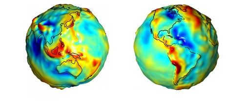
Geodesy, a scientific field that deals with the measurement and analysis of the Earth’s size and shape using surveys and mathematical calculations, plays a crucial role in the study of our planet.
Over the course of history, geodesy has held great significance as early scientists and philosophers worked tirelessly to determine the true shape of the Earth. Aristotle is recognized as one of the first individuals to make an attempt at calculating the Earth’s size, making him an early pioneer of geodesy. Following in his footsteps, the Greek philosopher Eratosthenes made an estimation of the Earth’s circumference, coming remarkably close to the measurement accepted nowadays at 40,233 kilometers.
To examine the Earth and employ geodesy, scientists frequently make use of the ellipsoid, geoid, and reference ellipsoid. An ellipsoid is a theoretical mathematical construct that presents a streamlined, simplified portrayal of the Earth’s exterior. Its purpose is to gauge distances on the surface while disregarding factors such as changes in elevation and landforms. Recognizing the intricacies of the Earth’s surface, surveyors utilize a geoid, a representation of the planet that is constructed using the average global sea level and therefore incorporates variations in elevation.
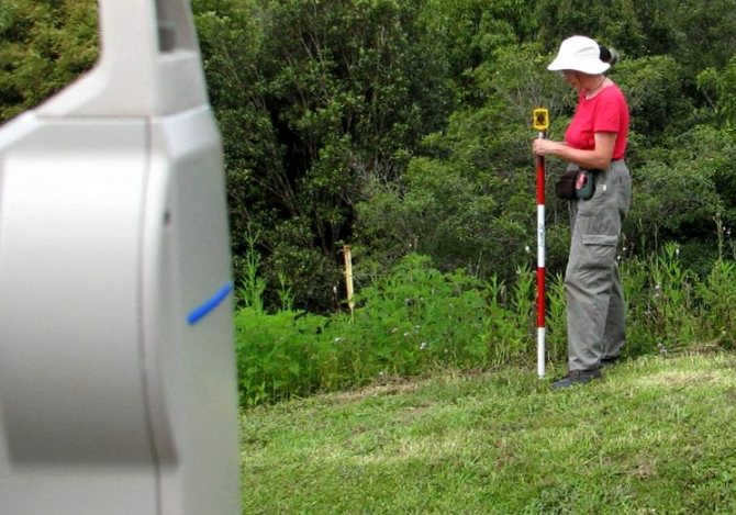
Data serves as the fundamental pillar of geodesy in the present era, serving as a benchmark for worldwide surveying activities. Contemporary advancements in technology, such as satellites and global positioning systems (GPS), have empowered surveyors and other scientists to conduct remarkably precise measurements of the Earth’s surface. In fact, these measurements are so precise that they yield data on the Earth’s surface with an accuracy of mere centimeters, offering the most meticulous insights into the Earth’s dimensions and structure.
Living in Athens
While residing in Athens, he wasted no time and continued his academic pursuits. During his time there, he received assistance in understanding poetry from the renowned grammarian Lysanias, who was a student of the great Callimachus. Additionally, he familiarized himself with various philosophical doctrines, particularly those of the Stoics and Platonists. He considered himself a follower of the latter. By immersing himself in the knowledge and culture of these two prestigious centers of ancient Greece, he became well-prepared to serve as a mentor to the heir. Ptolemy III, who was generous with promises and incentives, convinced the scholar to return to Alexandria. Eratosthenes couldn’t resist the opportunity to work at the renowned Library of Alexandria and eventually became its director.
Reaching a Conclusion about the Acceleration of Free Fall through the Lens of the Law of Universal Gravitation
Nevertheless, it was not until the law of universal gravitation was unveiled that the reason behind the specific value of this acceleration became apparent. It is worth reminding ourselves that the force of gravity experienced on Earth is a direct consequence of the law of universal gravitation, applying to objects situated on the planet’s surface.
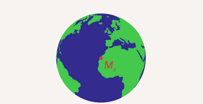
Figure 1. The force of gravity acting on a body on the Earth
In this scenario, we assume that the entire mass of the Earth is concentrated at its center. The Earth’s radius represents the distance between objects (Fig. 1). The body itself, which is located above the Earth’s surface, experiences attraction. Let’s record the corresponding equations.
, where – the mass of the body on the Earth’s surface, – the acceleration due to gravity.
In this case, the law of universal gravitation can be written as:
Here – mass of the Earth, – mass of the body, – radius of the Earth, – gravitational constant. By comparing the expressions for the force of gravity and gravitational force, we can derive the equation for the acceleration due to gravity:
Note: The acceleration of free fall is dependent on the Earth’s mass and radius. If these values change, it will result in a change in the acceleration of free fall.
Also, check out: The most well-known and devastating meteorites in history – a terrifying nightmare from outer space that collided with Earth.
Eratosthenes’ sieve
This method, utilized by the scientist, is detailed in Nicomachus of Herasen’s treatise and is employed to identify prime numbers. It has been observed that certain numbers can be evenly divided by 2, 3, 4, and 6, while others can only be divided evenly by themselves. The latter (such as 7, 11, 13) are referred to as prime numbers. When dealing with smaller numbers, determining prime numbers is usually not a problem. However, for larger numbers, the rule of Eratosthenes is applied. Despite numerous alternative methods, it is still commonly known as Eratosthenes’ sieve.
The classification of natural numbers can be divided into three categories:
- Numbers that have only one divisor (referred to as “ones”)
- Numbers that have exactly two divisors (known as prime numbers)
- Numbers that have more than two divisors (known as composite numbers)
The Eratosthenes method is a technique that involves systematically eliminating all numbers except for prime numbers. The process starts by removing numbers that are divisible by 2, then by 3, and so on. The resulting table should only contain prime numbers. Eratosthenes successfully listed a sequence of prime numbers up to 1000. The table below displays the first five hundred prime numbers.
Using an Online Calculator to Determine the Area of a Land Plot
There are numerous services and online calculators available today that can assist in calculating the area of a land plot. Simply utilize one of the popular search engines, such as Yandex, to find a suitable calculator.
It is important to note that the online calculator will require precise measurements of all sides of the land plot in meters. This information is crucial for the algorithm to accurately determine the area of your specific land plot.
Mesolabia
Regrettably, scarcely any works by Eratosthenes have survived in the realm of mathematics up to the present day. The entirety of the information has been preserved in Eutokius’ commentaries on Eratosthenes’ correspondence with King Ptolemy. Within these commentaries, the details regarding the Delian problem (or the “doubling of a cube”) are expounded upon, alongside the explanation of the mesolabium, a mechanical apparatus utilized for extracting cubic roots.
The apparatus was comprised of three identical right-angled triangles and two parallel rails. One of the triangles remained fixed, while the other two were capable of sliding along the rails (AB and CD). Assuming that point K is situated in the middle of side DB, and the two movable triangles are positioned in such a way that the points of intersection of their sides (L and N) align with the line AK, the volume of the cube with an edge length of ML will be twice that of the cube with an edge length of DK.
“Catasterisms” – Metamorphosis into a Constellation
The starry sky held great fascination for the ancient Greeks, as it did for many other civilizations, as evidenced by the surviving works of that era. Eratosthenes, a renowned figure mentioned in various biographies, had a particular interest in astronomy. One such work attributed to him is “Catasterisms,” a treatise that combines Greek mythology with observations of over 700 celestial objects. The authorship of Eratosthenes is a topic of ongoing debate, primarily due to stylistic differences. It is hard to believe that someone like Eratosthenes, who had a strong inclination towards poetry, would write “Catasterisms” in a dry and devoid of emotion style. Additionally, this historical source contains some astronomical inaccuracies. Nevertheless, mainstream science attributes the authorship to Eratosthenes.
Introduction. Galileo’s experiments on determining the acceleration of free fall
In the previous lesson, we discussed the topic of the law of universal gravitation. Now, let’s explore how this law is connected to the acceleration of free fall that has already been established. Galileo Galilei’s experiments
were the first to determine the acceleration of free fall. As you may remember, he measured the acceleration of objects on an inclined plane and was able to deduce that the maximum acceleration of these objects (which is the acceleration of free fall) is .
Library of Alexandria
The Library of Alexandria was not merely a school or a repository for ancient knowledge. It served as the epicenter of scientific advancements during its time. In discussing the renowned scholar Eratosthenes, it is impossible to overlook his significant contributions as the chief curator of the Library of Alexandria.
Not only did the library house and support the work of many esteemed philosophers of antiquity, but it also played a crucial role in training individuals for administrative positions under the Ptolemies. With a vast team of scribes and an abundance of papyrus, the library had the means to expand its collection and effectively rival the Pergamon library. Additionally, every effort was made to increase the library’s holdings, including meticulously copying any scrolls or parchments discovered on ships.
Eratosthenes was known for his groundbreaking contributions, one of which was the creation of a dedicated department focused on the study of Homer and his enduring influence. Additionally, he personally invested a considerable amount of his own money into acquiring ancient scrolls. Historical records suggest that Eratosthenes amassed a collection of over seven hundred thousand manuscripts and parchments. He built upon the work of his mentor Callimachus, the founder of scientific bibliography, and faithfully fulfilled his responsibilities until a tragic event occurred in 194 BC – he lost his vision and could no longer pursue his beloved work. This unfortunate circumstance extinguished his zest for life, and he eventually passed away, foregoing any nourishment.
Throughout history, people have always been curious about the Earth’s parameters, leading to the ancient calculation of its equatorial circumference in kilometers.
Currently, the astronomical values are determined in the following manner:
| Name | Unit of measurement | Indicator |
| Maximum distance from the Sun | million kilometers. | 152 |
| Minimum distance from the Sun | 147 | |
| Polar diameter | thousand km | 12.71 |
| Equatorial diameter | 12.75 | |
| Average surface temperature | 0 °C | 12.71 |
| Maximum temperature | 60 | |
| Minimum temperature | 90 | |
| Rotation period around the Sun | day | 365.3 |
| Duration of revolution around the axis | hour | 23.9 |
| Mass | kg | 5.9722* 10^24 |
| Volume | km^3 | 1.08321*10^12 |
| Orbit length | thousand km | 939120 |
| Average density | g/cm^3 | 5.51*10^-10 |
| Number of satellites | pcs. | 1 (Moon) |
| Distance between the Moon and the Earth (average) | thousand kilometers | 384.4 |
The planet is composed of the following components:
| Component Name | Depth, km | Percentage of total volume |
| Crust | 5-70 | 1 |
| Mantle | 35-2890 | 70-80 |
| Core | 2890-6371 | approximately 30 |
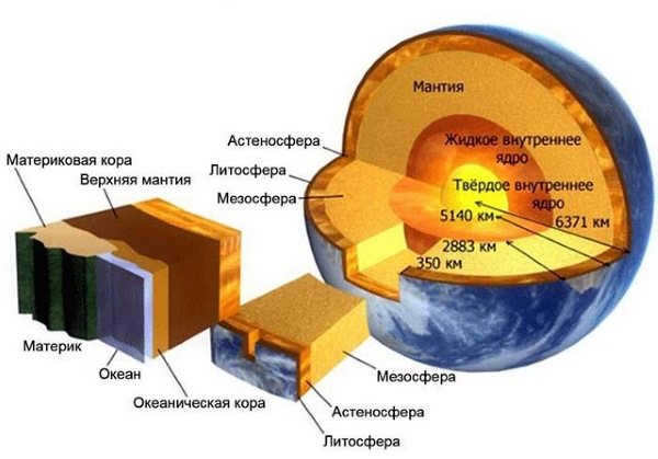
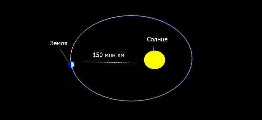
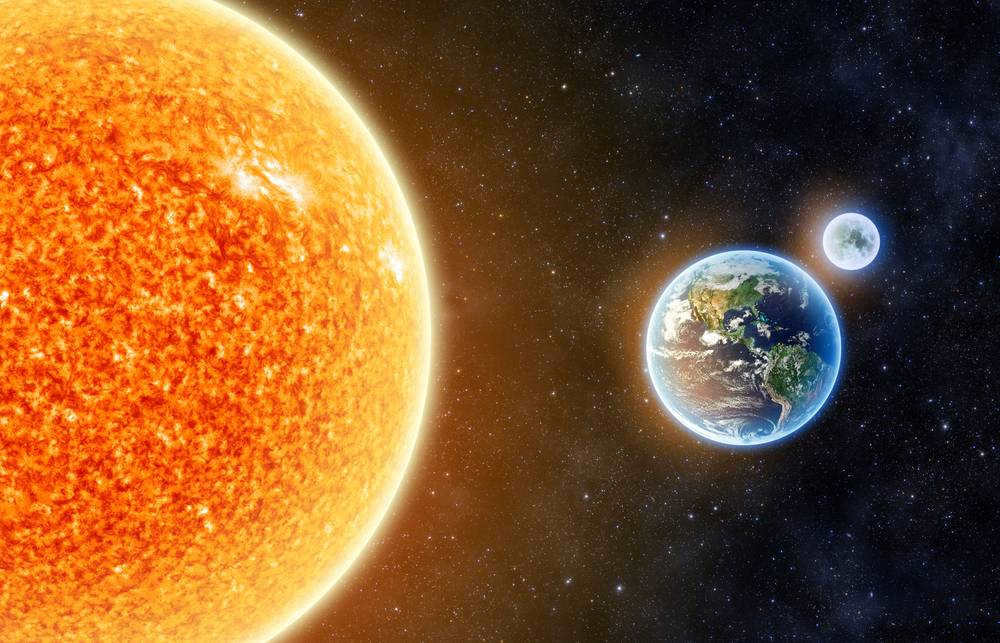
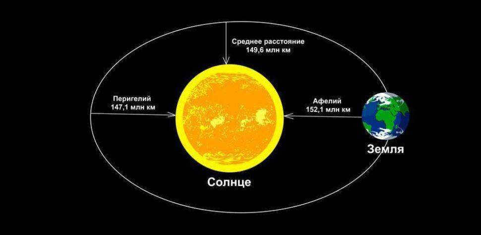
Scientists have determined that this particular celestial object was formed approximately 4.5 billion years ago. One of the distinguishing characteristics of Earth compared to other celestial bodies in the solar system is its suitability for sustaining life. This characteristic can be attributed to the specific distance between the planet and the Sun, which is approximately 150 million kilometers.
The presence of water, which covers approximately 71% of the Earth’s surface, is fundamental to the existence of life. Additionally, the composition of the Earth’s atmosphere, consisting primarily of nitrogen (78%), oxygen (21%), and argon (1%), plays a crucial role in creating favorable conditions for habitation.
The region of our planet that supports life is known as the biosphere. It encompasses the deepest oceanic trenches and extends up to 9,000 kilometers above sea level.
The Moon and Earth’s Asteroids
Earth has a solitary moon, which not only influences physical phenomena like tides but has also left its mark on history and culture. Specifically, the Moon is the only celestial body that humans have set foot on. This momentous occasion took place on July 20, 1969, with Neil Armstrong taking the historic first step. All in all, a total of 13 astronauts have landed on the moon.
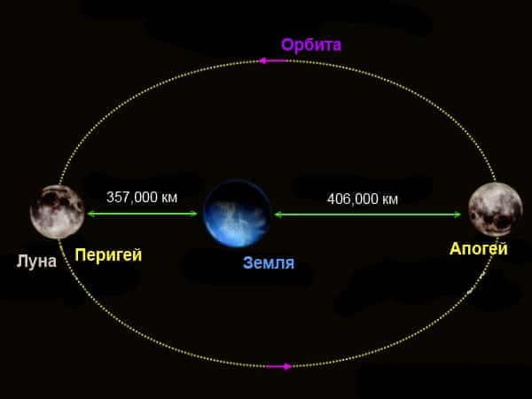
The Moon serves as Earth’s only satellite.
The Moon came into existence approximately 4.5 billion years ago as a result of a collision between the Earth and a celestial body about the size of Mars known as Theia. Our satellite holds a special place in the solar system as one of the largest moons and the second densest (after Io). It is locked in a gravitational embrace with the Earth, causing one side to always face us.
With a diameter of 3,474.8 km (about a quarter of the Earth’s size) and a mass of 7.3477 x 10^22 kg, the Moon boasts an average density of 3.3464 g/cm^3. Despite its size, it only exerts about 17% of the gravity we experience on Earth. The Moon’s influence extends beyond the celestial realm, affecting phenomena such as the Earth’s tides and the behavior of living organisms.
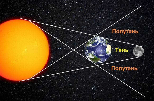
It is important to remember that both lunar and solar eclipses occur. The former takes place when the Moon enters the Earth’s shadow, while the latter occurs when the satellite passes between us and the Sun. The atmosphere of the satellite is weak, leading to extreme temperature fluctuations ranging from -153°C to 107°C.
Let’s take a look at the orbit of asteroid 2006 RH120.
The atmosphere contains helium, neon, and argon. The first two are produced by the solar wind, while argon is a result of the radioactive decay of potassium. There is also evidence of frozen water in the craters. The surface is divided into various types, including maria, which are flat plains that were mistakenly thought to be seas by ancient astronomers. There are also terrae, which are highland-like lands, as well as mountainous regions and craters.
There are a total of five asteroids orbiting the Earth. One of these asteroids is known as Satellite 2010 TK7, which can be found at the L4 point. Another asteroid, named 2006 RH120, has a unique orbit that brings it close to the Earth-Moon system every 20 years. In addition to these natural satellites, there are also a staggering 1,265 artificial satellites currently in orbit around the Earth. Furthermore, there are an astonishing 300,000 fragments of debris floating in space.
The Earth’s Geometric Shape
The Earth is not a perfect sphere, but rather a flattened ellipsoid or spheroid, which causes variations in its circumference and diameter. The compression at the poles creates a bulge along the main meridian, leading to an increase in both the diameter and circumference of the Earth.
Gravity and the Earth’s daily rotation also play a significant role in shaping its form. The centrifugal force caused by the rotation is greatest at the equator and decreases towards the poles. This gravitational effect contributes to the difference in diameters, with the equatorial diameter measuring 12,754 km and the polar diameter measuring 12,711 km.
Local geography plays a small role in shaping the planet (variations in continental elevations and tidal effects contribute to this).
In astronautics and geodesy, the Earth’s shape is commonly referred to using terms such as:
- Rotational ellipsoid which arises from the Earth’s daily rotation on its axis.
- Geoid: A geoid is a three-dimensional object with irregular shapes. It represents an imaginary surface that closely aligns with the Earth’s oceanic surface and extends over the landmasses. The concept of “altitude above sea level” found in geography reference books and atlases is derived from this surface. However, in reality, the actual water level may not always match the geoid due to variations in temperature, salinity, and atmospheric pressure across different locations on the globe.
The measurement of the Earth’s circumference around the equator according to contemporary scientists
Throughout the years and centuries, there have been significant advancements in measuring tools and techniques. As a result, mankind has been able to explore outer space and create highly detailed maps of the Earth’s surface. This has led to a more precise determination of the length of the equator. The equator, which is the line of zero latitude, traverses the Earth’s surface with varying elevations, ranging from the Challenger Abyss in the Mariana Depression at a depth of 10,994 meters to the summit of Mount Everest, also known as Jomolungma, at a height of 8,848 meters. While the equator itself does not possess such extreme altitude differences, it still poses challenges in accurately measuring its length. Therefore, calculations are based on the average radius of the Earth, which is 6,378 kilometers and 137 meters according to the geophysical standard WGS-84. This gives us a calculated length of the equator of 40,075 kilometers.
Equator – its definition and significance
The equator is a conceptual circle that encompasses the entire Earth and runs through its center. It is recognized as the longest parallel on Earth, measuring 40,075 kilometers in length. The equatorial line runs perpendicular to the Earth’s axis of rotation and is equidistant from both poles.
When establishing the prime meridian, researchers utilize a symbolic circle with a radius equal to the average radius of the Earth. The first individual credited with calculating the length of this imaginary line was the Greek geographer, astronomer, and philologist Eratosthenes in the 3rd century BC. Since then, numerous scientists have made attempts to determine the precise length of the equator.
In the 17th century, Snellius, a Dutch astronomer, proposed the calculation of the circumference of a perfect circle without considering any obstacles, such as mountains or elevations, that may be present. Later, in the mid-19th century, the Soviet astronomer and geodesist F. Krassovsky successfully determined the length of the Earth’s elliptical shape. This calculation, made in the middle of the 19th century, is now widely used as a reference point for scientific research and development.
The equatorial belt depicted on geographical maps serves as a valuable tool for scientists to perform calculations, locate various natural features, and understand different climatic zones.
The equator, which is the imaginary line closest to the center of our solar system, receives the highest amount of thermal radiation.
Consequently, the further away from the polar regions, the colder the climate becomes. In the equatorial zone, summer is perpetual and the air is hot and humid as a result of frequent evaporation. The length of day and night is equal here, and during the equinoxes, the sun’s rays shine directly downwards.
Summary
The equator spans a distance of 40075 kilometers, a size that can be appreciated by comparing it to the mileage covered by a typical passenger car. For instance, it would take an average Nissan Juke three years to travel the same distance. This line acts as a geographical division, separating the Northern and Southern hemispheres. The equator is also home to the most humid regions on Earth, housing a diverse range of exotic animal and plant species. Additionally, countries located near the equator, known for their warm climate, attract a large number of tourists.
Measuring equipment and satellites are currently used to determine the circumference of the Earth along the equator in kilometers. However, it is possible to calculate this value without the need for advanced tools, as demonstrated by the ancient Greek scientist Erastothenes. Erastothenes was part of a scientific center that included an observatory, a vivarium, and a laboratory.
As the head of the complex’s library, Erastothenes was highly knowledgeable. One day, he heard from fellow travelers about a remarkable phenomenon that occurred in Siena, located south of Alexandria. These travelers reported that on the first day of summer, at 12 o’clock noon, there were no shadows in the settlement.
Eratosthenes, the ancient Greek scientist, was the first to calculate the Earth’s circumference along the equator.
The sun was directly overhead, with its rays shining vertically onto the ground. If you looked at the surface of the body of water, you could see a reflection of the sun at the bottom. The astronomer returned to his hometown and noticed that during the longest day of the year at noon, the walls of the building and everything beyond them cast a shadow on the ground.
Using his observations, he was able to calculate the approximate circumference of the earth. His method was as follows. Due to the vast distance between our planet and the sun, the heat rays descend onto the cities below in parallel.
If the Earth were flat, the shadows would disappear simultaneously everywhere. However, due to the Earth’s curvature, the buildings in Alexandria (which is 500 miles away from Siena) have a different angle than the buildings in Siena. On the hottest afternoon, a scholar measured the shadow cast by a stele.
By knowing the length of the obelisk, he calculated the length of the line connecting the top of the monument and the end of the shadow. This created a hypothetical triangle. Following the geometric principles of that time, he determined the angles of the triangle. Consequently, it was discovered that the angle of divergence is approximately 70 degrees. This indicates that Alexandria is displaced from Siena on the Earth’s curved surface by this amount.
This difference in angle between population centers represents only 1/50th of the complete circumference. All closed circular bands encompass 360 degrees. The astronomer multiplied the distance between the cities (500 miles) by 50 and obtained an estimate for the circumference of the planet – 25,000 miles. Contemporary scientists, utilizing advanced technology, measured this value and derived a measurement of 24,894 miles.
Does the length of the equator remain constant?
Calculations of Circumference and Radius
The Earth’s circumference along the equator is measured at 40075 kilometers. This figure was determined using the following method:
Scientists have calculated that the polar radius is slightly shorter than the equatorial radius. The polar radius measures 6356.8 km, while the equatorial radius measures 6378.2 km.
The difference between these values is 21 km. There are two possible calculations:
- Calculation of the Earth’s circumference using the equatorial radius: 2 * 3.1415 * 6378.2 = 40074
- Calculation using the polar parameters: 2 * 3.1415 * 6356.8 = 39940
Scientists have successfully determined the Earth’s total surface area and it amounts to 510.072 million square kilometers. While this may seem like a vast expanse, the majority (nearly 70%) is covered by water bodies such as oceans, seas, and rivers. The remaining 30% is comprised of land, which equates to approximately 148.940 million square kilometers. When we divide this land area by the estimated global population, each individual is left with a mere 0.02 km of land. This is a remarkably small figure, especially considering that it includes mountain ranges and deserts.
The total land area is 510.072 million square kilometers.
Caution. Back in ancient times, individuals possessed a general notion of the Earth’s shape, but their imaginations ran wild. For instance, the people of Babylon firmly believed that they resided on a portion of a colossal mountain, and atop this mountain was a solid dome – the sky.
Countries situated on the equator
The equatorial line traverses 13 countries. If you commence from the prime meridian and travel eastward, the roster appears as follows:
- Principe and São Tomé is a nation comprised of islands located off the coast of Africa. The equator intersects its constituent island of Rolache. A monument has been erected at this site to signify its extraordinary location.
- Gabon Gabon is almost evenly split by the Earth’s equator, although this geographical feature is not widely emphasized in the country. There are no visible markers or settlements specifically denoting the hemispheric division.
- The Republic of Congo is characterized by lush tropical vegetation where the equator bisects the country. There are no informational signs in these areas, with the exception of Makoua, where a weathered pedestal supports a small globe.
- The Democratic Republic of Congo has commemorative markers in the town of Mbandaka, as well as at points where the equator intersects rivers and highways.
- Uganda features a well-known tourist complex near Lake Victoria, in the town of Kayabu, which consists of two rings marking the equatorial line.
- Kenya. The country of Kenya actively utilizes the factor of being crossed by the equator, which contributes to its thriving tourism industry.
- Somalia. In the southern part of Somalia, there is a dividing line that marks the equator. However, due to the current instability and poverty in the country, there are no signs highlighting this geographical feature as a tourist attraction.
- Maldives. The boundary between the Northern and Southern Hemispheres runs along the surface of the sea, intersecting the various atolls of the Maldives.
- Indonesia. The equator crosses three major Indonesian islands and approximately ten smaller islets, making it a unique geographical feature of the country.
- Kiribati. The imaginary boundary between the Southern and Northern Hemispheres stretches across the sea, encompassing the islands of Kiribati.
- Colombia. The conditional line of the cross-section of the Earth’s surface extends to the southern part of the country, specifically in the area of dense jungle. The R. Apopolis intersects this natural strip three times.
- Brazil. The meridian runs through the northern and western regions of the country, leaving behind memorial markers in numerous locations.
How Much Time Does it Take to Walk Around the Earth?
Scientists have long been able to calculate the circumference of the Earth along the equator in kilometers. This established length allows us to determine how long it would take to walk the entire distance.
To find this value, a simple calculation needs to be done:
- If you were to walk this route without stopping at a speed of 5 km/h, it would take approximately 8000 hours or almost 1 year. (40075/5=8015/24=333).
- Assuming that the planet’s surface is flat (without any bodies of water or mountains) and a person is traveling at a speed of 6 km/hour, it would take approximately 9-10 months to complete the journey (40075/6=6680/24=278 days). Each month consists of an average of 30 days, so: 278/30=9.3 months. However, it is important to note that it is not possible to continuously travel without taking breaks for rest and safety. For safety reasons, it is recommended that a traveler walks no more than 6 hours per day. This significantly increases the total time required for the expedition. (6680/6=1113 days). Considering that there are 365 days in a year, the journey would take approximately 3 years and 18 days.
Interesting facts
Here are some fascinating characteristics of the equator:
- The regions surrounding the equator are known for their warm and humid climate, and they are home to a wide variety of flora and fauna.
- The equatorial forests are the densest in the world, with some areas being impenetrable due to thick vegetation.
- The equatorial region receives abundant rainfall, with precipitation occurring nearly every day. This leads to vibrant and picturesque vegetation.
- Due to the high temperature regime, the countries located along the equator are ideal for year-round tourist activities.
- There is an active volcano named Wolf in Ecuador that straddles the meridian.
- The Congo River in Africa crosses the imaginary line that divides the globe into two halves.
- The Earth’s land area can be divided into climatic belts thanks to the circumference of the Earth along the equator.
- The municipality of Macapa in Brazil is situated in both hemispheres simultaneously. In addition, there is a stadium named “Zeran” that intersects the Earth’s circumference right in the center of the field. Adjacent to it is a monument called “Marco Zero” which commemorates the prime meridian. The “Equatorial Street” extends from this monument all the way to the banks of the Amazon River.
- In San Antonio, Ecuador, you can find the Middle of the World Museum and Obelisk.
- The term equator derives from Latin, meaning “to equalize”. In actuality, the equator splits the planet into two nearly identical hemispheres. The regions of the globe may vary from one another due to the Earth’s imperfect shape.
- The equatorial region experiences perpetual summers and minimal daily temperature variations. This is because the sun’s rays evenly warm the Earth’s surface in this area.
- The Earth rotates at a speed of 465 m/s along the meridian.
- The ancient Greek astronomer and mathematician E. Kirensky was the first to accurately calculate the circumference of the Earth. According to his calculations, the length of this path is 250 thousand stadia, or 40 thousand kilometers, which is very close to modern, more precise measurements.
- There are 33 islands that the equator passes through.
- When moving from the poles to the equatorial zone, their weight decreases by 0.53%, which is due to centrifugal force and the distance from the center of the globe.
- The geostationary orbit is positioned at a height of 35.8 thousand kilometers above the main parallel. Communication satellites are placed above it. A signal travels back and forth at the speed of light in just ¼ of a second.
- Only 5% of the planet’s surface is occupied by the near-equatorial area, yet it is home to nearly half of the world’s animal diversity.
- In adherence to the age-old tradition of sailors, any vessel crossing the meridian was required to partake in Neptune’s Day festivities. As part of the celebration, new recruits were subjected to a special ritual, which involved the seasoned sailors dousing them in fuel oil before compelling them to bathe in the sea or a pool. Following this, the recruits’ hair and beards were trimmed off with an axe. Sailors who successfully completed this ceremony were bestowed with a special document, exempting them from further consecrations.
It is fascinating how the Earth’s equatorial circumference aids mankind in determining geographical points and ensuring accurate orientation for ships and airplanes.
Formatting of the article: Svetlana Ovsyanikova
Definition of the concept
The equator is referred to as an imaginary line that runs directly through the center of our planet. It is known as the geographical equator and has a latitude of 0 degrees. The equator serves as a point of reference for scientists to conduct various calculations, which will be discussed later on. It effectively divides the globe into two equal halves.
In the regions that the equator passes through, the duration of day and night is always equal, without any deviation even by a fraction of a second.
The equatorial zone receives the highest amount of ultraviolet rays. As a result, the further away a location is from this imaginary line, the less heat and light it receives. This explains why the highest temperature readings are recorded near the equator.
Officially, the distance from the Earth’s surface to space
One possible way to define the distance to space is 260,000 kilometers. This is where the Earth’s gravity ends and the gravity of the yellow dwarf star begins to take effect.
Another way to define space is by the absence of gravitational force, which also means the absence of atmosphere. In this definition, space begins at the point where there is no atmosphere between celestial bodies and planets.
It is true, to some extent, that cosmonauts venture into outer space from the International Space Station, as mentioned in articles on internet portals and media.
There are other distance options that have been confirmed by scientific research, award-winning discoveries, and calculations. These distances can also be considered as reliable guides to space.
The initial numbers
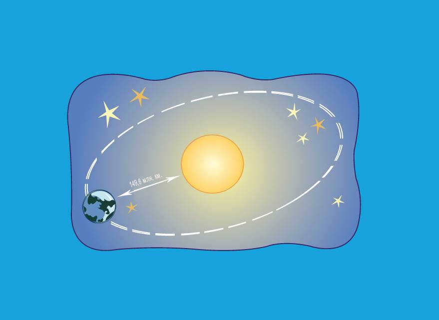
Calculating the distance from the Sun to the Earth has been a significant achievement in astronomy. The pioneering astronomers Richer and Cassini were able to accurately measure this distance by observing the position of Mars in the night sky and using geometric calculations. This groundbreaking calculation was made in 1672 and yielded a distance of 139 million kilometers, which, although underestimated, was a remarkable feat considering the time period.
It was not until the second half of the twentieth century, during the scientific and technological revolution triggered by World War II, that major advancements in space measurement techniques were made.
One of the notable breakthroughs was the development of the radar method, which revolutionized the way space distances were measured. This new method provided completely new ways of accurately determining distances within the vast expanse of space.
How was the distance determined?
Ancient astronomers have long pondered the distance between the Earth and the Sun. In 1673, Giovanni Domenico Cassini, an engineer and astronomer from Italy and France, was able to calculate the distance using parallax. He conducted his calculations from Paris and determined that the distance from Earth to the Sun was approximately 138.5 million kilometers. Although this measurement was about 11.5 million kilometers less than the actual distance, it was still a significant scientific breakthrough for that time.
In the 1960s, the radar method was introduced to calculate gaps. The concept is to send a short and powerful signal to a celestial object and then receive its reflection. Radio waves travel at the speed of light in space, so by accurately measuring the pulse’s travel time, it is possible to calculate the distance to any object, not just in space.
This method has been instrumental in determining the distances to cosmic objects. It has also allowed for the establishment of the astronomical unit: 1 a.u. = 149,597,870 km +- 1 km.
This level of precision has been sufficient for scientific purposes. In practical applications, the distance is often rounded to 149,600,000 kilometers, which is approximately equal to the parallax of the Sun, 8.794 seconds of arc.
.
The Sun: Unraveling the Pyramid of Lies. Part 1.
To graduate from high school, one must simply accept that the sun is 100 times larger than the earth and located 150 million kilometers away. But is this really the case? Shall we put it to the test?
First, take a look at this image and tell me what you see – a sun positioned 150 million kilometers away? Or.
According to the official heliocentric theory, the earth takes on the shape of a sphere (more precisely, a geoid) and is approximately 100 times smaller than the sun. This implies that at any given moment, based on geometry, exactly half of the planet’s surface is illuminated by the sun, and due to the distance of 150 million kilometers, only parallel rays of light reach the earth.
If we objectively examine the photograph, what do we observe: clouds that extend up to 10,000 meters in height. The sun positioned above the clouds. Rays of light radiating beneath the clouds. Illuminated areas of the cloud tops clearly oriented towards the light source. All the light emanates from a single point – this is the crucial point. At first glance, there is nothing unusual here; it should be this way. Everything appears to be as it should be. However, within the heliocentric model, such an image is impossible! The sun’s light illuminates precisely half of the planet, resulting in a long and straight boundary between day and night. This means that the entire horizon line on the side facing the sun should be a source of light. But we do not observe that. Instead, we witness an unmistakable localized point of light.
Observe a sunset. According to the heliocentric model, light should evenly fade across the horizon as the planet rotates. However, in reality, we perceive the sun shrinking and vanishing behind the horizon line. The sun, located at a distance of 150 million kilometers, cannot physically generate such an effect.
Let’s attempt to envision how the sun and sunlight would appear within a heliocentric system:
An essential component of the heliocentric theory is a parallel stream of light that completely encompasses half of the planet’s surface. In this scenario, the second photograph would look slightly different than it does presently: beams of light and shadow would extend through the clouds along the entire horizon line, not exclusively from the visible solar disk. This bears no resemblance to reality, does it?
Now let’s imagine that the sun is in close proximity and emits light locally:
Only under these circumstances does everything align with reality.
What does all of this signify?
1. The earth does not orbit the sun – the heliocentric theory is erroneous!
2. The earth does not…
Yes, I understand that this information is difficult to comprehend; it requires time to grasp. I, too, once wholeheartedly believed in the sun being millions of kilometers away. Do you know why? I had never contemplated it before, that’s all!
P. S. A special thanks to the creator of the YouTube video “CUCKS IN COSMOS.” It is an incredible video, so be sure to watch it. And a special hello to Cookie.
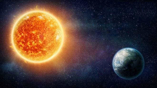
Understanding the Sun is crucial for the human race. One of the main reasons is due to the magnetic storms.
These storms are closely connected to the Sun’s 11-year activity cycle. A powerful magnetic storm has the potential to disrupt communication systems, lead to more car accidents, and negatively impact the health of individuals who are weather-sensitive. Throughout the observation period, scientists identify various notable occurrences of such phenomena:
- In 1859, the telegraph in North America and Europe ceased to function and the aurora borealis was visible worldwide.
- On 03/13/1989, there were extensive power outages in Quebec, causing disruptions in high-frequency communications worldwide. The aurora borealis could be seen in Mexico and Simferopol.
- On 23.07.2012, an event of equal magnitude to Carrington’s occurred.
What is the path of the Sun called as it moves through the sky?
Due to the Earth’s orbit, we observe the Sun each day against a backdrop of different stars. However, it appears to us that the Sun transitions from one constellation to another. The trajectory that the Sun follows as it traverses the sky is known as the ecliptic. The constellations that lie along the ecliptic are referred to as zodiacal constellations. Throughout the year, the Sun can be seen in the constellations of Sagittarius, Capricorn, Aquarius, Pisces, Aries, Taurus, Gemini, Cancer, Leo, Virgo, Libra, Scorpio, and Serpentine. For instance, on January 1, the Sun is situated in Sagittarius. However, the stars of this constellation are not visible because it, along with the Sun, is positioned in the daylight portion of the sky and is obscured by sunlight.
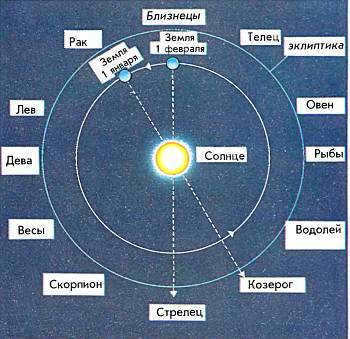
Every year, the Earth completes a full orbit around the Sun, making it appear as though the Sun is moving through the zodiacal constellations. As we progress through the months, the Sun’s position appears to change, with it being in Sagittarius on January 1 and Capricorn on February 1, for example. This apparent path of the Sun is known as the ecliptic.
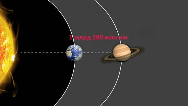
The measurements of distance in space are unique, separated from the international system of measurement and given their own category. One example is the astronomical unit (AU), which represents the average distance from the Sun to the third planet, Earth.
This unit can also be referred to as the radius of Earth’s orbit.
The AU is defined as the distance between the centers of Earth and its orbit.
Within a single star system like the solar system, we can use astronomical units to measure distances between objects. However, on the scale of the entire Universe, the AU is a small unit. Therefore, distances between stars and galaxies are usually expressed in light-years.
In the field of physics, light has long served as the standard for the swiftest phenomenon in existence. However, on a cosmic scale that transcends dimensions, light itself does not travel instantaneously. During its journey from one corner of the Universe to another, light gradually decelerates, scatters, alters its spectrum, and encounters various material obstacles.
A light year is a unit of distance that represents the product of the speed of light and one Earth year. In order to perform this multiplication, the Julian year must first be converted into seconds, as the speed of light is also measured in seconds.
By utilizing astronomical units, it becomes possible to conduct more intricate calculations.
Speed of Light
The concept of visible light rays refers to a continuous flow of subatomic particles known as photons, derived from the Greek term “photos” meaning “light”. To a human on Earth, one light-year represents an immeasurably vast distance. In the presence of Earth’s gravity, an average individual can achieve a speed of approximately 20 kilometers per hour. In contrast, photons travel 60 million times faster, covering a distance of 300 thousand kilometers every second. This represents the ultimate speed attainable by visible light in a vacuum.
When encountering air or water, such as in the Earth’s atmosphere or oceans, light only slows down by a maximum of 25% and still travels at a speed of 225,000 kilometers per second. These figures serve as the basis for all other calculations related to space travel within the solar system and between stars. In just one minute, light can cover a distance of 18 million kilometers. As technological advancements bring us closer to achieving the speed of light, the duration of space travel will continue to decrease.
The calculation of the duration of a hypothetical flight to Mars can be easily determined based on the information provided above. There exists a meticulously calculated flight trajectory, potential options, and the minimum distance between Earth and Mars, which is over 54 million kilometers. At the speed of light, this distance can be traversed in just 3 minutes. Unlike conventional forms of transportation that would take countless months, a journey to Mars would be almost instantaneous if one could travel at the speed of light. The time it takes to travel between Mars and Earth, three minutes, is incomparable to any form of transportation on Earth.
If advancements in technology allow for travel at the speed of light, reaching the Red Planet would become a feasible endeavor. Given the current rate of scientific progress, it is only a matter of time before new, futuristic modes of transportation are discovered.
Each person on Earth has access to 285 galaxies
Image: NASA/ESA/Hubble Heritage Team/nasa.gov
When we divide the total number of known galaxies by the current population of Earth, we find that each person has access to 285 galaxies.
Given the immense scale of these numbers, it is practically impossible to manually count every single galaxy. Even obtaining a rough estimate is an incredibly challenging task. Until recently, astronomers believed that there were approximately 100-200 billion galaxies in the universe. However, their calculations were not just slightly off, but rather off by a factor of ten.
New research indicates that the actual number of galaxies is around 2 trillion, which means that there are 285 galaxies available for each individual on Earth. Nevertheless, future generations of scientists, in 20-30 years’ time, may find this estimate to be significantly underestimated.
Modern Age research
Advancements in technology have completely transformed the field of astronomical research, enabling scientists to acquire the most precise and reliable data on spatial distances.
The radar method
The radar technique for measuring distances relies on the emission of pulses towards a celestial object. These waves are then reflected back from the entity and analyzed for their intensity and travel time, allowing researchers to accurately calculate the distance traveled.
Measuring distance using a laser
There are multiple methods for measuring the distance to a star within our solar system. Credit: marsplaneta.ru.
The concept of laser ranging is similar to that of the radio wave technique. A high-powered transmitter emits a beam of light towards a celestial object, which then reflects back to Earth. The intensity and duration of the beam’s travel are considered when determining the distance.
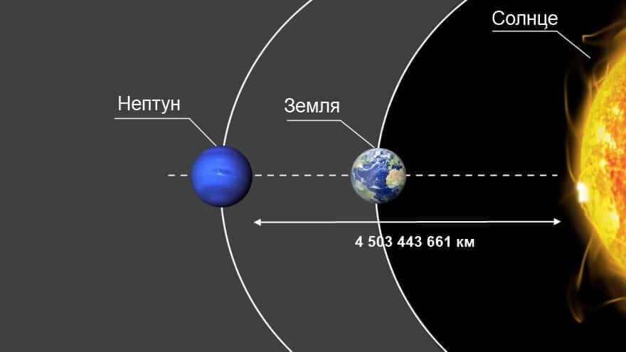

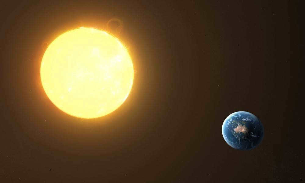
This technique is extremely precise and allows for data to be obtained with an error margin of just a few centimeters, but it requires advanced and costly equipment.
A glimpse into the past
As we construct our staircase to the outer reaches of the Universe, we often overlook the foundation upon which it is built. In the meantime, the parallax method measures distance not in standard meters, but in astronomical units, which are equivalent to the Earth’s orbit radii. However, determining the exact value of this unit took some time. So, let’s take a step back and descend the cosmic distance ladder back to Earth.
Aristarchus of Samos, who suggested the heliocentric model of the universe one and a half millennia before Copernicus, was likely the earliest to make an attempt at calculating the distance of the Sun. He determined that the Sun was 20 times more distant from us than the Moon. This calculation, which we now know to be off by a factor of 20, persisted until the time of Kepler. Although Kepler himself did not directly measure the astronomical unit, he recognized that the Sun must be significantly farther away than Aristarchus had estimated (as did subsequent astronomers).
The initial approximation of the distance between the Earth and the Sun was derived by Jean Dominique Cassini and Jean Richet. In 1672, while Mars was in opposition, they took measurements of its position relative to the stars simultaneously from Paris (Cassini) and Cayenne (Richet). The distance from France to French Guiana served as the baseline for the parallactic triangle, which allowed them to determine the distance to Mars. By applying the equations of celestial mechanics, they then calculated the astronomical unit, arriving at a value of 140 million kilometers.
Throughout the following two centuries, the principal instrument for ascertaining the scale of the Solar System was the transits of Venus across the Sun’s disc. By simultaneously observing them from different locations around the globe, it became possible to calculate the distance from Earth to Venus, and consequently all other distances within the Solar System. This phenomenon was observed four times during the 18th and 19th centuries: in 1761, 1769, 1874, and 1882. These observations were among the earliest international scientific endeavors. Expansive expeditions were organized (the renowned James Cook led the British expedition in 1769), and specialized observation stations were established… While in the late 18th century Russia only provided French scientists with the opportunity to observe the transit from its territory (specifically Tobolsk), Russian scientists actively participated in the research in 1874 and 1882. Unfortunately, the exceedingly complex nature of the observations resulted in significant variations in estimates of the astronomical unit, ranging from approximately 147 to 153 million kilometers. A more reliable value of 149.5 million kilometers was only obtained at the turn of the 19th and 20th centuries through observations of asteroids. Lastly, it should be noted that the results of all these measurements were based on knowledge of the length of the baseline, in which the radius of the Earth served as the astronomical unit. Thus, the foundation of the cosmic distances ladder was ultimately laid by geodesists.
It was only in the second half of the 20th century that scientists had fundamentally new methods at their disposal for determining cosmic distances – laser and radar. These methods allowed for a dramatic increase in measurement accuracy within the Solar System by orders of magnitude. The radar error for Mars and Venus is a few meters, and distances to corner reflectors placed on the Moon are measured to the nearest centimeter. The currently accepted value for the astronomical unit is 149,597,870,691 meters.
Christian Huygens’ approach to right-angled triangles
Christiaan Huygens, a Dutch scientist, made his own calculations in 1653. His methodology happened to be similar to that of Aristarchus of Samos. Huygens also utilized the method of right triangles, but specifically for the Earth-Venus-Sun system. By coincidence, he correctly estimated the size of Venus and conducted further calculations. However, the scientific community did not regard the astronomer’s measurements as credible and dismissed them as mere conjecture.
Cassini and Richet’s findings
In 1672, Giovanni Cassini conducted observations in Paris of Mars’ movement across the night sky. He assigned similar studies to his assistant Jean Richet, who was sent to Guiana.
Cassini utilized the positions of the stars surrounding Mars for his measurements and then compared the data with Richet’s observations. Using scientific methods, the scientist was able to determine the length of the Earth-Mars segment, from which he calculated the distance between the Earth and the Sun. The astronomer’s work and its results were widely recognized.
For scientists, the Earth’s diameter holds practical significance, as it can be calculated by knowing the planet’s equatorial circumference.
The primary characteristics of planet Earth
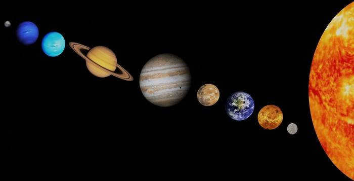
Planet Earth has an estimated age of at least 4.5 billion years. It belongs to the group of terrestrial planets, which also includes Mercury, Venus, and Mars. Unlike the gas giants (Jupiter, Saturn, Neptune, Uranus), these planets are primarily composed of rock with a thin surface layer. Earth is the largest of the terrestrial planets and the fifth largest in the entire solar system.
What sets Earth apart is the presence of life. Several factors contribute to the existence of life on Earth:
- The distance from the Sun, which is approximately 150 million kilometers.
- Surface temperature: the average temperature is around +13°C, with a minimum of -90°C and a maximum of +60°C.
- Water, which covers 71% of the planet’s surface, serves as the foundation of life.
- The composition of the atmosphere: 78% nitrogen, 21% oxygen, and 1% argon.
The Earth surpasses all other planets in the Earth group in terms of its physical characteristics:
- The mass of the Earth is approximately 5.9722±0.0006×1024 kg;
- The volume of the Earth is approximately 1.08321×10¹³ km³;
- The density of the Earth is approximately 5.514×10 g/cm³;
- The Earth has a circumference of 40075.16 km at the equator and a diameter of 12756.1 km;
- Between the poles, the Earth has a circumference of 40008 km and a diameter of 12713.5 km.
The Earth is unique in its density due to the presence of a solid inner core, which occupies approximately 30% of its volume. It is also composed of a liquid mantle (70-80% of the volume) and a crust (1%).
Form of the planet
Our planet is commonly referred to as a sphere, but this is not entirely accurate from a geometric standpoint. The variation between ocean trenches and mountain peaks is insignificant on a global scale. The difference in height between the lowest point (Mariana Trench) and the highest point (Mount Everest) is only 19 km.
Gravity plays a major role in shaping the Earth. The mass is attracted towards the center (the core), causing the celestial body to contract and take on a spherical form. The centrifugal force resulting from the planet’s rotation is greatest at the equator. As a result, this region has the largest circumference and diameter.
The equator is an imaginary line that is perpendicular to the Earth’s axis of rotation and runs along the Earth at an equal distance from the poles. Due to the Earth’s spherical shape, the equator is the longest parallel. Its position with respect to the plane of the Earth’s orbit varies between 22-24.5°. The tilt of the Earth’s axis is influenced by the gravitational pull of other planets and the Sun.
Along the equator, the length of day and night is exactly the same. During the equinox, which occurs twice a year, the sun’s rays are directly overhead. On other days, the angle of the sun’s rays is not much different, resulting in the equatorial regions receiving the highest amount of ultraviolet light. It is always summer here, and the air is hot and humid due to constant evaporation.
In order to conduct calculations, it is necessary to divide the planet into parallels and meridians. The equator has a geographic latitude of 0 degrees. This is the reference point for all Earth coordinates and divides it into two equal halves.
Parallels and meridians are used to determine the location of objects. They provide orientation in the air, on land, and in water. Additionally, they help distinguish climatic zones and time zones.
Measuring the Earth’s Circumference Using Geometry
In order to determine the circumference of the Earth along the equator, specialized instruments and space satellites are typically used. However, it is possible to obtain data without these complex tools by applying knowledge of geometry. One of the first individuals to successfully accomplish this was the ancient Greek scientist, Eratosthenes.
Legend has it that travelers informed Eratosthenes that on the day of the summer solstice, they observed the bottom of the deepest wells illuminated and objects casting no shadows. The sun was directly overhead, at its zenith. This phenomenon was occurring approximately 500 miles south of Alexandria, in Siena. Eratosthenes, being an astronomer, knew that in his hometown, objects did cast shadows and the sun did not appear directly overhead in deep wells.
During the midday of the longest day of summer, Eratosthenes decided to measure the length of the shadow cast by the obelisk in the city. He already knew the height of the obelisk, which allowed him to calculate the length of an imaginary line connecting the top of the obelisk to the tip of its shadow. By utilizing this information, he was able to determine the angles of the triangle formed by these measurements, which amounted to 7 degrees. This discovery indicated that Siena was situated at a certain distance from Alexandria.
It is worth noting that an angle of 7 degrees constitutes approximately 1/50th of a complete circle, which always measures 360 degrees. Encouraged by this realization, the astronomer decided to continue his calculations. He multiplied the distance to Siena by 50, which yielded an estimated circumference of the Earth totaling 25,000 miles. Modern studies have confirmed that Eratosthenes’ estimation was not far off; the actual equatorial circumference of our planet is approximately 24,894 miles, or 40,075 kilometers.
The inaccuracy can be attributed to two factors. Firstly, Alexandria and Siena are located on different meridians, which means that calculating the circumference between them is not accurate. Currently, calculations of the circumference are done between objects that are on the same meridian.
Calculating the radius and diameter
Once the circumference is known, it becomes relatively easy to calculate the radius and diameter of the globe. The following formulas can be used: d=l/π; r=½*π. Here is a breakdown of the variables:
- d represents the diameter, which connects opposite sides of the circle and passes through the center.
- l is the length of the circle, which is a line equidistant from the center.
- r denotes the radius, which is the line drawn from the center to any point on the circle.
- π is a number equal to 3.14. It is an infinite value, so the more decimal places used, the more precise the calculation.
Using both formulas is not necessary. The diameter and radius have a reciprocal relationship. Calculate one value and then find the other: the diameter is twice the radius and vice versa.
How long does it take to walk around the world?
To determine this, we calculate the length of the equatorial circle in kilometers. With this value and the estimated walking speed, we can find out the time it takes to go around the Earth. The formula used is: t = S/V. The Latin letters represent:
It would take 40075 km to walk around the Earth along the equator. The average walking speed is 6 km/h. By substituting these values into the formula, we get: 40075/6 = 6679 hours. When converted to days, this is equal to 278.
The calculations are hypothetical, as only America, Africa, and the Indonesian islands are crossed by the equator on land. The remaining portion passes through the Atlantic, Indian, and Pacific oceans.
Fascinating facts about the Earth’s equator
The region surrounding the equator is known for its warm and humid climate. It boasts the most diverse flora and fauna on the planet, with dense forests and some areas that are virtually impenetrable. Summer lasts all year round, with average temperatures ranging from +25 to +30°C. The difference between daytime and nighttime temperatures is minimal, as the sun constantly warms the earth. Rain is a common occurrence, with almost daily showers.
This climate attracts tourists, although not all countries have the necessary conditions. The Maldives see the highest number of visitors each year, while Ecuador, Brazil, and Kenya also draw in a significant amount of tourists.
The geographical attractions of equatorial countries are fascinating:
- 33 islands are crossed by the zero parallel, with 17 of them belonging to Indonesia. Some of these islands are not located in the ocean: 2 are found in a lake on the Indonesian island of Kalimantan, 9 are situated at the mouth of the Amazon River, and another 5 can be found in Africa’s Lake Victoria.
- There are a total of 14 countries situated on the equator. Ecuador, which is intersected by the zero parallel, is actually named after it. It would be quite the feat for a traveler to successfully cross all of these countries along the equator.
- With the exception of Gabon and Somalia, nearly all equatorial countries have commemorative markers dedicated to the zero parallel. The ones in Brazil and Ecuador are particularly beautiful.
- The Galapagos archipelago is home to an active volcano called Wolf, which straddles both sides of the equator.
- The white volcano Cayambe, with a height of 4690 meters, can be found not far from the city of Quito, which is the capital of Ecuador. The slopes of this majestic volcano are adorned with eternal ice.
- A remarkable fact about the Congo River in Africa is that it crosses the equator not once, but twice.
Man has harnessed the unique characteristics of the equator to his advantage. Due to the Earth’s rotation, this region experiences a speed 1.4 times faster than the speed of sound. As a result, it is an ideal location for launching space satellites, as they instantly gain supersonic speed, saving up to 10% of fuel. Additionally, communication satellites in geostationary orbit remain fixed above the equator, allowing for faster signal transmission to Earth compared to other regions.
The Earth’s diameter holds great significance for scientists. It serves as a crucial component in the calculation of our planet’s area and the distance to its core. Additionally, it plays a vital role in the creation of maps and the execution of space launches. Join us as we explore the methodologies used to determine these parameters and unveil their respective values.
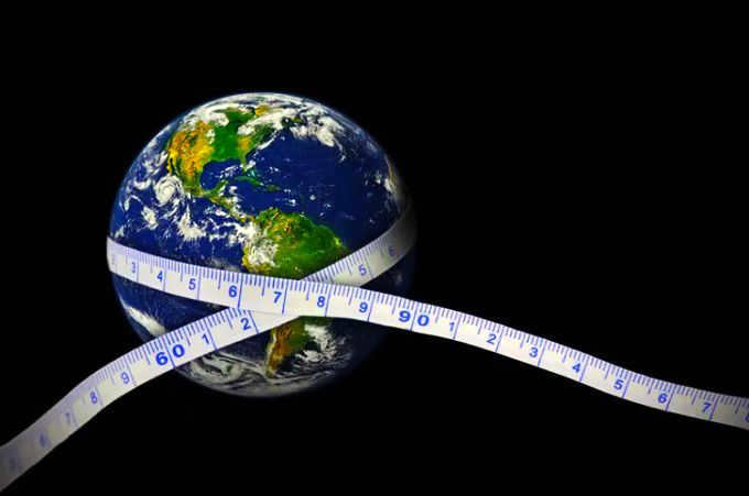
Essential Earth Characteristics
The primary distinction between Earth and other celestial bodies within the solar system is the existence of life on our planet. The following are the fundamental characteristics of our planet.
- The diameter at the equator is 12,756 kilometers, while at the poles it is 12,713 kilometers.
- The average radius measures 6,371 kilometers. At this distance from the surface lies the core’s center. The Earth’s equatorial radius is 6,378 kilometers. The distance to the Earth’s center at the poles is 6,356.5 kilometers.
- The Earth’s circumference at the equator is 40,075 kilometers, and at the poles, it is 40,008 kilometers.
- The distance from the Sun to Earth is approximately 150 million kilometers, making it an ideal location for the development and sustenance of life. If the Earth’s orbit was just a few million kilometers closer or farther away, the conditions necessary for the evolution of life would be significantly compromised.
- It takes the Earth 365 days, 5 hours, 48 minutes, and 46 seconds to complete one revolution around the Sun. In addition, it takes 23 hours, 46 minutes, and 4 seconds for the Earth to complete a full rotation on its axis. Over the course of 100 years, the Earth’s rotational speed decreases by 0.017 seconds. It would take approximately 140 million years for the length of a day to increase by one hour.
- The Earth’s axis of rotation is tilted at an angle of slightly over 23 degrees, which is the reason for the seasonal changes in climate and the distinct shift of seasons. If the axis of rotation were inclined a few degrees more or less, the Earth would experience less favorable climatic conditions, leading to the formation of glaciers over larger parts of the surface.
- The average temperature on our planet is approximately 15°C.
- About 71% of the Earth’s total surface area is covered by water, with a mass of 1,460 million billion tons. In comparison, the atmosphere weighs 275 times less, with a mass of just over 5 quadrillion tons.
- The Earth’s atmosphere is composed of 21% oxygen, while nitrogen, a biologically inert gas, makes up 78% of the atmosphere.
- The mass of the Earth is estimated to be around 6∙10 24 kilograms.
- The volume of the planet is approximately 1.08∙10 12 cubic kilometers.
- The density is 5.5 grams per cubic centimeter.
- Our nearest celestial object is the Moon, which is approximately 384,000 kilometers away from Earth on average.
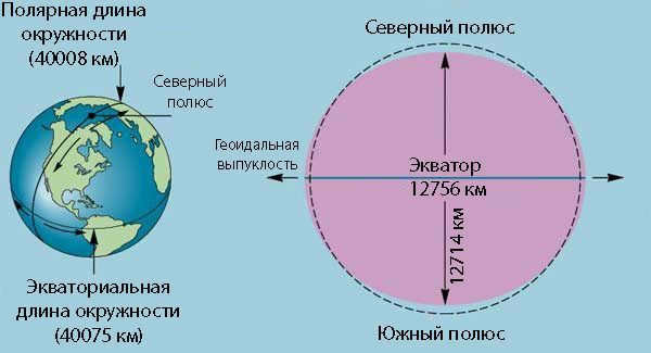
The form of the planet
When inquired about the form of the Earth, the majority of individuals will respond that it is round. Nevertheless, this is incorrect. The Earth is impacted by gravitational forces: the massive mass is drawn towards the core, creating a continuous compression. The most potent centrifugal force, which results from the Earth’s rotation around its own axis, is found at the equator.
The Earth is akin to an “irregular sphere”. Compression is the reason why the equatorial diameter of the planet is marginally larger than at the poles. Scientists categorize the shape of our planet as close to a “flattened ellipsoid”.
Interestingly, the neglect of the Earth’s compression at the poles caused the meter standard of 1795 to be 200 microns shorter.
The local geography also plays a significant role in determining the shape of a planet. However, it does not have a global impact on the overall shape of the planet. For instance, the variation between Mount Everest and the Mariana Trench is approximately 19 kilometers. This difference is relatively small when considering the planet as a whole. The highest point on Earth, taking into account the Earth’s curvature, is the summit of the Chimborazo volcano situated in Ecuador.
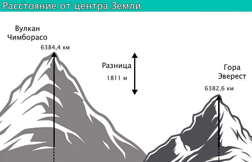
Difference in distance between the center of the Earth and the highest point of the Chimborazo volcano compared to Mount Everest
What is the equator and its purpose
The equator can be defined as a line that is perpendicular to the Earth’s axis and is equidistant from the poles on the Earth’s surface.
On this line, the length of the day is equal to the length of the night. However, due to atmospheric refraction, the day is slightly longer by a few minutes. During the equinoxes, which occur twice a year, the Sun is directly overhead at the zenith and the rays are perpendicular to the Earth’s surface. The latitude at the equator is 0 degrees.
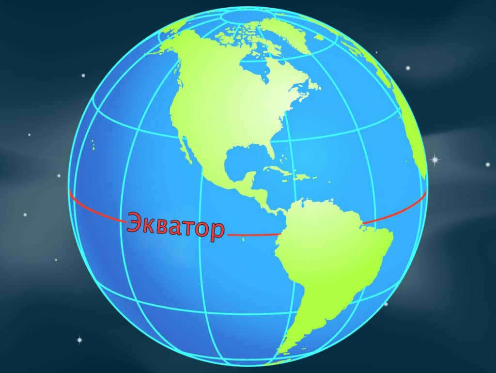
The equator plays a crucial role in determining the latitude of a geographic feature. Any point located to the south of this imaginary line is said to have a southern latitude, while any object located to the north of it is said to have a northern latitude.
Calculating the Earth’s Circumference
The size of the Earth can be calculated using advanced instruments and satellites. However, before these technologies were available, mathematical methods had to be used. In the 18th century, scientists P. Meschen, A. M. Lejeander, and C. Cassini utilized the triangulation method to measure the length of the Earth’s circumference.
Let’s imagine that we have the task of determining the distance between various points that are separated by several hundred kilometers. In order to accomplish this, we will need to establish a reference network on the ground. One effective method for doing this is by using triangles. These triangles will have vertices located at specific points of elevation. By constructing imaginary pyramids on these vertices, we can ensure that they are aligned with nearby points of interest.
The purpose of these imaginary structures is to provide a convenient means of setting up an angle gauge and calculating the degrees of the angles involved. Within one of these triangles, we can measure the length of one side by traversing level ground. This measured side will serve as the baseline for our calculations.
To determine the length of the equator, a simple approach is to multiply the number of kilometers in one degree by 360.
The process of measuring the circumference commences with the triangle, which serves as the baseline. The other sides of this shape are determined by analyzing the angles and sides. One of these sides also functions as the side of the adjacent triangle and acts as a starting point for determining the sides of yet another triangle. By conducting mathematical calculations, it becomes feasible to ascertain the parameters of the final triangle. Consequently, the value of the meridian arc can be obtained. The larger the meridian arcs, the more accurate it becomes to calculate the desired value – the radius of our planet.
Once the length of the meridian arc is known, it becomes relatively easy to calculate the length of one degree. This method serves as the foundation of geodesy.
How to calculate the radius and diameter of a celestial body
Calculating the radius and diameter of a celestial body is a simple task. To accomplish this, you can utilize the following formulas: d=l/π; r=½π. Here is what each letter represents:
- d – diameter;
- l – the circumference of the celestial body;
- r – radius (a line that extends from the center to any point on the circumference);
- π is a mathematical constant approximately equal to 3.14, which signifies the ratio of the circumference to the diameter.
The dimension in question has been known since ancient times, specifically in ancient Greece. The calculations needed to determine its length were carried out by Eratosthenes, an ancient Greek mathematician, astronomer, and geographer. Eratosthenes discovered that on June 21, the summer solstice, in the city of Siena, which is located around five hundred miles away from Alexandria, the bottom of wells would be illuminated at noon, without any shadows being cast by objects. This indicated that the sun was directly overhead in that part of the planet. However, in Alexandria, no such phenomenon was observed.
During the summer solstice, Eratosthenes measured the shadow cast by an obelisk in Alexandria (he knew the obelisk’s height). This measurement allowed him to determine that there was a 7-degree difference in latitude between Alexandria and Siena.
The astronomer conducted additional calculations. 7° corresponds to approximately 1/50th of a complete circle, which is equivalent to 360°. By multiplying the distance from Siena to Alexandria by 50, the mathematician determined that the circumference of the Earth was 25,000 miles.
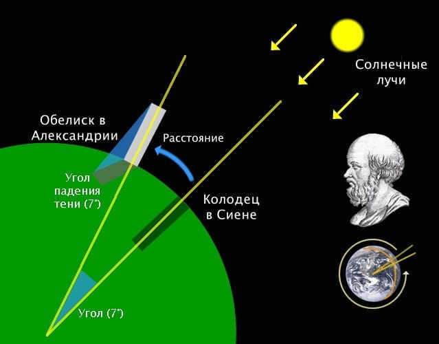
Eratosthenes conducted a measurement of the Earth’s circumference.
The calculated length of the Earth’s circumference by Eratosthenes is slightly less than the actual measurement. This discrepancy is not due to inaccurate calculations: this method of determining the Earth’s circumference is quite precise. During Eratosthenes’ time, the exact distance between the two settlements was unknown. Additionally, the scientist did not account for the fact that the two cities are situated on different meridians.
In the medieval period, the church prohibited references to such research. It was only in the 16th century, with F. Magellan’s circumnavigation of the globe, that it was confirmed that the planet does indeed have a spherical shape, and that its circumference is approximately 40 thousand kilometers.
How much time does it take to complete a full circle around the Earth on foot?
If we know the distance of the Earth’s equator, we can estimate the time it would take to walk around it. Assuming an average walking speed of 6 kilometers per hour, we can use the formula t=S/V to calculate that it would take approximately 6700 hours, or 278 days.

This is the estimated time it would take to walk around the Earth without taking any breaks. Assuming that the hypothetical pedestrian walks for 6 hours each day, it would require approximately 1110 days, which is slightly over 3 years, to complete such a journey.
Fascinating facts about the Earth’s equator
The equator experiences a consistently hot and humid climate throughout the year. The forests in the Amazon, equatorial Africa, and Indonesia are known for their diverse range of plant and animal species. The temperature during the day typically ranges between 25 and 30 degrees Celsius. Even at night, the temperature doesn’t drop significantly, as the earth’s surface retains heat from the sun’s rays.
However, the equator also boasts some intriguing geographical characteristics:
- It traverses more than 30 islands;
- It intersects 14 countries;
- The country of Ecuador derived its name from the equator;
- Most countries located on the equator have erected monuments and memorials to commemorate the zero parallel.
- In close proximity to Quito, there stands the Cayambe volcano, soaring to a height of approximately 4.7 km, boasting a peak adorned with perpetual ice. This is quite remarkable considering the equatorial climate’s reputation for constant heat.
- The Congo River, coursing through the heart of the African continent, intersects the zero parallel not once, but twice.
- Due to the Earth’s rapid orbit in this region, it serves as an ideal launching pad for satellites, allowing them to quickly accelerate to high speeds.
The size of the Earth is a fundamental parameter in the field of astronomy and holds significant practical value. By utilizing simple mathematical calculations, it is possible to determine the Earth’s diameter and radius, thereby providing valuable insights.
Geodesy, Size, and Shape of Planet Earth
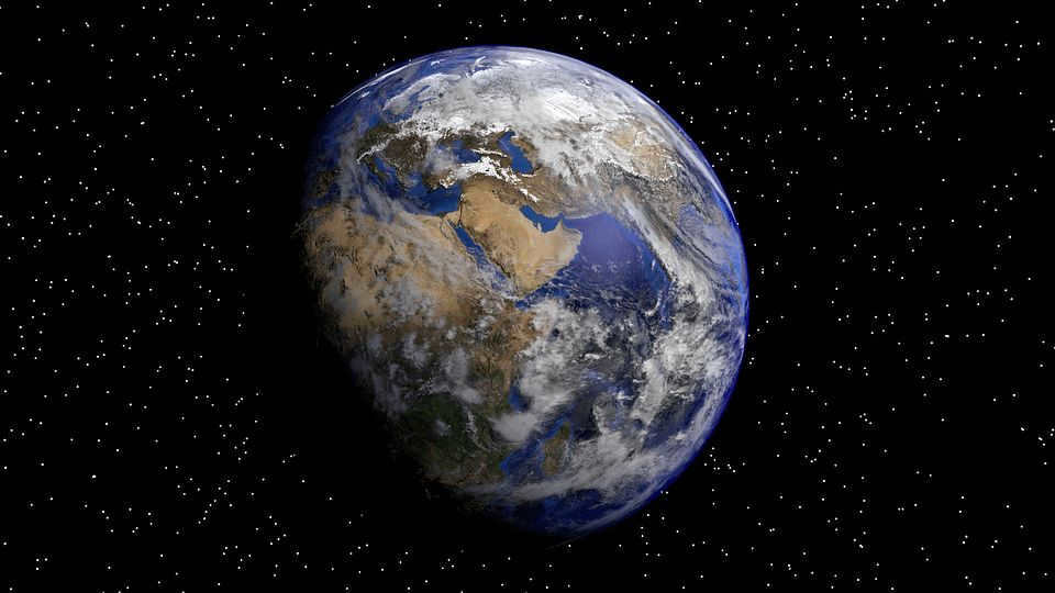
The Earth is a remarkable planet, with a mean distance of 149,597,890 km from the Sun. It is the third planet in our solar system and possesses several unique characteristics. It originated approximately 4.5-4.6 billion years ago and stands as the solitary planet known to sustain life. A combination of factors, including atmospheric composition and physical attributes like the abundance of water, which covers about 70.8% of the planet’s surface, contribute to the flourishing of life.
An additional distinctive feature of the Earth is its size. It is the largest planet among the terrestrial group, which includes Mercury, Venus, Earth, and Mars. These planets consist primarily of a thin layer of rock. In contrast, the gas giants, such as Jupiter, Saturn, Neptune, and Uranus, have different compositions. When considering factors such as mass, density, and diameter, Earth ranks as the fifth largest planet in the entire solar system.
With a mass of approximately 5.9722±0.0006×10 24 kg, Earth holds the title of being the largest among the group of terrestrial planets. It also boasts the largest volume among its planetary counterparts, measuring at 1.08321×10¹² km³.
Furthermore, Earth outshines its fellow Earth-group planets in terms of density, thanks to its composition of crust, mantle, and core. Among these layers, the Earth’s crust is the thinnest, while the mantle encompasses a whopping 84% of the planet’s volume and extends 2,900 kilometers beneath its surface. The core is the key factor behind Earth’s high density, as it consists of a solid, dense inner core surrounded by a liquid outer core.
When it comes to average density, Earth measures at 5.514×10 g/cm³. In comparison, Mars, the smallest of the Earth-like planets in the solar system, only possesses around 70% of Earth’s density.
Earth is categorized as the largest among the planets in the Earth group in terms of circumference and diameter. The equatorial circumference of Earth measures 40,075.16 kilometers, while it is slightly smaller at 40,008 km between the North and South poles. The diameter of Earth at the poles is 12,713.5 km, while at the equator it is 12,756.1 km. To put it in perspective, the solar system’s largest planet, Jupiter, has a diameter of 142,984 kilometers.
The Earth’s Shape
The Earth is not a perfect sphere, but rather a slightly flattened spheroid or ellipsoid. This is why its circumference and diameter are different. Due to the planet’s rotation and gravity, its poles are slightly flattened, resulting in a bulge at the equator. As a result, the Earth’s circumference and diameter are larger at the equator than at the poles.
The equatorial bulge of the Earth is approximately 42.72 kilometers. This bulge is caused by the combined forces of the planet’s rotation and gravity. Gravity pulls the mass of the Earth towards its center of gravity, causing it to contract and form a sphere. However, the rotation of the Earth creates a centrifugal force that counteracts this contraction, resulting in the equatorial bulge.
As the Earth spins, the centrifugal force distorts the sphere. This force is responsible for pushing objects away from the center of gravity. When our planet rotates, the equator experiences the greatest centrifugal force, resulting in a slight bulge that increases the circumference and diameter of that region.
While local topography does have an impact on the Earth’s shape, its influence on a global level is minimal. The most notable variations in local topography can be seen in Mount Everest, which stands as the tallest point above sea level at 8,848 meters, and the Mariana Trench, which lies as the lowest point below sea level at 10,994±40 meters. Despite this disparity of approximately 19 km, the difference is relatively small when considering the overall size of the planet. Taking into account the equatorial bulge, the highest point on Earth and the farthest distance from the Earth’s center is found at the summit of the Chimborazo volcano in Ecuador, making it the highest peak near the equator with an elevation of 6,267 meters.
Geodesy, which is the scientific discipline responsible for measuring the size and shape of the Earth through surveys and mathematical calculations, plays a crucial role in the comprehensive study of our planet’s dimensions and form.
Throughout the course of history, geodesy has held great significance as scientists and philosophers of the past attempted to unravel the mysteries surrounding the Earth’s shape. Aristotle, widely recognized as one of the pioneering figures in this field, was the first to undertake the task of calculating the Earth’s size, making him an early geodesist. This was followed by the Greek philosopher Eratosthenes, who provided an estimate of the Earth’s circumference at 40,233 kilometers, a measurement that aligns closely with the currently accepted value.
In order to study the Earth and utilize geodesy, scientists frequently make use of the ellipsoid, geoid, and reference ellipsoid. An ellipsoid is a theoretical mathematical construct that provides a simplified and smooth depiction of the Earth’s surface. Its purpose is to calculate distances on the surface without factoring in variables such as changes in elevation and land formations. Taking into consideration the actual characteristics of the Earth’s surface, surveyors employ a geoid, which is a model of the planet constructed using the global mean sea level and, as a result, accounts for differences in height.

