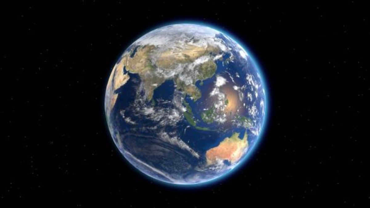
The answer to the question about the shape of the earth is quite simple. The earth is a sphere.

It is common knowledge that the Earth has a spherical shape. In other words, it is round. However, this understanding was not always prevalent. In fact, our understanding of the Earth’s shape has evolved over time. In ancient times, different civilizations had various conceptions of the Earth. Some believed that we lived on an island surrounded by water, while others thought that the planet had no boundaries at all.
Furthermore, many ancient cultures held the belief that the Earth was flat. This perspective can be found in the mythology of numerous ancient civilizations. Additionally, early Buddhism and Hinduism also subscribed to the notion of a flat Earth.

The concept of a flat Earth can be found in ancient writings of scientists and philosophers. During that time, astronomy had not yet emerged as a scientific discipline. People’s understanding of the world was largely influenced by philosophical perspectives, which were based on direct observations. As a result, individuals perceived the Earth’s shape and terrain as being flat.
This perception can be attributed to the limited visibility of the planet from an observer’s point of view. From ground level, the Earth appears to have a flat plane that extends to the horizon. It is only from a higher vantage point that one can observe the curvature of the Earth’s surface.

Naturally, with the advancement of astronomy and the exploration of planetary geography, this perspective became obsolete. It was, as we are aware, acknowledged as incorrect. And the spherical perspective received substantial evidence. Hence, officially, our abode is a spherical planet.
Therefore, the characteristics of the Earth encompass: its shape, density, age, weight and mass, climate, and temperature, among others.
As we are aware, the Earth’s color is blue. This is a consequence of the presence of water on its surface.
The ancient belief about the shape of the Earth
In antiquity, there was a prevailing belief in the spherical nature of the Earth.
It is important to mention that earlier scholars who held this belief were ridiculed. Furthermore, they were persecuted by the church. Interestingly, religion had long resisted accepting even the undeniable fact of the Earth’s shape.
Despite the opposition, Pythagoras, centuries before our era, already considered our home planet to be a sphere. Later, Aristotle, based on observations of lunar eclipses, also concluded that the Earth was round.
Moreover, Eratosthenes, the renowned astronomer-scientist, made calculations to determine the radius of the Earth. Isaac Newton, on the other hand, inquired about the Earth’s shape and put forth the concept of it being ellipsoidal.
However, it wasn’t until the introduction of the general model of the universe that this fact became widely accepted. Nowadays, there is a wealth of evidence supporting the spherical shape of the Earth.
The Modern Theory: What Shape is the Earth?
Presently, the field of astronomy largely agrees on the Earth’s spherical shape. However, this approximation is only accurate up to a certain degree, typically within a 0.5% margin of error.
In reality, our planet is not a perfect sphere, as it is slightly flattened at the poles. This is a result of its daily rotation, which leads to differences in continent heights and surface distortion.
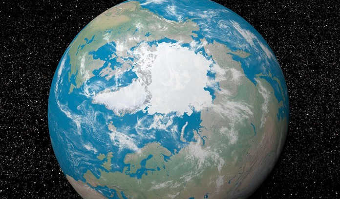
When discussing the form of a planet, it is common to refer to an ellipsoid of rotation or a geoid, which represents the surface that is perpendicular to gravity.
Nowadays, we have the ability to observe our planet from outer space, enabling us to witness its physical features. Moreover, we can visualize our position within the solar system, giving us a greater understanding of our home. Undoubtedly, people have always held a keen interest in learning everything there is to know about it.
The Society Dedicated to the Belief in a Flat Earth
Despite the vast amount of modern scientific evidence and technological advancements, there exists a group of individuals who firmly believe in the concept of a flat earth. This belief is so strong that it has even given rise to an organized society known as the Flat Earth Society. Unsurprisingly, this society is comprised of individuals who adhere to the notion of a flat earth.
The Core Tenets of the Society:
- The Earth is a flat disk with a diameter measuring 40 thousand kilometers.
- The center of the Earth is situated at the North Pole.
- The existence of the South Pole is deemed to be a fictitious construct.
- All celestial bodies and space objects are positioned above the surface of the Earth.
- The notion of gravity is completely dismissed and refuted.
- According to this belief system, the planet is perpetually moving upwards, resulting in a constant free-fall acceleration.
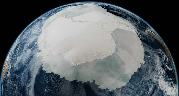
- Antarctica is thought to be an icy barrier encompassing the entire edge of the flat Earth.
- All scientific knowledge, photographs, and images are deemed to be fraudulent and fabricated.
- The society perceives all scientific endeavors and discoveries as elaborate human experiments.
Surprisingly, those who have faith in this phenomenon are providing their own proof for what is occurring. They even turn to the Bible. It is pointless to debate with them. As the saying goes, people believe what they believe.
And after these events, I witnessed four angels positioned at the four corners of the globe, holding back the four winds of the earth, preventing the wind from blowing upon the land, sea, or any tree.
Bible
However, rejecting scientific knowledge is merely an alternative perspective on the world around us. It is impossible to compel an individual to accept it. Nevertheless, solid and well-established facts serve as evidence.
The Earth, known as the blue planet within the solar system, serves as our habitat. It possesses a rich chemical composition and its resources are still not fully explored. Despite this, humanity has managed to utilize them in various aspects of life.
Since the dawn of human curiosity about the nature of our planet, numerous models have been proposed. From the fantastical to the plausible, these models shaped the worldviews of entire civilizations.
In ancient times, when travel over long distances was rare, it was challenging to arrive at a reasonable conclusion. Thinkers resorted to comparing the shape of the Earth to familiar objects, offering philosophical rather than scientific explanations. One such example is the ancient Greek philosopher Xenophanes, who believed that the Earth resembled a colossal stump, with roots extending into the depths of space to provide support.
As previously mentioned, Aristotle, a brilliant thinker of antiquity, came closest to the truth with his assumption. Through logical reasoning and remarkable scientific insight, he deduced that the Earth is a spherical object.
The authority of Aristotle was immense. However, as time went on and more data accumulated, it became clear that some things could not be explained based on the ideal form of the planet. In the late 17th century, French astronomer J. Richet embarked on a journey to various continents. He brought with him a clock, with a carefully selected pendulum length for accurate timekeeping. In Guiana, he noticed that the clock was falling behind, so he adjusted the length of the pendulum using the guidance of celestial bodies, restoring its precision. When he returned to Paris, he was once again surprised to find that the clock was now running fast. This led the astronomer to conclude that there must be some external factor affecting the clock.
Gradually, a series of reports validating Richet’s findings started to emerge. It reminded me of Newton’s assertions regarding the Earth’s flattening at the poles and the pendulum’s capacity to oscillate at varying speeds across different regions of the globe. It became apparent that the pendulum swings more vigorously in areas where the distance to the Earth’s center of gravity is shorter, whereas it swings slower in areas where the distance to the Earth’s center of gravity is longer. Consequently, this raises the question of what should be deemed the actual shape of the planet?
During that time, Giovanni Cassini held the position of director at the Paris Observatory (which was known for its expertise in the study of the Earth and planets). However, his research was not thorough and comprehensive enough. It was his son who eventually formalized the conclusion that contradicted Newton’s theories and stated that the Earth had an elongated shape, similar to that of an egg or a lemon. Despite this, the scientific community did not support this viewpoint, and research on the topic continued.
Additional investigation revealed that scientists have determined that the Earth’s shape is actually an ellipsoid of rotation, with a discrepancy of 21 km between the equatorial and polar radii. If our planet were uniform and motionless, it would naturally assume a spherical shape due to the gravitational forces acting upon it. However, in reality, things are a bit more complicated: external factors, such as the Earth’s rotation on its axis and around the sun, introduce centrifugal forces that cause the spherical shape to distort, resulting in an ellipsoidal shape.
Nevertheless, the ellipsoid of rotation does not provide the most precise depiction of our planet’s shape. Advances in science, the advent of highly sensitive instruments, and the advent of human space travel have altered this perspective, or rather, provided greater clarity. In fact, the internal structure and surface of our planet are in a constant state of flux, with the distribution of matter throughout the planet’s thickness being uneven and density gradually increasing towards the core. As a result, it is impossible to discern any patterns in the distribution of densities.
The ellipsoid of revolution is a diagrammatic depiction of the form of our planet
This non-uniformity causes a displacement in the action of gravitational forces, and as the planet’s surface is a result of the cumulative impact of gravity, its geometric uniformity is disrupted and imparts to the Earth an irregular and intricate shape that is challenging to characterize.
Nowadays, it has become common practice to compare the shape of the Earth to a geoid – a shape that is created by tracing the surface of the oceans and extending it beneath the continents. The level of the World Ocean is the most accurate representation of the Earth’s surface, as it is directly influenced by gravity. The geoid is a unique shape that is specific to our planet. The differences between the geoid and the rotational ellipsoid are quite significant, as the geoid rises on land and sinks in the oceans. Additionally, there are variations in relief on the relatively flat equator, with an average difference in elevation of 200 meters.
Geoid deviations compared to the rotational ellipsoid
It is important to note that the most recent data do not contradict the views of Aristotle, Newton, and other researchers. It is commonly stated that in the first approximation, the Earth can be considered a sphere, in the second approximation – a sphere flattened at the poles, in the third approximation – a rotational ellipsoid, and in the fourth approximation – a geoid. However, even the fourth approximation should not be regarded as the most precise. The surface, thickness, and deep interior of our planet are constantly changing, which naturally affects its shape.
Related articles
Our planet
Our planet – How old is Earth and where did it come from? – Understanding the composition of our planet – Exploring the lifespan of Earth – Unraveling the mysteries of Earth’s shape – Debunking misconceptions about our planet – Investigating changes in Earth’s axial tilt – Comparing the characteristics of Earth’s poles – Examining Earth’s ecological systems – Unraveling the complexities of Earth’s weather patterns.
Planet Earth.
Planet Earth In the eyes of Roman authors, the term “Germania” was closely associated with vast stretches of “woodland” and “swampland.” Tacitus succinctly captured the Romans’ perception of the territories occupied by the northern barbarians: “While the landscape may exhibit some variations in certain areas, overall it is both terrifying and
The Kingdom of Aparia
In the year 1542, a Spanish brigantine sailed towards the meeting point of three majestic rivers. “The currents of one river clashed with the currents of another, causing our ship to be tossed back and forth, while countless uprooted trees floated towards us from all directions,” chronicled the expedition’s historian. At every moment, the vessel was at the mercy of the powerful forces of nature that surrounded it.
In 1795, Mungo Park arrived in Mandingo Land after disembarking from his ship at the Gambia River mouth. With the assistance of an interpreter, guide, and servant, he ventured into the unexplored territory. The expedition journeyed through the Mandingo people’s lands, where vast herds of goats and cows roamed and antelope could be spotted in the savannah.
The Land of Promise
The sailor’s spirits were lifted by the gentle breeze that arrived four days later, filling him with a glimmer of hope for salvation. Where could the Promised Land be? The next morning, it revealed itself, surrounded by vibrant vegetation. John was filled with uncertainty. His calculations indicated that New Hebrides was still a week away. Perhaps it was indeed the long-awaited Promised Land.
CHAPTER IV. PLANET EARTH
CHAPTER IV. PLANET EARTH … The region of freezing temperatures extends far and wide – an untamed and desolate territory, plagued by never-ending storms and hailstorms. This hail, which never thaws, accumulates into massive hills, resembling the remnants of ancient structures. The layers of ice and snow here seem to have no end[82] Milton, “The Lost”
Earth and sky
During the Bronze Age, novel religious concepts that had permeated Scandinavia towards the end of the Neolithic era gradually disseminated throughout the Northern regions. One significant development was the veneration of the deity of the sky. The inhabitants of ancient societies directed their attention towards this new form of worship.
EARTH AND SEA
In his book “Earth and Sea: Reflections on World History,” the renowned German political scientist Carl Schmitt stated: “In addition to the ‘autochthonous,’ or those born on land, there are also the ‘autothalassic,’ or exclusively sea-determined peoples who have never been born on land.”
15. Europe is often referred to as the navel of the earth, but that’s not the whole point. If the globe has a rear end, then surely this place is it. ………………………………………….. Oh my, why even talk about summer when we have a brand new world to call home.
New Earth
Thirty years ago, the strategic goal of the Leningrad Region was to ensure that the population, especially those living in the city, had access to potatoes, vegetables, milk, and meat. And even now, I know from personal experience, that residents of Saint Petersburg prefer to buy local produce, such as Gatchina potatoes, vegetables, milk, and meat, just like my wife and I do.
Planet Earth
Planet Earth possesses a remarkable and divine attribute of fertility. Unfortunately, there are groups of individuals who fail to recognize and harness this inherent quality. Planet Earth holds not only economic significance but also moral importance. Various authors have eloquently expressed this notion
The Earth’s shape is not spherical
Man’s understanding of the world started with observation – the flow of rivers, the flight of birds, the appearance and disappearance of the sun, the changes in the moon, and so on. Over time, man began to seek an understanding of the true nature of the planet he inhabits. It is evident that the earth is not perfectly spherical.
The Earth is a sphere
Ever since the inception of human curiosity about the nature of our planet, there have been innumerable depictions of Earth. These depictions, ranging from fantastical to plausible, have shaped the worldviews of entire nations and civilizations.
My Planet!
My Planet! Behind the forest owned by the count lies a vast field adorned with lush, emerald greenery. It is here that the first delicate sprouts of young wheat emerge! Although still small in stature, they grow so densely that the gentle breeze sways them rhythmically, creating a mesmerizing undulating motion.
Both in textbooks and in depictions of that era, our planet is portrayed as being round. However, this perception is not completely accurate. The true shape of the Earth is actually different. Many individuals are curious about the actual shape of our planet.
As a result, we have decided to dedicate this article to informing you about the authentic shape of the Earth, its distinct features, and the rationale behind its portrayal.
The actual form of the planet Earth
Despite being seemingly surprising, the Earth is not perfectly spherical. Instead, it is flattened at the poles and bulges at the equator. This unique shape is referred to as a geoid and is the product of various contributing factors. These factors encompass the Earth’s rotational motion, gravitational pull, and the distribution of its mass. In simpler terms, the shape of the Earth is influenced by its own gravitational force and the way its mass is distributed.
To gain a deeper understanding, envision the Earth as a ball of clay spinning on its axis. Due to the rotational force, the clay material is pushed outward at the equator, causing a slight flattening at the poles.
Exciting findings
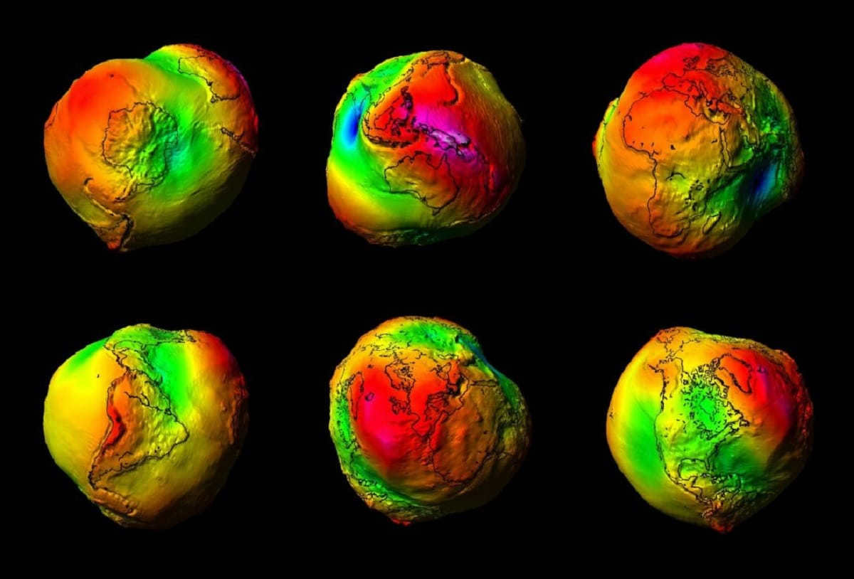
The composition of the Earth’s mass is not consistent throughout. Variations in thickness of ice sheets, the movement of groundwater, the slow flow of magma deep within the Earth, and other geographic factors contribute to these differences. As a result, the Earth’s gravitational field is also not uniform. However, these variations are relatively small, amounting to less than 1% between the most extreme points. A NASA mission called GRACE (Gravity Recovery and Climate Experiment), named after a female scientist, conducted extensive measurements to map the Earth’s uneven gravity field. The resulting map depicted a highly distorted sphere in India, representing the significant gravitational differences across the planet.
The Earth has a shape that resembles a potato, according to scientific research. In a fascinating demonstration, the European Space Agency (ESA) has created a video simulation to visualize the Earth’s gravity map. This simulation is based on data gathered by the Gravity Field and Steady State Ocean Circulation Explorer (GOCE), a five-meter Arrowhead probe operated by the ESA. GOCE has been orbiting in low Earth orbit for nearly two years, collecting valuable information about the planet’s gravitational field and its global impact.
According to the research team responsible for GOCE, it has been explained that the Earth is essentially a geoid. One could describe our planet as having a surface that would prevent a ball from rolling if placed on it. Another definition, which may be more precise but also more technical, is that a geoid’s shape encompasses all areas where the gravitational field is vertical. If we were able to traverse the geoid on a larger scale, we would observe that gravity consistently points directly downwards. However, it is important to note that the weight of an object may not be the same at all points, as gravity varies across different locations.
The Earth’s gravity varies across its surface
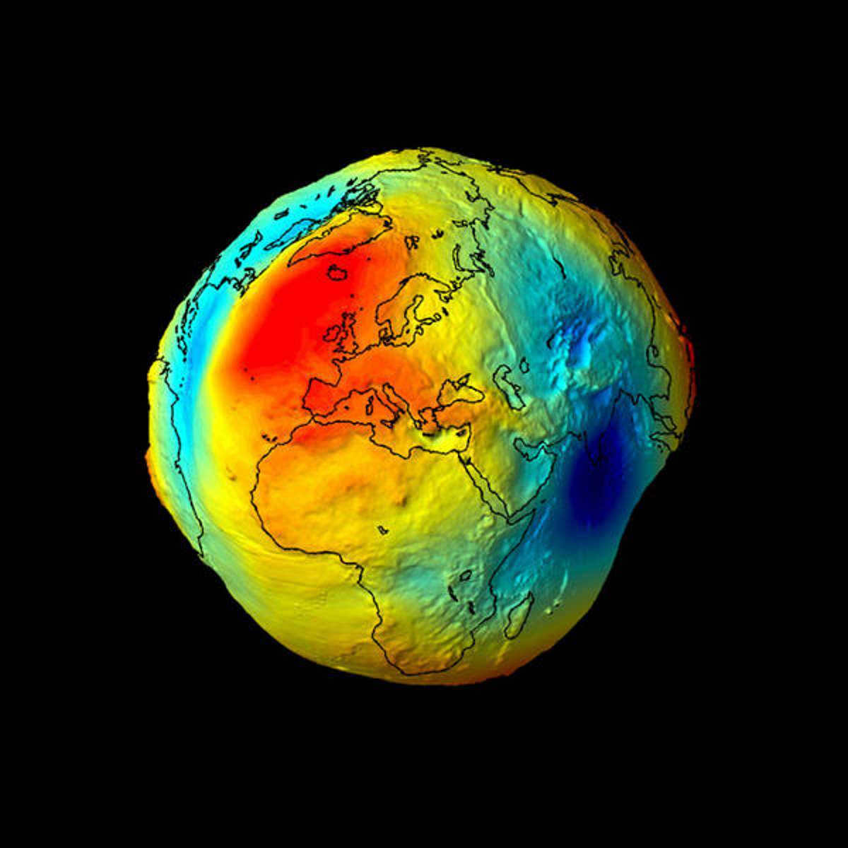
The Earth takes the shape of a geoid due to various factors. One such factor is the flattening of the poles caused by centrifugal force. However, as observed, the Earth is not a perfect ellipsoid either, as its surface is characterized by varying landforms.
Mountains and valleys are examples of asymmetrical rock formations with two rectilinear thrusts. This uneven distribution of mass affects gravity and contributes to the Earth’s asymmetrical shape, resulting in it being classified as a geoid.
One aspect that is often overlooked when considering the Earth’s shape is the extensive coverage of water on its surface. Although the ocean floor remains largely unexplored, it is known to contain various landforms. Furthermore, it is important to note that not all oceans are the same, and as a result, water levels vary across different regions due to differences in salinity.
It is crucial to understand that the geoid, which represents the Earth’s equipotential surface, does not accurately depict the true shape of our planet if the oceans were removed. Rather, it represents the surface where gravity is perpendicular at all points (which explains why a ball doesn’t roll, experiencing only downward acceleration), regardless of other influencing factors.
One of the most crucial points to consider is that when studying the actual shape of the Earth, photographs often exaggerate the height or depth of valleys and hills by a factor of 7000 compared to reality. This is in stark contrast to the Earth itself, where the difference between the highest point (Mount Everest at 8,848 meters) and the lowest point (the Dead Sea at -429 meters) is quite significant. In reality, the geoid ranges from -106 to 85 meters, with only minor irregularities of around 200 meters.
By understanding these facts, you can gain a deeper understanding of the true shape of our planet and its unique characteristics.
Please note that the content of this article adheres to our editorial ethics guidelines. If you spot any errors, please click here to report them.
For more information on the actual shape of the Earth, please refer to the full article summary: Network Meteorology " Meteorology " Science " the actual shape of the earth
Planned educational outcomes
Ancient concepts regarding the Earth’s shape, evidence supporting its sphericity, the equator’s length, the polar and equatorial radii, and the impact of the Earth’s shape and size on the planet’s existence.
Learning objectives to be addressed
Practical activities to demonstrate the decrease in the angle of the sun’s rays from the equator to the poles.
Key concepts covered in the lesson
Equator, equatorial and polar radii, geoid.
Type of ICT resources utilized in the lesson
ORGANIZATIONAL STRUCTURE OF THE LESSON
1 STEP Knowledge activation
What educational outcomes will be achieved / (What SDIs will be formed)
Welcoming students and guests. Preparing for the lesson – let’s mentally motivate ourselves to succeed.
Can you think of any factors that may have hindered ancient civilizations from creating a globe?
Furthermore, what were the prevailing beliefs regarding the shape and size of the planet during that time?
Here are three sections that discuss the various theories about the shape of the Earth held by ancient peoples.
What do you all know about the shape and size of our planet?
Let’s write down our assumptions about the shape and size on the board.
Back then, people were unaware of the actual shape and size of our planet.
These are some of the suggestions made about the shape of the Earth in ancient times.
Let’s make some educated guesses about the shape and size of the Earth.
STEP 2: Create a problem-solving scenario
What if our assumptions are incorrect as well? Shall we verify them?
Now, let’s write down the topic and objective of our lesson.
Using the textbook’s section “You will learn” on page 39, let’s formulate the topic and goal of the lesson.
If people were unaware of the Earth’s shape in the past, and now we have a globe on our tables, what was the initial problem that needed to be solved?
1. Determine how people discovered the shape of the Earth.
5 STEP “Discovery” of new knowledge (Learning a new topic).
Let’s explore how people determined the shape of the Earth.
After reading the text, discuss as a group how to complete the chart:
E.P. – Evidence of Sphericity.
Presentation – Assignments – Shape of the Earth – 3 slides.
“Proof One Slide with a description of the sunset, the ship, the moon.
However, this only demonstrates that the Earth’s surface is simply convex – and nothing more.
Another ancient Greek scholar, Aristotle, mentions as evidence the rounded shape of the Earth’s shadow on the moon during eclipses.
However, a circular body can also produce a circular silhouette.
However, if the Earth were not shaped like a sphere, but instead like a watermelon or a squash, meaning it would either be elongated or flattened, it would still be possible to circumnavigate it.
The spherical nature of our planet is ultimately confirmed by images taken from space.
Through the use of artificial satellites, scientists have been able to accurately determine the size and shape of the Earth.
Illustrate the Earth’s shape based on the knowledge we have acquired.
Nevertheless, this is not entirely accurate. The Earth is not actually a sphere! – scientists would protest. To address this issue, we will closely examine the dimensions of the Earth.
Presentation – Theory – Dimensions of the Earth – Slide 1.
How can we provide evidence that the Earth is not a spherical object? (Interestingly, even the renowned British mathematician and astronomer Isaac Newton posited the idea that the Earth should possess a flattened shape. This is due to its rotation, akin to that of a massive wolf, around its axis, resulting in an ellipsoidal form of rotation).
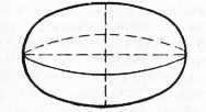
Let us state a conclusion: the Earth is flattened at its poles, resembling an ellipsoid of rotation. Let us depict it.
However, the surface of the ellipsoid is flat, while the Earth’s surface exhibits mountains, depressions, and thus the ellipsoid assumes the shape of a geoid. This is the true shape of our planet.
Folks, are you in agreement that the Earth is a perfectly spherical object?
Allow us to introduce a new concept – the geoid.
Let us illustrate the actual shape of the Earth – the GEOID.
What is the significance of the Earth’s shapes and sizes in the planet’s existence? The textbook material and practical exercises according to the plan will assist us in understanding this.
Conduct practical exercises with a gnomon. – Work in teams. (The length of the shadow is dependent on the angle at which the sun’s rays hit.)
If the light source is positioned above the object (zenith) – there is no shadow. There is also more heat.
If the angle at which the rays hit is small, there is a shadow – and less heat.
Experiments confirm the decreasing angle of the rays from the equator to the poles.
Write down in your notebook the consequences of the size and shape of the earth.
Read the first section of paragraph 11.
Working in teams – Evidence supporting the spherical shape of the earth: provided and actually proven.
Globe experiment – a ship emerges from beyond the horizon.
A round sheet is placed in front of a lamp to conduct a shadow experiment.
Try experimenting with a pencil case or any other object.
Create a simplified shape of the Earth by drawing a globe.
Learn about the equator and its length, as well as the areas of the Earth and the equatorial and polar radii.
Now let’s calculate the difference between these two radii, which amounts to 21 km!
Next, draw an ellipsoid of rotation.
However, keep in mind that the Earth’s surface is not perfectly even due to the presence of mountains, plains, and depressions.
The force of gravity holds the atmosphere and the hydrosphere in place.
Different angles of sunlight incidence result in varying temperatures and natural conditions.
Follow these 6 steps to learn and implement the plan. Consolidate your new knowledge through practical tasks and independent performance.
Finally, reflect on the lesson and summarize what you have learned in step 7.
Assess our progress. What was the original plan? Did everything go according to plan? What aspect did you find most enjoyable? Let’s capture a group photo.
Get ready for the quiz on Section II – Earth in the Universe.
Create a cardboard circle with a diameter of 4-5 cm and pierce it with a nail that is 2 cm long. This will result in the creation of a basic tool – a gnomon;
Illuminate the globe using a bright lamp;
Position the gnomon in a location on the globe where it will not cast a shadow;
Move the gnomon across the surface of the globe towards the North and South Poles;
Draw conclusions about how the length of the shadow changes.
Create a cardboard circle with a diameter of 4-5 cm and pierce it with a nail that is 2 cm long. This will create a simple device – a gnomon;
Illuminate the globe with a bright lamp;
Position the gnomon in a location on the globe where it will not be shaded;
Shift the gnomon across the surface of the globe towards the North and South Poles;
The planets in the solar system differ in size. The terrestrial planets (Mercury, Venus, Earth, Mars) are made of solid material and are relatively small. The gas-giant planets are characterized by their massive size.
1. What is the most compelling proof of the Earth’s spherical shape?
The most compelling proof of the Earth’s spherical shape comes from observations, images, and measurements of the Earth taken from space.
2. How have people’s perceptions of the Earth’s shape evolved?
Initially, the concept of the Earth’s shape was not immediately grasped by people. In India, it was believed that the Earth was akin to a half ball, held up by elephants or giant turtles. The Greeks, on the other hand, envisioned the Earth as a convex disc. However, even the Babylonians and ancient Indians had inklings about the Earth’s convexity. Over time, evidence supporting the spherical nature of our planet gradually accumulated. Notably, Aristotle and Pythagoras regarded the Earth as a sphere.
3. What are the indicators that define the Earth’s size? Provide the values for these indicators.
The following indicators define the dimensions of the Earth: the polar radius – 6357 km, the equatorial radius – 6378 km, the length of the equator – 40076 km, and the Earth’s surface area – 510 million km2.
4. How does the shape and size of the Earth impact the planet’s existence?
The Earth’s size enables it to contain air and water, which facilitates the existence of life. Because of its spherical shape, the sun’s rays hit the Earth at varying angles, leading to the formation of diverse climatic conditions. The Earth’s temperature rises from the poles to the equator. Consequently, distinct climates give rise to diverse natural conditions.
What causes the changing of seasons on Earth?
What led to the invention of the globe? Why is it referred to as a three-dimensional representation of the Earth?
Can humans perceive the Earth’s rotation?
What are some types of rocks? How do they differ in their properties?
What are the effects of the Earth’s rotation on its axis?
Explain the use of horizontals and bergstrokes in determining the direction of elevation change in a terrain.
Discuss the effects of the Earth’s motion around the Sun.
Is it easier to observe the ground in a city or in a rural area?
Which position does the Earth hold in relation to the Sun? Which planets surround it?
Weather and Climate. Enumerate the factors that shape climate.
If you found this material interesting and helpful, feel free to share it with your friends!
About our Website
Our website offers a wide range of helpful calculators, converters, and tables, as well as valuable reference materials in various fields of study.
Utilizing the appropriate online tools is the simplest and most efficient way to perform calculations on the web. You can easily find the perfect tool for your needs by using our search function.
This website incorporates LaTeX technology, ensuring accurate rendering of formulas and expressions. Please be patient and allow the page to fully load for optimal display.
The impact of Earth’s size on life:
Earth possesses sufficient gravitational force to retain air and water, making life on the planet feasible.
The effect of Earth’s shape on life:
The sun’s rays strike its surface at varying angles. Near the equator, the Earth’s surface is heated more intensely, while at the poles, it is heated more weakly. As a result, the Earth undergoes a change in natural conditions as it transitions from the equator to the poles.
How to compose a quality response? How to compose a quality response?
- Provide a correct and precise answer;
- Elaborate and clarify the answer for maximum usefulness;
- Write proficiently, as answers free of grammatical, spelling, and punctuation errors are better comprehended.
The Navigator is a masculine noun that can have several synonyms.
1. Sailor. The elderly sailor gazed out into the distance, contemplating the upcoming perilous journey;
2. Argonaut. The Argonaut was dressed in tattered pants, and his shirt carried the scent of the sea and salt;
3. The Seafarer. The seasoned mariner knew that many vessels had met their demise in this location, as there were sharp rocks lurking beneath the water’s surface;
4. The sea wolf. The weathered sea wolf felt a sense of joy, as he was about to embark on a lengthy voyage.

Ancient Indian perspective on the form of the Earth
What were the alterations in notions regarding the shape of the Earth?
During the era of ancient Greece in the ninth to eighth centuries B.C. (Homer’s era), the Earth’s shape started to be depicted as a convex hemisphere, akin to a warrior’s shield. The Greeks held the belief that the land was surrounded by the ocean on all sides.

Illustration of the Earth and the Cosmos during the time of Homer
In the 6th century B.C., Pythagoras and his followers asserted that the Earth was a spherical shape. It is believed that Pythagoras acquired this knowledge from Egyptian priests, who kept their discoveries hidden unlike the philosophers of ancient Greece. However, Pythagoras was unable to provide evidence for his hypothesis. The first concrete evidence for the Earth’s spherical shape came from Aristotle in the 4th century BC. Some of his observations were accurate, while others were incorrect. We will discuss this in more detail later. Aristotle supported his argument for a spherical Earth with the following observations:
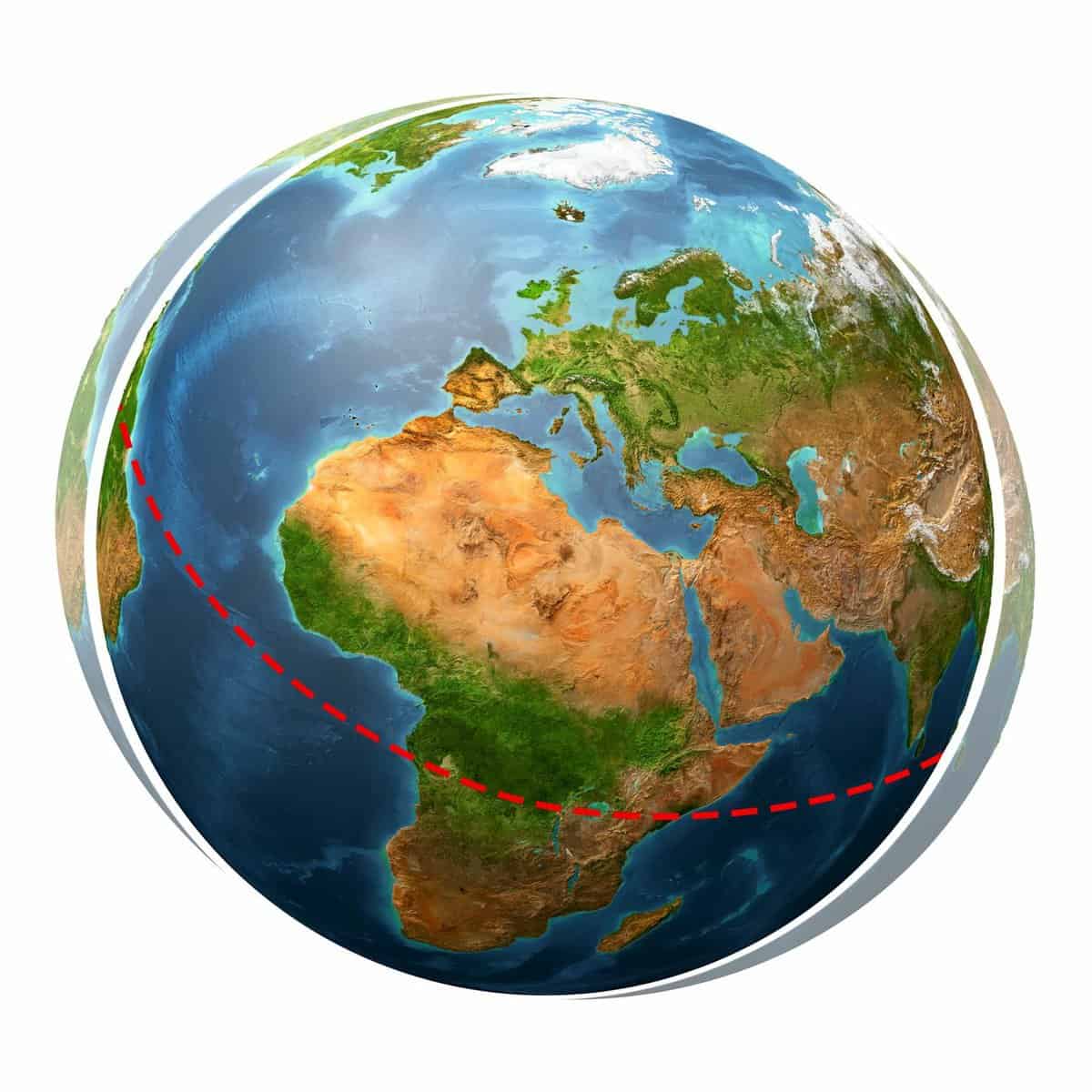
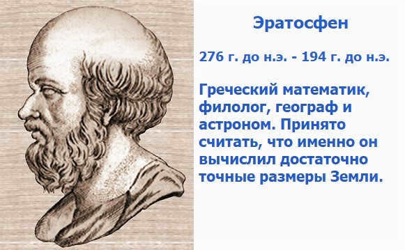
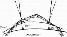
Over time, the understanding of the Earth’s spherical shape shifted from being based solely on observations to incorporating accurate calculations. The ancient Greek scientist Eratosthenes (III-II centuries BC) was the first to calculate the Earth’s size. He accomplished this by determining the arc length of the 1° meridian.
Eratosthenes made an intriguing observation in Siena (Aswan) during the summer solstice on June 21. He noticed that the Sun’s rays illuminated the bottom of the deepest wells, indicating that it was positioned directly overhead at the zenith. The angle of incidence of the Sun’s rays was measured to be 90 °. In Alexandria, however, the Sun was observed to be at an angle of 7°12′ from the zenith, which corresponds to 1/50th of a circle. By measuring the distance between Siena and Alexandria and multiplying it by 50, Eratosthenes was able to calculate the length of the Earth’s meridian, and subsequently its radius. The values he obtained differ from modern calculations by less than 25 kilometers.

Eratosthenes of Cyrenaica made significant calculations.
As a result, the ancient Greek scientists had reasonably accurate concepts regarding the Earth’s shape and size. However, their geographical maps were flawed due to limited knowledge and insufficient exploration of land and ocean during that era.
During the Middle Ages, which lasted until the 15th century, a significant portion of the scientific knowledge inherited from ancient civilizations was suppressed due to the overwhelming influence of the church. The burning of the Alexandrian library had a devastating impact on scientific progress, halting almost all ongoing research. The belief in the Earth’s sphericity was deemed heretical and vehemently dismissed. It was only through the rediscovery of meridian length measurements by Arab and Chinese scholars that Europeans were able to regain this knowledge, which they had acquired from these cultures.

During the Middle Ages, European society held various beliefs about the shape of the Earth. However, with the onset of the Renaissance in the late 15th century, there was a significant shift in knowledge acquisition across all scientific fields. This period marked the beginning of the Great Geographical Discoveries, which expanded our understanding of the Earth’s horizons.
- Christopher Columbus, in his search for a western route to India, discovered the New World (America) in 1497.
- Vasco da Gama successfully navigated a route to India around Africa in 1497.
- Ferdinand Magellan and his crew achieved the first circumnavigation of the globe from 1519 to 1522.
The confirmation of this theoretical assumption came from the following observation. In 1672, French astronomer J. Richet was sent to Cayenne (French Guiana) to study Mars during the Great Confrontation. He brought along a clock with a pendulum that swung once every second. However, when he arrived in Cayenne, the clock started to fall behind and he had to shorten the length of the pendulum. On the other hand, when he returned to Paris, the clock started to run fast. I. Newton explained this phenomenon by attributing the slowing down of the pendulum swing to the decrease in gravity caused by the increase in centrifugal force when moving from temperate latitudes to equatorial latitudes.
In the 19th century, the French Academy of Sciences conducted two expeditions to measure the arc length of the 1-degree meridian. One expedition was sent to the Arctic Circle, while the other went to the equatorial regions. The results showed that at the pole, the meridian had a length of 11.7 km, while at the equator it measured 110.6 km. This confirmed Newton’s hypothesis.
A spheroid, or an ellipsoid of rotation, refers to a sphere that is flattened at the poles but maintains uniformity. The Earth’s compression is minimal, with the equatorial radius being only 21.4 km longer than the polar radius.

Exploring the dimensions and form of our planet. The Earth is best described as an ellipsoid of rotation.

The Earth’s Size, Shape, and Other Characteristics
The Earth’s true surface, with its mountains and valleys, does not exactly match the geoid’s surface and is several kilometers away from it. The actual surface of the planet, with its mountains and valleys, is constantly affected by gravity, which seeks to even it out and align it with the flat surface.
The calculations conducted by F.N. Krasovsky (1940-1946) to determine the dimensions of the Earth revealed a small difference between the geoid and spheroid. As a result, the USSR adopted the dimensions of the Earth’s ellipsoid, which was named after the head of the research. The dimensions of Krasovsky’s ellipsoid are as follows:
- Equatorial radius – a = 6378.2 km;
- Polar radius – b = 6356.8 km;
- Polar compression – (a – b) : a = 1/298;
- Meridian length – 40008.5 km;
- Equator length – 40075.7 km;
- Surface area of the Earth – 510 million km².

Upon analyzing space images of the Earth, researchers have discovered that the northern polar radius is slightly larger than the southern radius, with a difference of 30-100 meters. These findings, while interesting, are not significant enough to affect practical applications, as they align closely with the measurements of the Krasovsky ellipsoid. However, with further dimensional refinement, it has been revealed that the Earth actually has a cardioid shape. Nevertheless, for the purpose of analyzing most geographical processes, it is still appropriate to consider the Earth as a sphere.
Signs of the Earth’s Roundness
Currently, the following are considered scientific evidence supporting the idea that the Earth is round.
- Photographs and measurements taken from space by artificial satellites at various distances and flight paths around the Earth.
- Angle measurements taken from the Earth’s surface.
- Lunar eclipses.
Signs of the Earth’s roundness, identified in ancient times, include objects gradually disappearing behind the horizon, an expanding field of view when ascending, changes in the visible night sky when moving along the meridian, global circumnavigation, and the illumination of tall objects after sunset and before sunrise. However, these signs only indicate the Earth’s convexity, not its true sphericity.
The importance of Earth’s spherical form
The size and form of Earth hold significant geographical importance. Its spherical shape leads to a reduction in the angle at which the sun’s rays hit the surface, from lower latitudes (equator) to higher latitudes (poles). Consequently, this gives rise to a key geographical pattern – the zonal distribution of climatic zones across the Earth’s surface. These climate zones, alongside other factors such as Earth’s distance from the Sun, its mass, and size, contribute to consistent variations in natural phenomena and processes from the equator to the poles.

The incident angle of the Sun’s rays on the Earth
The gravitational force of the Earth, determined by its mass and size, is responsible for holding the water and air layers together, enabling the development of life on the planet. The distance from the Sun is another fortuitous occurrence for all life on Earth. If the Earth were positioned closer, it could have turned into a scorching desert; if it were farther away, it could have been covered in a permanent ice shell.
A spheroid configuration concentrates the maximum mass of substance at the minimum volume. The matter of the planet is compressed, with the central nucleus forming inside and the layers forming outside. The layer structure of the Earth is one of its most fundamental characteristics. The spherical shape of the layers, including the geographical one, determines the infinity and unity of space.
The deviation of the true shape of the Earth (geoid) from the elliptical shape causes the substance of the Earth to disperse in order to attain a state of equilibrium. Consequently, regions with a tendency to sink and rise appear on the Earth’s surface, and fault zones are created between them.
You will find this fascinating
Have you ever wondered why the Sun always rises in the east and sets in the west? In ancient times, the Egyptians believed that this was due to the movement of the god…
Have you ever wondered why we have summers and winters? Why do they not occur simultaneously all over the Earth?…
The Earth is crisscrossed by a series of lines that divide its surface into quadrilaterals – this is known as the degree grid. This network…
Take a moment to ponder this! When is the best time to start orienteering – before embarking on a hike or when you’re already lost? What are some strategies to…


