
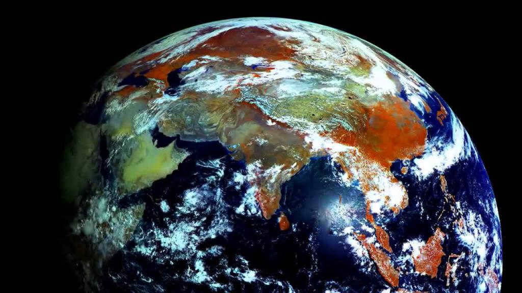
The Earth is positioned as the eighth planet in our solar system, and it is situated about 150 million kilometers away from the Sun. Along with Mercury, Venus, and Mars, Earth is classified as a terrestrial planet. In contrast, the second group of planets, known as giant planets, consists of Jupiter, Saturn, Uranus, and Neptune. Earth, being part of the terrestrial group, possesses its own natural satellite called the Moon. While many other planets have satellites, Earth is unique in having such a massive one. The Moon’s mass is only 81.3 times smaller compared to Earth’s mass.
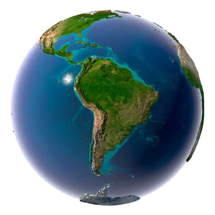
The Earth is shaped like a sphere, although it is slightly flattened at the poles. The official term for the shape of our planet is a geoid. A geoid is a figure whose surface is perpendicular to the direction of gravity.
Representations of the Earth’s Size and Shape
Aristotle was the first to propose the idea of the Earth being spherical. He provided several pieces of evidence to support his theory:
- The circular shadow cast by the Earth on the Moon during eclipses;
- The horizon expands as you rise in altitude;
- The starry sky changes as you move along the meridian.
Another significant proof of the Earth’s true shape came from Magellan’s circumnavigation of the globe.
As early as 1492, Martin Beheim invented the first globe model of the Earth.
The size and shape of the Earth are crucial in geography because:
- There is a latitudinal zonality.
- The angle of incidence of the Sun’s rays changes from the equator to the poles.
The Earth’s Size and Shape
A person with knowledge of the natural sciences can easily identify the shape of our planet. However, throughout history, there has been uncertainty and various representations of Earth’s shape. Ancient poets and philosophers envisioned it as a cylinder, a circle surrounded by oceans, or a sphere. This understanding of Earth’s shape was hindered by the strict religious beliefs of the Middle Ages.
In 1841, the renowned astronomer Bessel used radius measurements to calculate the Earth’s radius. These calculations were considered highly accurate and were used in geodesy for over a century. Later, Krasovsky conducted more precise measurements in 1936, revealing that the Earth has an ellipsoidal shape.
The distance from the center of the Earth to the equator measures 6378 km, while the distance from the center of the Earth to one of the poles is 6356.8 km. This difference of 21 km indicates that the Earth is not a perfect sphere, but rather slightly flattened at the poles. However, when considering the scale of the globe, this deviation is not perceptible.
It is important to note the following dimensions of our planet:
- The equatorial diameter measures 12756.5 km
- The polar diameter measures 12713.7 kilometers
- The meridian circumference is 40008.6 km
- The equatorial circumference distance is 40075.7 km
- The surface area of the Earth is 510 million m2
- The volume of the Earth is 1080 billion km3
General facts about the planet
Aside from our planet, the Earth group also encompasses:
The circumstances that allow for the existence of living organisms can only be found on planet Earth. Firstly, the distance between the Sun and Earth determines the planet’s temperature. Secondly, the planet’s size. Our planet is sufficiently large to retain an atmospheric gas shell through the force of gravity. Thirdly, the rotation speed of our planet prevents one side from becoming excessively hot and the other side from becoming excessively cold.
There are hypotheses regarding the origin of our planet:
Both hypotheses are centered around the idea that the Earth originated from a vast cloud of gas and dust approximately 4.5 billion years ago. Nevertheless, the mystery of how the complete chemical makeup of the periodic table came to be present in the planet’s composition remains unsolved. Additionally, it remains unclear what caused the cosmic dust and gas to condense into the anti-solar nebula.
Our planet orbits the sun, completing a full revolution in approximately one year. The closest point to the Sun occurs in January, and as we move farther away, the Earth’s rotation slows down. This is why winter is shorter than summer in the northern latitudes. The Earth rotates from west to east, completing a full revolution in 24 hours.
The Earth’s daily rotation
In addition to its orbit around the Sun, our planet also rotates on its axis. This rotation occurs from west to east. From our perspective, the Sun appears to rise in the east and set in the west.
When we talk about “days,” we are referring to the time it takes for the Earth to complete one full rotation around its axis. This rotation takes approximately 23 hours, 56 minutes, and 4 seconds. The remaining 4 minutes are accumulated over a span of 4 years, resulting in an additional day known as a leap year. The Earth rotates on its own axis, which is inclined at an angle of 66 degrees to the plane of its orbit around the Sun. This daily rotation is what causes the change from night to day. The consequences of the Earth’s daily rotation include:
- The transition from day to night.
- The rhythmicity of various processes, which are influenced by the arrival of heat and light.
The Earth’s yearly rotation
The Earth moves in an elliptical path around the Sun, resulting in its annual motion. Throughout this journey, the Earth’s axis remains consistent and parallel to itself. This phenomenon has several significant effects:
- The alteration of seasons.
- Natural rhythms that vary with the seasons, including humidity, air temperature, and the behavior of animal and plant life.
Notably, the summer and winter solstices mark pivotal days in this annual revolution.
The date of the summer solstice is June 22nd. At a latitude of 23 degrees in the Northern Hemisphere, the Sun’s rays shine directly down onto the Earth’s surface. North of this latitude, the Sun will never be directly overhead. The length of the day becomes longer than the night. At a latitude of 66 degrees, the Sun will not go below the horizon during the day. This is known as a polar day. During this time, the Northern Hemisphere experiences a true summer, receiving more daylight and warmth.
The dates of the autumn and spring equinoxes are March 21 and September 23. During these times, the Sun is directly above the equator. As you move north or south of the equator, the Sun’s angle in the sky decreases uniformly. This dividing line of light passes through the Earth’s axis, splitting it in half. Day and night are equal in length all over the globe.
The tropics are two lines of latitude, 23 degrees north and 23 degrees south of the equator. On the day of the summer solstice, the Sun is directly overhead for locations north of the tropics, while on the day of the winter solstice, the Sun is directly overhead for locations south of the tropics.
The Arctic and Antarctic Circles
The polar circles, located 66 o south and north of the equator, delineate the regions of the polar day and night. During the summer solstice in the Northern Hemisphere, the Sun remains below the horizon, while in the Southern Hemisphere, the Sun does not set on this day.
Geographically speaking, the poles
The geographical poles, known as the North Pole and the South Pole, signify the points where the planet’s axis of rotation intersects with the Earth’s surface. All lines of longitude converge precisely at the poles. At the poles, there is a continuous period of daylight or darkness for nearly half a year, as the Sun never dips below or rises above the horizon.
The phenomenon of polar day and night
The concept of polar night refers to a period of time when the Sun remains below the horizon throughout the day. This phenomenon can be observed from the Arctic Circle to the North Pole, where the duration of polar night spans nearly 180 days.
Conversely, during the polar day, the Sun remains above the horizon for extended periods of time. The further one travels from the Arctic Circle towards the North Pole, the longer the duration of the polar day becomes.
While we commonly think of a year as consisting of 365 days, it is more accurately defined as the time it takes for the Earth to complete one revolution around the Sun. This revolution gives rise to the formation of various lighting belts in the polar circles and tropics. There are a total of five belts, including two cold belts, two temperate belts, and one hot belt. The boundaries of these belts are demarcated by the polar circles and tropics.
The hot belt
Between the tropics of Cancer and Capricorn lies the tropical zone. Within this zone, twice a year the Sun reaches its highest point in the sky, on the solstice days the star is directly overhead at the tropics. In this zone, the length of day and night is equal and does not vary significantly.
Temperate zones
The temperate zones are located between the polar circles and the tropics. There is the temperate zone in the Southern Hemisphere (between the Tropic of Capricorn and the Antarctic Circle) and the temperate zone in the Northern Hemisphere (between the Arctic Circle and the Tropic of Cancer). In these zones, the Sun is never directly overhead.
Cold zones
There are two frigid belts situated to the south of the Southern Belt and to the north of the Northern Belt. Within these belts, the Sun never reaches the zenith. The length of the day and night varies greatly, depending on the season and latitude. These belts are known for their distinctive phenomena, such as the polar night and polar day.
The planet is made up of various layers such as:
Furthermore, it is now customary to differentiate another layer known as the biosphere, which is home to living organisms. All of these layers are interconnected and closely interact with each other.
The term “geographical shell” refers to the physical system in which the lithosphere, atmosphere, biosphere, and hydrosphere interact.
The lithosphere of the Earth
The core is believed to consist primarily of iron with a small amount of silicon. The core has a radius of approximately 3500 km. The outer part of the core is liquid, while the inner part is thought to be solid.
The mantle, which spans 3,000 kilometers, follows the core. Despite its solid nature, it is believed to be quite plastic. The lithosphere, the uppermost shell, encompasses the Earth. The Earth is enveloped by the heterogeneous crust, which varies in thickness from 5 km to 75 km. The lithosphere is composed of basalt, granite, and sedimentary layers.
The hydrosphere of Earth
The Earth’s hydrosphere is the intermittent watery space that exists between the atmosphere and the crust of the Earth. Roughly 70% of our planet is covered by water, with 96% of the hydrosphere’s mass being ocean water, 4% being groundwater, and the remainder being ice and snow located in Antarctica.
The atmosphere of Earth
One of the most crucial factors for the emergence of life on Earth is the atmosphere. Nitrogen constitutes 78% of the Earth’s atmosphere, while argon and oxygen make up only 1% each. It is worth mentioning that the composition also includes various gases and carbon dioxide. Notably, the combination of nitrogen and oxygen is essential for DNA creation and the production of biological energy, without which life would be impossible.
The Earth’s biosphere
The biosphere refers to the active life zone of organisms, which encompasses the lower atmosphere, hydrosphere, and upper lithosphere. Life in these areas strongly interacts and is interconnected through biochemical processes involving energy and substance redistribution.
Daylight does not have the ability to penetrate the water column to a significant extent. As a result, it is possible to observe living organisms at a depth of approximately 50 meters. Underwater life flourishes in various locations such as where currents converge, at river mouths, and in areas with rising water levels. The continental shelves are also teeming with a diverse range of living organisms. These areas receive ample light and the water is warmed to an ideal temperature. Additionally, the rivers that flow into the oceans bring an abundance of nutrients.
Our planet is incredibly fascinating, boasting a plethora of intriguing details:
- Earth, compared to other celestial bodies in the solar system, has the highest density at its core.
- The gravitational pull between the Earth and the Moon is responsible for the tides on our planet. It is widely believed that the Moon is tidally locked to Earth, meaning it always shows the same face. This synchronization occurs due to the Earth’s gravitational forces.
- Over time, the Earth’s rotation gradually slows down, resulting in longer daylight hours. It would take approximately 140 million years for the planet to have a 25-hour day instead of the usual 24.
Out of all the planets in our solar system, only ours has witnessed the emergence and rapid development of life, making Earth truly unique.
Related article:
Earth stands out as a one-of-a-kind world, hosting an infinite array of living macro- and microorganisms. It is widely known that our planet, the sole inhabited one in the solar system, does not fall into the category of massive celestial bodies. Nevertheless, its surface area is staggering.
What sets Earth apart is the fact that it is currently the only known inhabited planet by humanity.
Fun fact: Earth is part of the Earth group of planets, which also includes Mercury, Venus, and Mars.

Exploring the Size of the Earth: Eratosthenes’ Pioneering Efforts
In ancient times, the dimensions of our planet have long been a matter of curiosity and fascination. Among the great thinkers of the past, Eratosthenes, a renowned Greek scientist and explorer from the 2nd century BC, made significant strides in addressing this very question.
Once the wise man made an observation that the position of the sun in the sky is different on solstice day in two cities in Egypt, Alexandria and Siena. Based on this observation, Eratosthenes used simple calculations and a special device called a scaphis to determine that the circumference of the planet is approximately 40,000 km, with a radius of 6,290 km. This discovery provided a significant breakthrough in measuring the surface area of the globe. The wise man’s estimation was very close to the actual value, as the average radius of the planet is 6,371 km.
It’s important to note that the Earth is not a perfect sphere, but rather a close spheroid in shape. Therefore, not all radii of the Earth are equal to each other.
Our ancestors faced the challenge of determining the land area of the globe without the aid of modern computing devices and high-tech advancements. However, this task was accomplished by experienced and meticulous observers.
In the 17th century, a method known as triangulation, or the measurement of touching triangles, was developed to calculate the land area of the globe. This method was primarily utilized during lengthy expeditions and voyages. The advantage of this method was that obstacles encountered along the way, such as forests, swamps, rivers, and quicksand, did not hinder the accurate determination of distances, as calculations were performed on paper.
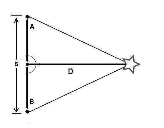
The measurements were conducted in the following manner: utilizing a telescope, angles were determined from two designated points A and B, typically hills, fortresses, towers, or other elevated locations, towards the corresponding opposite points C and D. With the knowledge of the lengths of sides AB, BC, and the degrees of the angles, it became possible to ascertain the dimensions of triangle ABC. Similarly, by considering the sides CB, BD, and the angles, the size of triangle BCD could be calculated. However, it should be noted that this method was characterized by its inherent complexity and laborious nature, making it a task that not everyone could successfully carry out.
Why was it impossible for scientists to accurately determine the precise size of the Earth?

It’s quite easy to explain! The Earth is made up of vast continents and islands of varying sizes, which are separated by bodies of water such as seas, straits, and oceans. However, when it comes to measuring distances using triangles, it becomes impossible to do so accurately in the sea. Additionally, the Earth’s terrain also plays a role in this. Mountains, ridges, and other landscape features greatly interfere with and distort the measurements, resulting in figures that are not truly representative of the actual size. This is why, for a long time, measurements of the Earth’s area were only relative.
For a long time, triangulation served as the primary and most precise method for measuring distance and area. However, with the arrival of the new age, the development of numerous measuring instruments, and the deployment of a satellite into orbit around the planet, not only has the study of Earth’s shape and nearby celestial bodies become accessible, but it has also become feasible to ascertain the overall surface area of the planet. The utilization of satellites has also facilitated the determination that over 70% of the Earth is covered by water, while land constitutes merely 29% of the total area. It has been discovered that the globe encompasses a surface area of 510,072,000 square kilometers.
Innovative methods for measuring
During this era of rapid technological advancements and increasing human knowledge, scientists have devised three primary methods to calculate the distances on our planet Earth:
Shape identification
Human exploration of the cosmos has provided evidence to support the assertions made by scientist Newton, who posited that the Earth takes the form of a “mandarin”. This model accurately represents the shape of our inhabited planet, which is “flattened” at the poles as a result of centrifugal force. Consequently, the radii of the Earth are not uniform.
Challenges in determining the size of the Earth

The measurement of even relatively small distances and areas can face numerous challenges of different kinds, not to mention measuring a vast object like an entire planet. In the past, the most common hindrances to measurements included mountains, adverse weather conditions (such as rain, fog, blizzards, snowstorms, etc.), and, naturally, human error.
With the introduction of various measuring devices and satellites, the inaccuracies in measurements were no longer solely due to differences in relief, large bodies of water (oceans, seas), and meteorological factors. However, a new concept called “measurement instrument error” emerged. This error is insignificant and practically imperceptible to the naked eye at a small distance, but when it comes to determining the size of the Earth, it can greatly distort the measurements.
Please note that different sources provide different information about the size and area of the Earth. It is crucial to exercise caution and verify the data to avoid any errors.
Research on the planet is an ongoing process that never ceases. Each year, new discoveries are made that have a profound impact on the future development of both the human and animal world. However, even with these new advancements, scientists still take the time to reexamine older data. By doing so, they are able to gain a better understanding of the ever-changing nature of our planet and establish a sequence of events that can lead to the transformation of various systems and properties.
One example of this is the melting of ice caused by global warming, which can lead to a significant increase in the volume of the world’s oceans. This, in turn, can result in a drastic reduction in land area and potentially lead to the extinction of certain species. Continuous research is the key to addressing many global issues, as well as the specific challenges faced by individual nations.
Planet by the Numbers
What can be said about our planet in general?
- The total surface area of the Earth is 510,072,000 square kilometers.
- The planet has an age exceeding 4.5 billion years.
- The Earth’s mass is 589,000,000,000,000,000,000,000,000,000,000,000,000,000,000 tons.
- The land area of the Earth, excluding water, is 148,940,000 square kilometers.
- The Earth’s water-covered area is 361,132,000 square kilometers.
- The average temperature on the planet is 14 degrees Celsius.
Curious information about our planet

- The Sun has a satellite called Planet Earth.
- A significant portion of the planet remains unexplored.
- Among all the planets in the solar system, Earth has the highest density.
- More than 60% of the planet’s fresh water exists in frozen form, such as glaciers and polar caps.
- At one point in time, all the continents that we see on maps today were connected as a single landmass.
- The marine topography is more prominent than the surface topography of the planet.
- Planet Earth originated from a nebula.
- There are over 15,000 active man-made satellites orbiting the planet.
The primary danger to the Earth and its inhabitants (at present) is the impact of sizable celestial bodies (asteroids) onto the planet’s surface. These objects have the potential to not only obliterate numerous life forms but also significantly alter the planet’s topography. Furthermore, certain asteroids possess the capability to shift the Earth from its axis, which could result in irreversible alterations to the entire solar system. Each year, numerous asteroids come close to the planet, yet only 20% of them have the potential to cause substantial harm.
An intriguing theory: some scientists propose that the Moon (Earth’s natural satellite) was once a part of the planet.
An “optimistic” outlook for the Earth
The future of our planet relies solely on the Sun’s “vitality”. Researchers propose that ongoing transformations on our neighboring star will result in elevated temperatures, the evaporation of both fresh and saltwater bodies, and numerous other significant alterations. The most alarming conjecture made by scientists is that the Sun, as it increases in size and mass, may eventually engulf the Earth. However, this event is not expected to occur in the near future, giving humanity ample time to explore possible solutions for salvation.
The exploration of Earth’s surface and the planet as a whole has been a subject of interest since ancient times. Even in the prehistoric era, wise thinkers and philosophers were intrigued by the size, shape, and characteristics of the Earth. Numerous explorers lost their lives while embarking on long journeys and expeditions dedicated to studying and measuring the planet’s expanse. Similarly, many scientists who proposed theories about the origin of life and the Earth’s shape faced persecution from religious leaders and their contemporaries.
Fortunately, those “dark” times are now behind us. Thanks to the plethora of modern technological advancements, mankind can now access reliable information about the planet it calls home.
The Structure of our Planet Earth. The Earth is composed of a relatively thin and rigid outer layer, known as the crust, which has a thickness ranging from 10 to 100 kilometers. This crust is enveloped by a vast hydrosphere, consisting of water in various forms, and a dense atmosphere. Moving deeper into the Earth, we encounter three main regions: the crust, the mantle, and the core. The Earth’s crust, which constitutes the uppermost part of the solid shell, varies in thickness, ranging from just one kilometer beneath the oceans to several tens of kilometers beneath the continents. It is composed of sedimentary layers and well-known minerals and rocks. Deeper within the crust, we find various types of basalts. Below the crust lies the mantle, a solid silicate layer thought to be composed mainly of olivine. This mantle has a thickness of 1 to 3 thousand kilometers and surrounds the liquid portion of the core. The core, which is located at the center of the Earth, is primarily made up of a solid inner core with a diameter of approximately 2000 kilometers.
The Hydrosphere
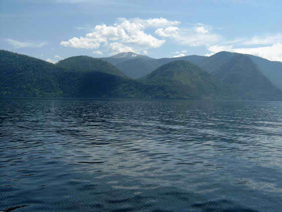
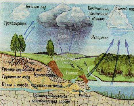
An important characteristic of our planet is its abundant water resources, which exist in various forms – gas (water vapor in the atmosphere), liquid (rivers, lakes, seas, oceans, and to a lesser extent, the atmosphere), and solid (snow and ice, primarily in glaciers). Due to the water balance, it is crucial to preserve the total amount of water on Earth. The vast world ocean covers most of the Earth’s surface (361.1 million km2 or 70.8% of the Earth’s surface area), with an average depth of approximately 3,800 m and the deepest point being the Mariana Trench in the Pacific Ocean, reaching a depth of 11,022 m. The total water volume is estimated to be 1,370 million km3, with an average salinity of 35 g/l. Glaciers, which cover about 11% of the land surface, occupy an area of approximately 149.1 million km2 (29.2%). The landmass rises above sea level by an average elevation of 875 m, with the highest peak being Mt. Everest in the Himalayas, reaching a height of 8,848 m. The presence of sedimentary rocks, dating back over 3.7 billion years according to radioisotope analysis, provides evidence of extensive bodies of water on Earth during that ancient era, when the first life forms are believed to have emerged. For more information, refer to CHEMISTRY OF THE HYDROSPHERE.
Ocean currents.
Sea currents, also known as ocean currents, refer to the continuous movement of water in the seas and oceans. These movements are caused by various factors, including the friction between the water and air, pressure gradients within the water, and the gravitational forces from the Moon and the Sun. The rotation of the Earth also plays a significant role in determining the direction of these currents, with currents in the Northern Hemisphere being deflected to the right and currents in the Southern Hemisphere being deflected to the left. There are different types of marine currents, depending on their causes. Some currents, known as wind currents, are caused by the friction between the wind and the surface of the sea. Others, known as density currents, are caused by the uneven distribution of water temperature and salinity. There are also runoff currents, which are caused by the slope of the water level. Sea currents can be categorized based on their variability, with some being permanent, temporary, or periodic (tidal). They can also be categorized based on their location, including surface currents, subsurface currents, intermediate currents, deep currents, and near-bottom currents. Additionally, sea currents can be classified based on their physical and chemical properties, such as whether they are desalinated or salty.
The water temperatures of these currents are either higher or lower than the surrounding temperature. Warm currents flow from low latitudes to high latitudes (e.g. Gulf Stream), while cold currents flow from high latitudes to low latitudes (Labrador Current). Currents that have the same temperature as the surrounding waters are referred to as neutral currents.
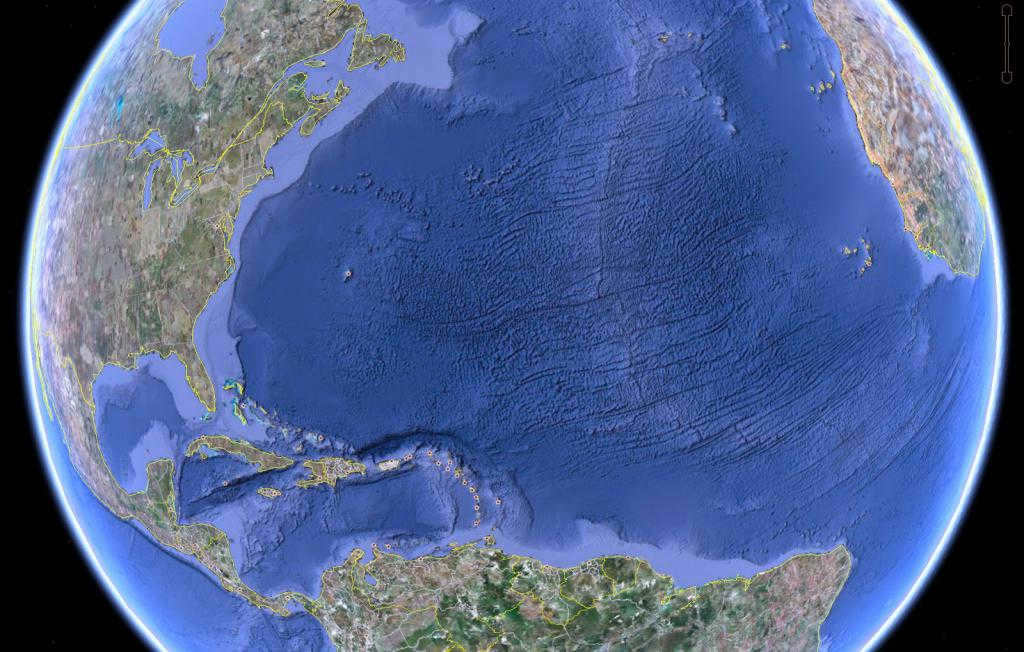
The Gulf Stream is a warm current system in the northern part of the Atlantic Ocean. It stretches for 10,000 km from the Florida Peninsula to the islands of Spitsbergen and Novaya Zemlya. The speed of the Gulf Stream varies from 6-10 km/h in the Florida Straits to 3-4 km/h in the area of B. Newfoundland Bank. The surface water temperature ranges from 24-28 to 10-20 °C. The average water flow rate in the Florida Straits is 25 million m3/s, which is 20 times the total flow rate of all the rivers in the world.
The Gulf Stream eventually merges into the North Atlantic Current at 40°W. This current, influenced by westerly and southwesterly winds, follows the shores of the Scandinavian Peninsula and affects the climate of Europe.
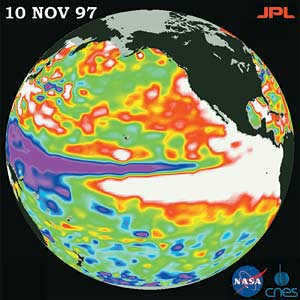
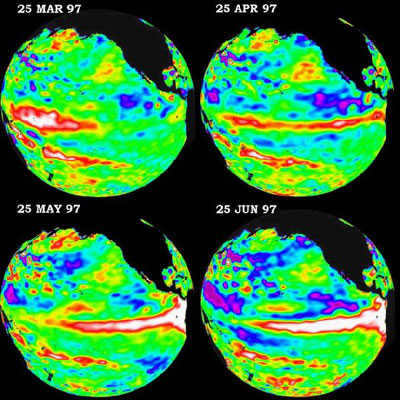
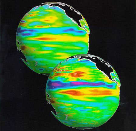
Unusual weather patterns across the world during El Niño years. In tropical regions, there is a rise in rainfall in areas to the east of the central Pacific and a decrease in rainfall in northern Australia, Indonesia, and the Philippines. From December to February, there is higher than normal rainfall along the coast of Ecuador, northwestern Peru, southern Brazil, central Argentina, and eastern Africa. From June to August, there is increased precipitation in the western United States and central Chile.
El Niño events are also accountable for significant global air temperature anomalies. These years witness remarkable temperature rises. Unusually warm conditions were observed in December and February across southeast Asia, the Seaside, Japan, the Sea of Japan, southeast Africa, and Brazil, as well as southeast Australia. Additionally, temperatures exceeding the average for multiple years were recorded in June-August on the west coast of South America and southeastern Brazil. Colder winters (December-February) prevail on the southwestern coast of the United States.
Laninho. Laniño is characterized by a decrease in surface water temperature in the eastern tropical Pacific Ocean, in contrast to El Niño. Instances of this phenomenon were recorded in 1984-1985, 1988-1989, and 1995-1996. During these periods, the eastern Pacific Ocean experiences abnormally cold weather. Winds cause a shift in the warm water zone, resulting in a “tongue” of cold waters extending for 5000 km, from the area of Ecuador to the Samoa Islands, right where the warm water belt of El Niño would typically be. The occurrence of Laninho brings powerful monsoon rains to Indochina, India, and Australia. In contrast, the Caribbean and the US suffer from droughts and tornadoes.
Unusual climate patterns across the globe during the Laninho years. Throughout the Laninho periods, there is an increase in rainfall over the western equatorial Pacific, Indonesia, and the Philippines, while the eastern ocean experiences a near absence of precipitation. The majority of rainfall occurs from December to February in northern South America and southern Africa, and from June to August in southeastern Australia. Conversely, drier conditions are observed from December to February along the coast of Ecuador, northwestern Peru, and equatorial eastern Africa, and from June to August in southern Brazil and central Argentina. There are widespread abnormalities on a large scale. Numerous areas experience abnormally cool conditions, such as cold winters in Japan and Primorye, southern Alaska and west-central Canada, and cool summers in southeast Africa, India, and southeast Asia. Conversely, warmer winters are observed in the southwestern United States.
Laninho, similar to Elninho, typically occurs during the months of December through March. The main distinction is that Elninho happens approximately every three to four years, whereas Laninho happens every six to seven years. Both events result in an increased number of hurricanes, but Laninho produces three to four times as many hurricanes compared to Elninho.
Based on recent observations, the onset of El Niño or Laninho can be reliably determined if:
1. An area of warmer-than-normal water forms near the equator in the eastern Pacific Ocean for El Niño, and colder water forms for Laninho.
2. If the atmospheric pressure at the port of Darwin, Australia, tends to decrease and the island of Tahiti tends to increase, Elninho is expected. Otherwise, it will be Laninho.
Elninho and Laninho are the primary manifestations of worldwide yearly climate fluctuations. They indicate significant shifts in ocean temperatures and precipitation, atmospheric circulation, and vertical air movements over the tropical Pacific Ocean.
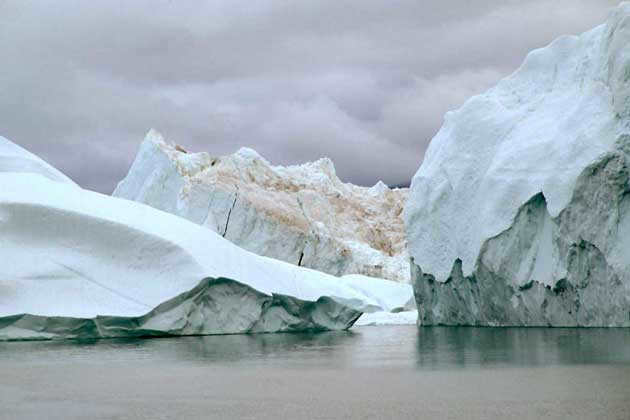
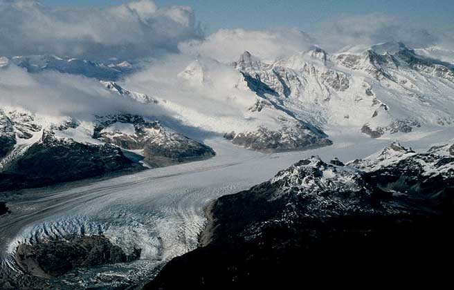
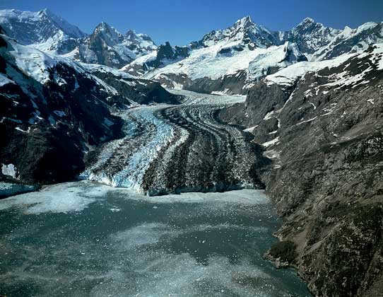
Glaciers are natural ice formations on the Earth’s surface that originate from atmospheric ice accumulation. They are created in regions where solid precipitation exceeds melting and evaporation rates. The motion of a glacier causes it to split into zones of ice accumulation (accumulation) and movement (ablation).
The Earth’s surface is covered by various forms of glaciation, including ice caps, ice shelves, and mountain glaciers. Currently, glaciers occupy approximately 16.3 million square kilometers, accounting for 10.9% of the total land area. The volume of ice contained within these glaciers is estimated to be around 30 million cubic kilometers. Glaciers are created through the gradual accumulation, compression, and recrystallization of snow over long periods of time. They can only exist in regions with consistently low air temperatures and high levels of snowfall, which are typically found in circumpolar or high mountain areas. Glaciers can take on different shapes, such as streams, domes, or floating slabs that slide into bodies of water. When glaciers break off and float freely, they are referred to as icebergs.
Formation of glaciers.
In the accumulation area of a glacier, snow transitions into firn and eventually into ice, resulting in an increase in the ice mass that is transported to the ablation area. In the ablation area, this mass decreases due to melting, chipping, evaporation, and wind blowing away snow. Glaciers can vary greatly in size, ranging from less than 0.1 km^2 to several million km^2. For instance, the ice sheet in Antarctica covers an area of nearly 14 million km^2 and has a maximum thickness exceeding 4.7 km. The largest icebergs, measuring 170 km in length and with a volume of up to 5 thousand km^3, are found near Antarctica. Climate change is also causing alterations in the total mass of glaciers.
Glacier movement.
Glaciers undergo movement from the accumulation area to the ablation area. The rate of glacier movement is typically slow, averaging from several tens to several hundred meters per year. However, there are instances of exceptionally rapid glacier movement. One notable example is the Jakobshavn glacier in Greenland, which flows into Disko Bay. It has a speed exceeding 7 km per year. Pulsating glaciers are highly mobile. Throughout their lifespan, they experience periods of relative rest, lasting from 10 to 50-100 years, interspersed with periods of brief, rapid movements, or pulsations. During these pulsations, the speed of glacier movement can reach 100-120 m/day, and the glacier tongue can move 10-15 km. This often leads to catastrophic consequences, such as ice collapses, snow avalanches, breakthroughs of submerged lakes, floods, and mudflows. The movements of the Medvezhy glacier in the Pamir Mountains have gained widespread attention.
Importance of Glaciers
Glaciers have a significant impact on the climate and are responsible for creating unique glacial landforms and stunning high-mountain landscapes. They also play a crucial role as reservoirs for fresh water, with nearly 70% of the world’s fresh water reserves being concentrated in glaciers. When glaciers melt, they contribute a substantial amount of water to river runoff in mountainous regions. In Central Asia, for instance, glaciers cover only 5% of the area, but account for 20% of the annual river runoff and 50% in the summer. If we were to distribute the entire mass of modern glaciers across the entire globe, it would form an ice shell with a thickness of approximately 50 meters. The mass of glaciers is about 32 times greater than that of all the surface waters on land combined. In Russia, the total area covered by glaciers is approximately 60 thousand km2, primarily consisting of ice caps on islands such as Novaya Zemlya, Severnaya Zemlya, and Franz Josef Land in the Arctic Ocean.
The outermost layer of the Earth is known as the Earth’s crust.
The lithosphere, the Earth’s solid shell, varies in thickness in different parts of the planet. It is 35-70 km thick under continents and about 5 km thick under oceans. The continents have “roots” that extend deep into the upper mantle’s viscous and partially molten boundary layer, known as the asthenosphere. These roots are analogous to icebergs in the ocean and are held in equilibrium by Archimedean buoyancy forces. This phenomenon explains the slow movement of continents, which is the largest-scale tectonic process resulting from the convection (mixing) of mantle material. The Earth’s crustal plates are constantly in motion, leading to various manifestations of crustal activity such as uplift in some areas and subsidence in others. When continental plates collide, mountain ranges are formed, while pulling apart creates basins and seas. The age of typical young mountains, like the Alps, is estimated to be around 30 million years, and the Mediterranean Sea is approximately 5 million years old. The Mohorovicich surface marks the lower boundary of the Earth’s crust. The crust can be divided into continental crust (with a thickness ranging from 35-45 km under plains to 70 km in mountains) and oceanic crust (5-10 km thick). Continental crust consists of three layers: upper (sedimentary), middle (commonly referred to as granitic), and lower (basaltic). Oceanic crust lacks the granitic layer and has a thinner sedimentary layer. In the transition zone between continents and oceans, an intermediate type of crust, known as subcontinental or suboceanic crust, develops. The Earth’s crust experiences constant tectonic movements, characterized by active areas called fold belts and relatively stable regions known as platforms.
Mantle.
The Earth’s mantle is a silicate shell located between the crust and the core. It consists mainly of olivine and exists in a unique plastic, amorphous state that is close to being molten. The upper mantle, which is approximately 700 km thick, is in this state. However, the inner mantle, which is about 2000 km thick, is solid and crystalline. In total, the mantle occupies around 83% of the Earth’s volume and contributes up to 67% of its mass. The upper boundary of the mantle is defined by the Mohorovichi surface at varying depths, ranging from 5-10 to 70 km. On the other hand, the lower boundary of the mantle is located at the boundary with the core, approximately 2900 km deep.
Core.
As you move closer to the center, the density of the substances increases, as does the temperature. The central region of the planet, extending to about half of its radius, is a concentrated core made up of iron and nickel. This core has a temperature of 4-5 thousand kelvin, with the outer section being molten and transitioning into the mantle. It is believed that the very center of the Earth has a higher temperature than the atmosphere of the Sun. This indicates that the Earth possesses internal sources of heat.
The outermost layer, known as the crust, is relatively thin (and thinner and denser beneath the oceans compared to the continents). It is separated from the underlying mantle by the Mohorovicic boundary. The Earth’s core, which is composed of metallic substances, constitutes the densest material. The crust, inner mantle, and inner core exist in a solid state, while the outer core is in a liquid state.
| Layer | Depth Range (km) | Temperature (K) | Composition |
| Crust | 0–33 | 287–700 | Solid Si |
| Upper Mantle | 33–410 | 700–2200 | |
| Lower Mantle | 1000–2900 | 3500–4300 | |
| Outer Core | 2900–4980 | 4500–5800 | Molten. Fe; Ni |
| Inner Core | 5120–6370 | 6200–6400 | Solid Fe; Ni |
| Center | 6370 | 6400 |
Earth is an exceptional planet where a diverse range of macro- and microorganisms coexist. It is widely known that Earth, the only inhabited planet in the solar system, is not classified as a giant celestial object. Nevertheless, the size of Earth’s surface is truly impressive.
One of the things that sets it apart is the fact that it is currently the sole inhabited planet recognized by humanity.
Fun fact: Earth is classified as a terrestrial planet, along with Mercury, Venus, and Mars.
Exploring the Earth’s Dimensions: Earliest Endeavors
Throughout history, the dimensions of our planet have captivated the minds of great thinkers. Among the many brilliant minds of antiquity, stands Eratosthenes, an esteemed Greek scientist and explorer who lived in the 2nd century BC.
It’s crucial to note that the Earth is not a perfect sphere, but rather a spheroid with a shape that closely resembles a globe. Consequently, the radii of the Earth are not all equal to one another.
Using Triangulation to Measure Distances

Our ancestors in the pre-technological era were able to determine the land area of the globe through the use of triangulation, a method that involved careful observation and calculation. Triangulation, also known as measurement by touching triangles, was perfected in the 17th century and required skilled observers to conduct long expeditions and travels. The advantage of this method was that natural obstacles such as forests, swamps, rivers, and quicksand did not hinder the accurate determination of distance, as all calculations were done on paper.
The measurements were conducted in the following manner: two points A and B (typically hills, fortresses, towers, and other high points) were selected, and angles were measured (using a telescope) with the corresponding opposite points C and D. By knowing the lengths of sides AB, BC, and the degrees of the angles, it became possible to ascertain the dimensions of triangle ABC. Similarly, by knowing the lengths of sides CB, BD, and the degrees of the angles, the dimensions of triangle BCD could be calculated. However, a drawback of this method is that it is rather challenging and labor-intensive, and not everyone was capable of performing it successfully.
What prevented scientists from accurately measuring the Earth’s precise size?
The solution is rather straightforward! The Earth is home to vast continents and islands of various sizes, which are divided by seas, straits, and oceans. However, when it comes to measuring distances across the open sea, the traditional method of using triangles becomes impractical. The Earth’s topography also complicates matters. Mountain ranges, ridges, and other geographical features greatly impede and distort the accuracy of measurements. As a result, determining the true size of the Earth’s surface has long been a relative endeavor.
A significant discovery
For a considerable period of time, triangulation served as the primary and most precise technique for measuring area and distance. However, with the arrival of the modern era, the development of numerous measuring devices, and the deployment of satellites into orbit around the globe, not only did the exploration of the shape of the Earth and neighboring celestial bodies become accessible, but it also became feasible to determine the complete surface area of the Earth. The utilization of satellites also facilitated the determination that over 70% of the Earth is covered in water, with land accounting for only 29% of the overall area. It was determined that the planet has a surface area totaling 510,072,000 square kilometers.
Advanced methods of measuring
During a time of thriving technological advancement and human intellect, scientists employ three primary methods for gauging the distances of Earth:
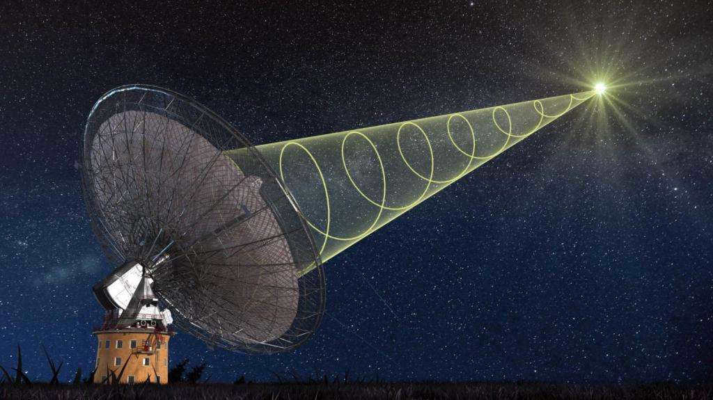
- Measurement through radio waves. Across various regions of the globe, there are 70 specialized telescopes (known as radio telescopes) which detect and transmit data about the length of radio waves or quasars to a central computer for calculations.
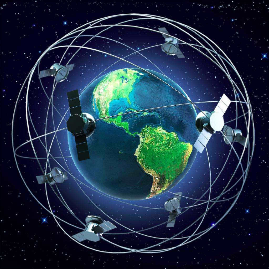
- Satellite ranging (also referred to as laser ranging). Some individuals mistakenly believe that satellites orbiting within Earth’s atmosphere serve no significant purpose. However, this assumption is far from accurate. For quite some time, scientists have been utilizing laser distance measurement to determine the dimensions of vast entities such as continents, islands, rivers, and ultimately the planet in its entirety.

Determining the Shape
Human exploration of outer space has provided evidence confirming the hypothesis put forth by scientist Newton, who posited that the Earth has a shape resembling that of a “mandarin”. This model suggests that the planet is slightly flattened at the poles, a result of the centrifugal force at play. As a consequence, the radii of the Earth vary.
Challenges in determining the size of the Earth

Measuring relatively small distances and areas can present numerous challenges, let alone measuring the size of an entire planet. In ancient times, there were common obstacles to accurate measurements, including mountains, adverse weather conditions such as rain, fog, blizzards, and human error.
Caution! There are varying sources with conflicting information regarding the size and area of the Earth. It is crucial to exercise caution and verify the data in order to prevent any inaccuracies.
Scientists and contemporary data analysis
Ongoing research on our planet is ceaseless. Every year, novel discoveries are made, which undoubtedly have an impact on the further advancement of both the human and animal realms. However, despite these new accomplishments, researchers are continuously reassessing data that was gathered a considerable time ago. This process of reevaluation aids scientists in gaining a better understanding of the nature of changes occurring on Earth and in constructing a sequence of events that could potentially lead to the transformation of various systems and properties of our planet.
Take, for instance, the melting of ice due to the effects of global warming which can result in a rise in the overall sea levels. As a result, there will be a substantial decrease in the land area, potentially leading to the extinction of certain species. The key to addressing numerous global issues lies in the ongoing pursuit of research, both on a global scale and within individual nations.
Interesting Facts about Our Planet
What can we learn about our planet?
- The Earth’s total surface area measures 510,072,000 square kilometers.
- Our planet is estimated to be over 4.5 billion years old.
- The Earth’s mass is a staggering 589,000,000,000,000,000,000,000,000,000,000,000,000,000,000 tons.
- The land area of the Earth, excluding water, is 148,940,000 square kilometers.
- The Earth’s water occupies an area of 361,132,000 square kilometers.
- The average temperature on Earth is approximately 14 degrees Celsius.
Fascinating information about our planet
- The Earth is a celestial body that revolves around the Sun.
- The majority of the planet remains unexplored and unknown.
- Earth possesses the highest density among all the planets in the solar system.
- Approximately 60% of the planet’s freshwater exists in the frozen state, such as glaciers and polar caps.
- All the continents that are clearly visible on maps today were once a single landmass in the distant past.
- The underwater topography of the Earth’s oceans is more prominent than the surface topography.
- Our planet originated from a nebula, a cloud of gas and dust in space.
- There are currently over 15,000 active man-made satellites orbiting the Earth.
Threats to our planet
The primary peril facing the Earth and its inhabitants (presently) is the arrival of sizable celestial bodies (asteroids) onto the planet’s surface. These objects have the potential to not only annihilate numerous life forms but also dramatically alter the planet’s topography. Furthermore, certain asteroids have the capability to displace the Earth from its axis, which could result in irreparable changes to the entire solar system. Every year, numerous asteroids come within close proximity to our planet, yet only 20% of them have the potential to cause significant harm.
An intriguing theory: some scientists propose that the Moon (the Earth’s natural satellite) was previously a part of our planet.
A Promising Future for Our Planet
The survival of all planets in our solar system hinges on the Sun’s “life activity.” Experts predict that the Sun’s ongoing transformations will result in rising temperatures, the evaporation of both fresh and saltwater, and a host of other significant alterations. Perhaps the most alarming prediction from scientists is that the Sun, as it grows in size and mass, may eventually engulf the Earth. However, this cataclysmic event is not imminent, and humanity still has the opportunity to explore potential solutions for our survival.
The study of the Earth’s surface and the planet as a whole has been an ongoing pursuit since ancient times. Even in ancient times, the size, shape, and properties of the Earth were subjects of great interest and contemplation for wise thinkers and sages. Countless explorers and adventurers lost their lives during long journeys and expeditions dedicated to exploring and measuring the planet. Similarly, many scientists who proposed theories about the origins of life and the Earth’s shape were persecuted by religious leaders and their contemporaries. But fortunately, those “dark” times are now behind us. With the vast array of modern technological advancements at our disposal, mankind can now access reliable and accurate information about the planet we call home.
Currently, the majority of the Earth’s surface is comprised of land and water, providing suitable environments for various forms of life. While there are some regions with extreme climates resembling desolate expanses, even these areas are not devoid of animal presence. It is truly astonishing to contemplate that our planet, which now teems with biodiversity, was once a luminous cloud of undefined shape, consisting of cosmic matter and gaseous substances.
The Creation of the Universe
Based on the prevailing theory, approximately 13.7 billion years ago, a massive explosion occurred, resulting in the dispersal of an unimaginable amount of energy and matter throughout space. This event marked the birth of the universe. Initially, the universe was a blazing inferno, with temperatures exceeding a billion degrees. The particles of matter possessed such immense energy that they repelled one another. However, over time, the universe gradually cooled, allowing for the formation of helium, hydrogen, and stardust atoms. These atoms began to accumulate and gave rise to nebulae, which eventually became the progenitors of future stars and planets.

Planet Earth
Planet Earth, like all other celestial bodies, was born from a gas nebula that began to contract around 4.5 to 5 billion years ago. The exact cause of this contraction is still unknown. One popular theory suggests that the Earth was formed as a result of a powerful shockwave from a supernova star that exploded several light years away. As a result of the gravitational attraction of cosmic particles and gases, the mass and size of the Earth increased rapidly. The newly formed planet resembled a glowing sphere.
Water and Land Formation
The violent release of gases and lava resulted in the formation of the initial atmosphere. The entire surface of the Earth was dominated by volcanoes and surrounded by gas clouds containing a significant amount of water. This water vapor condensed and fell as rain, only to evaporate upon contact with the lava and hot surface. This active volcanic period persisted for two billion years and gradually subsided around three billion years ago.
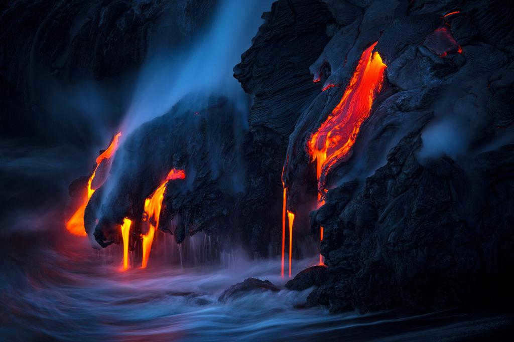
The Earth gradually cooled as the lava solidified, forming its landmass. Water vapor from the atmosphere and melted ice, brought to the surface by asteroids and comets, transformed into liquid. During this time, the size of the Earth’s land area was already comparable to the present, although the initial oceans were much smaller. Volcanic activity continued for another billion years, but with less intensity. This marked the beginning of a geological transformation of the Earth, as water and wind eroded the surface, causing extinct volcanoes to vanish and plains to emerge.
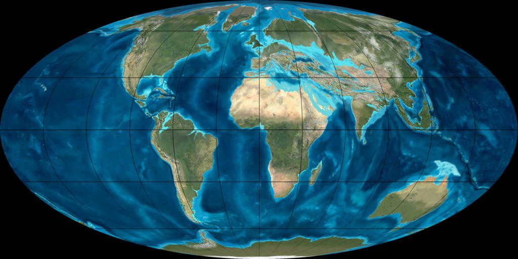
Supercontinents: the era of giants
Renowned scientists have revealed that continents are not stationary, but rather in constant motion. Additionally, every 500 years, they come together to form a colossal supercontinent. The most recent supercontinent, known as Pangea, existed approximately 200 to 250 million years ago. Pangea, which translates to “all-Earth” in Greek, was surrounded by the vast Panthalassa Ocean. The combined landmass of Pangea and Panthalassa was equivalent to the entire surface area of our planet.
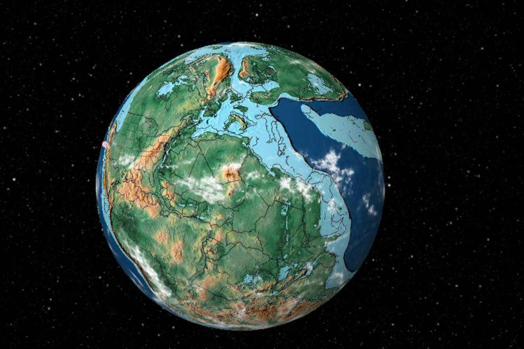
The Descendants of Pangea
Around 170 to 200 million years ago, Pangea fragmented into two separate landmasses for reasons that remain somewhat unclear. These landmasses then proceeded to break apart further, forming various tectonic plates. This tumultuous period of geological activity gave rise to the continents and oceans as we know them today. The reshaping of the Earth’s landmasses left behind evidence of this colossal process, such as island arcs, rugged mountain ranges, and deep oceanic trenches. While the continents are still moving towards each other, their progress is incredibly slow in relation to their size, with a mere few centimeters per year. Scientists predict that in another 250 million years, the continents will once again converge to form a new supercontinent.
The Solar System
However, the Earth’s position in relation to the Sun is what primarily allows for the presence of an atmosphere, a water shell, sufficient light, and moderate temperatures. These factors are essential for life to exist, and as a result, life can only be found on one of the eight planets in the solar system. The planets can be divided into two groups based on their structure, and they are distributed according to their distance from the Sun.
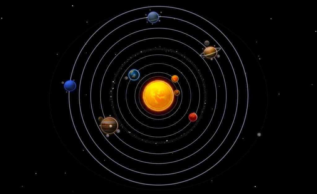
- Mercury is located 58 million kilometers away from the Sun. This planet, which is the smallest in the system, has an extremely thin atmosphere, leading to extreme temperature fluctuations on its surface, ranging from +430 ° C to -190 ° C.
- Venus is situated at a distance of 108 million kilometers from the Sun. The density of its atmosphere is ninety times higher than that of Earth. Venus can be considered a true greenhouse, with surface temperatures reaching up to 460 ° C, making it impossible for water to exist in a liquid state and therefore ruling out the possibility of life.
- Earth is positioned at a distance of 149.5 million kilometers from the Sun. It provides the perfect conditions for life to thrive. In terms of mass and surface area, Earth surpasses each of the other planets in the Earth group.
- Mars – 228 million kilometers. The density of the carbon dioxide atmosphere on Mars is 500 to 800 times less than that of Earth’s atmosphere. The temperature conditions on the Martian surface are not suitable for sustaining life. Mars is an extremely cold planet, with surface temperatures dropping to as low as -100°C at night.
Planets classified as gas giants:
- Jupiter – 778 million kilometers. Jupiter is the largest planet in our solar system. It has a mass two and a half times greater than the combined mass of the other seven planets, and its surface area is almost 122 times that of Earth. Jupiter is mainly composed of helium and hydrogen.
- Saturn – 1.43 billion kilometers. Known for its stunning rings, Saturn has a density lower than that of water.
- Uranus is located 2.88 billion kilometers away. It holds the title of being the coldest planet in the solar system, with surface temperatures dropping down to -224 °C.
- Neptune is found 4.5 billion kilometers away. As the planet farthest from the Sun, its atmosphere primarily consists of hydrogen and helium, along with methane. Similar to Uranus, Neptune experiences extremely cold temperatures, with it falling below -200 °C.
Examining this data, one cannot help but be amazed by the fortuitous alignment of events that allowed for the existence of life on our planet. For a considerable period, both scientists and enthusiasts of science fiction entertained the possibility of extraterrestrial life on Venus and Mars. However, research conducted in recent decades has revealed the improbability of such a scenario. The neighboring Blue Planets possess a climate that is far too severe and an atmospheric density that is unsuitable for sustaining life. The very oceans that served as the cradle for Earth’s biosphere are absent there, and the insufficient magnetic field fails to shield living organisms from the sun’s lethal radiation.
- The average diameter of the Earth is 6371 kilometers.
- The equatorial circumference of the Earth is 40,076 km.
- The volume of the Earth is 1.08*1012 km 3 .
- The average density of the Earth is 5518 kg/m 3 .
- The mass of the Earth is 5.97*1021 tons.
- The Earth rotates around its own axis at a speed of 1675 km/h.
- The Earth rotates around the Sun at a speed of 107,000 km/h.
- The Earth completes a full revolution around its own axis in 23 hours and 56 minutes.
- The Earth completes a revolution around the Sun in 365 days and 6 hours.
What is the distribution of water and land on planet Earth?
The distribution of water and land on Earth is heavily skewed towards water. Rivers, oceans, lakes, and reservoirs cover 70.8% of the planet’s surface. However, there is still plenty of land for billions of people to inhabit. Here are the exact figures:
- The total area of planet Earth is 510,000,000,000 km2.
- The land area is 149,000,000,000 km2.
- In the northern hemisphere, the land area is 100,000,000 km2, while in the southern hemisphere, it is 49,000,000 km2.
- The average elevation of the land above sea level is 860 meters.
- The total area of water on planet Earth is 361,000,000 km2.
- In the northern hemisphere, the water area is 155,000,000 km2, and in the southern hemisphere, it is 206,000,000 km2.
- The mean depth of the Earth’s oceans is 3.7 kilometers.
Interesting Trivia
It is an intriguing fact that the Earth is still largely unexplored by humanity, as the vast expanse of the ocean covers over 70% of its surface, yet only a mere 5% of the ocean depths have been thoroughly investigated.
According to scientific calculations, the total mass of water on our planet exceeds a staggering 1.3*10^18 tons. However, only 3% of this immense mass is freshwater, with approximately 90% of it being locked in the form of ice.
The ice cap of Antarctica holds around 90% of the world’s ice and about 80% of the planet’s freshwater reserves. This continent is also the highest one, boasting an average elevation of 2.2 kilometers, which is more than double the average elevation of Eurasia.


