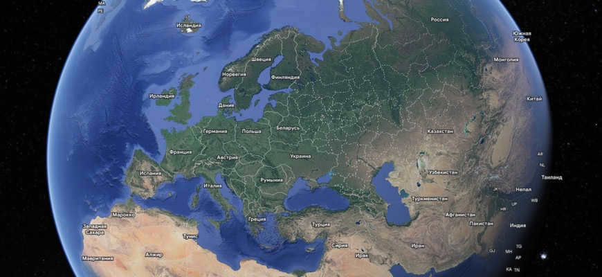
Legend has it that the primary astronaut Yuri Gagarin, in the wake of seeing our planet from space, excitedly expressed: “Earth… What a sight!”. And without a doubt, beholding the view of our planet from the vastness of space, one cannot help but marvel at its stunning beauty, with its majestic continents and vast oceans, all contributing to the indelible tapestry of colors on our globe. Thanks to the boundless treasure trove of information available on the internet, we can now easily indulge in the awe-inspiring sights of our home planet. In this article, I will share with you some online resources that offer real-time views from satellites and explain how to utilize such services.
Online Network Services for Satellite Map Viewing
There is a wide range of websites available for viewing satellite maps online, and it is important not to be misled. The majority of these resources gather information from a small number of primary sources, including the NASA channel on the streaming site ustream.tv, as well as map services from Google and Yandex. Creating these maps from scratch requires significant financial investment, limiting the number of resources that can provide this service.
Using these services is straightforward and user-friendly, even for those who are inexperienced. To access these resources, simply visit the website, switch the display mode from schematic to satellite, and enter the desired location in the search bar. From there, you can use the mouse wheel to adjust the scale of the display to your preference.
Maps like these are generated at different intervals (usually every few months or even years). To obtain a live satellite perspective, you must visit the NASA channel mentioned earlier or gain access to military satellites, a privilege limited to a select few military experts.
The views captured by satellites are undeniably captivating.
Now, let’s delve deeper into the online resources available for viewing satellite imagery of our planet.
NASA’s live video stream
If you are interested in accessing the satellite view from your computer, then the NASA video stream on ustream.tv is the perfect solution for you. This stream provides a real-time broadcast of images captured from the International Space Station (ISS), which continuously transmits data to Earth from its orbit. By tuning in, you will be able to witness breathtaking sunsets and sunrises, as well as explore the vast oceans and seas, all online and in real time. The experience is truly priceless.
In the event that you encounter a blue or black screen, or no image at all when visiting the website, there is no need to worry. These technical glitches are usually temporary and the channel will be up and running again in no time.
Explore Google Maps with high-resolution satellite imagery
Aside from the live feed from the International Space Station, there are numerous online satellite map services available for viewing our planet. One of the most well-known is the Google Maps service. As with all Google products, it boasts an appealing design and compatibility with various operating systems. Whether you’re traveling by car, public transportation, or on foot, Google Maps makes it easy to plot your desired route. You can switch between the schematic mode of map display or the satellite mode by selecting “Satellite” in the bottom left corner. There’s even a 3D version available for viewing multiple city streets and buildings. Furthermore, Google Maps provides information on key landmarks, bars, gas stations, and other helpful points of interest along your journey.
Yandex.Maps – satellite map of Russia
The map service known as “Yandex.Maps” is a great alternative to Google Maps in our country. Yandex, being a domestic company, offers the opportunity to create maps of Russia with a higher level of detail and more frequent updates compared to Google (Yandex maps are updated every two weeks). Yandex.Maps offers four different display modes including a satellite view and satellite view with labels. Additionally, it provides useful features such as the ability to highlight specific areas, cities or districts, measure distances, provide route guidance, and more.


Yahoo! Maps: A Great Alternative to Google Maps
"If you’re looking for an alternative to Google Maps, Yahoo! Maps is a fantastic option. Launched in 2007, the service has gained a growing number of fans over the years. Yahoo! Maps offers similar features to Google, allowing you to search for directions, find specific locations, and access information about nearby businesses and services. You can even view real-time traffic data to help plan your journey accordingly.
To switch to satellite view, simply click on the “Satellite” option located at the top right of the screen.

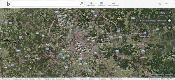
Microsoft Bing – online satellite maps provided by Microsoft
Developed by Microsoft, the “Bing Maps” platform is a popular alternative to Google. This service offers extensive information on over 70 cities worldwide. Similar to other similar platforms, users can find directions for traveling by car or public transportation, explore local services, view cities in 3D, and utilize other useful features. Additionally, Bing Maps offers a unique “bird’s eye” mode, which provides aerial views from various angles.
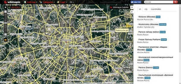
WikiMapia – Explore the Earth’s Surface Online with Wikipedia
The WikiMapia service, affiliated with the popular Wikipedia platform, offers a variety of map options. Users can access satellite maps, panoramic views, and hybrid maps. This service is continuously developed and enhanced by volunteers, allowing users to easily correct any inaccuracies they may come across. These corrections are beneficial for tourists exploring new places as they provide accurate information. No separate account is required to contribute data, and all edits are reviewed by moderators to ensure accuracy.
Nokia Maps: A Unique Mapping Service
With the acquisition of Earthimine, a leading 3D modeling company, Nokia introduced a groundbreaking online mapping service, Here. While it currently offers a limited selection of American and European cities, it provides valuable information across various domains. Notably, it offers diverse map options, including an impressive 3D map and a reliable satellite map. The collaboration with “Here” enables users to plan routes to captivating tourist destinations.

Summary
The majority of the mentioned sources provide the opportunity to observe the desired landscape, enjoying a satellite image that is nearly real-time. Among the selection of sources, the NASA live stream on ustream.tv stands out – the views from the ISS can be truly captivating.
There are numerous online services and applications that provide users with access to a global map. Some of these platforms support the display of satellite imagery, which is regularly refreshed to ensure accurate representation of the Earth’s topography. While real-time satellite data is limited and typically inaccessible to the general public, traditional maps are regularly updated, offering users relatively recent and detailed views of the terrain.
Google Maps
Google Maps is the most widely used service for viewing geographical information. It provides users with up-to-date data on streets, landmarks, and other points of interest. This service is available both through the website and mobile applications for Android and iOS. The best part about Google Maps is that it is completely free to use, and it also offers a user-friendly interface in Russian. Additionally, it provides easy navigation features to help users find their way around. One of the key features of Google Maps is the ability to view satellite imagery, which we will discuss in more detail in the following section. The satellite photos on Google Maps are updated approximately every 1-2 years, ensuring that users have access to the latest information.
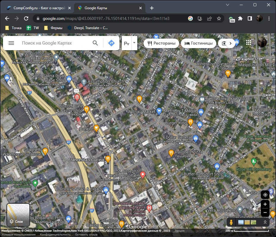
- To comprehend the functioning of Google Maps, let’s analyze their website. Upon launching the webpage, on the left-hand side, you can locate the “Layers” icon, which you can click to transition to the satellite perspective.

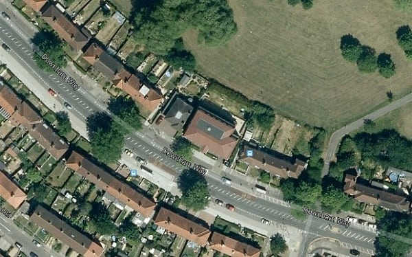
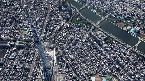
- In the provided image, I have not zoomed in excessively on the streets, allowing for a comprehensive view of the entire map. The buildings are easily distinguishable, large objects are clearly visible, and even the presence of cars on the road can be observed. This level of detail is typically sufficient for the average user. Additionally, important street names and locations are consistently highlighted. However, some may argue that the inclusion of these layers is unnecessary in certain cases.
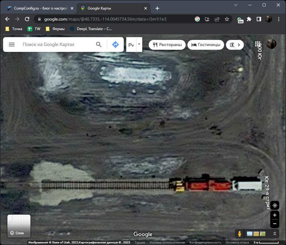
- The image below showcases the highest level of detail available on Google Maps. It provides a clear view of various features such as railway tracks, tire marks on roads, indentations, and hills. With sufficient expertise, it is even possible to identify the specific models of machinery present on the ground, if required.
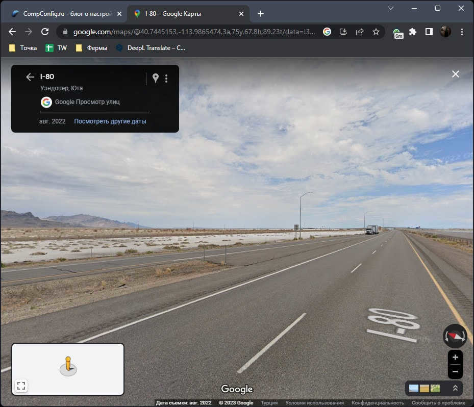
- The Google car has extensively explored numerous locations worldwide. Therefore, if you approach closely or drag the figure onto the road, you can switch to the street view mode. This option is particularly useful if the satellite view does not provide enough detail for your needs.
In addition, it is worth mentioning that you have the option to search for a location using its coordinates. This allows you to easily switch to satellite mode and examine the surroundings. This feature can be particularly helpful when exploring a specific site or landscape, or when gathering information about a particular point based on its coordinates.
Google Earth
Google Earth is a web service provided by Google that offers separate versions for computers and mobile devices. Unlike regular maps, this service provides additional features such as satellite images that are updated more frequently (typically once a year).
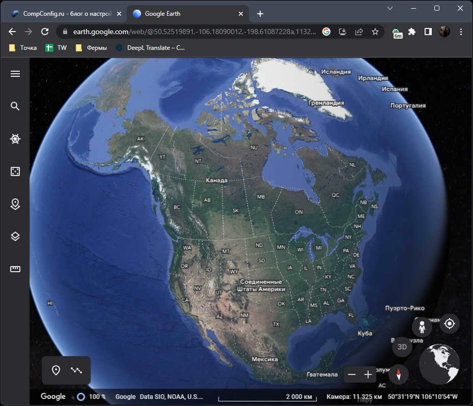
- Google Earth presents the Earth as a planet, allowing users to access more detailed information about each object. Users have the ability to rotate the planet, zoom in, change the viewing angle, and utilize standard navigation tools to pinpoint specific locations.
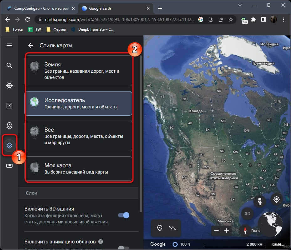
- The menu on the left allows you to access the “Map Style” menu. You can use this menu to enable or disable specific elements. It gives you the option to remove borders, road names, city names, and objects.
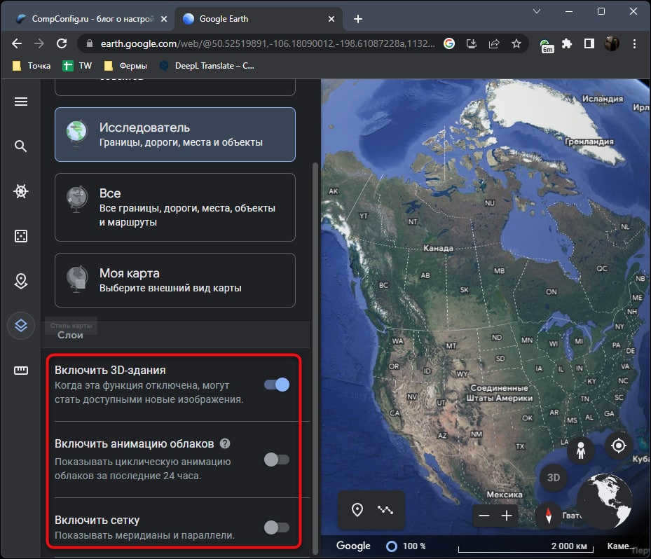
- Below that, there are switches for layers. These switches control the animation of clouds, the grid on the globe, and the display of 3D buildings. Currently, 3D buildings are only available in major cities around the world.
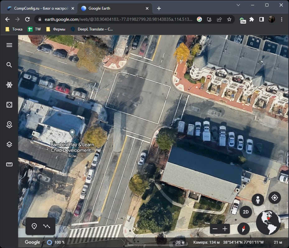
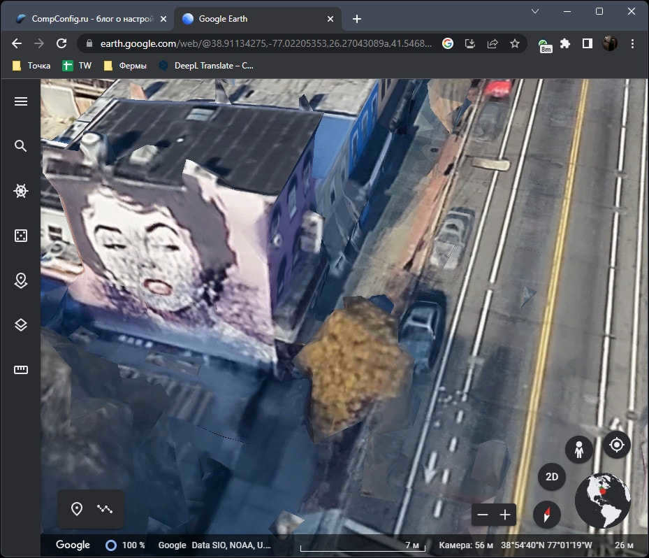
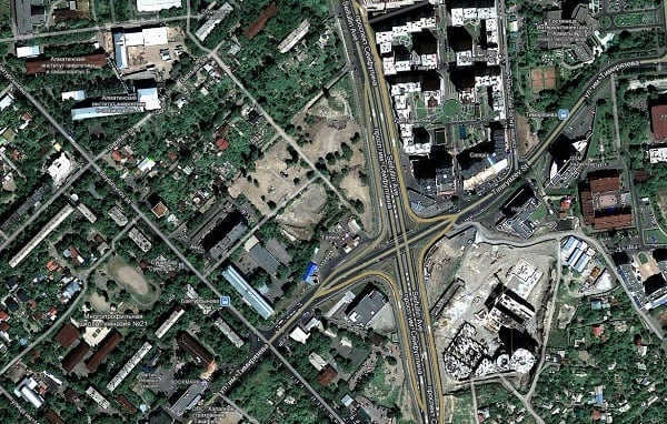
In the image below, you can observe a nearly complete zoom of the satellite picture, accompanied by the inclusion of 3D structures. Certain elements may appear slightly unfocused, but this can be rectified by adjusting the camera angle until satisfaction is achieved. It has been observed that the level of detail in Google Earth’s imagery surpasses that of other maps (with the exception of premium maps used by professionals, which will be addressed later in this article).
Yandex.Maps.
If we are discussing local maps, then the undeniable leader is Yandex.Maps, particularly as it is presently the sole service that offers comprehensive viewing of satellite maps with regular updates. The process of using Yandex.Maps is identical on the website and the mobile application (Android, iOS), so the following instructions can be regarded as universal.
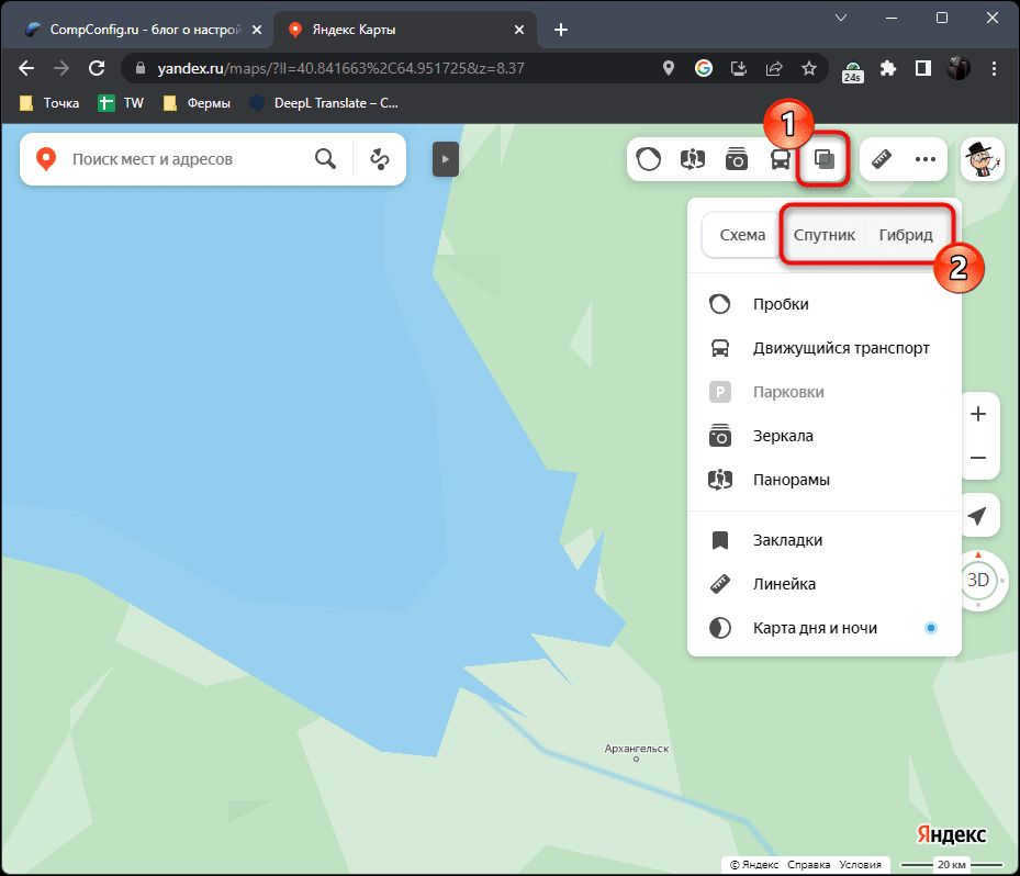
- To begin, when you open the site or application, you will need to expand the menu labeled “Layers” and switch to the “Satellite” or “Hybrid” option.
- When you choose the first mode, the satellite map is shown without any labels. Borders, country names, and street names are not displayed. This type of display is especially useful when you want to explore the terrain in great detail, and the presence of labels and road lines only hinders this.
- If you opt for the “Hybrid” mode, the names of countries, cities, towns, and roads will be visible, along with oceans, seas, rivers, and lakes. However, Yandex has chosen not to display state border lines in any of the modes.
- When comparing Google images (specifically maps, not Earth), it can be noted that Yandex offers slightly better quality when objects are significantly zoomed in. The details are more visible, allowing for better differentiation of vegetation and small objects like cars. For studying maps in maximum detail, Yandex.Maps proves to be more convenient.

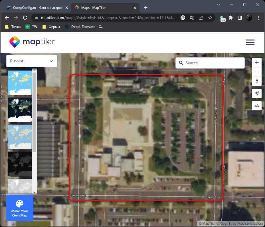
MapTiler
MapTiler is a renowned enterprise that offers extensive mapping services. Users can freely access a variety of maps through the website, using either a computer or smartphone browser. However, support for mobile apps or PC programs is currently not available. The interface is in English, but it is possible to switch object names to Russian for easier navigation on satellite images. These images are updated periodically, similar to other maps, usually every few years.
- The maximum zoom level is worth mentioning as it contains valuable information when working with satellite images. However, in MapTiler, the quality of the zoomed-in images is rather poor. All objects appear washed out and even large objects are difficult to see. This is a clear drawback of MapTiler and the images it utilizes.
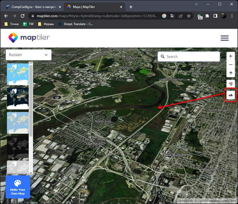
- While switching to the terrain view is supported, the elevation is not clearly visible. Therefore, this mode can only be considered useful for changing the viewing angle and nothing more.
After using MapTiler, one is left with mixed feelings. It appears that the maps on the website serve mainly for orientation purposes, and if you want high-resolution images, you have to reach out to the company’s representatives and negotiate the pricing for obtaining the complete satellite map or specific images. It’s clear that the maps in the free version are not updated frequently, with updates occurring no more than once every two or three years.
EOSDIS Worldview
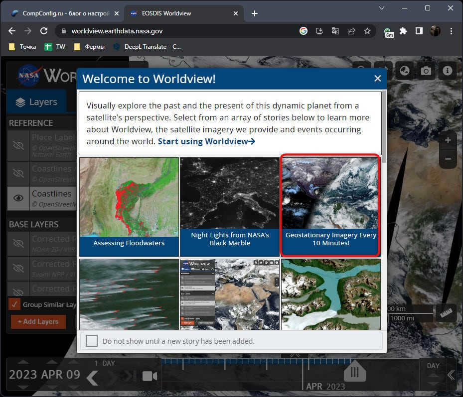
EOSDIS Worldview is a unique service provided by NASA that provides real-time monitoring of the Earth’s situation. Unlike other satellite maps, it offers a comprehensive view of satellite images, enabling users to track weather patterns, wind conditions, and even view a night map. While the website does not support the Russian language, users can still navigate the site using a browser translator or rely on their own understanding.
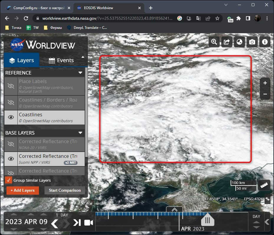
- To access the satellite map in EOSDIS Worldview, you should choose the “Geostationary Imagery Every 10 Minutes” option. This mode provides regular updates every 10 minutes, allowing you to observe cloud formations and get a general overview of the Earth.
- When using this mode, if you want to view real-time images, make sure to select today’s date in the bottom right corner.
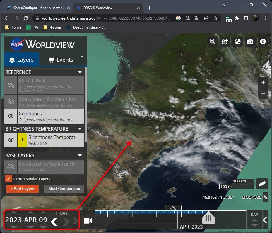
- It is crucial to take note of the positioning of the clouds. They can obstruct the view of certain terrains, as demonstrated in the screenshot below. Therefore, it is advisable to adjust the time and date of the photograph in order to capture the desired object without any cloud coverage.
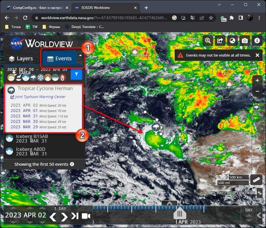
- By navigating to the “Events” tab and choosing one of the most recent events, you can observe its location on the map and discover where a cyclone has emerged, an iceberg has materialized, or a tornado has begun. This provides an exhilarating and valuable opportunity to acquaint oneself with the current natural occurrences worldwide.
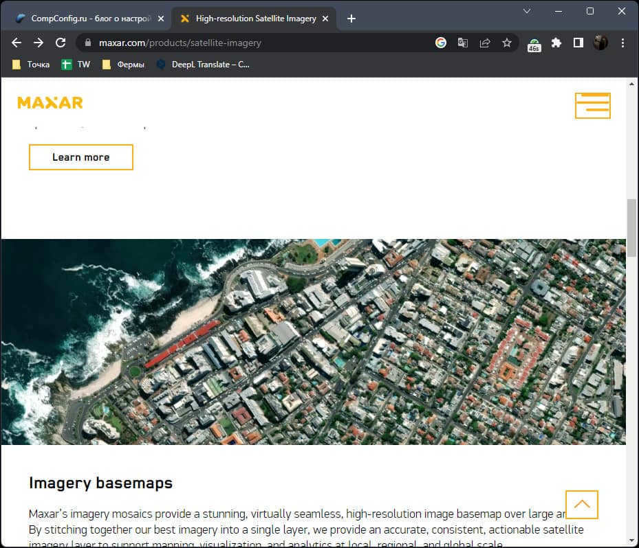
MAXAR
Rephrase the text, making it unique, using the English language and preserving the HTML markup:
To conclude, let’s discuss the MAXAR corporation, a company that specializes in satellite launches and the acquisition of near real-time imagery. MAXAR is currently one of the quickest sources of information from satellite imagery, excluding government satellites. Access to these images is restricted for regular users, as they are only made available to the public by MAXAR or provided to organizations, governments, or media outlets. If you’re interested in obtaining information from MAXAR, it’s recommended to follow news about the company, visit their blog, or analyze the images they have already published online. Typically, they release these images during natural disasters such as fires, floods, tsunamis, and other forms of devastation. Additionally, MAXAR provides up-to-date imagery of conflict zones, showcasing the destruction of cities, troop movements, and other specialized information.
As mentioned previously, obtaining real-time satellite information has become extremely difficult in recent times. Consequently, one can only rely on periodically updated maps. If you are interested in high-quality, maximum zoom images, I highly recommend focusing your attention on Yandex.Maps. For a more comprehensive exploration of the Earth, Google Earth is the ideal choice.
Many users harbor a desire to admire satellite photographs of their hometowns, to observe their homes, nearby rivers, forests, and essentially everything that constitutes their “small homeland,” from an aerial perspective. Satellite mapping services offer a remarkable opportunity to view these desired locations in exquisite graphical detail. In my personal quest to view my own house from a satellite, I discovered several exceptional services, which I will discuss in this article.
Key Information to Consider When Locating Your Home on an Online Map
There is a wide range of online mapping services available that grant users access to high-resolution satellite maps. However, the majority of these services rely on Google Maps API, with only a few (including domestic Yandex.Maps) offering their own unique cartographic developments that differ from Google’s dominant maps within this market segment.
Simultaneously, the process of using these maps is quite standardized. You visit one of them, activate the satellite view if needed, and input your address (including the settlement, street, and house number) into the search field. Subsequently, the service locates the requested destination, and you have the ability to zoom in or out using the mouse scroll. In the event that the service fails to locate your house for any reason, I suggest inputting the city name (including the settlement or village) and street, then manually locating the desired house using the mouse.

Several platforms offer the opportunity to not just observe your residence from an aerial perspective, but also take a virtual stroll through the streets of your hometown and appreciate the architecture that interests us.
Shall we explore the compilation of platforms that can assist us in viewing our residence via satellite?
Google Maps – observe your residence from the satellite in real-time
Undoubtedly, the most widely used global mapping resource is Google Maps. Alongside providing maps in schematic and satellite formats, this service also offers a 360° street view of numerous cities worldwide (Street View). It also provides information regarding street traffic and congestion (Google Traffic), a route planner from point A to point B, a 3D visualization of various geographical landmarks, and many other helpful features.
To have a glimpse of your abode, you can utilize two fundamental functionalities:
- Get a regular aerial perspective of your residence. To accomplish this, visit Google Maps and select the image beside “Satellite” at the bottom to activate the satellite view of the location. After that, input your address (including city, street, and house) into the search bar and hit enter. Once your residence is located, utilize the scroll wheel on your mouse to adjust the display level to your liking;
- Utilizing Street View. If your residence is situated near a roadway, you have the option to virtually explore it in detail. To achieve this, locate your address on the map as described above, and subsequently select the button featuring an icon of a small person located at the lower right-hand corner (street view mode). While holding down the left mouse button, drag the aforementioned small person to the street adjacent to your dwelling. This action will transport you to street view mode, enabling you to employ your mouse to observe the various nearby landmarks, including your own abode.
Explore Russia with Yandex.Maps
Discover the convenience of Yandex.Maps, a popular mapping service that provides comprehensive coverage of the Russian territory. With Yandex.Maps, you can easily navigate and find any object you need in Russia.
Yandex.Maps stands out as the top choice among mapping services in Russia. It surpasses other competitors, including Google Maps, in terms of accuracy, frequency of data updates, and level of detail for the Russian territory.
Similar to Google Maps, Yandex.Maps offers various viewing options, including standard maps, satellite imagery, and the innovative “Hybrid” mode that combines text and schematic markings on the satellite view. Additionally, users can access street view mode through “Yandex.Panoramas,” check real-time traffic information with “Yandex.Traffic,” and contribute to the community-driven “People’s Map” by making edits and updates.
If you want to see where you are at the moment using the “Yandex.Maps” service, you can simply visit their website and enter your address in the search bar at the top of the page. Once you hit enter, the map will show your location. To explore the area in more detail, you can switch to street view mode by clicking on the binoculars icon at the bottom of the screen. This will allow you to see street panoramas and photos. From there, you can select any of the streets highlighted in blue to enter street view mode and get a closer look at the vibrant colors of these places.
Bing.Maps is a satellite map from Microsoft
"Bing.Maps" is a web-based mapping service provided by Microsoft, previously referred to as "Windows Live Maps" and "MSN Virtual Earth". It offers a variety of features including satellite map visualization, street view, 3D mapping for over 60 cities globally, optimal route guidance, and other functionalities commonly found in similar services.
To monitor your home using Bing.Maps, simply navigate to the service, click on the “Road” option located on the right-hand side, and choose the “Hybrid View” mode. Then, enter the desired address in the search bar and explore the view that appears.
MapQuest: A Well-Known Mapping Service in the United States
“MapQuest” (also known as “Card Search” in translation) is a popular American mapping service that is widely used in the United States, second only to Google Maps. This platform offers highly detailed street information for numerous countries around the world, assists in planning convenient routes, provides real-time traffic updates, and much more.
In order to utilize this tool, you must navigate to the designated website and locate the button featuring a globe icon, positioned on the right side of the screen. By selecting this button, the display mode will transition to satellite view. Following this, simply input the desired address (preferably in the Latin alphabet) into the search bar located on the left side of the interface. Once completed, you will be able to appreciate the MapQuest service’s presentation of the specified location.
Summary
Now you have the opportunity to observe your residence from a satellite using the services mentioned in this article. For Russia, I would suggest using the “Yandex.Maps” service – its high level of detail and frequent updates make it the best choice for cartographic services in the country. On a global scale, Google Maps is the undisputed leader, so it is recommended to utilize the features of this service to view maps of various countries around the world.
Observing Satellites with a Satellite Map
Satellites, moving at speeds of up to 30,000 km/h and reaching heights of up to 36,000 kilometers, encompass our beautiful blue planet. These technological wonders have become an integral part of our modern world. In addition to facilitating various communication channels, satellites are also utilized for weather forecasting and space exploration. Stay informed about their presence and movements with the help of our satellite map!
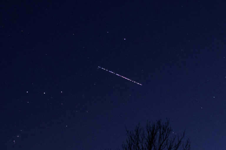
Currently, there are nearly 2,400 satellites orbiting Earth. In the following sections, we will guide you on how to spot a satellite and provide essential tips to ensure a successful observation. Let’s begin with a closer look at the Starlink satellites.
Update: Since August 2020, astronomers have responded to numerous requests to equip the new Starlinks with a sun shield to reduce light reflections. As a result, observing Starlinks with the naked eye has become more challenging.
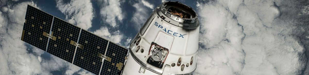
Over time, there has been a growing number of Starlink satellites becoming visible in the United States. These satellites are launched into space by SpaceX, a US company. What makes this unique is that each rocket carries up to 60 Starlink satellites into Earth’s orbit simultaneously.
Consequently, you can witness the satellites soaring past like a flock of precious gems during specific nighttime hours. A genuinely remarkable spectacle! The primary goal of the Starlink satellites is to deliver rapid broadband Internet access, even in distant areas.
In order to accomplish this, Elon Musk, the proprietor of SpaceX, aims to deploy as many as 12,000 Starlink satellites into space.
Real-time satellite radar for SpaceX’s Starlink satellites
Starlink 24
Is it possible to see satellites at night?
Yes, it is possible to see satellites flying in the night sky on most nights. The condition for this is that the sky is clear and there are no clouds or fog obstructing the view.
Satellites themselves are usually not illuminated, unlike airplanes or helicopters in the night sky that have strobe lights or position lights. The International Space Station (ISS) is an exception as it is illuminated, but its illumination cannot be seen from Earth due to the long distance.
The visibility of satellites depends on their sun sails reflecting sunlight back to Earth. Satellites are most visible when it is dark on Earth but the satellite is still illuminated by sunlight.
When and where can you see satellites?

No matter where you are located, whether it be in the United States, South America, or any other country, satellites are only visible when they reflect sunlight back to Earth. This is typically true for up to 2 hours after sunset or before sunset. Anytime outside of this timeframe, satellites will not be visible.
Can you spot the ISS?
As an observer, you can easily catch a glimpse of the ISS with the naked eye. In the night sky, the space station often appears much brighter than the surrounding stars.
Observing the ISS in real-time
Curious about when the ISS will be visible to you? Use the LIVE satellite radar for the ISS to find out. This tool will provide you with the current position of the ISS and its projected path.
On the satellite map, you can track the ISS’s current location and trajectory. The blue infobox below the map displays the upcoming visible overflights for your current position.
Observing the International Space Station (ISS):
Observing the TERRA Satellite:
Starting Azimuth: This information shows you the specific day and time when the visible overflight of the satellite begins. It also indicates the direction in which the overflight will start, represented by a clockwise number of degrees. The north direction is denoted by 0° or 360°, east by 90°, south by 180°, and west by 270°. For instance, a degree of 45° corresponds to a northeastern viewing direction.
Maximum Elevation: This provides the altitude at which the satellite will pass in degrees. The maximum elevation can reach 90°, indicating a flyover directly above you. Conversely, a low value like 10° means that the satellite will only be visible just above the horizon.
END AZIMUTH: This section provides information on the exact location (in degrees) and time when the visible overflight of the satellite comes to an end.
TOTAL DURATION: This indicates the overall duration of time that the satellite remains visible during its overflight.
No upcoming visible passes: This indicates that there will be no visible overflights of this satellite in your region in the near future.


